
June 8, 2020
Robert Loucks, Christopher Zahm, Toti Larson
Report on Louisiana’s Upper Cretaceous Austin Chalk
Robert Loucks, with Christopher Zahm and Toti Larson, is finishing up a report for the Reservoir Characterization Research Laboratory on the Upper Cretaceous Austin Chalk Group in Louisiana. To date, almost nothing has been published on the unit’s stratigraphy, lithofacies, environmental setting, depositional processes, or associated subsurface geological characteristics. Six cores from Louisiana have provided the opportunity to investigate the formation’s geology and reservoir characteristics.
Sedimentation of the Austin Chalk Group occurred during a worldwide rise in sea levels that flooded Early Cretaceous shelfs. The local depositional setting was an outer-shelf, open-marine environment. Most of the sediment came from the shallower water column and consisted of organisms such as phytoplankton. Fine-grained siliciclastic sediment was blown in by winds. The sea bottom was below the storm wave base (>300 ft), and its conditions varied from aerobic to anaerobic. The lower-oxygen settings produced fair to excellent source rocks for hydrocarbon development.
This study provides data of academic interest on the deposition settings and processes of argillaceous (clay-bearing) chalks. The Austin Chalk is also a very active exploration and production play, and this report provides important information on geological characteristics that are valuable to the exploration and exploitation of argillaceous chalks.
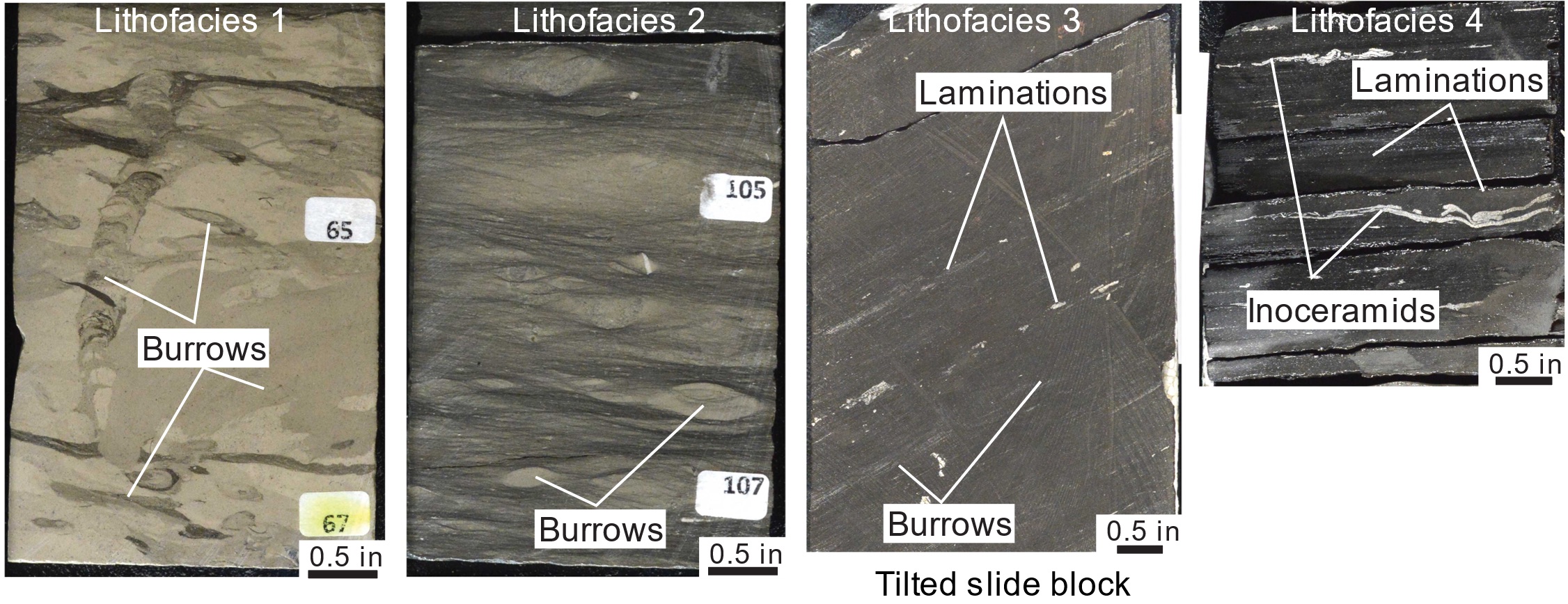
There are four general lithofacies within the Austin Chalk Group: Lithofacies 1 is an organic-matter-poor marly chalk and lesser chalk with many bioturbations, or disturbances in the deposited sediment from living organisms. Lithofacies 2 is a highly bioturbated marly chalk to chalky marl ranging from poor to rich in organic matter. Lithofacies 3 is a slightly burrowed (horizontal), organic-matter-rich marly chalk to lesser chalky marl with lamination, or fine layering in the sediment. Lithofacies 4 is an organic-matter-rich, well-laminated marly chalk.
Tim Dooley
The Salt Tectonics Modeling Lab is Open for Business
Physical modeling is one of the core research tools in the Applied Geodynamics Laboratory’s (AGL’s) focus on salt tectonic processes. The salt tectonics modeling laboratory was one of a handful of the Bureau’s research facilities allowed to remain open during the COVID-19 lockdown, thanks to lobbying by AGL, Bureau leadership, and the Jackson School Dean’s office. Principal Investigator and Senior Research Scientist Tim Dooley is the sole researcher in these facilities and thus an expert on social distancing!
Most of the AGL’s experiments last for weeks or even months, which factored into the lab gaining its exemption from the lockdown. Dooley is currently working on three main experimental threads in close consultation with other AGL researchers:
- Shortening of diaper-bearing trapezoidal-shaped salt basins with and without regional dip at the salt base.
- Minibasin subsidence into layered evaporite sequences.
- Growth and shortening of sediment-inclusion-bearing salt walls.
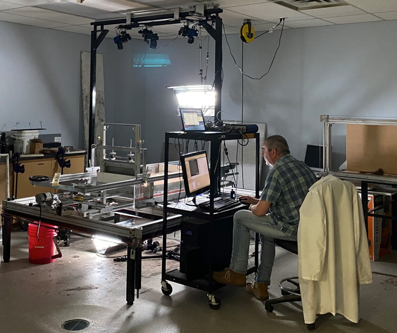
Tim Dooley completing work in the salt tectonics modeling laboratory while maintaining social distancing.
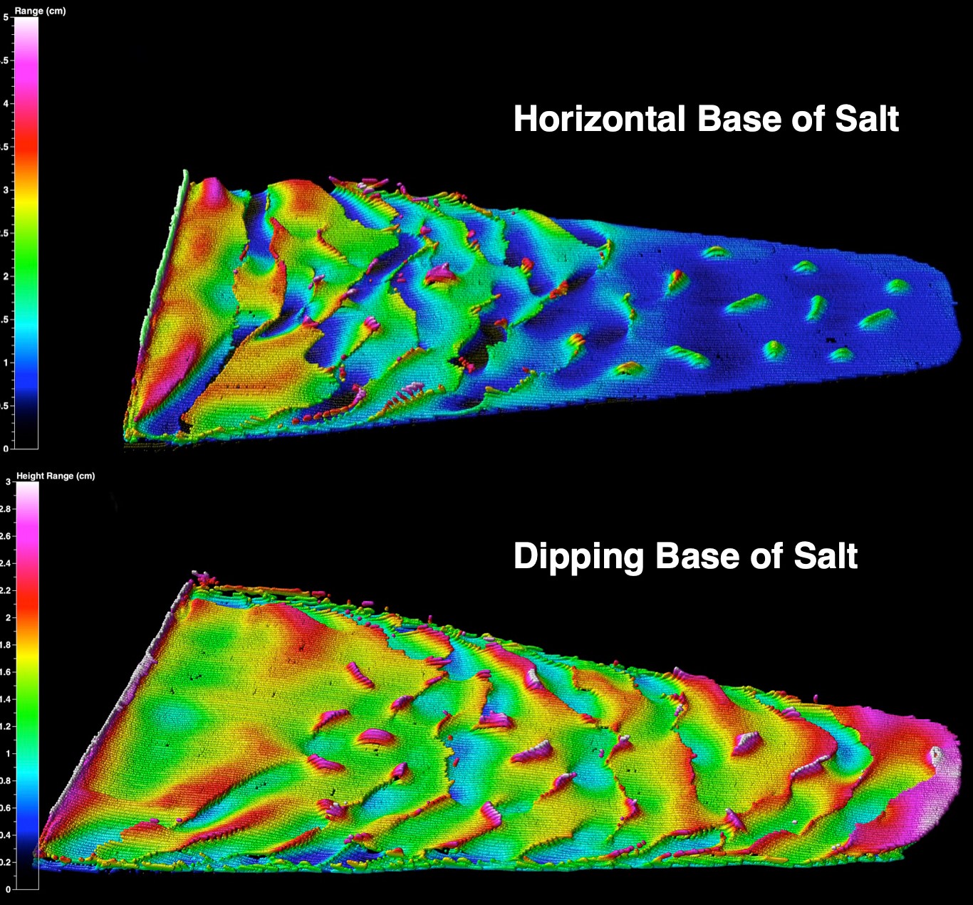
Modeling showing shortening of diaper-bearing trapezoidal-shaped salt basins.
Tiffany Caudle
Reaching the Public with GIS, GeoFORCE, and More
Completing the final report and deliverables for the Texas Wetlands Status and Trends Online GIS Viewer project
The Bureau developed a user-friendly, interactive, web-based display of GIS-based maps of historical and current Texas wetland types, boundaries, and distribution. The new interface and revamped website allow users to view and analyze wetland mapping datasets from the 1950’s, 1970’s, and 2000’s. An educational resource was developed to analyze the status and trends of wetlands at Powderhorn Ranch and Mustang Island State Park.
You can find these resources on the updated wetlands website.
Making changes to the GeoFORCE 9th grade Summer Academy field guide
GeoFORCE Texas is a K–12 outreach program designed to increase the number and diversity of students pursuing STEM degrees and careers, especially geology. In the 9th-grade academy, students are first introduced to geology as part of their GeoFORCE Texas adventures. The trip focuses on coastal processes and sedimentary environments. Tiffany Caudle has been editing and reformatting the field guide as well as adding stops to the trip.
Learn more about GeoFORCE Texas on the Jackson School’s website.
Geologic mapping for the Texas STATEMAP project
Caudle has been mapping geologic units and quadrangle features (shorelines, lakes, etc) of the Lake Stephenson and Smith Point quadrangles using lidar-derived elevations and aerial photographs. The geology of the Lake Stephenson and Smith Point quadrangles consists of sediments deposited within a Pleistocene barrier and bay-estuary system. The final map will address geologic framework needs for planning and management of land use for this sensitive coastal environment. The detailed geologic map will aid in identifying areas of potential geologic hazards including shoreline erosion, active growth faults, land subsidence, and wetland habitat conversion.
Rolling with COVID-19 impacts to the Texas High School Coastal Monitoring Program
Unfortunately, the THSCMP spring field trips were cancelled due to COVID-19. Despite the cancellation, Caudle has been reviewing data collected earlier in the academic year and communicating with THSCMP-participant teachers about how to provide an online learning experience that will replace the students’ final data collection field trip. One idea is to create a presentation for the students that reviews the data they collected this academic year, analyzes the shoreline and dune trends at their monitoring locations compared with data collected by past THSCMP participants, and discusses how coastal issues vary along the Texas coast.
Learn more about the Texas High School Coastal Monitoring Program on the THSCMP website.
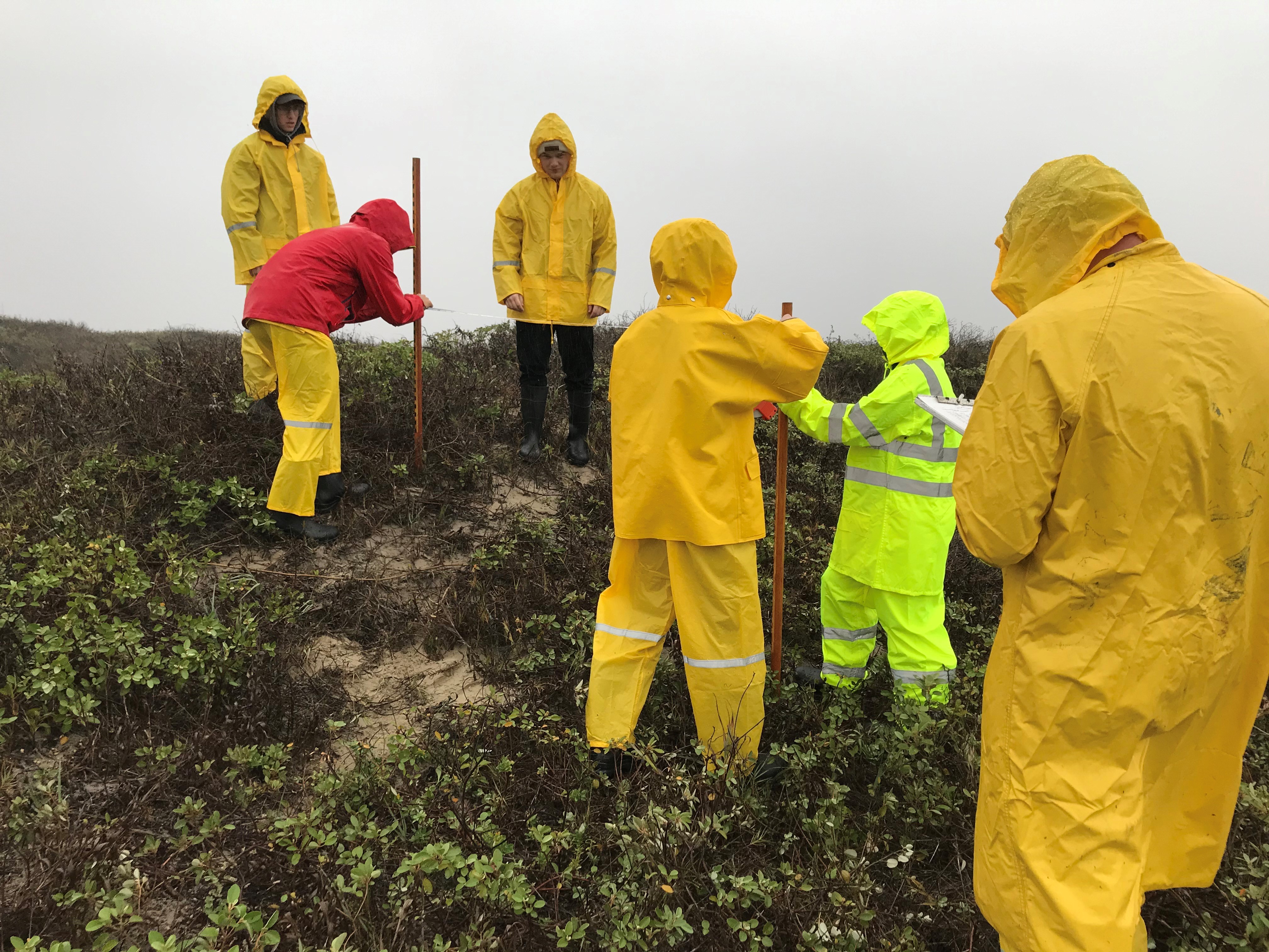
Students participating in a past field trip as part of the Texas High School Coastal Monitoring Program.
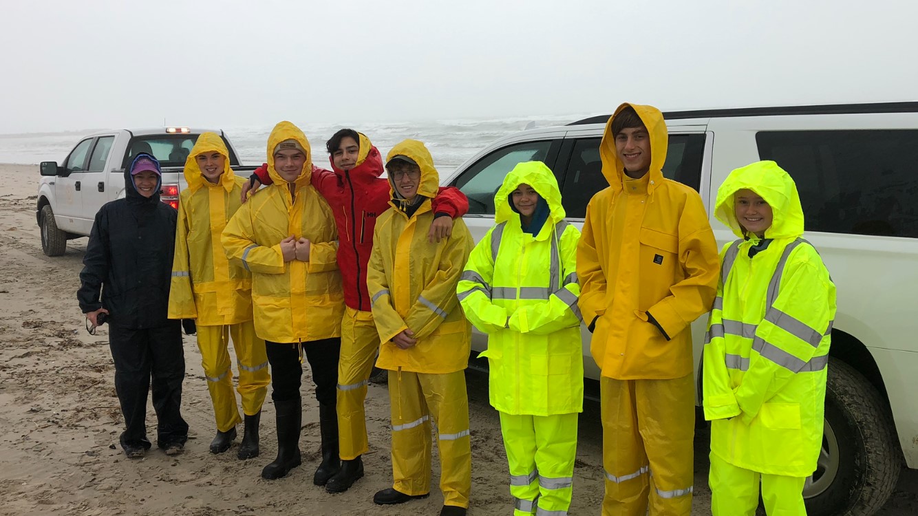
Students participating in a past field trip as part of the Texas High School Coastal Monitoring Program.
Kutalmis Saylam
Hydrographic and Topographic Surveying with Airborne Lidar
In recent years, Near Surface Observatory (NSO) researchers at the Bureau of Economic Geology have completed multiple inland and shoreline hydrographic surveys using airborne lidar technology, demonstrating lidar’s versatility and accuracy. Bureau researchers use an airborne lidar system together with a high-resolution aerial imaging camera, unmanned aerial vehicles (UAV), an echo sounder, and ground-penetrating radar (GPR) to create precise, detailed hydrographic and topographic surveys.
Environmental conditions and aquatic properties greatly vary between each body of water, posing challenges in creating accurate surveys. To account for this, our researchers take various in situ measurements and use relevant geodetic survey tools, such as post-processed GPS, to quantify airborne lidar and other remotely sensed information accuracy expectations.
We are interested in pursuing funding opportunities for exploring innovative applications of topographic and hydrographic lidar and for providing advanced mapping services to internal and external research communities and State and Federal agencies. Contact Kutalmis Saylam to learn more.
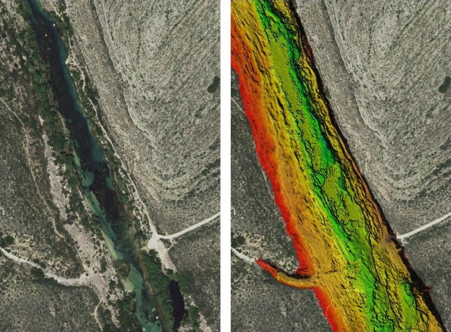
Habitat mapping of Devils River, Texas, with airborne lidar.

