
September 14, 2020

Lucie Costard
Ground Penetrating Radar and Bathymetric Surveying
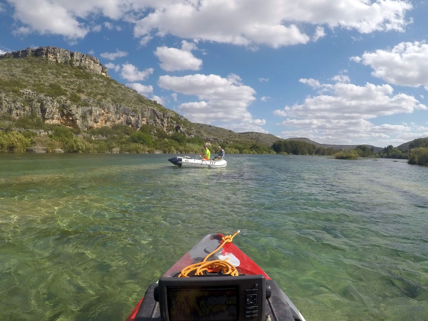
Bureau researchers Aaron Averett and Lucie Costard operating the GPR on an inflatable boat on the Devils River, November 2019.
Photo by Kutalmis Saylam.
Researchers from the Bureau's Near Surface Observatory are now using ground-penetrating radar (GPR) to supplement bathymetric Lidar surveys. GPR is a geophysical method commonly applied to near-surface problems on dry land in areas such as archaeology, engineering, and environmental studies. Thick underwater vegetation can hinder the penetration of bathymetric Lidar; however, putting GPR in an inflatable boat can provide water depths in areas that were previously unmeasurable.
The method was first tested in Austin's Barton Springs Pool in early 2019. The first field survey of the Devils River followed, in November 2019. The GPR data was used to fill in gaps caused by aquatic vegetation. Although using GPR for bathymetry studies is a relatively new and unused technique, results from our early testing is promising. We are excited to continue this research using the diverse expertise from Bureau researchers of different groups and backgrounds.
Read the Devils River publication
Saylam, K., Averett, A., Costard, L., Wolaver, B. D., Robertson, S. 2020. Multi-Sensor Approach to Improve Bathymetric Lidar Mapping of Semi-Arid Groundwater-Dependent Streams: Devils River, Texas. Remote Sensing, v. 12, 2491, doi:10.3390/rs12152491.

Tara Bongiovanni
Monitoring Hydrologic Effects of Invasive Vegetation Control Efforts in the Upper Brazos River Basin, Texas
In the Brazos River, between Possum Kingdom Reservoir and the confluence of the Double Mountain Fork, woody phreatophyte vegetation inventories in 1969 showed that saltcedar occupied 39% of the floodplain. By 1979, 57% of the channel was occupied by saltcedar. Saltcedar invasion has caused ~3 m of sediment accumulation, reduced the width of the Brazos River by ~90 m, and adversely affected the wide, shallow stream habitat utilized by two endangered cyprinids, the sharpnose shiner (Notropis oxyrhynchus) and the smalleye shiner (N. buccula).
This project will expand upon our study of surface water–groundwater interactions by investigating soil moisture, groundwater, and streamflow response to saltcedar control to be applied on the Double Mountain Fork.
Publication
Wolaver, B. D., Gholoubi, A., Caldwell, T. G., Bongiovanni, T., Pierre, J. P. 2019. Final Report Monitoring of Hydrologic Effects of Salt Cedar Control in the Upper Brazos River Basin, Texas August 31, 2019. TPWD Contract No. 505176.

