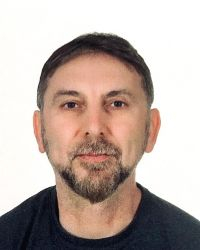
Dr. Kutalmis Saylam

Google Scholar link
Research Interests
- Remote sensing
- Airborne topographic and bathymetric lidar
- Hydrography
- Land surveying
Academic Background
- Ph.D. in Geomatics, Shallow Water Earth Observation lab, Department of Geography, Environment and Geomatics, University of Ottawa
- M.Eng. in Geodesy and Geomatics Engineering, University of New Brunswick
- B.S. Eng. in Agricultural and Hydrological Engineering, University of Ankara
- Visiting Researcher, Agricultural and Biological Engineering, University of Florida
Professional Appointments
- Research Scientist Associate V – Remote Sensing/Lidar Manager (August 2012 - present). Near-Surface Laboratory, Bureau of Economic Geology, Jackson School of Geosciences, The University of Texas at Austin.
- Professional Engineer - Team Leader (LSO4) (March 2011 - August 2012). Geospatial Imaging Section, Geospatial Reference Group, Ministry of Sustainable Resources Government of BC, Victoria, BC.
- Standards and Development Engineer (LSO4). Geospatial Reference Group, GeoBC, Government of BC, Victoria, BC (April 2007 - March 2011).
- Airborne Lidar Specialist (April 2004 - March 2007). Terrestrial Survey Division, Optech Incorporated, Vaughan, Ontario
Peer-reviewed publications (selected)
Saylam, K., Averett, A. R., Andrews, J. R., Short, S. R., Kurtz, N. T., & Tilling, R. L. (2025). Airborne lidar to verify ICESat-2 Arctic summer sea ice heights and melt pond depths: Calibration and validation campaign, Greenland 2022. Earth and Space Science, 12, e2024EA004100. https://doi.org/10.1029/2024EA004100
Saylam, K.; Briseno, A.; Averett, A.R.; Andrews, J.R. Analysis of Depths Derived by Airborne Lidar and Satellite Imaging to Support Bathymetric Mapping Efforts with Varying Environmental Conditions: Lower Laguna Madre, Gulf of Mexico. Remote Sens. 2023, 15, 5754. https://doi.org/10.3390/rs15245754
Saylam, K.; R. Averett, A.; Costard, L.; D. Wolaver, B.; Robertson, S. Multi-Sensor Approach to Improve Bathymetric Lidar Mapping of Semi-Arid Groundwater-Dependent Streams: Devils River, Texas. Remote Sens. 2020, 12, 2491. https://doi.org/10.3390/rs12152491
Saylam, K.; Hupp, J.; Andrews, J.; Averett, A.; Knudby, A. Quantifying Airborne Lidar Bathymetry Quality-Control Measures: A Case Study in Frio River, Texas. Sensors 2018, 18, 4153. https://doi.org/10.3390/s18124153
Saylam, K., Hupp, J. R., Averett, A. R., Gutelius, W. F., and Gelhar, W. B., 2018, Airborne Lidar bathymetry: Assessing quality assurance and quality control methods with Leica Chiroptera examples: International Journal of Remote Sensing, v. 39, no. 8, p. 2518–2542. https://doi.org/10.1080/01431161.2018.1430916
Saylam, K., Brown, R., and Hupp, J. R., 2017, Assessment of depth and turbidity with airborne Lidar bathymetry and multiband satellite imagery in shallow water bodies of the Alaskan North Slope: International Journal of Applied Earth Observation and Geoinformation, v. 58, no. C, pp. 191-200. https://doi.org/10.1016/j.jag.2017.02.012
Peer-reviewed book chapters
Paine, J. G., Andrews, J. R., Saylam, K., and Tremblay, T. A., 2015, Airborne Lidar-based wetland and permafrost-feature mapping on an Arctic coastal plain, North Slope, Alaska, in Tiner, R. W., Lang, M. W., and Klemas, V. V., eds., Remote sensing of wetlands: applications and advances. London, CRC Press, p. 413-434. (ResearchGate link)
Non-peer reviewed journal articles
Saylam, K., 2016, A tale of two airborne Lidar scanners—Lower Colorado River Basin Survey: Lidar, v. 6, no. 8, p. 34-37. (link)
Saylam, K., Andrews, J. R., and Hupp, J. R., 2016, Inventory and characterization of more than 4,500 shallow-water bodies: Lidar bathymetry on the Alaskan North Slope: Hydro International, Focus on Shallow Water, v. 20, no. 3, p. 22-25. (link)
Professional Memberships
- Present: Professional Geomatics Engineer (P.Eng.), Association of Professional Engineers and Geoscientists of B.C. (#151537, APEGBC)
- American Society of Photogrammetry and Remote Sensing (ASPRS) – member
- Canadian Institute of Geomatics (CIG) – Member