
July 13, 2020

Jon Paul Pierre
Assessing and Projecting Impacts to Landscapes and Ecosystem Services from Energy Development in Texas
Texas’ energy resources provide obvious advantages to the citizens and the state economy. But the systems that power Texas come at the cost of environmental impacts, particularly in semiarid west Texas, where landscapes are fragile and extremely difficult to restore.
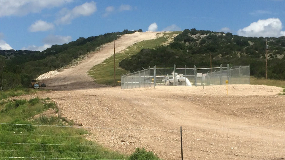
We quantify and map current energy footprints to forecast future impacts to landscapes and ecosystems from a range of development scenarios over the next 30 years. The projected impacts depend not only on economic drivers, but also on decisions made by energy developers. From regional and local perspectives, the impacts to Texas’ landscape can be reduced by planning and considering where and how infrastructure is installed.
Research informs us that energy development—for both fossil fuels and renewables—is now and will be the largest driver of land use change. As stewards of the environment, we need to understand the expectations of future energy development so that land managers can better influence where infrastructure should or should not be installed.
At the Bureau, we hope to create a foundation of knowledge that stakeholders can use to communicate with each other and plan for the future. Armed with this knowledge, stakeholders can join together to provide energy to our expanding populations while conserving ecosystem services and improving our quality of life.

Robin Dommisse
Integrating Multidisciplinary Interpretations to Build Regional and Field-Scale Geological Models
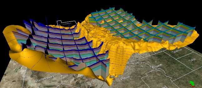
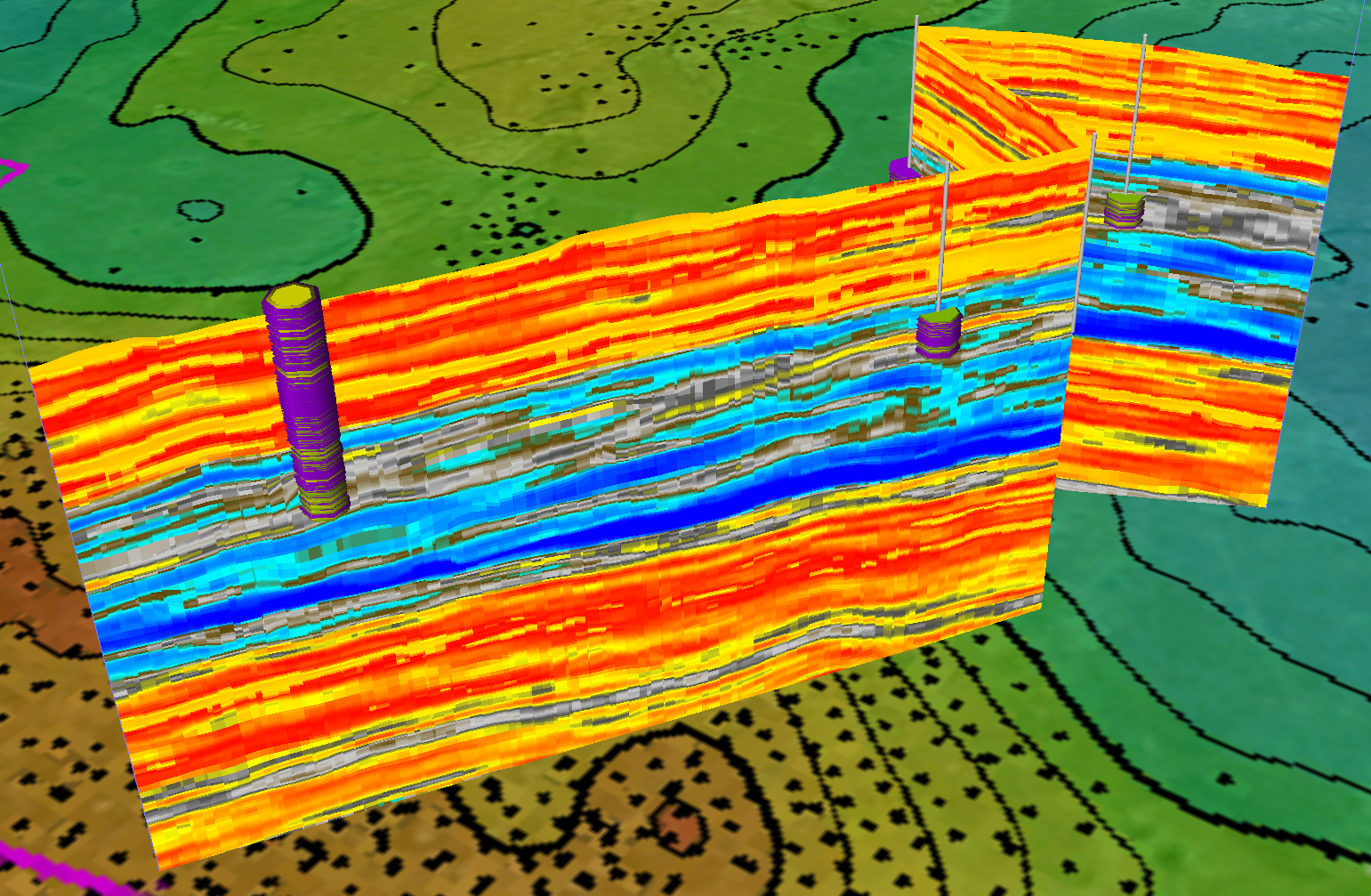
My research focuses on building integrated, multidisciplinary 3D geomodels. This starts by integrating outcrop, core, and well-log correlations into high-resolution sequence stratigraphic frameworks. The structural and seismic stratigraphic interpretation utilizes next-generation 3D interpretation tools to create the most accurate 3D reservoir framework needed to constrain lateral and vertical velocity distributions.
Advanced techniques such as geomorphology-based modeling (stratal-slicing) are critical to properly capturing precise chronostratigraphy and lithostratigraphy. Advanced fault interpretation and automated fault extraction techniques are used to build faulted frameworks. Following time-depth conversion, facies interpretations obtained from core and seismic attribute analysis are combined with insights into the depositional environment to build an accurate 3D facies architecture.
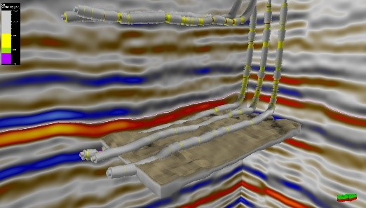
Next, petrophysical parameters derived from well logs and cores are distributed to obtain 3D facies-conditioned distributions of rock and fluid parameters. Finally, all historical well production is integrated into the model to enable the analysis of the main geological, petrophysical, and geomechanical drivers for well productivity.
The resulting 3D models integrate the Bureau’s geological understanding of regional geology with detailed reservoir-scale interpretations. The models are applicable to a wide variety of research areas critical to the decision-making processes of our industry sponsors and the oil and gas industry at large. Applicable research topics include: controls on sediment routing, influence on the distribution of unconventional reservoirs, shelf-to-basin correlations of the Permian Basin, mature field reservoir characterization, enhanced oil recovery, analysis of seismicity, and CO₂ sequestration.
Recent Publications
Dommisse, R., Janson, X., Male, F., Price, B., Payne, S., and Lewis, A., 2019, July. An Integrated, Multiscale Geomodel of the Northern Delaware Basin. SPE/AAPG/SEG Unconventional Resources Technology Conference. doi:10.15530/urtec-2019-97.
Dommisse, R., Kerans, C., Zahm, C., Male, F., Pollock, S., and Bianco, R., 2019, 3-D Integrated Geological Model Construction of Fasken Ranch Area, Midland Basin, Texas. 2019 AAPG Annual Convention and Exhibition. Read the abstract.
Kerans, C., Dommisse, R., Rush, J., and Waite, L., 2019, Contrasting Guadalupian Infill Histories of the Midland and Delaware Basins. 2019 AAPG Annual Convention and Exhibition. Read the abstract.
Janson, X., Price, B., Zahm, C., Covault, J., Dommisse, R., and Dunlap, D., 2019, Seismic Geomorphology of Permian Shelf Margin, Slope and Basin in the Northern Delaware Basin. 2019 AAPG Annual Convention and Exhibition. Read the abstract.


Mariana Olariu & Hongliu Zeng
Prograding muddy shelves in the Paleogene Wilcox Deltas, South Texas Gulf Coast
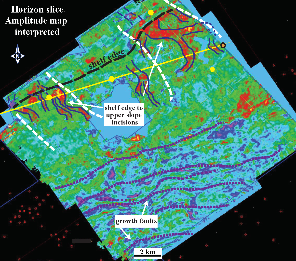
Core facies analysis integrated with subsurface well-log correlations and 3D seismic document two thick mudstone-dominated deltaic successions in the Wilcox Group along the south Texas Gulf Coast. Outer-shelf mudstones and an upper slope tens of meters thick lie at the base of upward-coarsening successions interpreted as fluvial or storm-wave dominated shelf deltas.
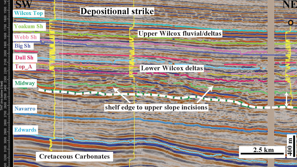
Lower Wilcox cores reflect deposition on a mud-dominated prodelta controlled by hyperpycnal processes. Fine-grained, low-density turbidites of the Lower Wilcox were generated by low-magnitude floods, but with a sufficient discharge to create hyperpycnal flows. The preponderance of thin-bedded and laminated heterolithic strata is typical of muddy distal shelf settings. Salinity fluctuations related to freshet conditions and river flood stages, high sedimentation rates, and episodic heightened water turbidity due to hyperpycnal river plumes lead to general reductions in bioturbation intensities. The presence of large outer-shelf to shelf-edge incisions in the lower Wilcox might had been initiated and sustained by hyperpycnal flows going off the shelf.
Cores of the middle Wilcox reflect deposition on a muddy wave-storm dominated shelf. Bioturbation intensities tend to be high, with unstressed, fully marine ichnological suites. Pervasively bioturbated sandy mudstones and muddy sandstones with Cruziana ichnofacies and structureless sandstones with Ophiomorpha record deposition in a wave-influenced prodelta to shelf environment. Amplitude maps show a strike-elongated geometry suggesting increased wave reworking of the shoreline.
Contrary to the general belief that Wilcox shelf margin deltas catch most of the sandstone in growth faulted depocenters on the outer shelf to upper slope this paper shows that at times the shelf margin prograded through mud accretion.
Why is this research important and why do the results matter?
The regional stratigraphy of the Wilcox Group in Texas has previously been interpreted based on well-log correlations and seismic interpretations at a large scale. As a result, the fault geometry and structural history are resolved, but not the lithology or depositional systems.
This research describes depositional environments and details the stratigraphy of the Wilcox deltas at a fourth-order scale (ca. 100 Ky) to assess the type of shorelines and changes in dominant processes in time and space.
This research is part of a regional study for the STARR (State of Texas Advanced Resource Recovery) Program and can be used by the oil and gas industry as a basic framework for their exploration efforts.
Publication
Olariu, M. I., and Zeng, H., 2018, Prograding muddy shelves in the Paleogene Wilcox deltas, south Texas Gulf Coast, Marine and Petroleum Geology, v. 91, 71–88, doi:10.1016/j.marpetgeo.2017.12.027.

