
Port Aransas High School
School Website: https://www.paisd.net/
2024-2025 field trip data: PortAransasHS2025.pdf
Galleries: 2017-2018 | 2018-2019 | 2019-2020 | 2020-2021 | 2021-2022 | 2022-2023 | 2023-2024 | 2024-2025 | 2025-2026
Beach and Dune Monitoring on Mustang Island by Tiffany Caudle and Jeffrey Paine
Port Aransas students collect data at three profile locations on Mustang Island: MUI01 near Horace Caldwell Pier, MUI02 in Mustang Island State Park, and MUI03 (Fig. 1). Port Aransas High School have been measuring these profiles since 1999.
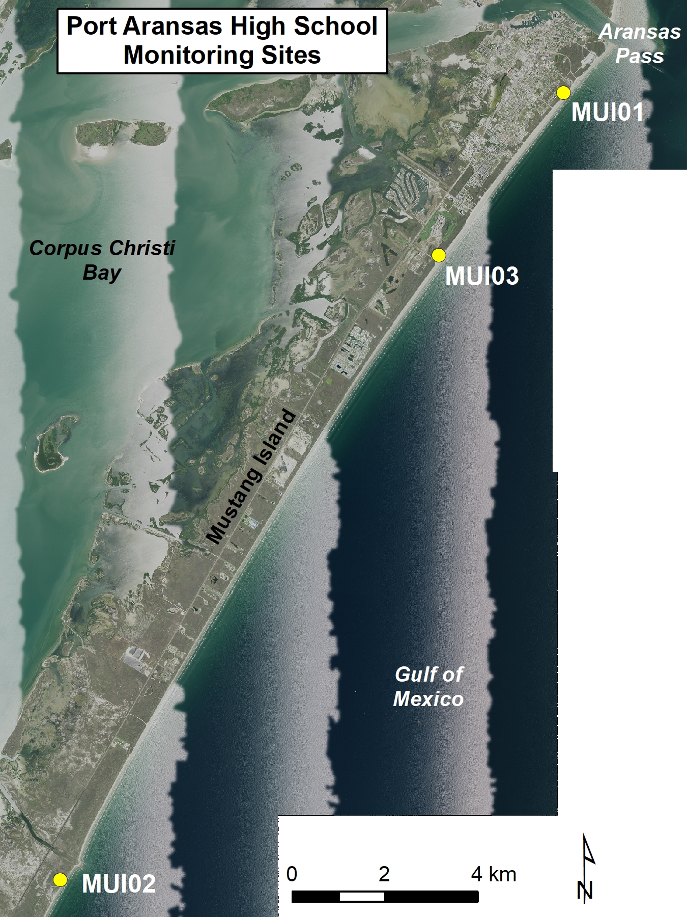
Figure 1. Location map of Port Aransas High School monitoring sites.
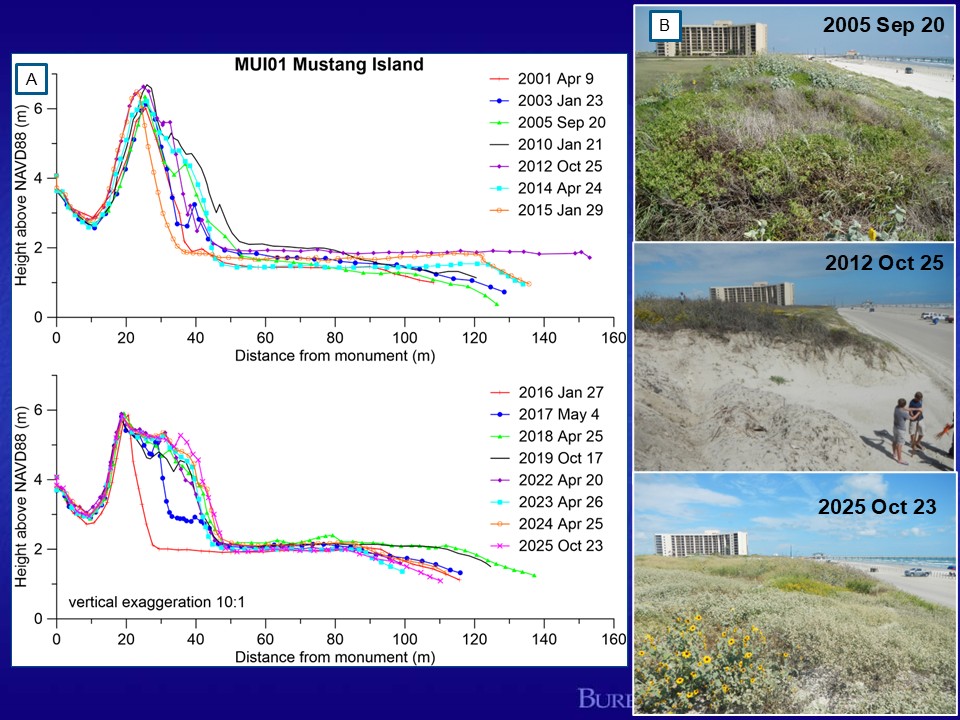
Figure 2. Student monitoring data from MUI01 on Mustang Island. (A) Beach profile data from April 2001 through October 2025 showing expansion of the dune width until dune notching in 2012 and more severely in 2016. Dune notching is a beach-maintenance practice where sand is removed from the dune and replaced with sargassum and sand scraped from the shoreline over time. The dune system at MUI01 has been filled in since 2018 but is no longer moving seaward due to the location of the Beach Road. (B) Photos showing the changes to the dune at MUI01 on September 20, 2005, October 25, 2012, and October 23, 2025. The 2012 photo shows the notch in the dune where sand was removed.
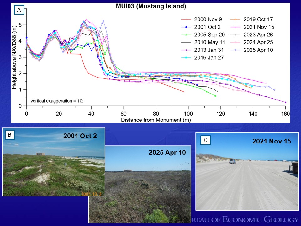
Figure 3. Student monitoring data from MUI03 on Mustang Island. (A) Beach profile data from November 2000 through April 2025. The profile plots show seaward expansion of the dune system through 2010. The Beach Road on the backbeach has stopped the expansion of the dunes creating a fixed position of the dune toe with minimal change between 2013 and 2025. (B). Photos from October 2, 2001 and April 10, 2025 looking north along the landward most dune crest on the beach profile. (C) Photo from November 15, 2021 looking north along the Beach Road.
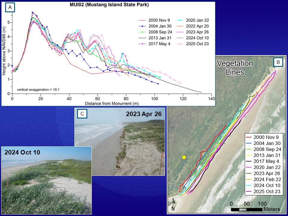
Figure 4. Student monitoring data at MUI02 in Mustang Island State Park. (A)Beach profile data and (B) GPS-mapped vegetation line positions between November 2000 and October 2024. The students have been documenting the seaward migration of the shore and vegetation lines as well as the growth of the dune system through 2020. The seaward most coppice dunes had been eroded, and the vegetation line had moved landward during the April 2022 field trip and scarped in April 2023. (C) Changes to the seaward-most dune crest and beach width in April 26, 2023 and October 10, 2024.


.png)

