
Brazosport High School
School Website: https://bphs.brazosportisd.net/
2024-2025 field trip data: BrazosportHS2025.pdf
Galleries: 2018-2019 | 2019-2020 | 2020-2021 | 2021-2022 | 2022-2023 | 2023-2024 | 2024-2025 | 2025-2026
Brazosport High School in Freeport, Texas, joined THSCMP during the 2018‒2019 academic year. Senior AP Environmental Science students collect data from sites at Surfside Beach and Quintana Beach. Three of the monitoring sites (SURF2, SURF4, and jetty park) are located in Surfside Beach on the southern end of Follets Island (Fig. 1). A fourth site (QUIN1) is located in Brazoria County’s Quintana Beach County Park (Fig. 1).
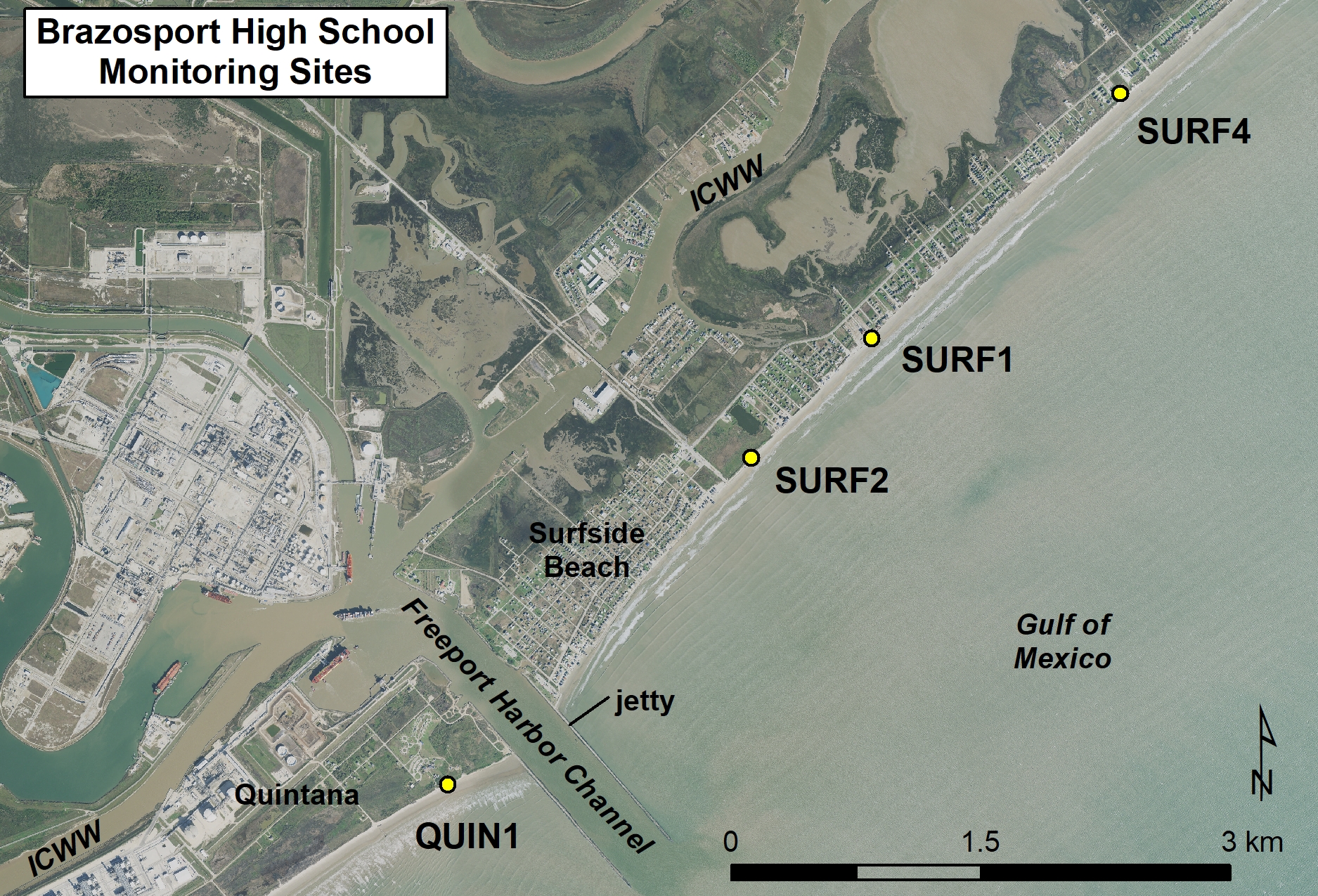
Figure 1. Location map of Brazosport High School monitoring sites.
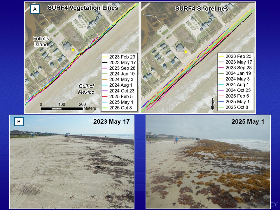
Figure 2. Brazosport High School monitoring activities at profile site SURF4 at Stahlman Park in Surfside Beach. (A) GPS mapped vegetation lines and shorelines from February 2023 to October 2025. (B) Photographs comparing beach widths from two different field trip dates: left, May 2023 and right, May 2025. Beach width is dependent on tide level and wind direction.
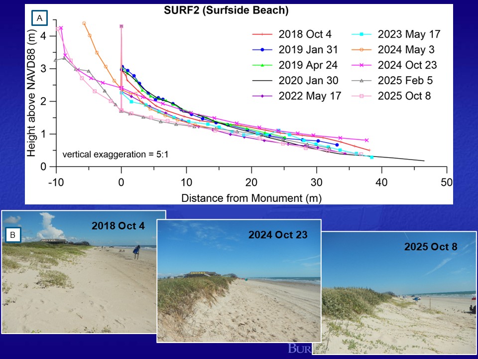
Figure 3. (A) Beach profile data at SURF2 showing changes in the topography between October 2018 and October 2025. (B) Photos looking northeast along the vegetation line at SURF2 from October 4, 2018; October, 23, 2024; and October 8, 2025. Hurricane Beryl impacted the Surfside area in July 2024. The middle picture (2024) shows the scarped dune at SURF2 after Beryl and the photo on the right documents the vegetation line recovery one year later.
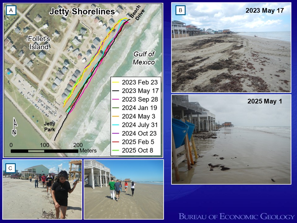
Figure 4. (A) Shoreline mapping between Jetty Park and Beach Drive in Surfside Beach from February 2023 through October 2025. (B) Comparison of beach width from May 2023 and May 2025. Students were unable to map the shoreline position in May 2025 because the wet/dry line was underneath the homes at the left of the picture. (C) Students mapping the shoreline position with GPS by Beach Drive and Jetty Park.
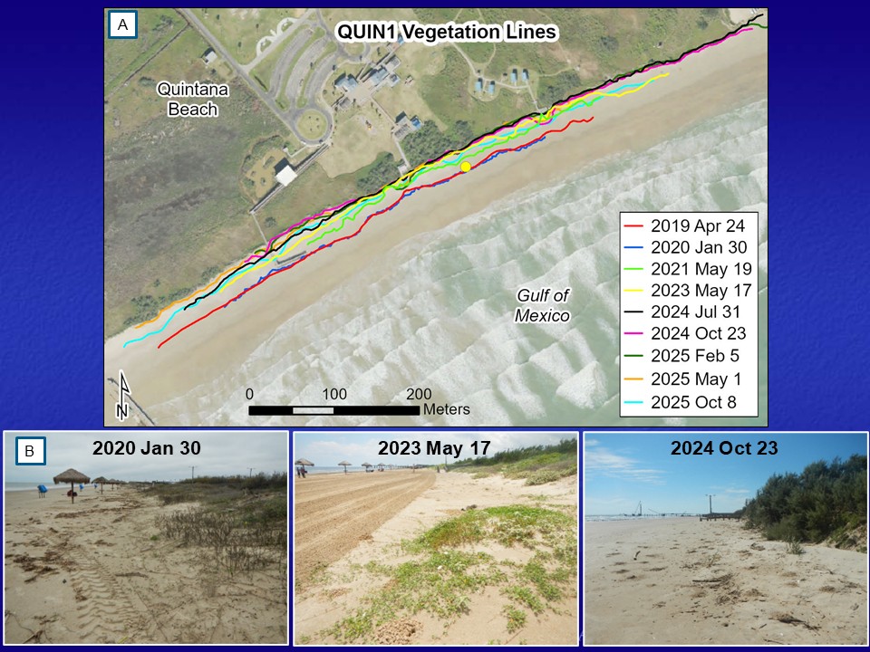
Figure 5. Vegetation line mapping and photography at site QUIN1 at Quintana Beach County Park. (A) GPS mapped vegetation line positions from April 2019 through October 2025. The vegetation line position had been stable prior to the 2020 hurricane season. Mapping in May 2021 documented that the vegetation line had moved 15 meters landward. Hurricane Beryl in July of 2024 caused significant damage to the park infrastructure and caused additional landward movement of the vegetation line in some areas. (B) Photos from QUIN1 looking southwest on January 30, 2020; May 17, 2023; and October 8, 2025. Notice the landward movement in the vegetation line position (distance between beach palapas and vegetation) between the 2020 and 2023 photographs. Hurricane Beryl destroyed the beach palapas, damaged the fishing pier, and deposited significant debris along the vegetation line in the park. A wide beach was present in October 2024.


.png)

