
Ball High School
School Website: https://ball.gisd.org/
2024-2025 field trip data: BallHS2025.pdf
Galleries: 2017-2018 | 2018-2019 | 2019-2020 | 2020-2021 | 2021-2022 | 2022-2023 | 2023-2024 | 2024-2025 | 2025-2026
Ball High School students conduct surveys at DEL01 in the Dellanera RV Park and JAM02 in Jamaica Beach (Fig. 1). Both sites monitor beach nourishment and Coastal Erosion Planning and Response Act (CEPRA) beach and dune restoration activities. They map shoreline positions along Babe’s Beach (west of 61st Street) in front of the Galveston Seawall. A new monitoring site was established in Galveston Island State Park (GISP1) to replace BEG02 (Fig. 1). The new site is easier and safer for students to access.
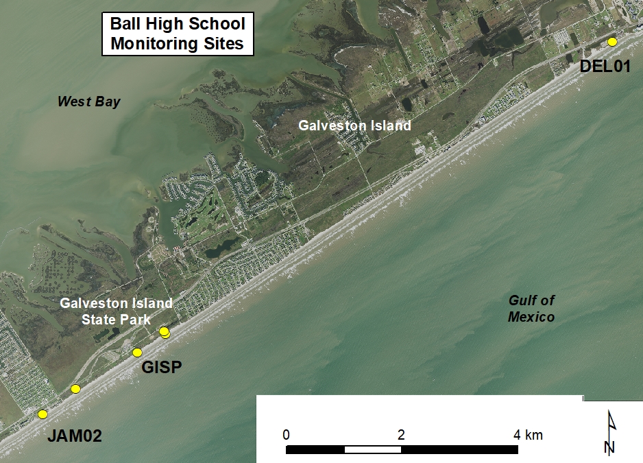
Figure 1. Location map of Ball High School monitoring sites
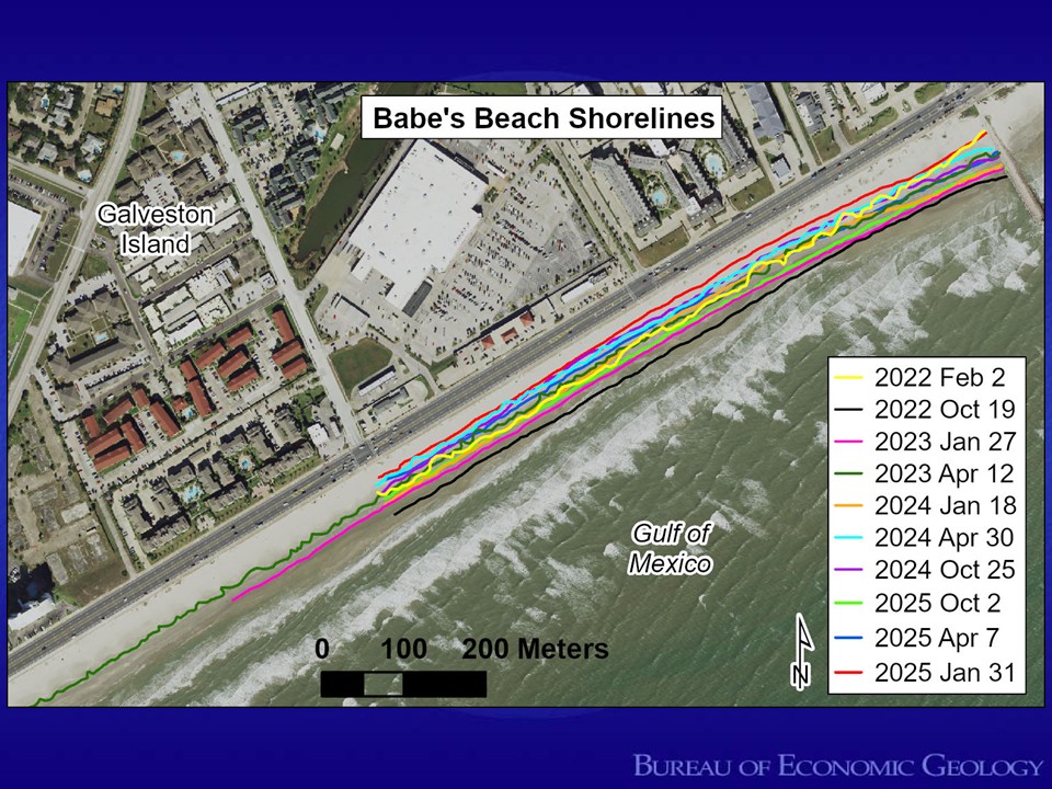
Figure 2. GPS-mapped shoreline positions at Babe’s Beach on Galveston Island.
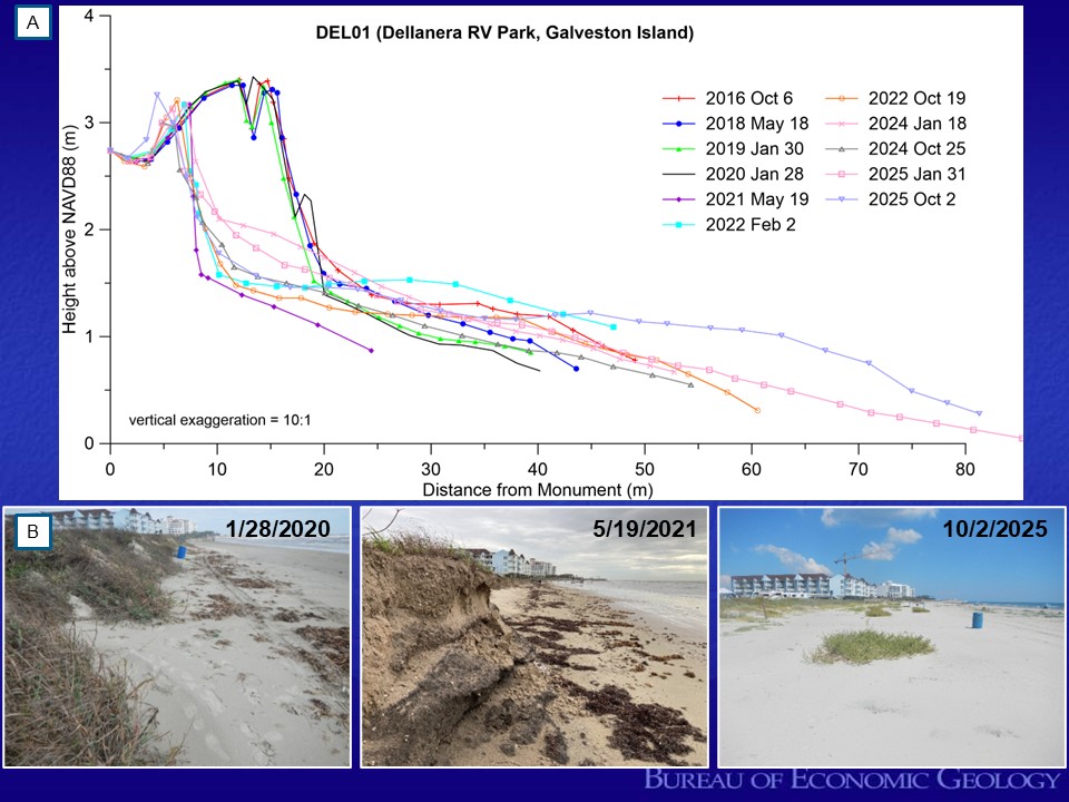
Figure 3. Monitoring changes at DEL01 at the Dellanera RV Park on Galveston Island. (A) Beach profile data between October 2016 and October 2025. (B) A series of photos looking northeast along the dune face and vegetation line from January 28, 2020; May 19, 2021; and October 2, 2025. The 2020 hurricane season caused significant erosion of the beach and dune restoration project. Note the scarped dune and narrow beach in the middle picture. The wide beach in the photo from October 2024 is the result of a well performing beach nourishment project that was completed in early 2023.
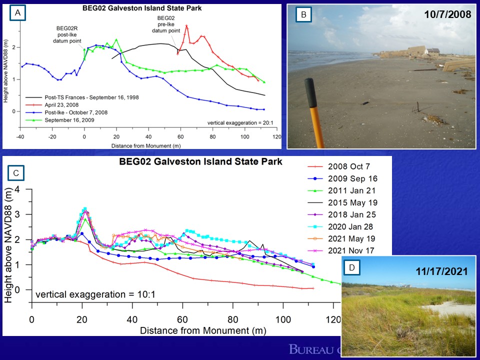
Figure 4. Hurricane Ike impacts and beach and dune recovery at BEG02 in Galveston Island State Park. (A) Beach-profile plots from BEG02 comparing the post–Hurricane Ike profile with a pre-storm profile from early 2008 and the post–Tropical Storm Frances profile from September 1998. Data from September 2009 (1-year post-storm) is also included. (B) Photo of Galveston Island State Park after landfall of Hurricane Ike showing beach and dune erosion and damage to park infrastructure. (C) Beach profile plots from October 2007 through November 2021 showing the recovery of the beach and dune system following hurricane Ike. (D) Photo from November 17, 2021 looking northeast of the vegetated coppice dunes at the park. Notice the toe of the washover feature.
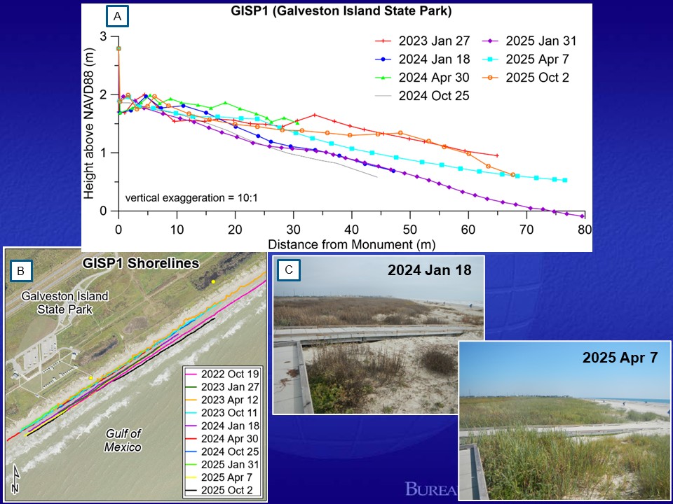
Figure 5. Data and photos from the new monitoring site GISP1 in Galveston Island State Park. (A) Beach profile data between January 2023 and October 2025 and (B) shoreline positions between October 2022 and October 2025. (C) Photos looking northeast from the dune crossover platform from January 18, 2024 and April 7, 2025. Notice how the vegetation is filling in on the incipient dunes at the base of the platform and that the vegetation line is moving seaward between these two dates.
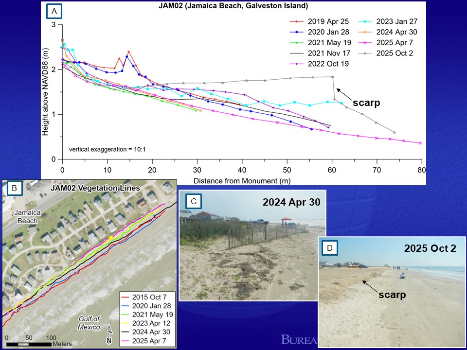
Figure 6. Monitoring of changes at JAM02 in Jamaica Beach, community adjacent to Galveston Island State Park. (A) Beach profile data between April 2019 and October 2025 and (B) vegetation line positions between October 2015 and April 2025. (C) Photo looking northeast along the vegetation line from April 30, 2024. Sand fencing was installed along the vegetation line to trap windblown sand and promote dune growth. (D) Photo from October 2, 2025 looking northeast along the wet/dry line. Notice the prominent scarp that was recorded in the beach profile dataset.


.png)

