Powderhorn Ranch Geoenvironmental Atlas
Water Wells and Windmills
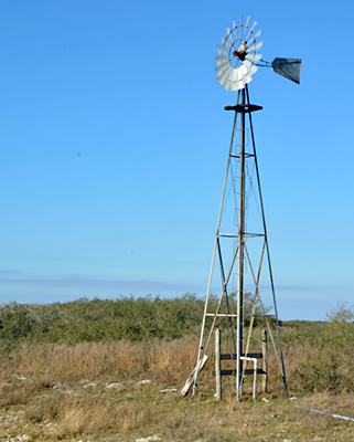
Windmill at Powderhorn Ranch
Numerous water wells and windmills were documented during geologic and geophysical investigations at Powderhorn Ranch. The locations of these wells were determined using GPS (fig. WW1 and table WWT1), their water depths and well depths were measured, samples from most of the wells were tested for total dissolved solids concentration (TDS), and 19 of the wells were geophysically logged. The water well at the ranch house is a water supply well and was not entered. Wells PH01 through PH19 are cased with PVC, are generally capped or open to the surface, and range in depth from 59 to 97 m. Water depths in these wells range from 1.0 to 5.8 m below the ground surface. Deeper water depths are found in wells at higher surface elevations. Estimates of TDS concentration range from fresh (191 mg/L) to moderately saline (3230 mg/L), but these values are measured without purging stagnant water from the well and may differ substantially from true ground-water values. Most of the water wells were drilled adjacent to oil or gas well drilling pads to support drilling activities and were left for other uses. Water levels, well depths, and water salinities were not measured at the windmills.
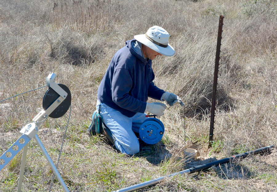
Measuring water depth in a water well before geophysical logging.
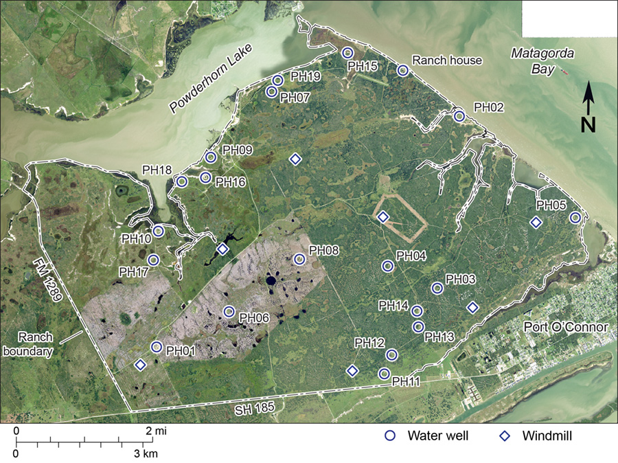
Figure WW1. Location of water wells and windmills on Powderhorn Ranch (table WWT1). Water wells PH01 through PH19 were logged with geophysical instruments to produce natural gamma and electrical conductivity logs that can be used in subsurface lithologic and ground-water studies.
Table WWT1. Water wells and windmills on Powderhorn Ranch (fig. WW1). Ground elevations were determined from an airborne lidar survey conducted by the Bureau of Economic Geology in July 2016. Well and water depths are measured from the ground surface. Total dissolved solids (TDS) concentration is estimated from the measured electrical conductivity of samples drawn from the wells during geophysical logging. Wells PH01 through PH19 were geophysically logged using spectral gamma and electromagnetic induction borehole tools.
| Well | Longitude (degrees W) | Latitude (degrees N) | Well Type | Ground elevation (m) | Well depth (m) | Water depth (m) | TDS (mg/L) |
| PH01 | 96.52396 | 28.4396 | PVC | 3.66 | 84.1 | 4.33 | 829 |
| PH02 | 96.44973 | 28.48747 | PVC | 1.97 | 92.4 | 3.95 | 2500 |
| PH03 | 96.45591 | 28.4509 | PVC | 3.71 | 61.16 | 4.98 | 633 |
| PH04 | 96.46777 | 28.4558 | PVC | 4.32 | 60.33 | 5.4 | 686 |
| PH05 | 96.42224 | 28.4653 | PVC | 2.16 | 86.8 | 3.67 | 1640 |
| PH06 | 96.5063 | 28.44681 | PVC | 4.43 | 78.61 | 5.52 | 1240 |
| PH07 | 96.49488 | 28.49355 | PVC | 2.49 | 58.81 | 3.9 | 847 |
| PH08 | 96.48898 | 28.45769 | PVC | 4.89 | 62.82 | 5.76 | - |
| PH09 | 96.5099 | 28.4798 | PVC | 1.83 | 89.25 | 3.29 | 2110 |
| PH10 | 96.52297 | 28.4643 | PVC | 1.59 | 78.6 | 2.39 | - |
| PH11 | 96.46915 | 28.43289 | PVC | 2.96 | 60.43 | 3.41 | 905 |
| PH12 | 96.46721 | 28.43686 | PVC | 3.49 | 61.91 | 4.92 | 1000 |
| PH13 | 96.46067 | 28.44271 | PVC | 3.24 | 60.11 | 4.48 | 889 |
| PH14 | 96.46095 | 28.44611 | PVC | 3.64 | 59.54 | 4.96 | 937 |
| PH15 | 96.47635 | 28.50143 | PVC | 2.61 | 89.04 | 3.81 | 407 |
| PH16 | 96.51126 | 28.47553 | PVC | 1.15 | 61.18 | 0.99 | 954 |
| PH17 | 96.52424 | 28.45815 | PVC | 2.51 | 72.52 | 2.96 | 191 |
| PH18 | 96.51703 | 28.47479 | PVC | 1.61 | 93.4 | 2.56 | 3230 |
| PH19 | 96.49339 | 28.49593 | PVC | 2.26 | 96.54 | 3.67 | 2650 |
| - | 96.46307 | 28.4975 | Supply | 3.33 | - | - | - |
| - | 96.46868 | 28.46638 | Windmill | 4.26 | - | - | - |
| - | 96.43181 | 28.46447 | Windmill | 3.2 | - | - | - |
| - | 96.47683 | 28.43371 | Windmill | 3.49 | - | - | - |
| - | 96.48955 | 28.47906 | Windmill | 2.93 | - | - | - |
| - | 96.50754 | 28.4602 | Windmill | 2.53 | - | - | - |
| - | 96.44753 | 28.44666 | Windmill | 2.47 | - | - | - |
| - | 96.52795 | 28.43593 | Windmill | 4.06 | - | - | - |