Powderhorn Ranch Geoenvironmental Atlas
Topography and 2016 Airborne Lidar Survey
Powderhorn Ranch is a low-relief area typical of the Texas coastal plain. Standard topographic maps show elevations at 5-ft intervals, which is insufficiently detailed to accurately map surficial geologic units, delineate wetlands, and forecast inundation areas and depths related to elevated bay and Gulf of Mexico water levels caused by frequent tropical cyclones.
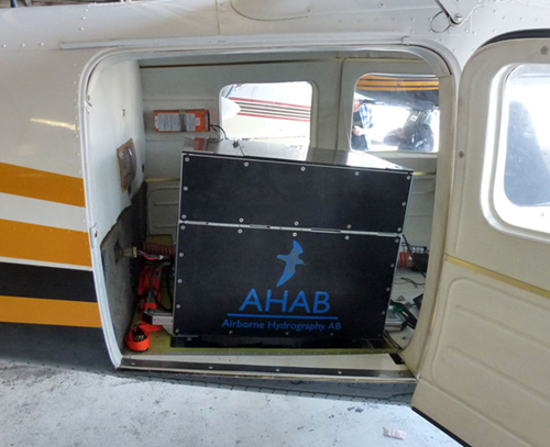
BEG's Chiroptera lidar system used for the Powderhorn Ranch topographic survey..
For this atlas, BEG researchers acquired lidar data along the western shore of Matagorda Bay July 5-8, 2016. Data were collected using the Chiroptera airborne system from Airborne Hydrography AB. The topographic lidar scanner operates at a wavelength of 1 µm, a pulse rate as high as 400 kHz, and an incident angle (from vertical) of 28 to 40 degrees. It can operate to a maximum height of about 1,500 m, allowing the system to rapidly scan large areas with a range accuracy of about 2 cm over a flat target. GPS data from base stations at the Calhoun County Airport near Port Lavaca and at Powderhorn Ranch were used to improve positioning accuracy. Flight elevation was between 450 to 580 m for all flights and laser pulse rate was 240 kHz, providing sufficient point density to allow creation of a high-resolution digital elevation model (DEM) with a 1-m grid-cell size (fig. T1). These data were used to establish ground elevations for water wells and associated geophysical logs, geophysical soundings, and wetland and upland habitat, to identify surficial geologic units and delineate their boundaries, and to estimate water inundation areas and depths for historic hurricanes Carla and Beulah. These data can be used to model inundation areas and depths for future storms with arbitrary storm-surge heights.
Topographically, Powderhorn Ranch consists of a series of generally coast-parallel ridges oriented ENE-WSW that reach elevations above 5 m, separated by parallel swales at lower elevations (fig. T1). The average elevation of the ranch is about 3 m. The lowest elevations, between sea level and less than 1 m above sea level, occur around drainages that connect the swales to Matagorda Bay and Powderhorn Lake. Most prominent among these lows are the northwestern part of the ranch along Powderhorn Lake and its tributaries, the northern tip of the ranch at the junction between Matagorda Bay and Powderhorn Lake, an area along Matagorda Bay where several prominent swales reach the bay, and along the southeastern margin of the ranch toward Port O’Connor.
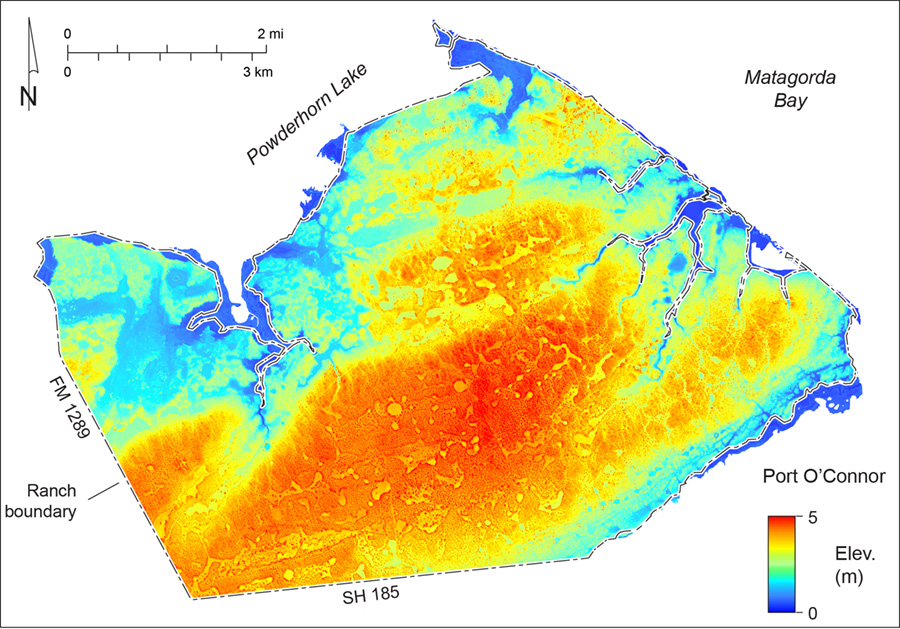
Figure T1. High-resolution (1-m grid cell size) digital elevation model (DEM) of Powderhorn Ranch created from the July 2016 BEG airborne lidar survey.