Franklin Mountains

What and Why and Where
What?
Click photos to view larger.
All photos by Jay Raney, UT BEG, unless otherwise noted.
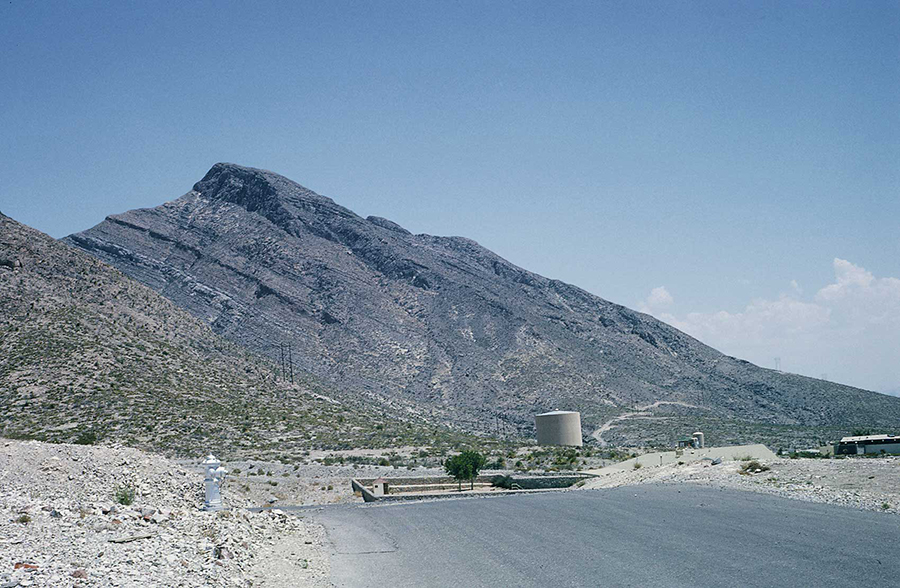
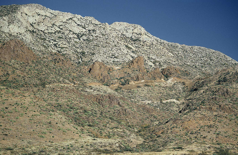
The Franklin Mountains rise high above El Paso. On either side of the Franklin Mountains are large desert basins. To the west is the Mesilla Basin or Mesilla Bolson. "Bolson" is Spanish for "purse." To the east of the Franklins is the Hueco Basin or Hueco Bolson. These basins are lower than the mountains because they have dropped down along faults that are along the edges of the mountains.
From where the Franklins begin in El Paso to where they end in New Mexico is a little more than 14 miles. Their width is variable, but they are generally about 3 miles wide.
Why?
Over millions of years, the Franklin Mountains have moved up along a series of faults, which are breaks in the Earth along the base of the mountains, and the basins next to the mountains have moved down.
Where?
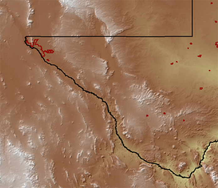
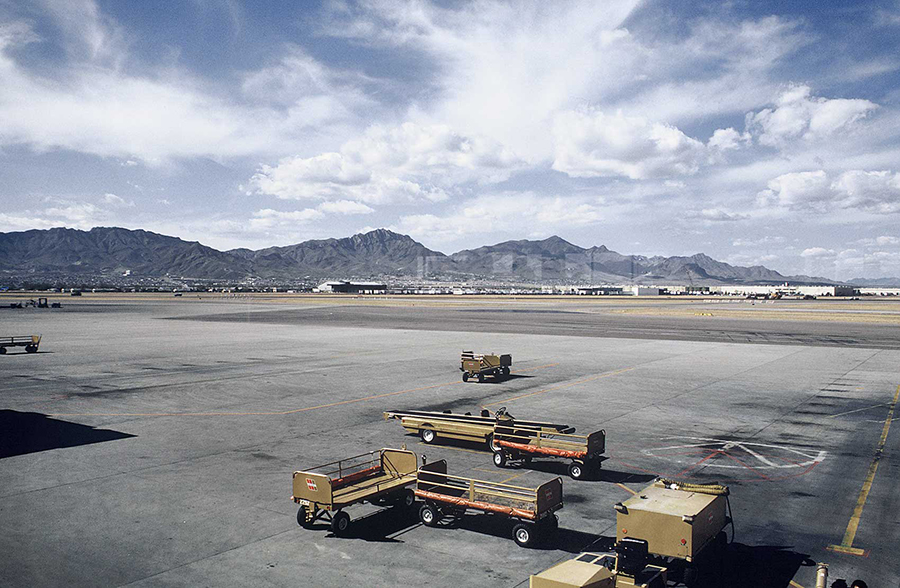
Regional map showing topography.
View of El Paso and Juarez. Photo by Jay Raney, UT BEG
McKelligon Canyon. Photo by Jay Raney, UT BEG
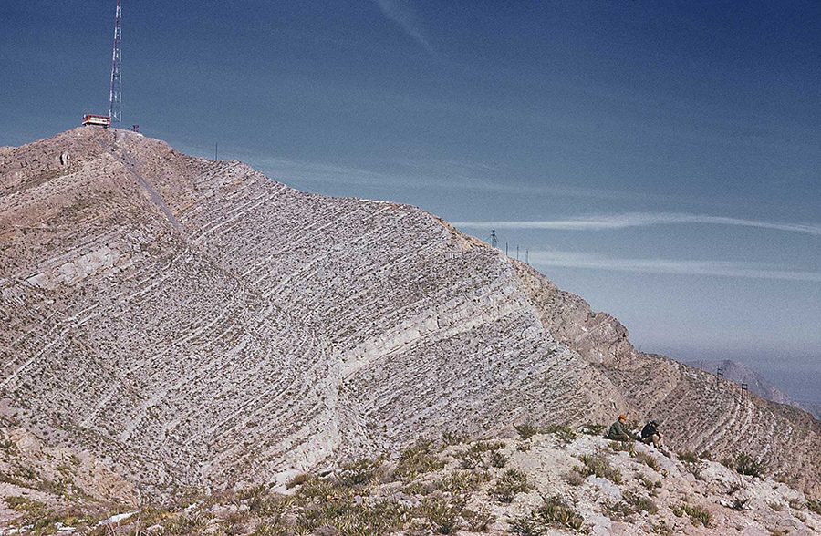
Photo by F. Jerry Lucia, UT BEG
Click images to view larger.
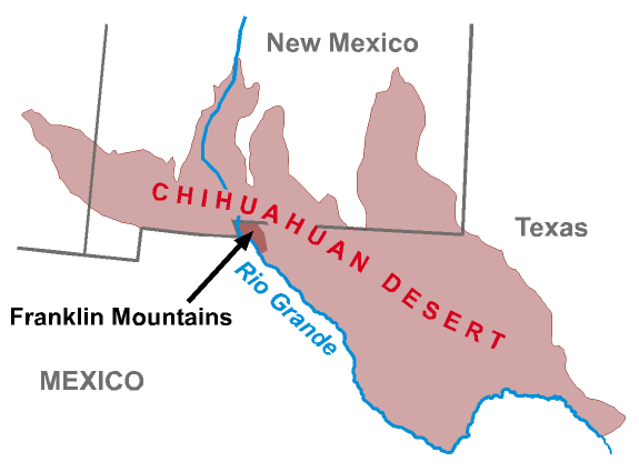
The Franklin Mountains are near the far west tip of Texas. The south end is almost in Mexico, and they extend to the north into New Mexico. Go to El Paso and you can't miss the Franklin Mountains. El Paso is built mostly in the valleys beside the mountains.
Driving directions: The main entrance to the Franklin Mountains State Park is on the west side of the Franklin Mountains at the Tom Mays unit. On the west side of the range, take Interstate 10 to the Canutillo/Trans-Mountain Road exit. Turn east toward the mountains for 3.8 miles on Loop 375/Trans-Mountain Road to the park entrance in the foothills. Alternatively, you can drive from the east side of the range on Loop 375/Trans-Mountain Road. Cross over the mountains on Loop 375. The park entrance is on your left (north) 3 miles down the west slope from the summit of the range.
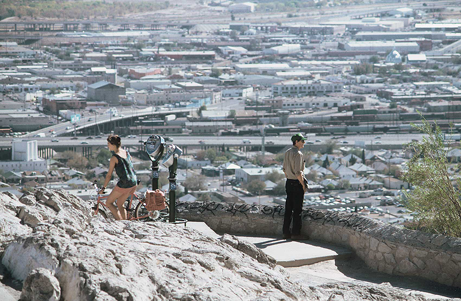
You can also drive to the south end of the park on Scenic Drive. From high up on the south end of the mountains a parking area and overlook offer a nice view of downtown El Paso in the foreground and Juarez in the distance. More directions and a map of the area can be found here or see Google map.
Franklin Mountains State Park
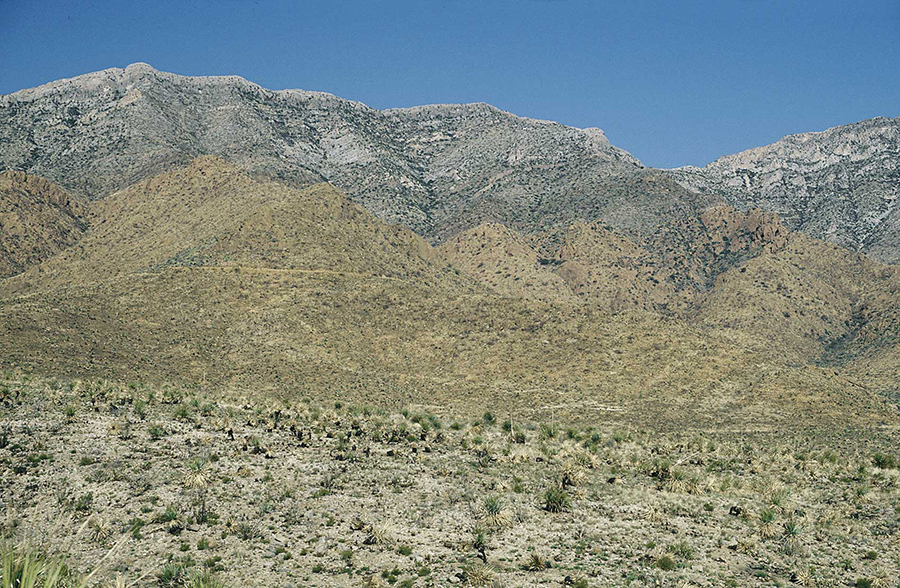
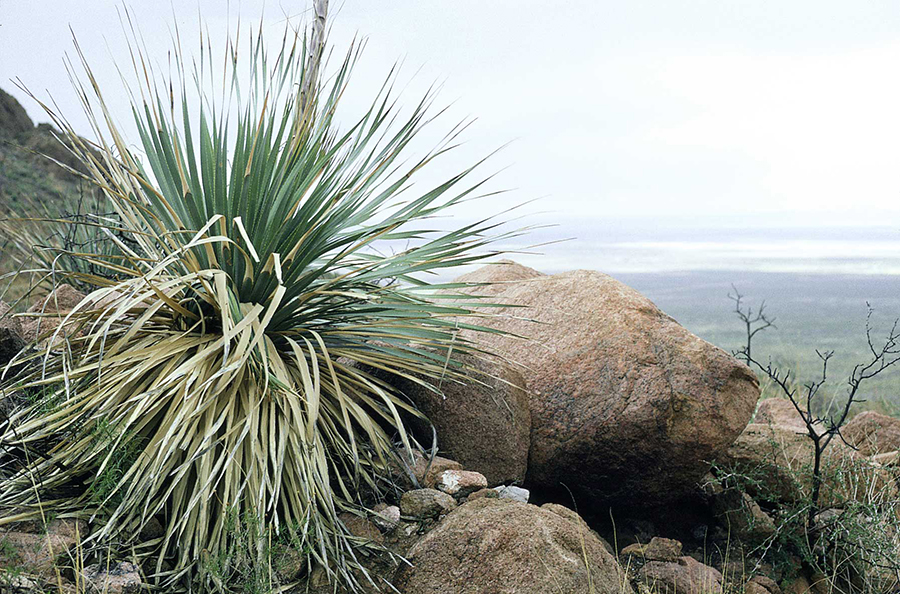
Franklin Mountains State Park protects 37 square miles of the Franklin Mountains. The mountains are rugged and the climate is dry, but you can see interesting rocks, plants, birds, and sometimes other wildlife. The park also offers ranger-led tours that provide great information on the natural history of the Chihuahuan Desert.
McKelligon Canyon
McKelligon Canyon is a spectacular canyon in the Franklin Mountains at the edge of El Paso. It's easy to find. Just take Alabama Road to McKelligon Canyon Road. Most of the hiking trails are steep and challenging, but you can enjoy the scenery without walking far from your car, and there are many wonderful places to have a picnic lunch.
Wilderness Park Museum
The Wilderness Park Museum is located on the floor of the Hueco Bolson on the east side of the Franklins. It's at 44301 Trans-Mountain Road next to the Border Patrol Museum, which is just west of the junction of Trans-Mountain Road and US 54 (Patriot Freeway). Gardens of native plants are at the Wilderness Park Museum, as well as good bird watching and gentle trails for short hikes near the museum. The people at the museum can give you information on other, longer trails that lead into the Franklins. Don't miss the great exhibits and interpretive displays that describe how Native Americans lived in the area.
FAQ
Frequently Asked Questions
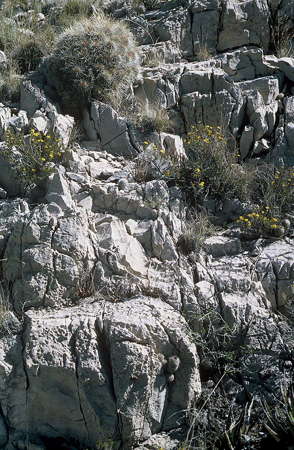
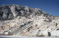
Old rocks, Franklin Mountains
Photos by Jay Raney, UT BEG. Click to view larger.
Q. How old are rocks in the Franklin Mountains?
A. Some really, really old rocks are in the Franklin Mountains—some more than 1 billion (1,000,000,000) years old! These rocks are so old that they are from a time in Earth's history when hardly anything was alive in the oceans, and what life existed, such as small soft-bodied animals with no shells or bones, is rarely preserved as fossils. You can see these old rocks in the road cuts along Trans-Mountain Road and in the generally dark-colored hills nearby; you can also see them many places along the lower slopes of the Franklins. Geologists call rocks this old "Precambrian."
The youngest rocks in the Franklins are Permian age, or about 270 million (270,000,000) years old. Permian-age rocks are present in the Tom Mays unit of Franklin Mountains State Park.
Q. How big are they?
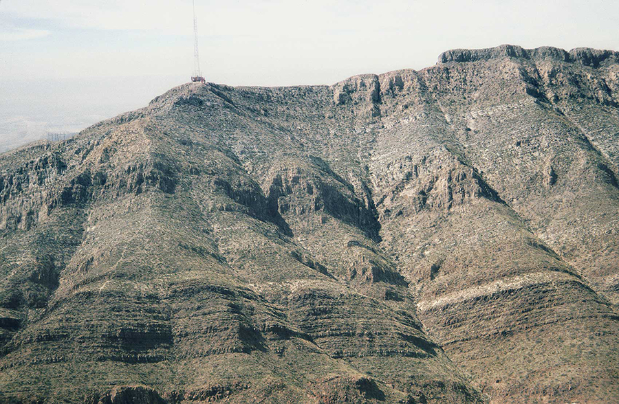
A. The Franklins are a long, skinny mountain range, which is typical of mountains in extensional areas such as the Rio Grande Rift. The highest peak in the Franklin Mountains is North Franklin Mountain. The top of North Franklin Mountain has an elevation of 7,192 feet (elevation means how high it is above sea level). A typical elevation at the base of the mountains is about 4,150 feet, which is also about the lowest elevation within Franklin Mountains Park. The "relief" of mountains, the difference between the highest elevations and the base of the mountains, is about 3,000 feet.
Activities
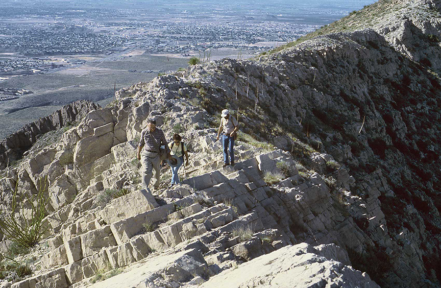
Photo by F. Jerry Lucia, UT BEG. Click photo to view larger.
What can I do in the Franklin Mountains?
- Go for a hike.
- Talk to a ranger.
- Go to the Wilderness Park Museum.
Have fun with math!
Download this activity in PDF format
All the dimensions have been given in English system units. Let's convert English system units to metric units.
1. What's the elevation of North Franklin Mountain in meters?
Hint: Collect your data. Go to Franklin Mountains and find the elevation in feet, then remember that 1 foot equals 0.3048 meter.
The elevation of North Franklin Mountain is 7,192 ft. 7,192 ft × 0.3048 m/ft = 2,192 meters (ft × m/ft = m)
2. If the Franklin Mountains are 23.2 kilometers long, how long are they in miles?
Hint: 1 kilometer equals 0.621 mile.
The length is 23.2 km × 0.621 mi/km = 14.4 miles (km × mi/km = km)
3. If the City of El Paso drills a water well in the Hueco Bolson that is 300 feet deep, how deep is the well in meters?
Hint: 1 meter equals 3.28 feet. (Be careful!)
Well depth = 300 ft and there are 3.28 ft/ 1 m (or 1 m/ 3.28 ft). In order to get an answer in feet, to keep units correct, m/ft × ft or: (m/ft × ft = ft), so 1 m/ 3.28 ft × 300 ft, or 300 ft / 3.28 ft = 91.5 m deep.
Other math questions:
4. The elevation of El Paso International Airport is 3,958 feet. Assume you are a pilot. If you take off in a small plane from the airport and you plan to fly over the top of North Franklin Mountain (see Franklin Mountains), what is the minimum amount of elevation you must gain to avoid crashing into the mountain?
7,192 ft (elevation of mountain peak) - 3, 958 (elevation of airport) = 3,232 ft.
5. Assume you are a geologist, and from your studies of one of the bounding faults on the Franklin Mountains you have determined that, on average, the fault has a major earthquake event every 20,000 years, the fault slips 20 feet in each major earthquake, and the total amount of slip along the fault is 7,500 feet. Assuming the frequency of fault events has been constant over time,
(a) how many earthquakes at 20 feet per event have occurred?
If total fault slip (displacement) is 7,500 ft, and the amount of slip per earthquake is 20 ft, then the total number of large earthquakes is 7,500 ft divided by 20 ft per event, or 375 earthquakes.
(b) How long has it taken for 7,500 feet of total slip to occur?
If major earthquakes occur every 20,000 years, and there were 375 earthquakes to produce the total displacement, the total time is 20,000 years/earthquake × 375 earthquakes = 7,500,000 years (7.5 million years).
(c) What is the average slip per year?
If the total slip is 7,500 ft and the total time is 7,500,000 years, then the average feet per year is 7,500 ft divided by 7,500,000 years, or 0.001 ft per year.
6. Let's go for a hike. Let's assume you are going to hike up the crest of the Franklin Mountains and that the ranger told you it's a moderately steep trail and that it is 2 miles from where you park your car and start walking to the ridge crest. You are in pretty good shape, but perhaps one of your friends is a slow walker. Because it's uphill, you can perhaps hike 1 mile every 35 minutes, and you plan on two 10-minute rest stops. Once you get to the ridge you plan on stopping for a picnic lunch for 45 minutes. You return by the same trail, but this time it's downhill so you expect to hike 1 mile every 25 minutes and you again take two 10-minute rest stops.
(a) If you start walking at 11:00 a.m., when will you get to the ridge crest to stop for lunch?
Hike up to ridge = 35 minutes/mile × 2 miles (70 minutes) + 2 rest stops × 10 minutes (20 minutes) = 90 minutes to hike to the ridge. If you leave your car at 11:00 a.m., you will arrive at the ridge crest at 11:00 a.m. + 90 minutes, or 12:30 p.m.
(b) When will you get back to your car?
You picnic for 45 minutes and hike down from the ridge 2 miles at 25 minutes per mile (50 minutes) + two rest stops of 10 minutes (45 minutes + 50 minutes + 20 minutes = 115 minutes, or 1 hour and 55 minutes). You will return to your car at 12:30 p.m. + 1 hour and 55 minutes, or 2:25 p.m.
(c) Excluding lunch, what is your average hiking speed, including rest stops, in miles per hour for the total hike?
Your average hiking speed in miles per hour (excluding lunch) is time hiking up (90 minutes) per 2 miles + time hiking down (70 minutes) per 2 miles, or 160 minutes per 4 miles. 160 minutes / 4 miles = 40 minutes per mile average hiking speed, or 1.5 miles per hour (1 mile/ 40 min = X miles/60 min; 60 min/40 min = 1.5 miles/hour)
7. How much does that rock weigh? Even if they are the same size, some rocks weigh more than others. A block of ash from a volcano, for example, may have lots of spaces in it that are filled with air, so it weighs less than a block of granite that's the same size. Most of the rocks in the Franklin Mountains will weigh about 1 ton per 14 ft3 ("cubic feet") of rock. If you find a block of rock that is 2 ft wide by 2 ft long by 3.5 ft tall (2 ft × 2 ft × 3.5 ft = 14 ft3) it would weigh 1 ton, or 2,000 pounds.
(a) If a block of rock that is 14 ft3 in volume weighs 2,000 pounds, how much does a block of rock weigh that is 7 ft3 in volume?
Remember, a 14-ft3 block of rock weighs 2,000 pounds. If you think about it, 7 ft3 is ½ of 14 ft3, so the block would weigh ½ of 2,000 pounds, or 1,000 pounds, OR 2,000 lb/14 ft3 = X lb/ 7 ft3, or 7 ft3 2,000 lb/14 ft3 = X. Therefore X = 2,000 lb divided by 2, or 1,000 lb.
(b) How much does a 1-ft3 block weigh? Could you lift a 1-ft3 block of rock?
A 1-ft3 block weighs 1/14 × 2,000 pounds, or 143 pounds. Can you lift it?
(c) How many tons, or how many pounds, does a large boulder weigh that is 2 ft wide by 5 ft long by 7 ft high?
The volume of the boulder is 2 ft × 5 ft × 7 ft, or 70 ft3; the weight is volume (70 ft3) divided by 14 ft3 × 2,000 pounds. 5 × 2,000 lb = 10,000 pounds. (5 tons)
When you are in the Franklins, find a large block of rock. Estimate its dimensions: approximate width, length, and height. It's OK not to be precise, but try to make good guesses. Multiply to get an estimate of its volume, then use 14 ft3 per ton to make an estimate of its weight.
8. In the Franklin Mountains link, we said the Franklin Mountains are about 14 miles long and about 3 miles wide, and they rise about 3,000 feet high above the valleys. Using these dimensions estimate the volume of rock in the Franklin Mountains in cubic miles.
Hint: There are several ways to solve this problem, but you have to use a little geometry. Assume that the mountains are a perfect prism lying in the desert, with no canyons and no irregular peaks. From either end, the prism looks like an isosceles triangle that is 3,000 ft high and has a base that is 3 miles across. The area of a triangle is ½ the base times the height. A mile is 5,280 ft long.
First make sure all your dimensions are in the same units. Height = 3,000 ft; width = 3 miles; length = 14 miles. Convert 3,000 ft to miles; 3,000 ft/5,280 ft = 0.568 mile. Because this is an estimate, let's keep it simple; round off to 0.6 mile. Next, calculate the area of the triangle that approximates a section cut across the mountains: ½ base × height = area or (½) (3 miles) × 0.6 mile = 1.5 mi × 0.6 mi = 0.9 mi2 (square miles). That’s the tough part. The total volume of the Franklin Mountains is the length of the mountains times the cross-sectional area, or 0.9 mi2 × 14 mi or 12.6 mi3 (cubic miles). That's a lot of rock.
Click on images to view larger
Dark-colored rocks. Photo by Jay Raney, UT BEG.
Light-colored rocks. Photo by Jay Raney, UT BEG.
Layered rocks. Photo by F. Jerry Lucia, UT BEG
Franklin cross-section diagram
Thin layers. Photo by F. Jerry Lucia, UT BEG
Thick layers. Photo by Jay Raney, UT BEG.
Rock Sediment and Soil Facts
Tell me about the dark-colored rocks.
The mostly dark colored rocks that you see on the lower slopes of the eastern Franklin Mountains and all along Trans-Mountain Road are Precambrian-age rocks. They are mostly volcanic rocks (rocks associated with volcanoes), granites (igneous rock with coarse crystals of quartz and feldspar), and sedimentary rocks, which are most commonly rocks deposited as sediments in water. These rocks have been so deeply buried that the heat and pressure of the deep Earth have changed them. They have been "metamorphosed." A well-layered, metamorphosed limestone (see light-colored rocks below) is now a marble.
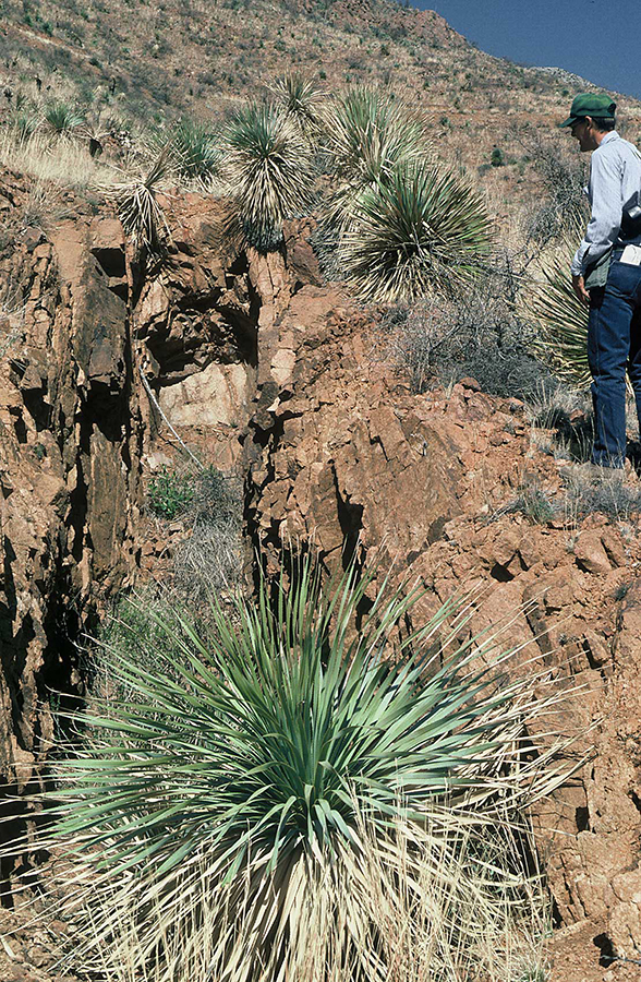
Tell me about the light-colored rocks.
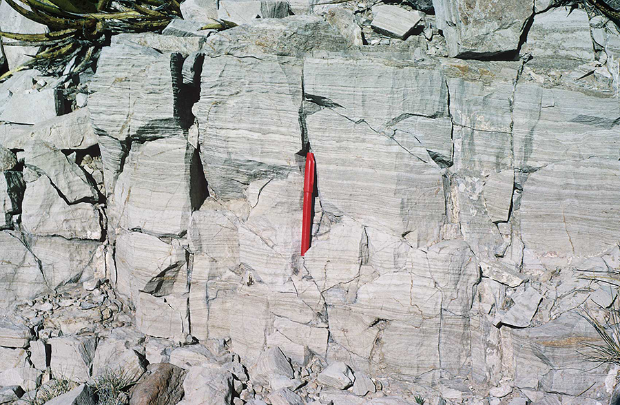
The rocks that you see in the western Franklin Mountains, along the ridge crest at the south end of the range and overlying the old dark-colored rocks of the east part of the range, are mostly light colored rocks—tans and grays. They are mostly layered, suggesting that they are sedimentary rocks, and they are mostly inclined to the west (geologists would say the bedding planes "dip" to the west). These are sedimentary rocks that were formed in ancient oceans—limestones and dolomites. Other kinds of rocks are there too—a little sandstone (composed of sand grains) and mudstone (made up of tiny grains of silt and clay and perhaps some sand).
Why are some rocks in layers?
They are sedimentary rocks. That means that they were once soft sediments, sand or silt or other particles, usually deposited in water such as a lake or an ocean. Most of the layered rocks in the Franklin Mountains were deposited in an ancient ocean. We know this because geologists find fossils of ancient marine life in these rocks.
Sediments are deposited in layers as particles that fall to the seafloor. As long as conditions don't change, the same processes continue, and the same kinds of particles are deposited to form a layer of sediment that is pretty homogeneous. But suppose there is a storm. Imagine that the rivers flood and sands and clays are carried into the ocean by the floodwaters. Conditions change. Now sands and clays from the flood are deposited, and the layers are different. Everyplace you see a change from one layer of sedimentary rock to another layer means that the conditions of deposition of the original sediments have changed. You may see thin layers, or you may see layers that are several feet thick.
Lake deposits
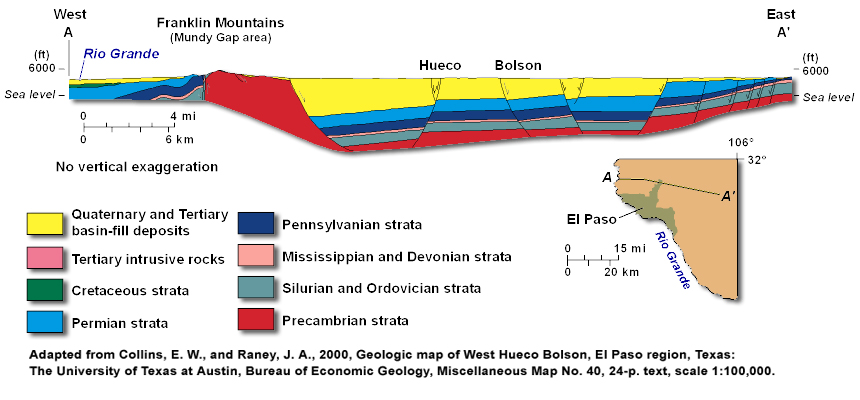
Because water flows downhill, any water from a rainstorm in the mountains either seeps into the ground or flows off to the basins. A big rainstorm may send floods of water rushing to the basins, and these flash flood will carry lots of loose sediments—usually sands, silts, and clays but sometimes gravel and boulders—out into the basins. As the water slows down, the sediments are deposited. Over millions of years the basins have become partly filled by these sediments. They are now thousands of feet thick in the deep parts of the basin (see Franklins Cross section diagram). Beneath these basin-fill sediments are the same rocks that you see in the mountains.
Ocean deposits
As sediments are deposited in an ocean, the particles fall to the seafloor. As long as conditions don't change, the same processes continue, and the same kinds of particles are deposited to form a layer of sediment that is pretty homogeneous. But suppose there is a storm. Imagine that the rivers flood and sands and clays are carried into the ocean by the floodwaters. Conditions change. Now sands and clays from the flood are deposited, and the layers are different. Everyplace you see a change from one layer of sedimentary rock to another layer means that the conditions of deposition of the original sediments have changed. You may see thin layers, or you may see layers that are several feet thick.
Tell me about gravel, sand, silt and clay.
What's caliche?
What's a sand dune?
Geodetective
See if you can track down the answers to these questions Click on the CLUE if you need it.
Q. Why do sedimentary rocks commonly form in layers?
CLUE
Look in "Rock Sediment and Soil Facts" under "Why are some rocks in layers?"
Q. The Franklin Mountains tilt to one side. Which direction do they tilt, and why?
CLUE
Look in the Glossary under "Faults" or "Rock Sediment and Soil Facts" under "Tell me about the light-colored rocks."
Q. The "youngest" rocks in the Franklin Mountains are from what geological age?
CLUE
Look on the "FAQ" page for "How old are the Franklin Mountains?"
Q. The Franklin Mountains are part of what desert?
CLUE
Look on the "Where" page under "Franklin Mountains State Park."

Photos by Jay Raney, UT BEG. Click images to view larger.
Lesson Plans
Click the buttons below to download lesson plans in PDF format.