Mustang Geologic Map
This layer of the interactive data viewer depicts the surficial geologic units found in Mustang Island State Park mapped from field investigations, digital elevation models, and 2022 aerial photography. This new geologic mapping follows the mapping conventions developed through the Texas STATEMAP geologic mapping program (https://www.beg.utexas.edu/research/areas/geologic-mapping). In recent years, Bureau scientists have focused mapping on the Texas Gulf Coastal Plain to address a variety of needs, including planning and managing lands in sensitive coastal environments and studying erosion, habitat change and land loss, and geologic hazards. All units within the park are late Holocene in age (<5,000 years old) and represent bay-margin marsh, beach, washover, spit and tidal flat; Gulf-margin beach, barrier flat, dune, and washover channel; and eolian dune (Fig. 1). Geologically, the map units found in the state park are very young. To understand why the barrier island formed where it did, you have to go further back in time to understand how the Texas Coastal Plain developed.
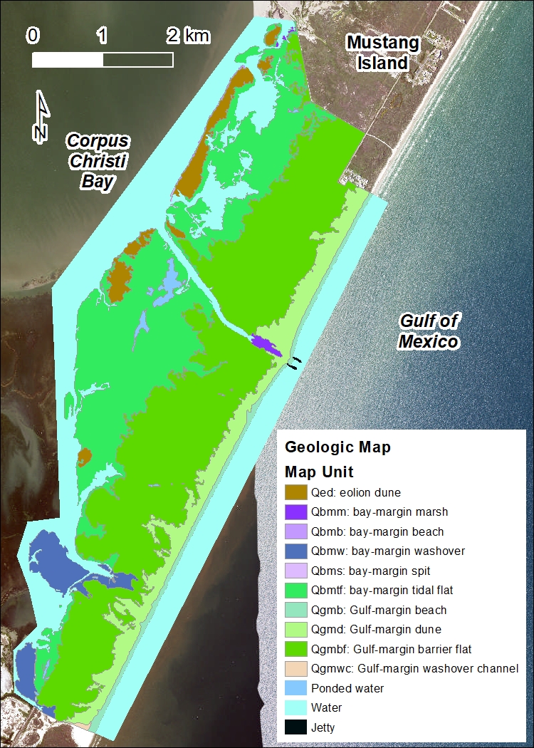
Figure 1. Geologic map of Mustang Island State Park.
The last 2 million years of Earth’s history was a time period called the Pleistocene, which fluctuated between periods of massive glaciation (cold periods where water was trapped in glaciers and sea level was lower) and interglacial stages. During the interglacial periods, climate was warmer and wetter. The melting glaciers and increased rainfall created large rivers that transported a huge amount of sand, silt, and mud to the coastal plain to be deposited at the edge of the Gulf of Mexico. As sea level fell during the cold glacier periods, the rivers carved deep channels through the sediments, creating wide river valleys.
About 18,000 years ago, the last glacial stage ended, and sea level was approximately 100-120 meters lower than today. As Earth warmed, the glaciers and ice sheets melted, causing large amounts of water to flow into the oceans and causing sea level to rapidly rise and fill the old river valleys. About 5,000 years ago, climate and sea level stabilized at near current levels (Fig. 2), although they are still rising. At the same time, the modern barrier islands of the Gulf coastline began to form. Sediments that were carried to the coast by rivers and eroded and deposited in the shallow nearshore were redistributed by wind, waves, currents, and storms. The stabilizing of sea level produced conditions that allowed for large barrier islands like Mustang Island to form.
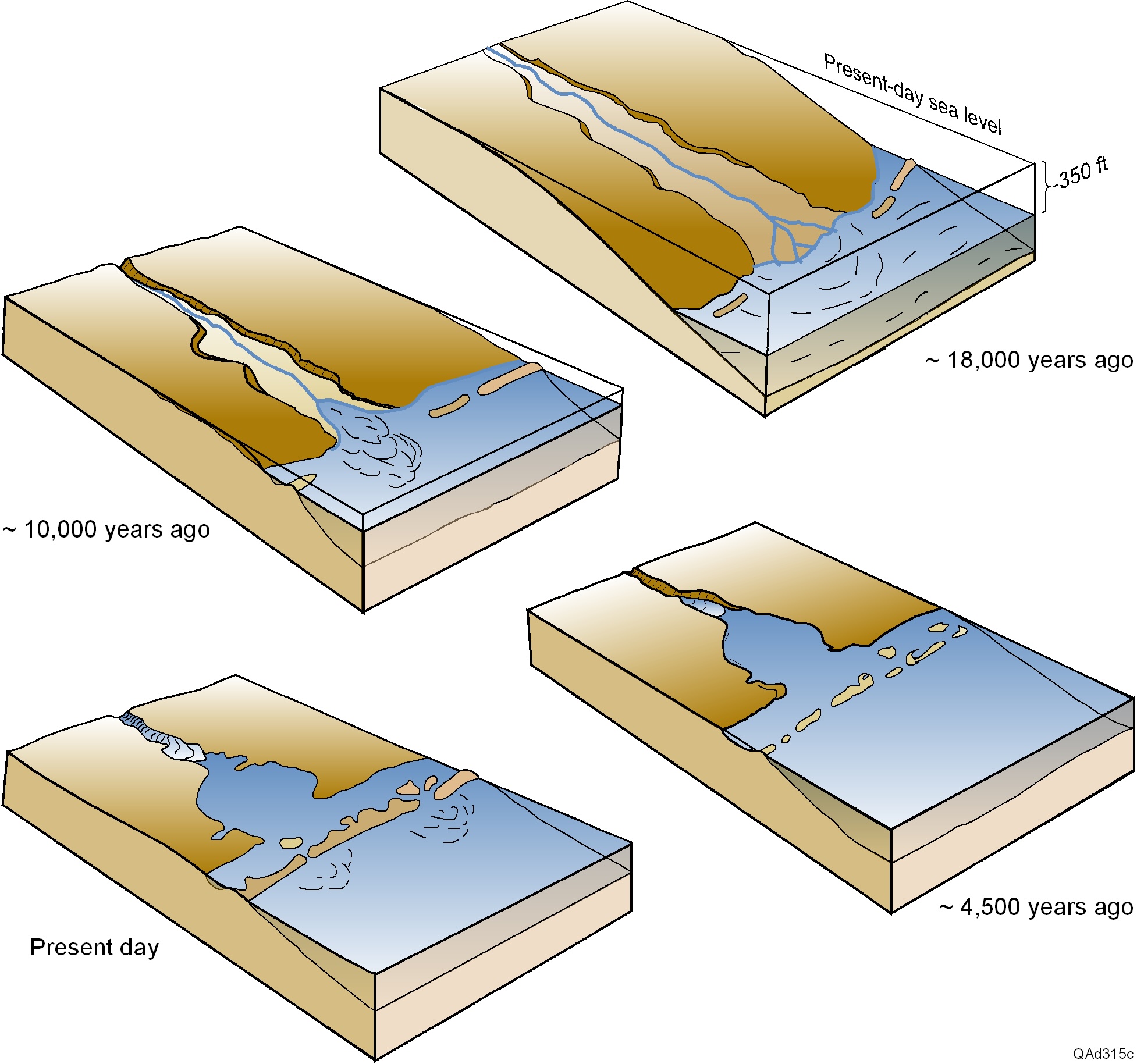
Figure 2. Schematic illustrations showing the effects of rising sea level on the evolution of ancient river valleys into the modern-day coastal environment.