
Cunningham Middle School at South Park
School Website: https://cunninghamsp.ccisd.us/
2024-2025 field trip data: CunninghamMS2025.pdf
Galleries: 2017-2018 | 2018-2019 | 2019-2020 | 2020-2021 | 2021-2022 | 2022-2023 | 2023-2024 | 2024-2025 | 2025-2026
The Bureau conducts field trips with students from Cunningham Middle School at South Park in the Corpus Christi Independent School District. Eighth grade students collect data at sites on northern Padre Island (Fig. 1). NPI08 monitors a very active foredune crest and maintained beach. NPC06 and NPISW, on the Padre Island seawall, monitor beach restoration and maintenance activities seaward of the seawall.
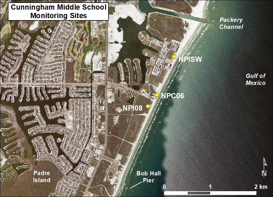
Figure 1. Location map of Cunningham Middle School monitoring site.
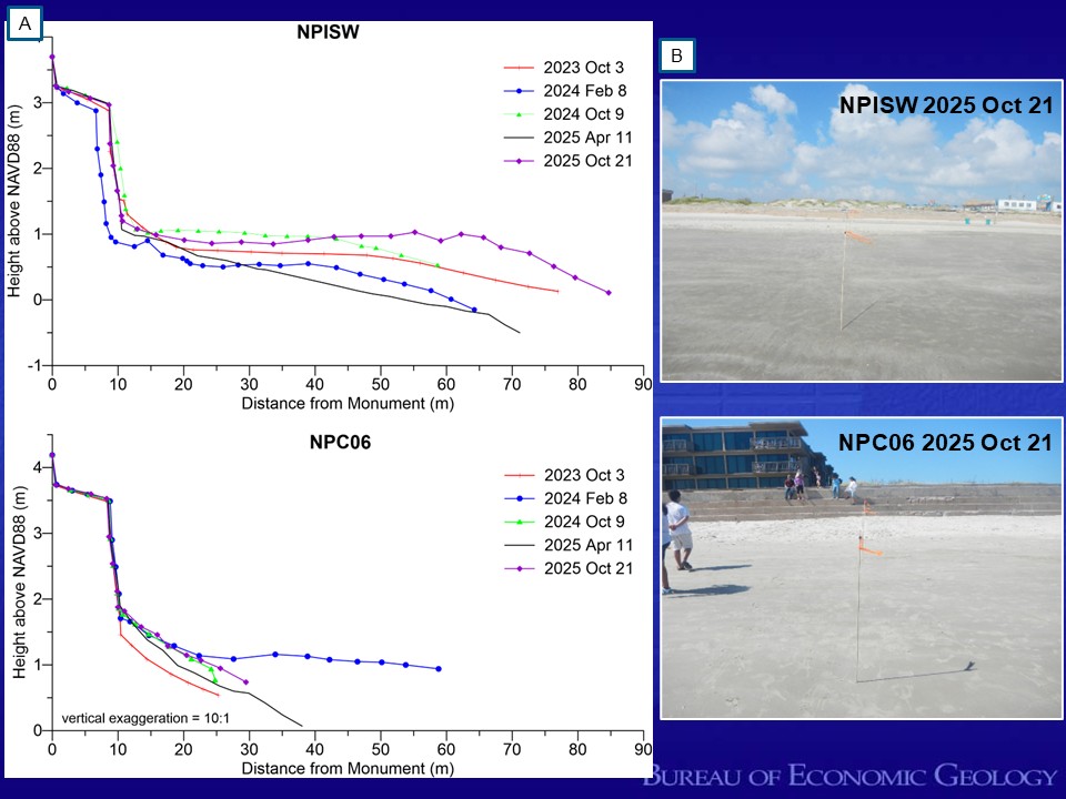
Figure 2. Comparison of beach widths at the northern (NPISW) and southern (NPC06) ends of the Padre Island seawall. (A) Beach profile plots from NPISW (upper) and NPC06 (lower) before and after the beach nourishment project that was completed in early 2024. The student collected data documented the rapid landward migration of the shoreline at NPC06 between April and October 2024 while the northern site remained stable. (B) Photos taken from the waterline looking up the beach profile toward the seawall at NPISW (upper) and NPC06 (lower) from October 21, 2025.
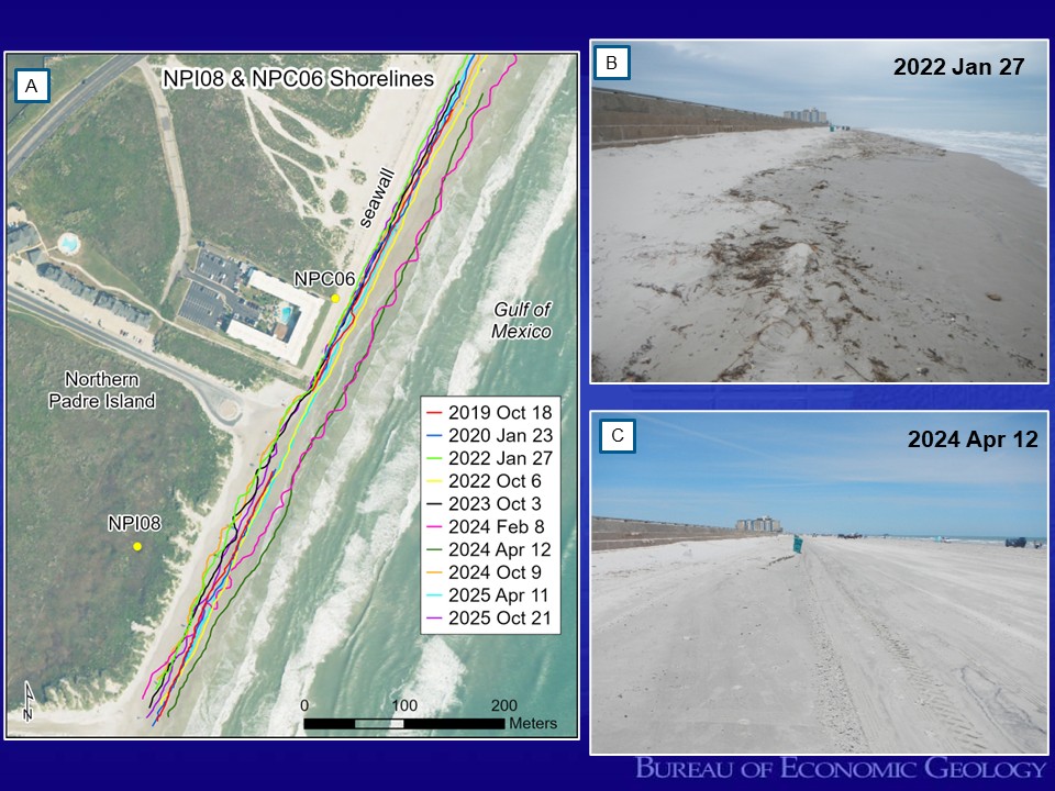
Figure 3. Shoreline mapping and photography at site NPC06 on the North Padre Island seawall monitoring the performance of beach nourishment and beach maintenance activities in front of the seawall and adjacent area. The beach in front of the seawall is periodically nourished with beneficial use material from maintenance dredging of Packery Channel. (A) GPS mapped shoreline positions for NPI08 and NPC06 between October 2019 and October 2025. (B) Photo looking north along the shoreline on January 27, 2022. Notice the narrow beach and how close the wet/dry line is to the base of the seawall. In April 2022, the waterline was at the base of the seawall and students were unable to map the shoreline position. (C) Photo taken on April 12, 2024, a few months after the completion of the latest beach nourishment project.


.png)

