Remote sensing and airborne lidar research
Near Surface Observatory Google Scholar link
The Bureau of Economic Geology (The Bureau), a research unit within the Jackson School of Geosciences at UT Austin, owns and operates an airborne survey system that incorporates topographic (NIR-1064 nm) and bathymetric lidar (visible-515 nm), and a 4-band aerial camera. This system, a Leica Chiroptera Mark 5 was purchased in late 2023, to collect research-grade, three dimensional lidar data to support diverse geophysical and geoscience applications.
Remote sensing staff at the Bureau welcome opportunities to explore innovative applications of topographic and bathymetric lidar imaging services to internal and external research communities and State and Federal agencies. Please contact Kutalmis Saylam.
The Bureau has conducted numerous research-grade airborne lidar surveys since 2000 using an Optech ALTM 1225, focusing in areas and topics that include determining coastal change and tropical cyclone impacts on the northwestern Gulf of Mexico coast, assessing geologic hazards in sinkhole-prone areas, and conducting detailed geologic mapping throughout Texas. In 2012, that system was replaced by a custom-built Chiroptera Mark 1, which added bathymetric mapping capabilities, The new system enabled research projects as diverse as determining the size and depth of thermokarst lakes on the Alaskan North Slope, mapping the shallow seafloor along the Gulf of Mexico and Pacific coast of California, measuring water depths and river-bottom morphology along the Colorado River in Arizona, and quantifying water volumes held in oilfield pits. In the summer of 2022, the Bureau loaned a Chiroptera Mark 4 from Leica, and mapped 11,000 km2 of sea ice in the Arctic for the Calibration/Validation campaign of NASA.
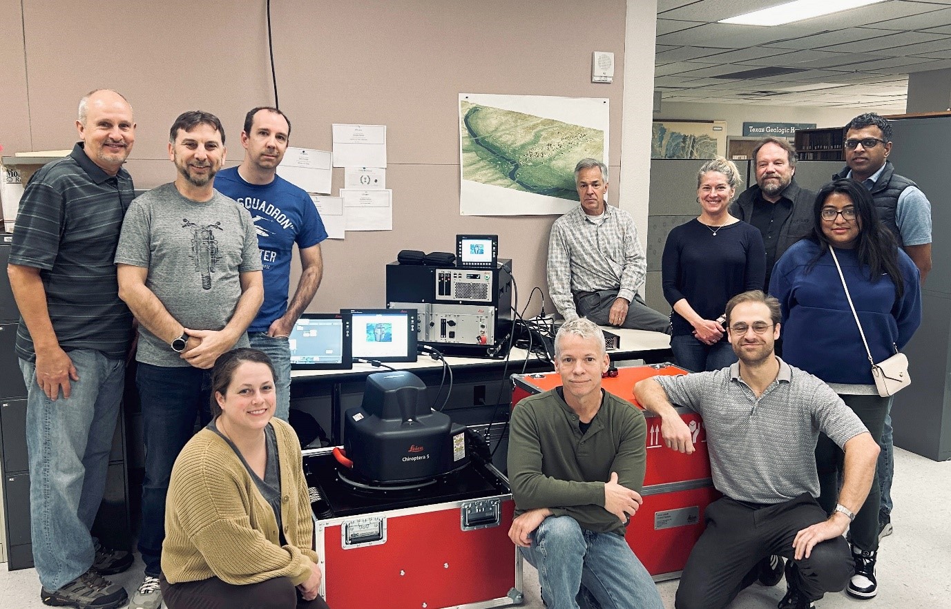
From left to right: Jay Kipper, Kutalmis Saylam, Jennifer Morris, Aaron Averett, John Andrews, Jeffrey Hyatt (Leica), Tiffany Caudle, Ben Grunau, Jeff Paine, Zarrin Tasneem (Leica) and Dushan Arumugam (Leica) – February 2024.
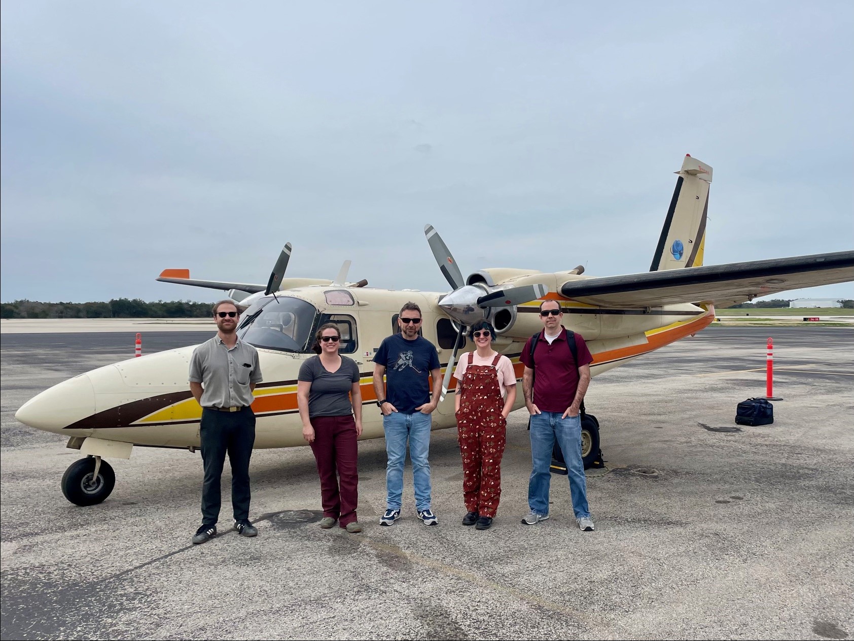
Gulf coast survey crew, 02/2024. From left to right: Ben Grunau, Jennifer Morris, Kutalmis Saylam, Kelsey Meisenhelder (UT Integrated Biology) and Aaron Averett. The survey aircraft is operated by Talos Aviation of Arizona.
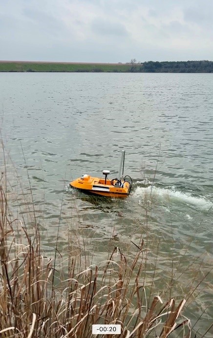
NSO owned and operated unmanned surface vehicle (USV) to measure depths of water reservoirs.
Selected lidar applications
Optech ALTM 1225 (2000-2011)
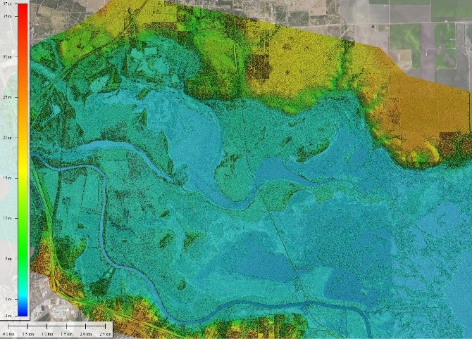
NIR lidar-derived DEM of Nueces Delta in Texas (02/2007).
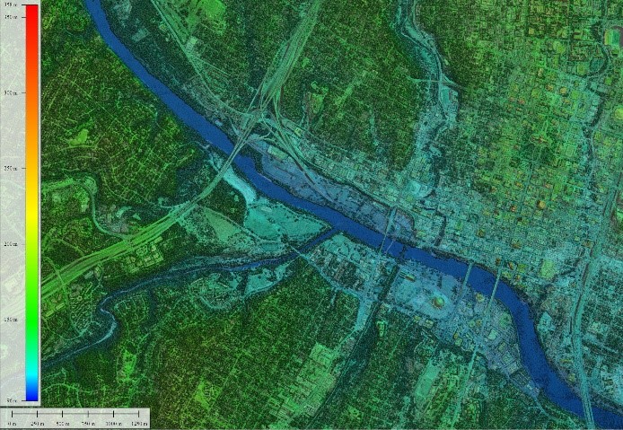
NIR lidar-derived DEM of downtown Austin (08/2000).
AHAB Chiroptera-I (2012-2022)
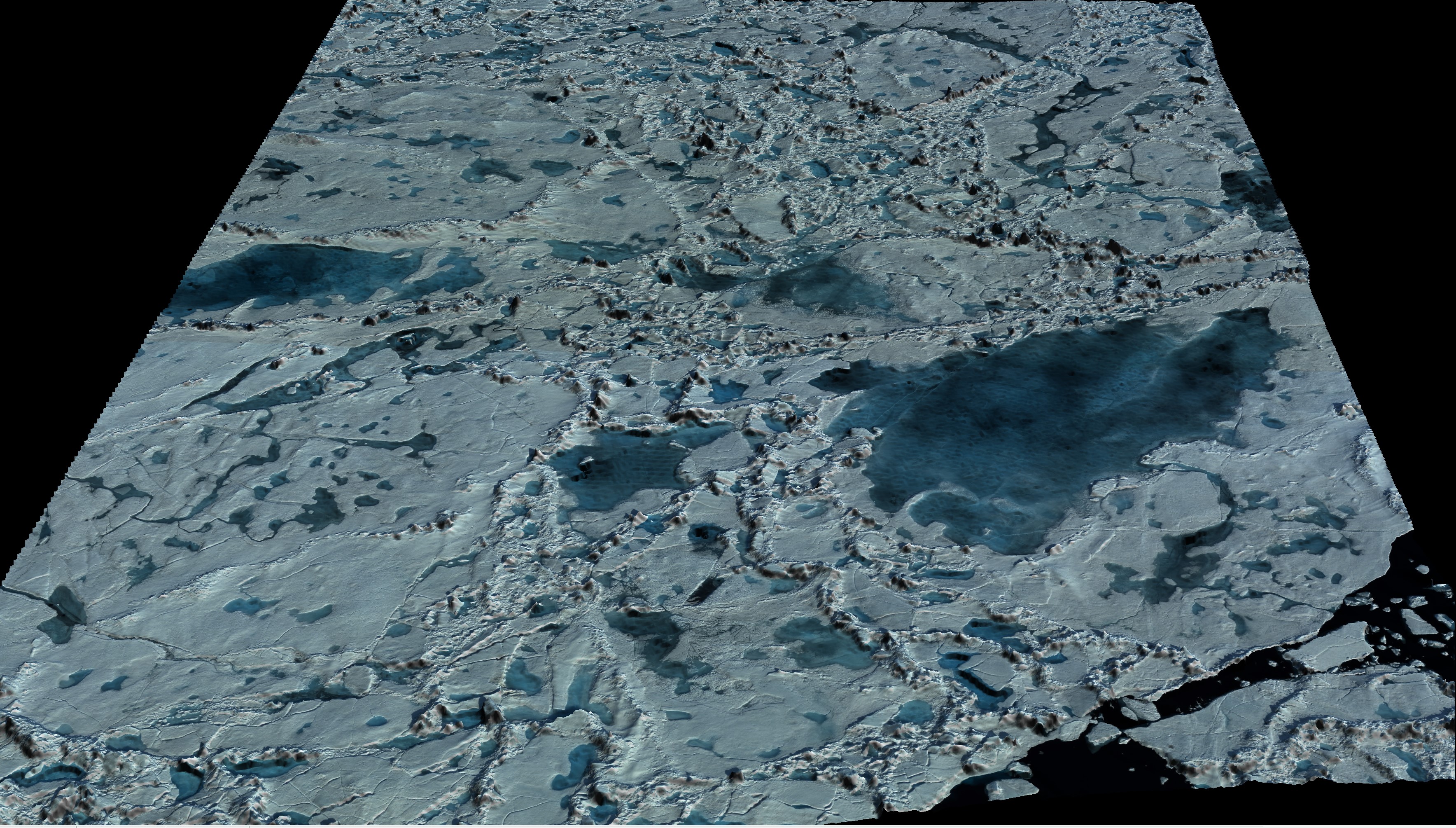
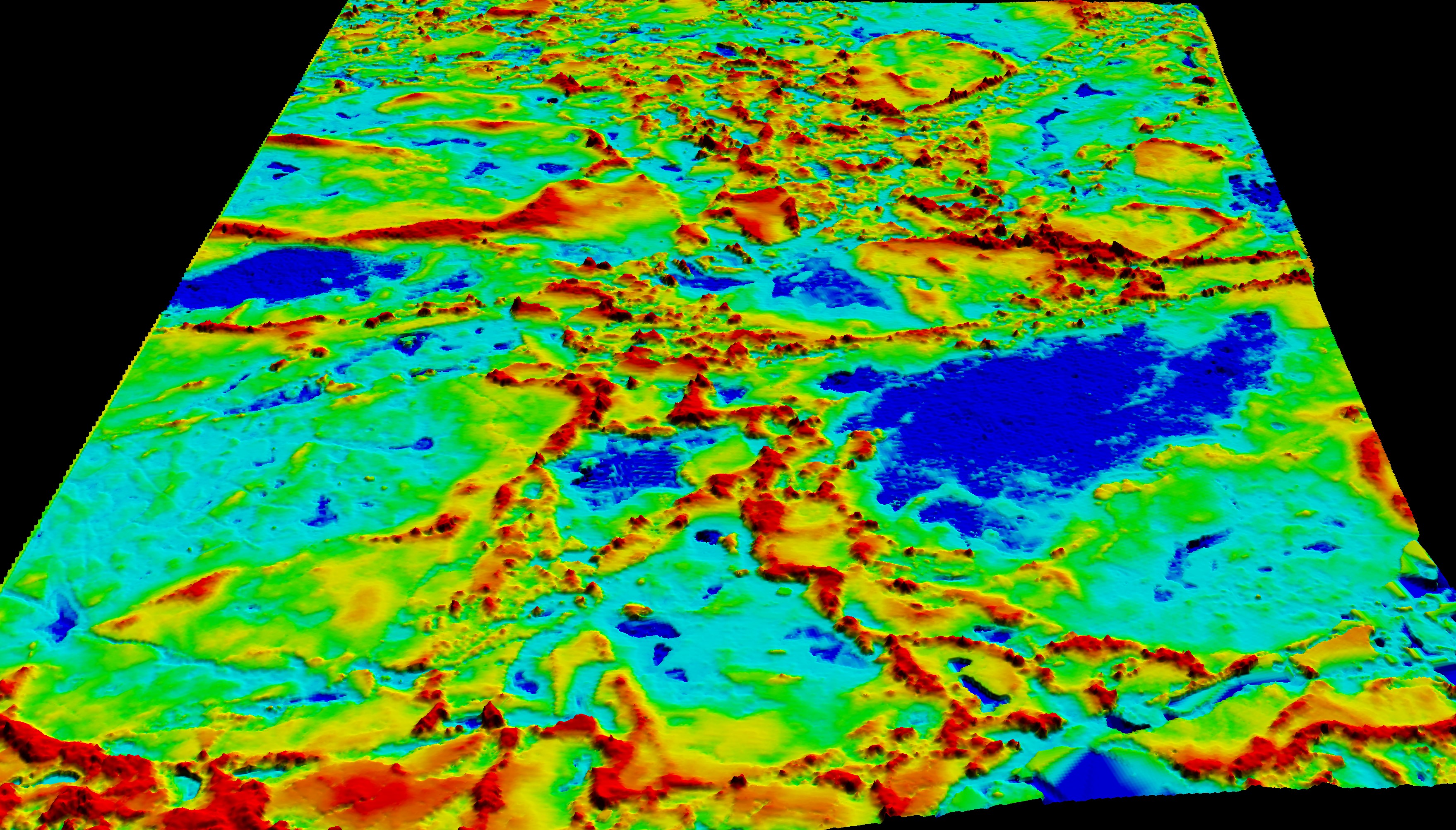
RGB imagery of Alaskan North Slope thermokarst lakes (08/2014).
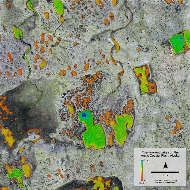
RGB imagery fused with NIR and green-wavelength lidar-derived DEM of Alaskan North Slope thermokarst lakes (08/2014).
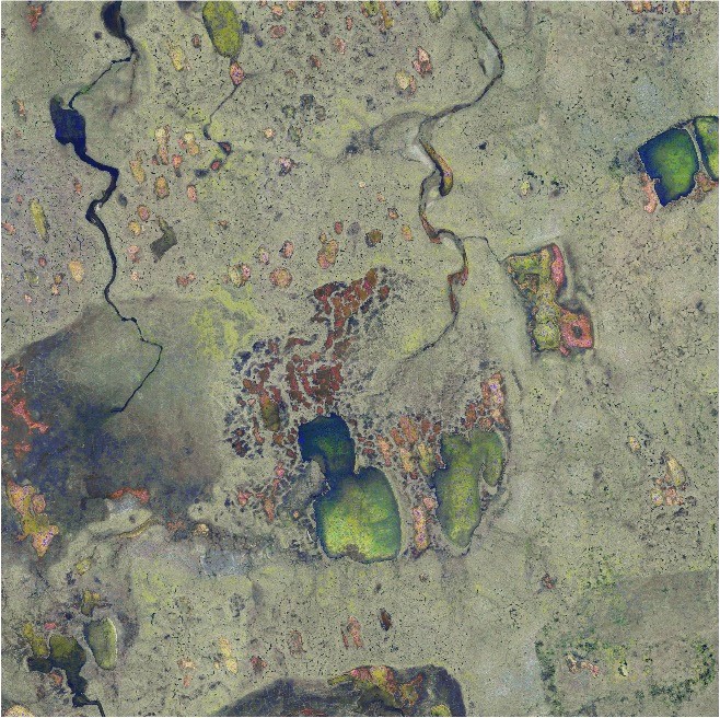
Sink hole in Wink, TX and the subsidence in the near areas as defined using NIR lidar-derived elevation model (2014).
Devils River topography in the southwest Texas. DEM constructed by using NIR and green-wavelength lidar (2017).
Leica Chiroptera-4X (2022)
RGB imagery fused with NIR and green-wavelength DEM of Arctic summer sea ice (07/2022).
NIR and green-wavelength DEM of Arctic summer sea ice (07/2022).
Leica Chiroptera-5 (2023- present)
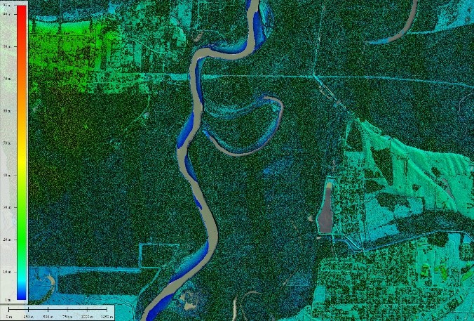
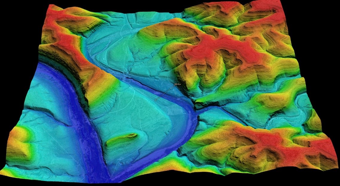
NIR DEM of Trinity River in eastern Texas (03/2024).
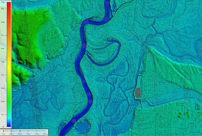
NIR and green-wavelength DSM of Trinity River (03/2024).
Research publications
Saylam, K., Averett, A. R., Andrews, J. R., Grunau, B. A., & Morris, J. N. Evaluating the geometric integrity of airborne lidar data for coastal and environmental applications: A case study along the Texas Gulf Coast. International Journal of Remote Sensing, v. 47, no. 7, 2026, pp. 1–30. https://doi.org/10.1080/01431161.2026.2651995
Saylam, K., Averett, A. R., Andrews, J. R., Short, S. R., Kurtz, N. T., & Tilling, R. L. (2025). Airborne lidar to verify ICESat-2 Arctic summer sea ice heights and melt pond depths: Calibration and validation campaign, Greenland 2022. Earth and Space Science, 12, e2024EA004100. https://doi.org/10.1029/2024EA004100
Saylam, K.; Briseno, A.; Averett, A.R.; Andrews, J.R. Analysis of Depths Derived by Airborne Lidar and Satellite Imaging to Support Bathymetric Mapping Efforts with Varying Environmental Conditions: Lower Laguna Madre, Gulf of Mexico. Remote Sensing 2023, 15, 5754. https://doi.org/10.3390/rs15245754.
Saylam, K.; R. Averett, A.; Costard, L.; D. Wolaver, B.; Robertson, S., Multi-Sensor Approach to Improve Bathymetric Lidar Mapping of Semi-Arid Groundwater-Dependent Streams: Devils River, Texas. Remote Sensing 2020, 12, 2491. https://doi.org/10.3390/rs12152491
Tiffany L. Caudle, Jeffrey G. Paine, John R. Andrews, Kutalmis Saylam; Beach, Dune, and Nearshore Analysis of Southern Texas Gulf Coast Using Chiroptera lidar and Imaging System. Journal of Coastal Research 1 March 2019; 35 (2): 251–268. doi: https://doi.org/10.2112/JCOASTRES-D-18-00069.1
Saylam, K., Hupp, J. R., Averett, A. R., Gutelius, W. F., and Gelhar, W. B., 2018, Airborne lidar bathymetry: assessing quality assurance and quality control methods with Leica Chiroptera examples: International Journal of Remote Sensing, v. 39, no. 8, p. 2518-2542, http://doi.org/10.1080/01431161.2018.1430916.
Saylam, K., Hupp, J. R., Andrews, J. R., Averett, A. R., and Knudby, A. J., 2018, Quantifying Airborne Lidar Bathymetry quality-control measures: a case study in Frio River, Texas: Sensors, v. 18, no. 12, p. 4153, http://doi.org/10.3390/s18124153.
Saylam, K., Brown, R., and Hupp, J. R., 2017, Assessment of depth and turbidity with airborne Lidar bathymetry and multiband satellite imagery in shallow water bodies of the Alaskan North Slope: International Journal of Applied Earth Observation and Geoinformation, v. 58, no. C, p. 191-200, http://doi.org/10.1016/j.jag.2017.02.012.
Young, M. H., Andrews, J. H., Caldwell, T. G., and Saylam, K., 2017, Airborne LiDAR and aerial imagery to assess potential habitats for the desert tortoise (Gopherus agassizii): Remote Sensing, v. 9, no. 458, 16 p., http://doi.org/10.3390/rs9050458.
Paine, J. G., Caudle, T., and Andrews, J. R., 2017, Shoreline and sand storage dynamics from annual airborne Lidar surveys, Texas Gulf Coast: Journal of Coastal Research, v. 33, no. 3, p. 487-506, http://doi.org/10.2112/JCOASTRES-D-15-00241.1.
Paine, J. G., Andrews, J. R., Saylam, K., and Tremblay, T. A., 2015, Airborne LiDAR-based wetland and permafrost-feature mapping on an Arctic coastal plain, North Slope, Alaska, in Tiner, R. W., Lang, M. W., and Klemas, V. V., eds., Remote sensing of wetlands: applications and advances: London, CRC Press, p. 413-434.
Jeffrey G. Paine, John R. Andrews, Kutalmis Saylam, Thomas A. Tremblay ,Aaron R. Averett, Tiffany L. Caudle, Thoralf Meyer, and Michael H. Young, (2013), "Airborne lidar on the Alaskan North Slope: Wetlands mapping, lake volumes, and permafrost features," The Leading Edge 32: 798-805. https://doi.org/10.1190/tle32070798.1
Industry magazine publications
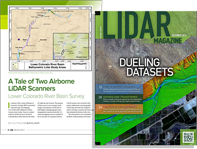
A tale of two airborne lidar scanners - lower Colorado River survey (01/2016).
The airborne lidar data acquisition project was sponsored by the Bureau of Reclamation to understand and map the overall geomorphology of the lower Colorado river basin, including the water-bottom surface. The survey area consisted of 120 miles of the river, with varying terrain altitude, water clarity, depth, and flow conditions.
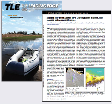
Airborne lidar on the Alaskan North Slope: Wetlands mapping, lake volumes, and permafrost features (07/2013).
The first field trip to the North Slope of Alaska (Deadhorse, AK) was completed in 08/2012. An area of roughly 450 square kilometers was covered and acquired more than 15 billion NIR and green-wavelength elevation points.
Lidar bathymetry on the Alaskan North Slope (04/2016).
Bureau researchers returned to Deadhorse, Alaska in July 2014, and conducted numerous surveys to capture a larger area. In two weeks, more than 4,500 thermokarst lakes were surveyed using the Chiroptera Lidar-I system. Survey findings revealed lakes deeper than 2 m (suitable for building ice roads), and datasets served a variety of supplemental environmental and industrial purposes.