Network and Station Design
TxSON consists of soil water content and meteorological sensors, installed in monitoring stations located in Fredericksburg, Brady, Marfa, and the greater Houston area. A subset of stations is additionally equipped with instruments for tracking meteorological measurements.
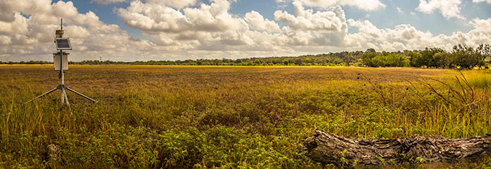
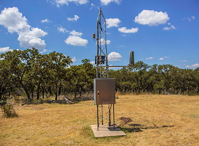
TxSON soil water content monitoring stations consist of a micrologger (Campbell Scientific CR200), sensors (e.g., CS-655) installed at 5, 10, 20, and 50-cm depths (or to bedrock), an 8” raingage (model TE525), a 10W solar panel, and cellular data modem. TxSON Meteorological Stations are additionally equipped with air temperature and humidity (Rotonic model HC2S3), wind speed and direction (model RM Young Wind Sentry), and solar radiation (model Hukesflux LP02).
Each water content sensor is installed horizontally into the undisturbed face of a trench excavated by a portable soil auger. The complete excavation is to 36 inches or to the limestone bedrock; whichever comes first. The hole is carefully backfilled and the sensor wires or leads (~20 feet) are routed through PVC conduit into a data logger housed above ground on a secured tripod. Power is maintained using a 10W solar panel and a 12V, 7AH sealed battery. This area is protected from livestock using 8’ cattle panels.
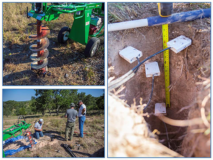
Installation of a TxSON soil moisture monitoring station. An auger (top left) is used to excavate a hole to 3 feet. Soil moisture sensors are inserted into the trench face (right). The wires are routed below ground to a tripod containing additional meteorological sensors, a solar panel, modem and a data logger.
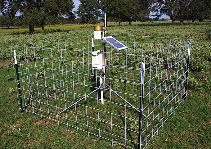
A micro-soil moisture monitoring station using a CR200 data logger, 3-4 soil moisture sensors, a precipitation gage and cellular communications. To date, 30 of these have been installed
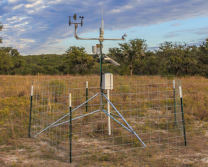
In addition to soil moisture and precipitation, a full meteorological station also includes air temperature and humidity, wind speed and direction, and incoming solar radiation allowing calculation of potential evapotranspiration. To date, 6 of these have been installed.
Leveraging existing data logging and transmission, soil moisture sensors have been added to 7 LCRA Hydromet raingage stations in eastern Gillespie County.