
Bureau Researchers Analyze New Daisetta Sinkhole
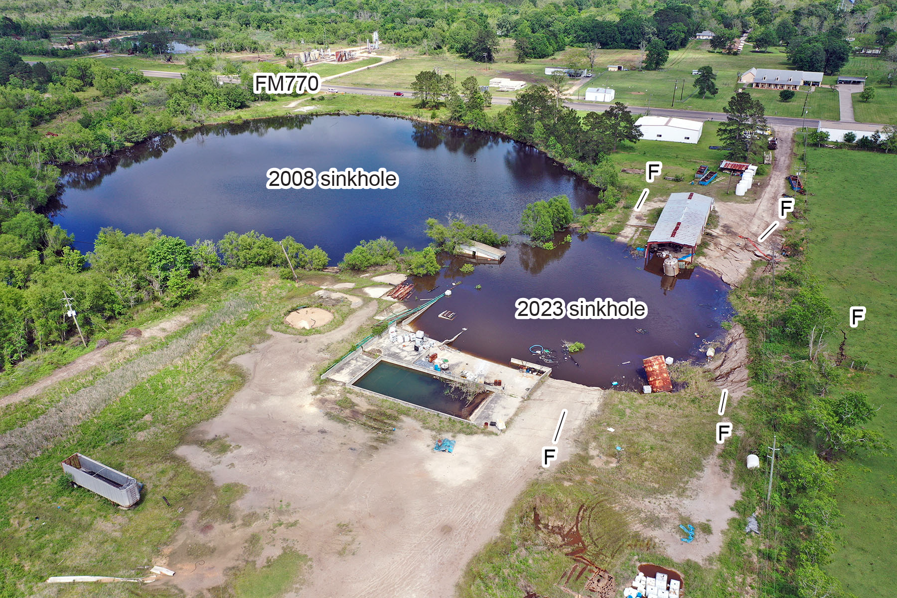
Oblique drone image of the 2008 and 2023 sinkholes in Daisetta, Texas, acquired on April 8, 2023. “F” denotes areas of prominent concentric cracks, fissures, and scarps. View to the northeast.
At the request of the Liberty County, Texas, Office of Emergency Management, a Bureau of Economic Geology hazard assessment team made up of researchers Jeff Paine, John Andrews, Jennifer Morris, and Kutalmis Saylam visited the new Daisetta sinkhole on April 8, 2023. This new, nearly circular sinkhole, located on the southwest side of the larger 2008 Daisetta sinkhole (the subject of earlier Bureau investigations), collapsed on Sunday, April 2, on the northwest flank of the Hull salt dome in the community of Daisetta, Texas.
On this initial visit, the team mapped concentric fissures and scarps around the new sinkhole and conducted a drone-based structure-from-motion survey to obtain high-resolution images and construct a post-collapse topographic map of the sinkhole area. Water depth in both sinkholes was measured using a graduated, weighted string lowered into the sinkholes with the drone. The team also acquired differential GPS elevations for drone imagery georeferencing and elevation-change detection and used a passive seismic method to estimate the depth to salt along the FM 770 highway near the sinkhole.
Data from the site visit will provide critical information on the sinkhole to emergency responders and the public. Studies at the site are supported by the Bureau’s State of Texas Advanced Resource Recovery (STARR) program. The team’s report on the sinkhole is available here. For more information, please contact Jeff Paine.
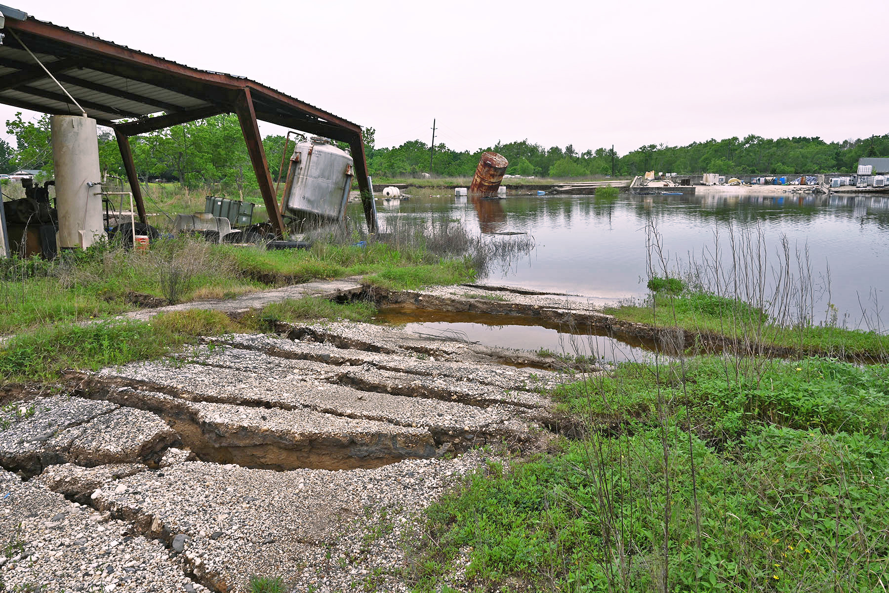
Concentric fissures and scarps stepping down to the 2023 sinkhole. View to the west.
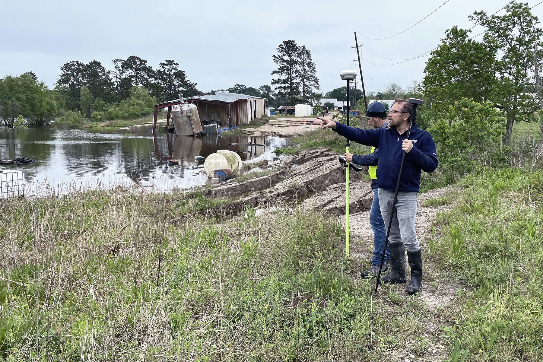
Jeff Paine and Kutalmis Saylam using GPS to map concentric fissures and scarps and assess elevation change of the land surface around the 2023 sinkhole. View to the east.
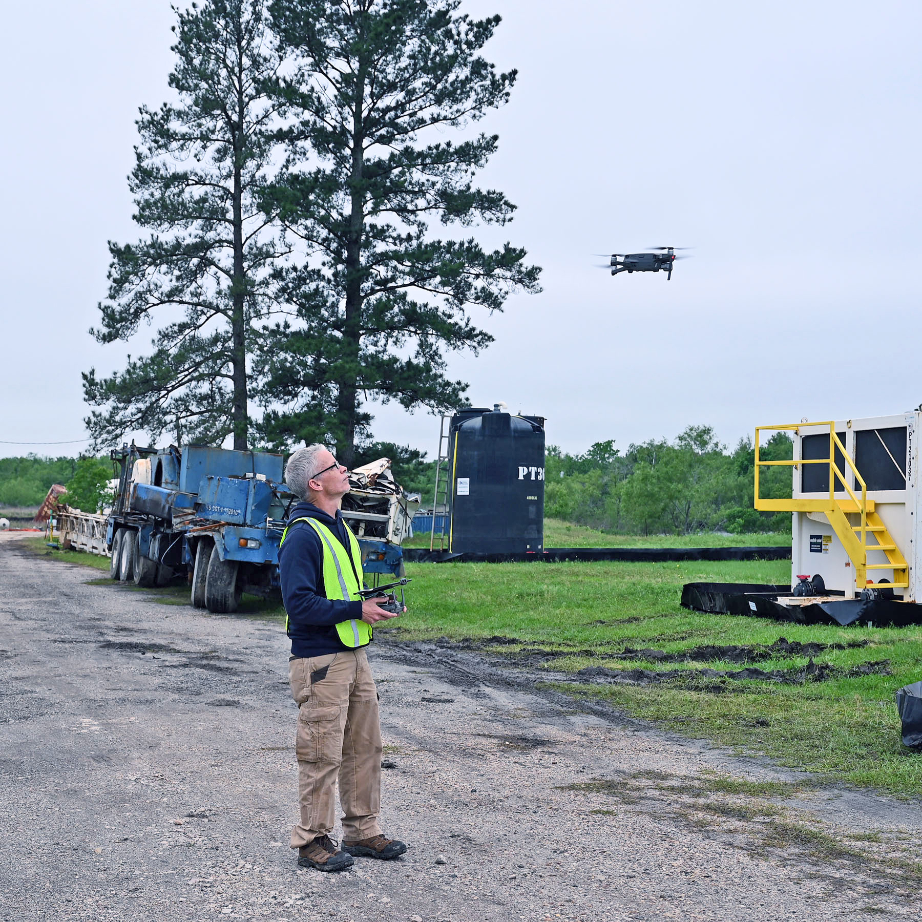
John Andrews operating a drone before flying an aerial survey of the 2008 and 2023 Daisetta sinkhole area. Products will include high-resolution imagery and a post-collapse topographic map to enable detection of future subsidence and sinkhole growth.

