
Texas Geologic Hazards
We think of Earth as mostly benign and unchanging, but geologists recognize that our planet is active on time scales ranging from seconds to millions of years. Some of these active processes constitute threats to humans and their homes, businesses, transportation modes, and recreational activities. Such threats are called geologic hazards, or geohazards.
Common Texas geohazards include those related to storms, earthquakes, coastal faulting and subsidence, coastal erosion, rockfalls, and sinkholes. Geologists employ a variety of instruments and tools to better understand geohazards and minimize their impact on society.
Floods and Tropical Cyclones
From local flash floods to regional storm surges and heavy rainfall associated with tropical cyclones, much of Texas is subject to flooding. Notable recent examples include Hurricane Ike, which made landfall on the upper Texas coast in 2008, and Hurricane Harvey, which made landfall on the middle Texas coast with strong winds and minor surge, stalled on the Texas Coastal Plain, and heavily damaged the Houston area with catastrophic rainfall-related flooding. Instruments such as airborne lidar help researchers assess the threat and impact of flooding through the development of high-resolution models of surface topography.
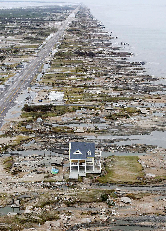
Bolivar Peninsula after Hurricane Ike, 2008.
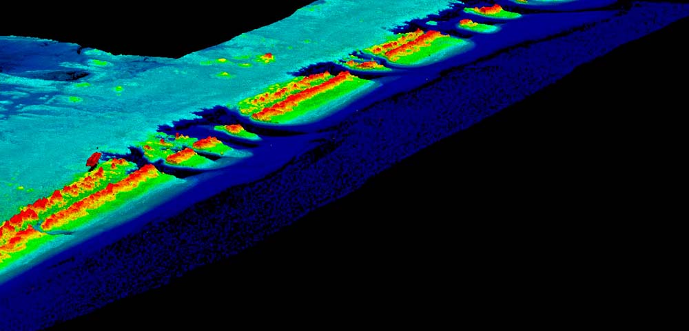
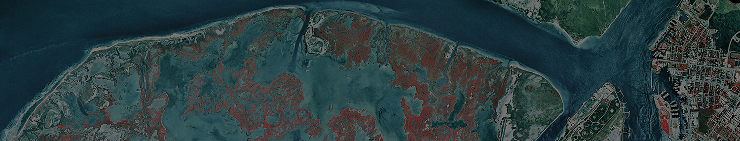
Airborne lidar-derived topographic image of San José Island showing breaches in the dunes caused by surge waters returning to the Gulf of Mexico during Hurricane Harvey (2018). (J. Andrews)
Coastal Erosion
Bureau researchers monitor chronic erosion and land loss on the Texas Gulf shoreline. Since the 1930's, about 80 percent of the shoreline has retreated, resulting in a net land loss of nearly 15,000 acres. These losses are caused by a combination of shortfalls in sediment supplied to the coast, sea-level rise, coastal land subsidence, waves and currents, and storms.
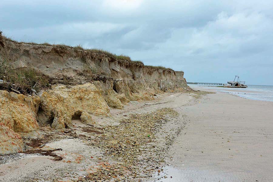
Rapidly eroding bluffs along the southern shore of Matagorda Bay. (J. Paine)
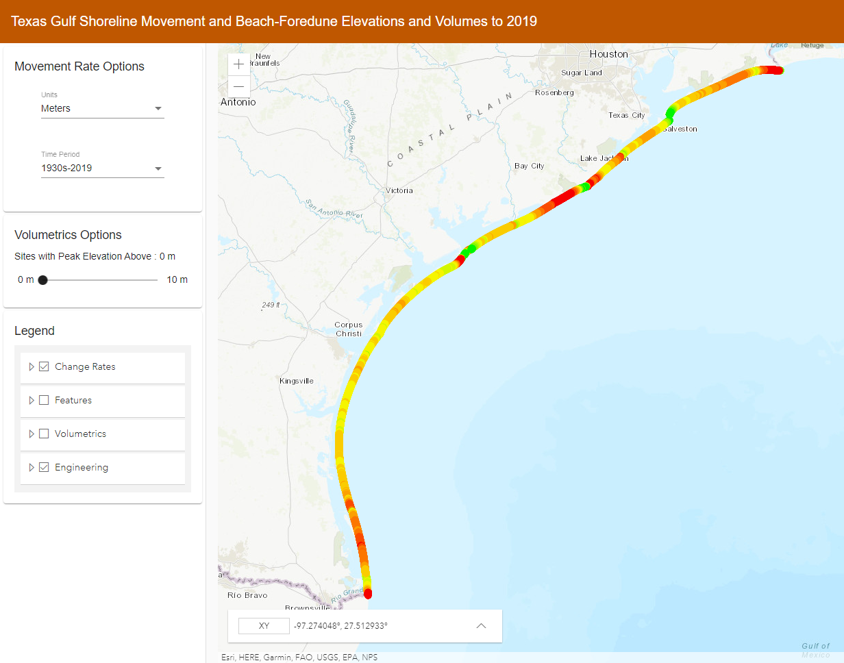
Shoreline change map, 2019. Click map to go to the web viewer.
The Bureau maintains a website that delivers shoreline change information to the public at https://www.beg.utexas.edu/research/programs/coastal/the-texas-shoreline-change-project.
Coastal Faults and Subsidence
Growth faults are common on the Texas Coastal Plain. Differential movement across these faults, which can cause extensive infrastructure damage and land and habitat loss by submergence, can be detected and monitored using airborne lidar, shallow seismic reflection, and ground-penetrating radar surveys.
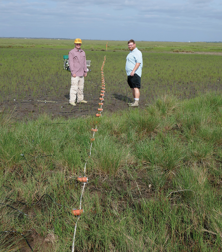
Acquiring shallow seismic reflection data to create a subsurface image across a growth fault at Essex Bayou, upper Texas coast, 2019. (J. Paine)
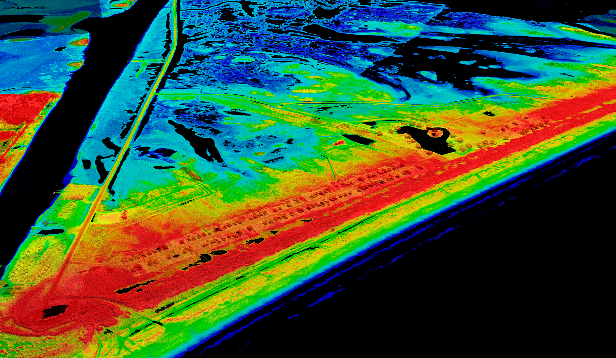
Airborne lidar–derived topographic image of Matagorda near the mouth of the Colorado River. A growth fault trends northeastward from the beach houses. Click image to view larger. (J. Andrews)
Earthquakes
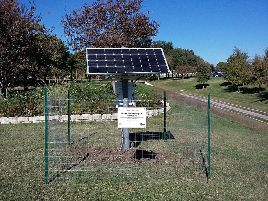
Seismic monitoring station, The University of Texas at Dallas. Click photo to view larger.
Earthquakes happen when strata on either side of a geologic fault move relative to one another. Earthquakes are common but are rarely felt by people because the signal is absorbed by rock layers and soil. Earthquakes are measured by seismometers, very sensitive instruments that detect Earth's movements in fractions of a second. Texas has been experiencing an increase in earthquakes since around 2010, mostly in geologic basins with oil and gas exploration and production. Studies are being conducted to understand why these are occurring and the potential risks to people and infrastructure.
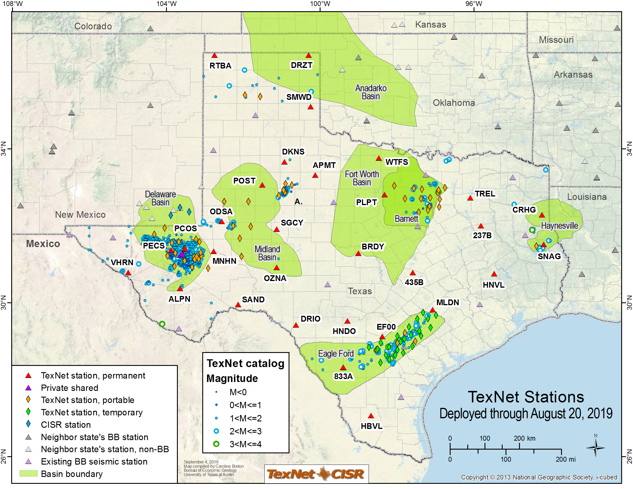
Map of TexNet permanent and portable stations, along with TexNet-supported SMU stations and non-TexNet stations used in detection and analysis of earthquakes by TexNet staff. Click map to view larger.
Landslides and Rockfalls
Unstable rock can suddenly collapse as a rockfall, or strata may move downslope as a unit or chaotically as a landslide. Virtually all parts of Texas are subject to these gravity-driven geohazards.
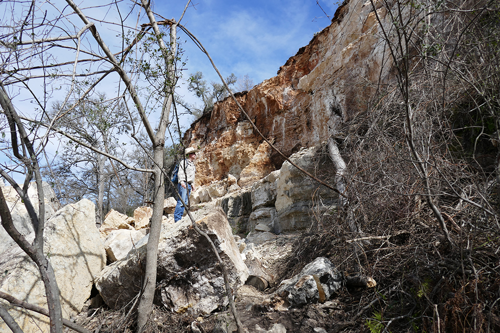
Failure face and fallen blocks from the Reimers Ranch rockfall, Austin area, 2019. (J. Paine)
Landslide on a cliff that overlooks Shoal Creek, Austin, May 4, 2018. (https://imgurinc.com/)
Sinkholes
Sinkholes are a common geohazard across Texas. They can be associated with salt domes in East Texas (salt dissolution), Cretaceous strata in Central Texas (carbonate dissolution and collapse), and bedded salt in West Texas (salt dissolution). Remote sensing and geologic and surface geophysical investigations help assess the threat of sinkhole development and study circumstances associated with collapse. Recent examples include Wink (2002), Daisetta (2008), Denver City (2009), Austin (2012 and 2019), and Alice (2016). Click images below to view larger.
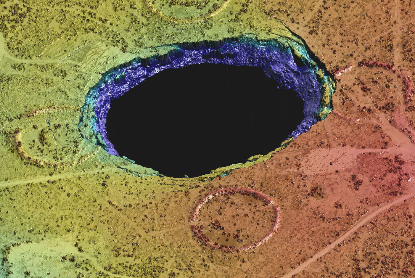
Lidar-derived point cloud of Wink Sink 2 near Wink in West Texas. Clearly shown are the collapse area, concentric fissures, and slide blocks. The sinkhole formed in 2002 over Permian bedded salt deposits. (J. Andrews)
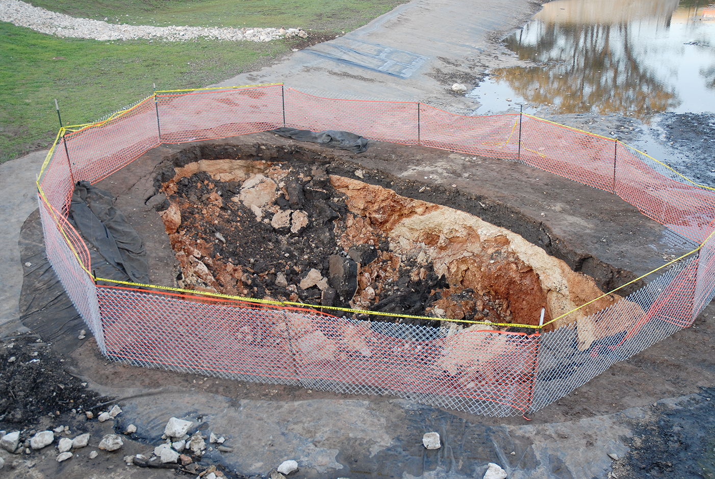
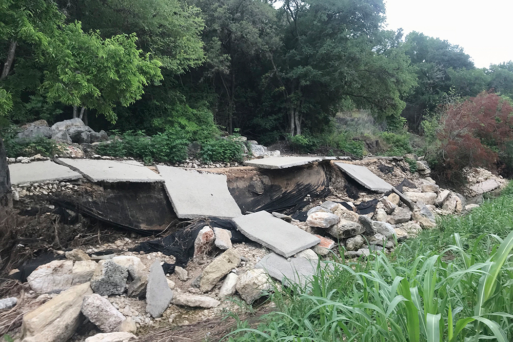
Karstic collapse in carbonate rock adjacent to a water retention pond, Austin, Texas, 2012. (J. Paine)
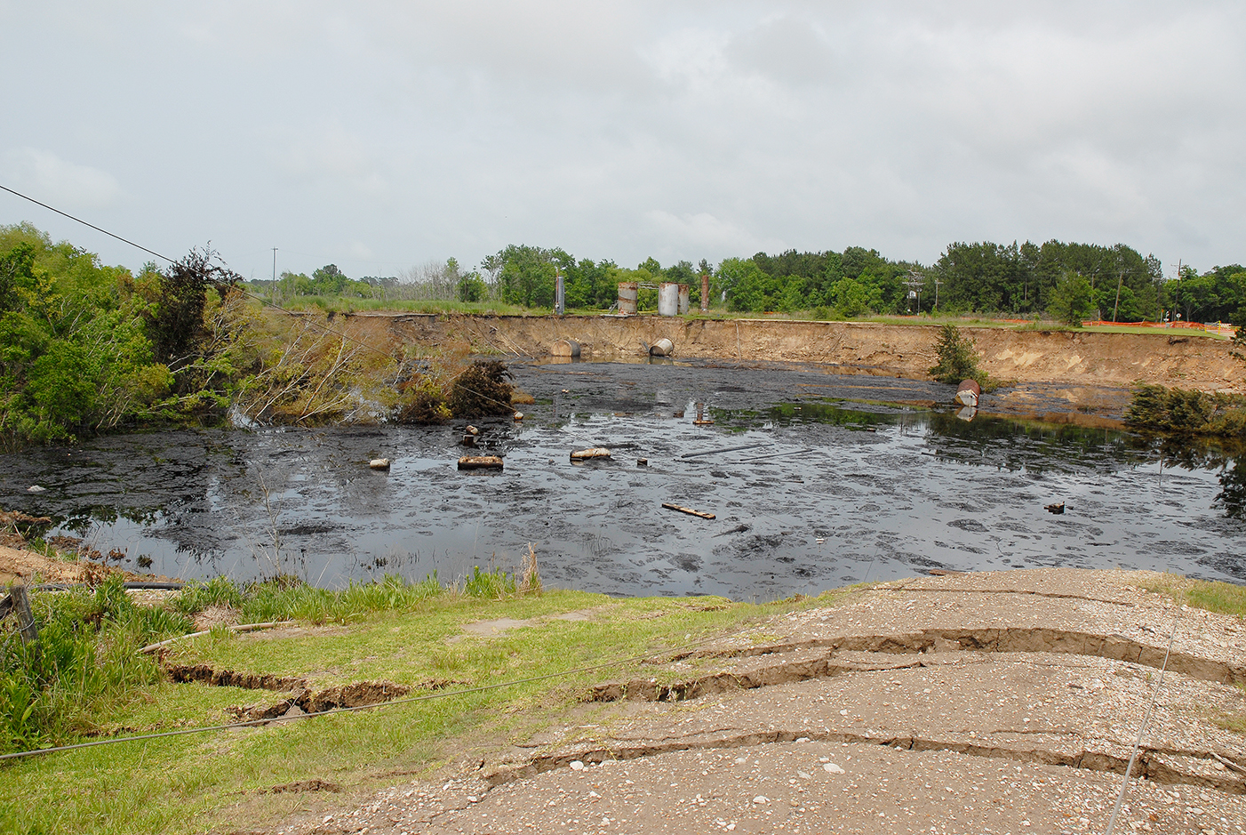
Oil and debris floating on water that partly fills the Daisetta sinkhole, which collapsed around an injection well near the Hull salt dome in 2008. (J. Paine)
Helpful Instruments and Tools
Helpful Instruments and Tools
Many instruments and tools help geologists identify, assess, and monitor geohazards. These include remote sensing methods such as airborne lidar and aerial and satellite imagery; precise geodetic surveys using GPS satellites and ground-based receivers; and airborne, ground-surface, and borehole geophysical surveys using seismic, ground-penetrating radar, and electromagnetic induction methods.
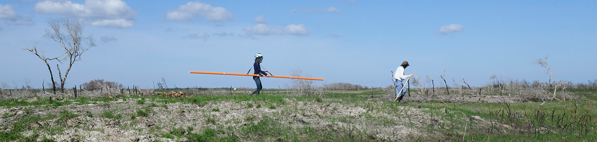
Continuous electromagnetic induction profiling using the CMD Explorer at Powderhorn Ranch, Matagorda Bay area.
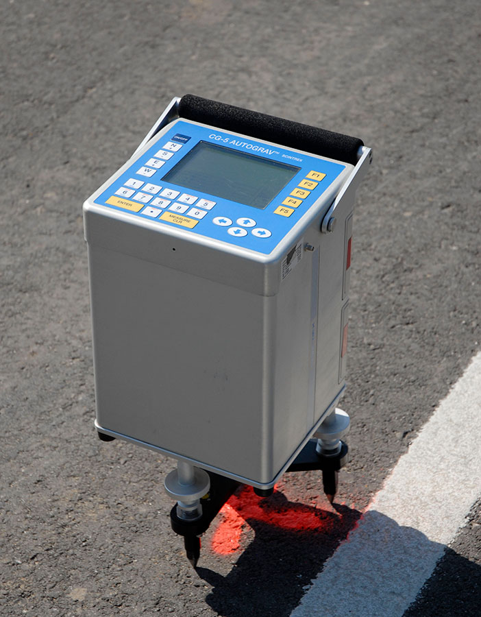
Scintrex CG-5 microgravity meter in use during a gravity survey to identify potential subsurface voids near the Daisetta sinkhole.
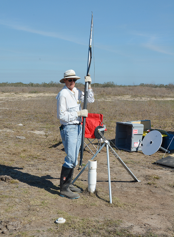
Borehole probe being lowered into a water well to measure the electrical conductivity of the shallow subsurface during geologic mapping on the Texas Coastal Plain.
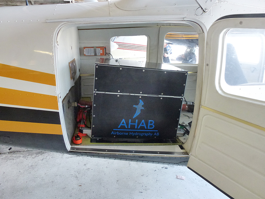
The Bureau's Leica Chiroptera airborne topographic and bathymetric lidar system mounted in a small aircraft in preparation for a survey.

