Near-Surface Geophysics at the Bureau’s NSO
Near-surface (or “shallow” or “environmental”) geophysics encompasses many geophysical methods, several of which were originally developed for the mining industry, that can be applied to help geologists, geomorphologists, archeologists, hydrologists, and engineers understand some aspect of the shallow subsurface. Commonly used near-surface geophysical methods include seismic reflection and refraction, ground-penetrating radar, electromagnetic induction (EM), resistivity, gravity, magnetics, and radioactivity. One of the principal advantages of most near-surface methods is that they are noninvasive. Exploration depths depend on the objective, the environment, and the method, generally ranging from a few centimeters to a few hundred meters below the surface.
At the Bureau’s Near Surface Observatory, airborne, ground surface, and borehole geophysical methods complement lidar- and drone-based remote sensing capabilities. Near-surface geophysical methods have found wide use at the Bureau, including supporting geologic mapping, detecting salinization, characterizing ground-water resources, determining alluvial thickness and bedrock depth, assessing geologic hazards, delineating contaminant plumes, and illuminating the geologic history of playa basins, among others. Our principal instruments and their common applications at the Bureau are described below.
Frequency-domain Electromagnetic Induction (FDEM)
FDEM instruments employ a constantly changing electrical current in an electrical coil to generate a time-varying magnetic field, which then induces electrical current to flow in the ground proportional to the electrical conductivity of the ground. These instruments compare the strength of the secondary magnetic field produced by the ground currents to the strength of the primary magnetic field generated by the instrument to estimate the electrical conductivity of the ground to exploration depths ranging from less than a meter to a few tens of meters. Because electrical conductivity of the ground is affected by clay content, moisture content, and pore-water salinity, FDEM instruments are useful in many geologic, hydrogeologic, and engineering investigations.
FDEM instruments in use at the Bureau include, from shallowest to deepest exploring, the Geonics EM38 (to 1.5 m depth), the Geonics EM31 (to 6 m depth), the CMD Explorer (simultaneous, continuous exploration to 2, 4, and 6 m), and the Geonics EM34-3 (to 50 m depth). These instruments are carried by hand or towed across the land surface. Instruments based on the same principle have been carried beneath low-flying aircraft to cover larger survey areas more efficiently.
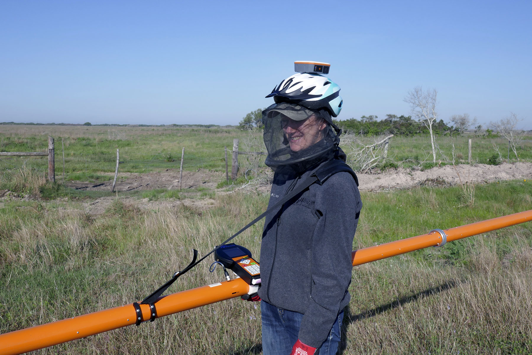
CMD Explorer with data logger and helmet-mounted GPS receiver acquiring continuous ground conductivity data at three simultaneous exploration depths at Powderhorn Ranch near Matagorda Bay, Texas.
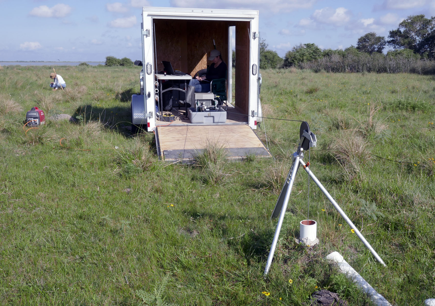
Time-domain Electromagnetic Induction (TDEM)
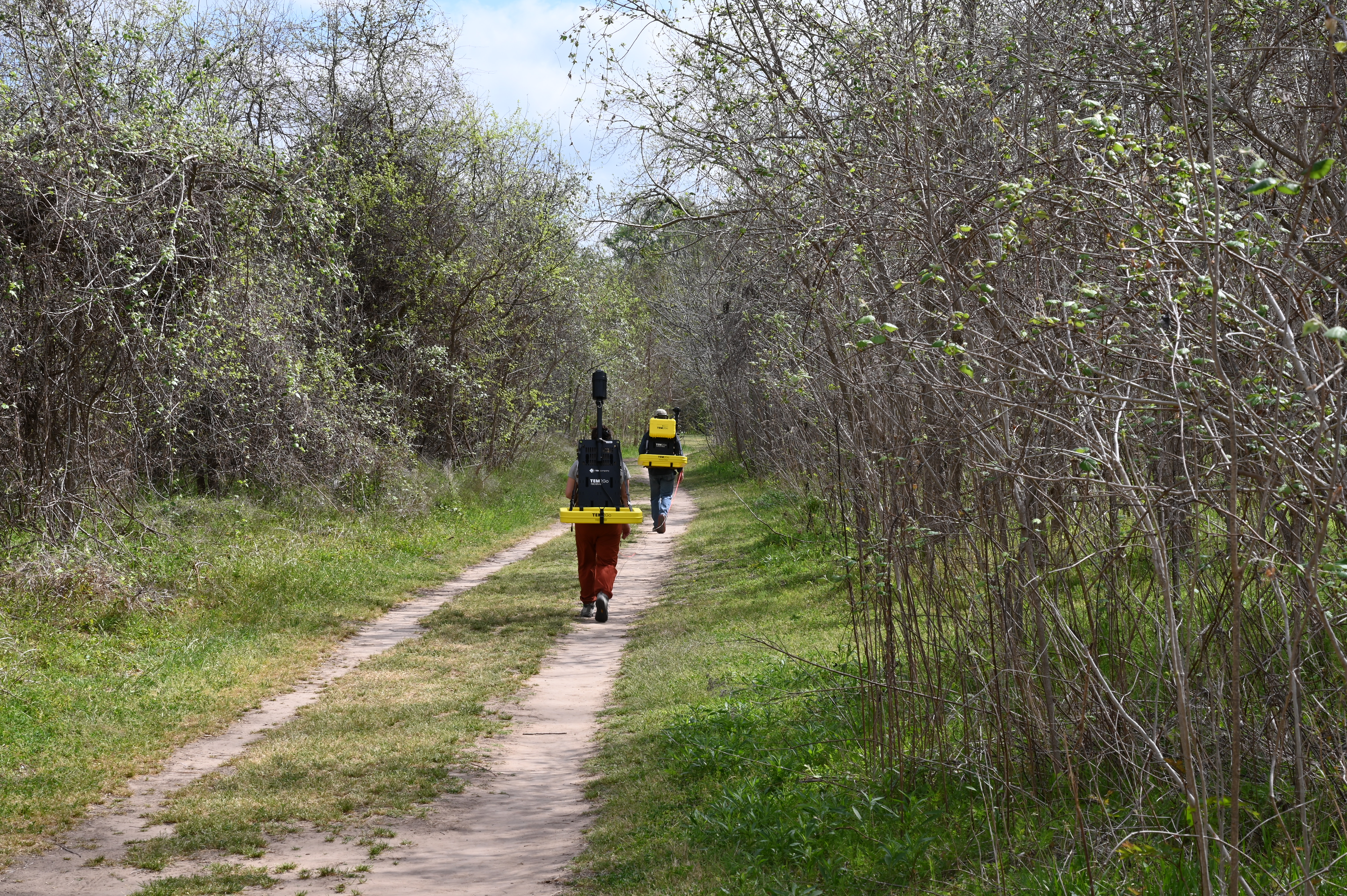
TDEM instruments are generally used to explore more deeply than FDEM instruments. TDEM employs a constant electrical current flowing through a wire loop laid out on the ground to generate a large, static primary magnetic field. When the current is shut off, the primary magnetic field collapses, inducing currents to flow in the ground beneath the wire loop. A receiving coil measures the strength of the decaying secondary magnetic field generated by induced ground currents. The strength and decay rate of this secondary magnetic field (the “transient”) yields information about the electrical conductivity structure of the subsurface to depths of tens to hundreds of meters, depending on the size of the transmitter loop and the electrical properties of the ground.
TDEM instruments currently in use at the Bureau include the sTEM system by TEMCompany, which employs a dual-moment design to simultaneously acquire low-moment transients optimal for the shallowest part of the subsurface and high-moment transients to achieve greater exploration depth. This instrument is being used to investigate the three-dimensional structure of coastal-plain strata, the thickness of alluvial sediments over bedrock, and the presence and salinity of aquifers, among other uses. A recent addition is the TEM2Go also by TEMCompany, which consists of two backpack-mounted coils that enable users to acquire TDEM soundings along a profile while carrying the instrument at a walking pace. In addition to ground surveys, TDEM instruments can be towed by helicopters or mounted on fixed-wing aircraft to rapidly survey large areas at high lateral resolution.
Seismic Reflection, Refraction, and HVSR
Seismic methods image the shallow subsurface using seismic waves generated at the ground surface. Much like a medical sonogram, generated seismic waves reflect off of lithologic discontinuities in the subsurface and return to the ground, where they are detected and recorded with an array of geophones. Seismic data are processed to produce 2D or 3D images of the shallow subsurface to depths of tens to hundreds of meters.
Bureau researchers have been acquiring shallow seismic data since the early 1990s using several different seismic systems for a variety of geological studies. Currently, we use an AnySeis system of 50 independent geophones that can be deployed at flexible spacings that depend on the depth of the target and the desired resolution. Though new and still under development, we have used this system to characterize growth faults on the Texas coastal plain and examine alluvial terrace strata along the Colorado River.
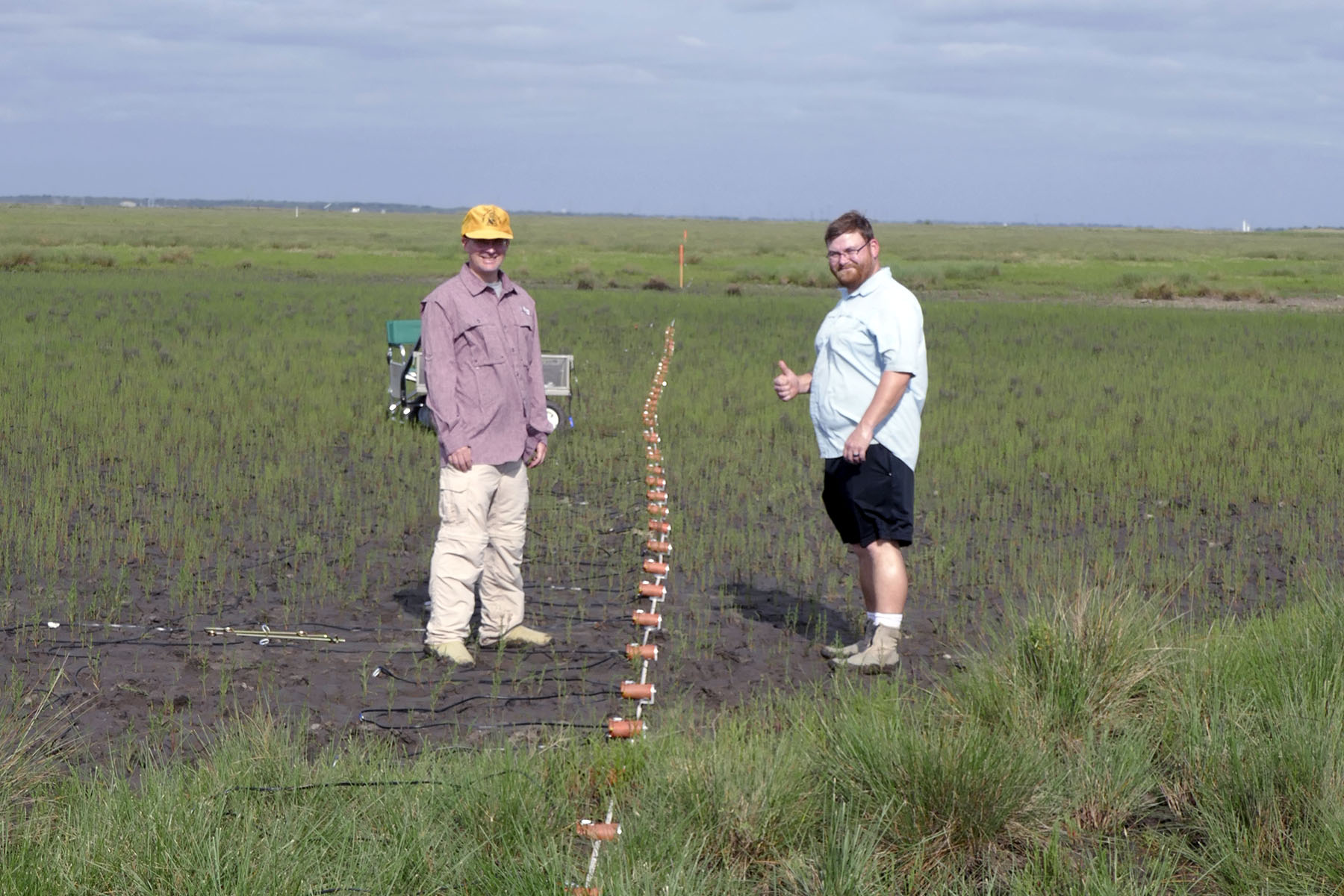
AnySeis geophone array acquiring 2D, shear-wave seismic reflection data across a growth fault at Essex Bayou near Surfside, Texas.
HVSR (for Horizontal to Vertical Spectral Ratio) is a relatively new method using passive seismic measurements to determine depth to bedrock. The method employs a three-component seismograph (a tromograph) to record ground motion under ambient conditions in two orthogonal horizontal directions and in the vertical direction. We have used this method to estimate thicknesses of alluvial terrace deposits in central Texas and depth to bedrock on the southern Cumberland Plateau in Tennessee using a Tromino tromograph.
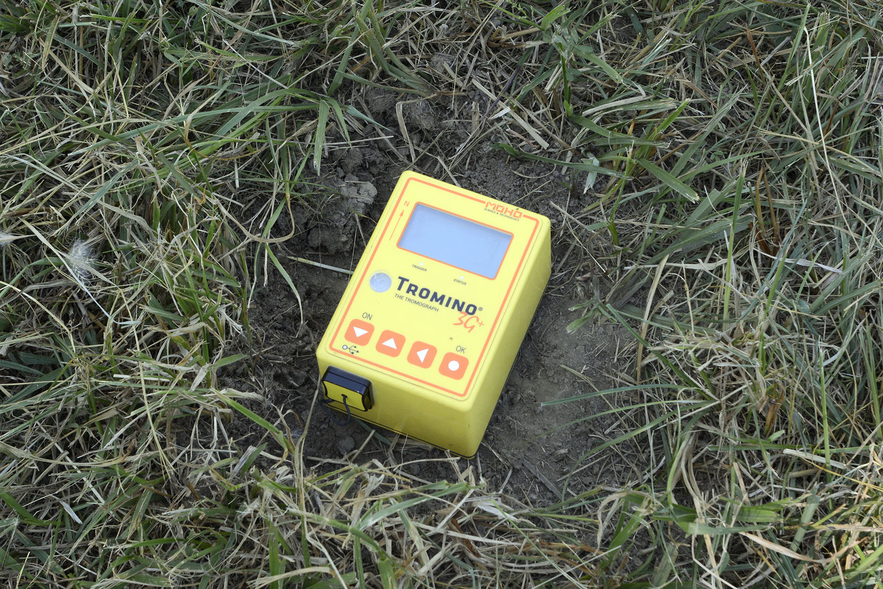
Tromino 3G passive seismic instrument deployed in a depth-to-bedrock study on the southern Cumberland Plateau near Sewanee, Tennessee.
Ground-penetrating Radar (GPR)
GPR instruments transmit radio-frequency EM pulses into the ground and record returns from electrical interfaces in the shallow subsurface. As the instrument is moved along the ground, a profile of the shallow subsurface (to a few meters depth) is recorded. Exploration depth of the instrument depends on the electrical properties of the subsurface and the frequency of the transmitter (lower frequencies achieve deeper exploration depths). Exploration depth typically ranges from less than a meter to a few meters.
At the Bureau, we use a GSSI SIR-4000 instrument with either a 200- or 350-MHz antenna. We have used GPR extensively to establish the sedimentary context of archaeological sites, map shallow strata hosting a fuel spill, examine the thickness and internal structure of alluvial deposits, identify chaotic blocks in collapse structures, locate unmarked graves, and estimate water depth in rivers.
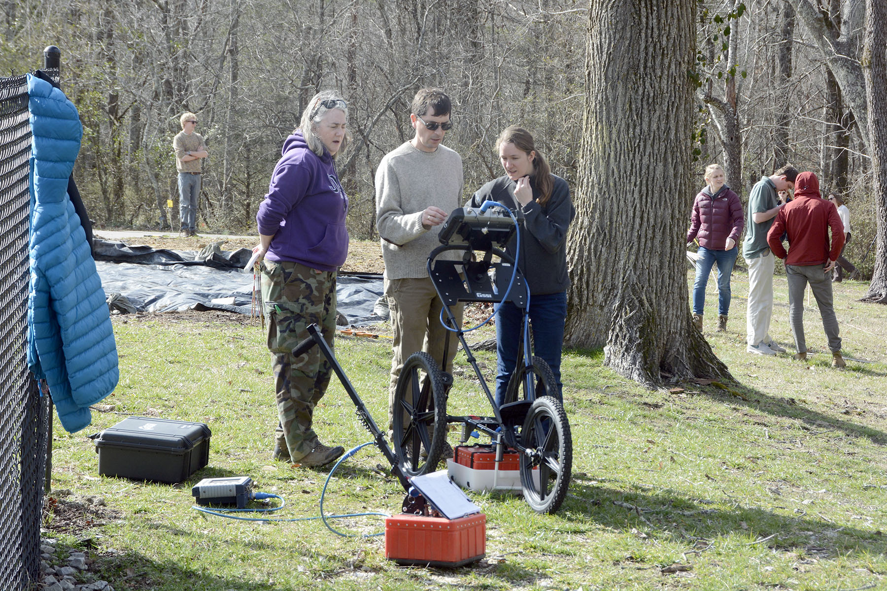
GSSI 400 MHz antennas investigating a historical site at Rebel’s Rest in Sewanee, Tennessee.
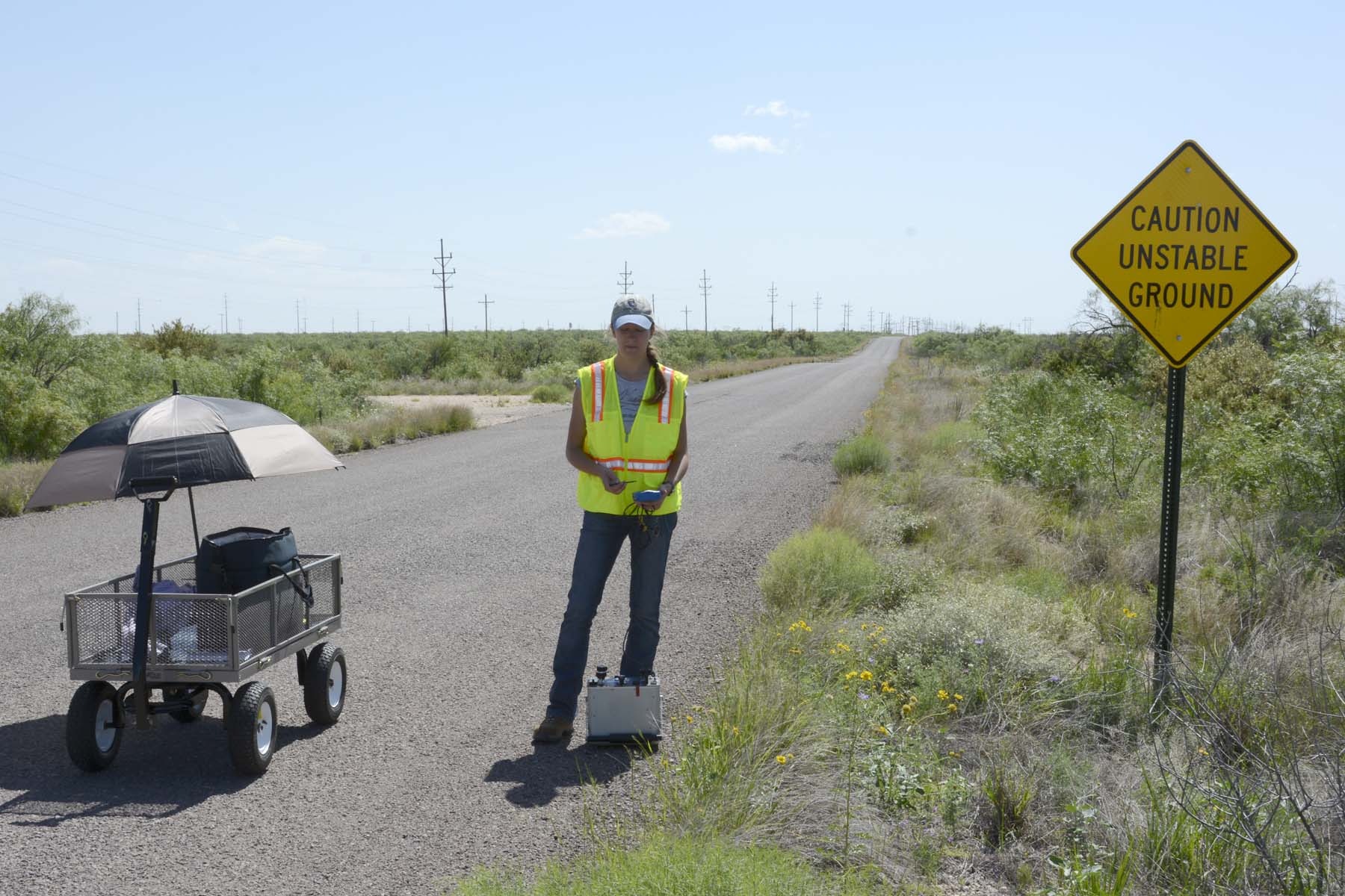
Borehole Geophysics
Highly detailed information about the subsurface can be obtained by geophysically logging shallow boreholes and water wells. Numerous geophysical methods can be used in borehole logging. Most useful in our studies are electromagnetic induction (EM) to measure electrical conductivity and magnetic susceptibility of the subsurface and natural gamma radiation to determine lithologic properties.
The Bureau has a trailer-mounted logging system that includes a winch capable of logging to depths of about 400 meters, a 1024-channel spectral gamma probe that simultaneously measures spontaneous electrical potential and two EM probes that measure electrical conductivity and magnetic susceptibility. Together, these slim-hole probes are very useful in examining vertical changes (at resolutions to a few centimeters) in lithologic and hydrologic character of the subsurface. We use them extensively to support geologic mapping and hydrogeological studies.
Logging a water well using the trailer-mounted winch system and spectral gamma and EM conductivity probes near Powderhorn Lake, Calhoun County, Texas.
Microgravity
Microgravity instruments measure extremely small variations in the strength of the Earth's gravitational field. We have used microgravity in sinkhole-prone areas of Texas to assess collapse risk related to the presence of voids in the shallow subsurface.
A Burris Gravity Meter acquiring microgravity data near the Wink sinkholes in Winkler County, Texas.