Bureau Near Surface Observatory Provides Rapid Response in Support of Hurricane Harvey Efforts
Hurricane Harvey, which rapidly intensified in the Gulf of Mexico and reached Saffir–Simpson Category 4 status before landfall on the Central Texas coast on Friday, August 25, 2017, brought extreme winds, heavy rainfall, massive flooding, and moderate storm surge to the open coast and bays of Texas. Within a week of landfall, researchers at the Bureau's Near Surface Observatory began acquiring airborne lidar data and imagery to assess storm impacts on the beach and dune system along the Texas Gulf shoreline, identify debris and infrastructure damage in Texas bays, and establish a baseline for monitoring beach and dune recovery in the months and years to come. These surveys are being flown as part of the General Land Office's comprehensive response to the ongoing effects of Hurricane Harvey as well as the Jackson School of Geosciences’ own rapid-response effort.
To make data available to emergency responders as quickly as possible, the Bureau team developed an around-the-clock process to acquire data one day and make it available to state agencies the next day. Aaron Averett flew in the aircraft, handing data off to John Hupp for processing at the end of each flight day. Hupp then processed the data the same day, passing it to John Andrews late in the evening. Andrews created preliminary digital elevation models and georeferenced aerial photographs, all of which were then uploaded to GLO to support their emergency response. Tiffany Caudle served as liaison with the Texas Department of Transportation (TxDOT) for aircraft usage and verified data quality and coverage before delivery. Kutalmis Saylam deployed GPS base stations in some of the most storm-ravaged areas on the Central Texas coast. Julie Duiker and her team worked with GLO and UT Austin to ensure contractual requirements were met in record time. Jeffrey G. Paine served as principal investigator.
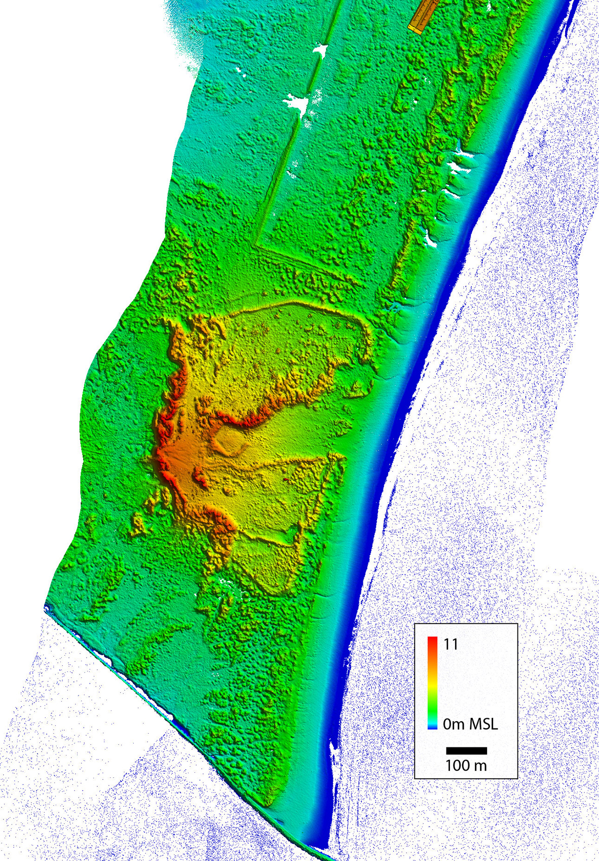
Two images from the lidar survey (below) illustrate the destruction wrought by Harvey winds on buildings and infrastructure in Rockport, and the impact of Harvey’s hurricane waves, storm surge, and backflow to the beach and dune system on southern San José Island.
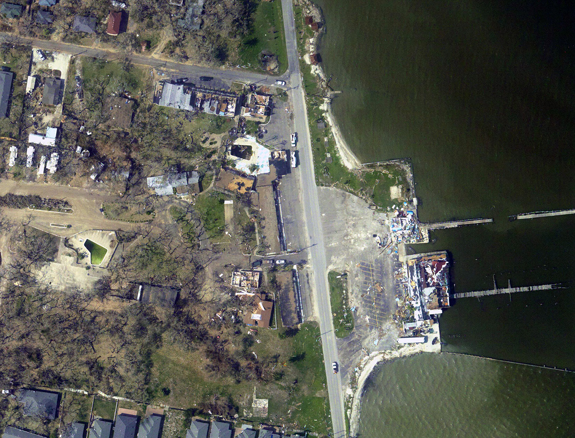
Aerial image taken from the survey aircraft of the extensive damage to Rockport by Hurricane Harvey.
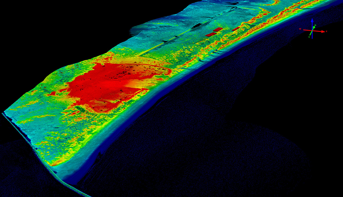
Images above and below: 3D data acquired by the Bureau's lidar team shows the effects of Hurricane Harvey to southern San José Island by waves, storm surge, and backflow to the beach and dune system.