
Virtual Reality Technology: Now an Affordable Tool for Geoscientists
For many of us, virtual reality (VR) is a relatively expensive new technology utilized to enhance the video game experience. But for the Bureau of Economic Geology’s Robin Dommisse, VR is a not-so-new and not-so-expensive technology that offers geoscientists incredible options to enrich their ability to visualize the nuances of rock formations.
“Recent advances in virtual reality headset technology and software have made it easier and more affordable than ever before to capture, visualize, and interact with geology in 3D,” explains Dommisse. “As geoscientists, we care about using VR as a tool because it enables us to better study rock outcrops using computers.”
Virtual reality is now practical for creating and utilizing fantastically detailed images that help geoscientists examine and analyze rocks and formations. Affordable VR headsets capable of wireless VR streaming have recently become available to leverage the powerful three-dimensional (3D) graphics capabilities of modern PCs. Today many free and low-cost software solutions can be paired with current entry-level VR headsets. In addition, there are several ways to freely share 3D VR models with others, which leads to better communication and collaboration among geoscientists.
Dommisse added, “3D geological outcrop digitization can now be achieved using public sources of lidar and satellite imagery in combination with high-resolution, drone-based photogrammetry workflows.” The potential for VR technology to augment and improve geoscience research is almost unlimited.
To see a recent presentation by Robin Dommisse about the latest geological adaptations of VR technology, featuring Bureau outcrop studies from Senior Research Scientist Charles Kerans and Ph.D. candidate Buddy Price, please go to the Bureau’s YouTube channel.
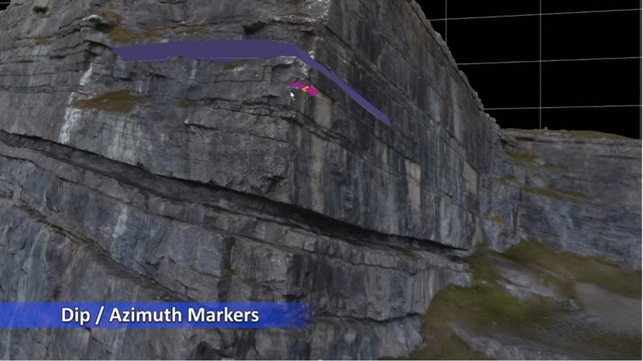
Three-dimensional outcrop visualized and interpreted in Virtual Reality Geological Studio software. The availability of affordable drones capable of capturing GPS-registered photographs, together with affordable photogrammetry software, has made it easy to create 3D digital outcrop models (DOM). Virtual Reality Geological Studio is a powerful and innovative digital outcrop modeling tool for geoscientists and engineers. Virtual Reality Geological Studio was invented by David Hodgetts from the University of Manchester and VRGeoscience Limited.
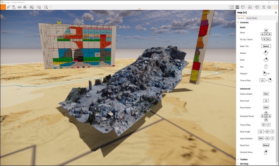
Outcrops can be visualized, annotated, and subsequently shared using stand-alone VR-enabled executables or webpages. This 3D VR scene was created using Enscape software, which is available for free to students and academics. This folded sandstone outcrop was provided courtesy of Buddy Price of the UT Jackson School of Geosciences and the Bureau of Economic Geology.
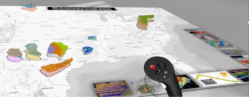
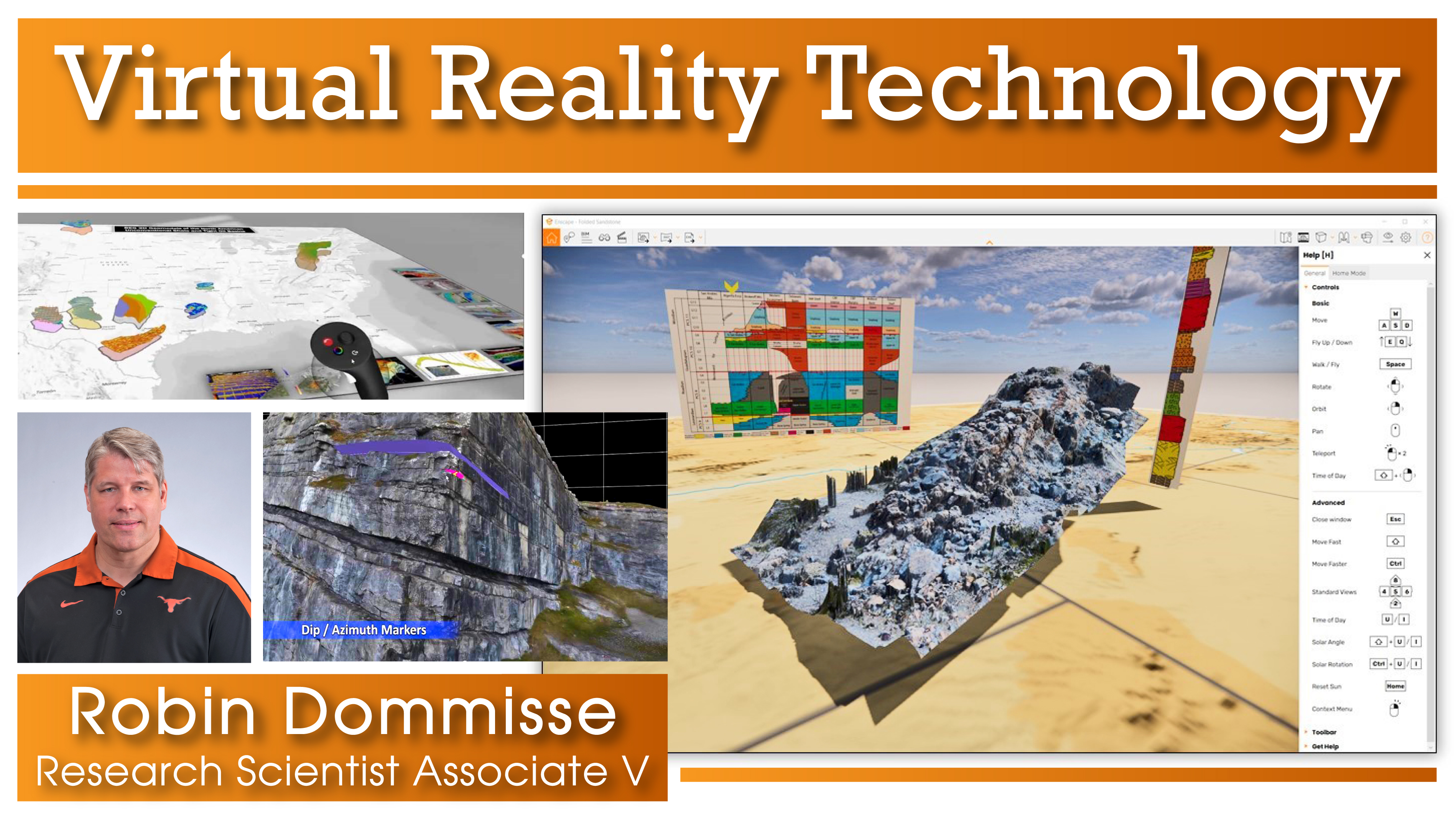
This VR scene shows 3D subsurface geomodels of the major U.S. shale basins using Gravity Sketch software, a free 3D VR drawing tool. The 3D reservoir models can be manipulated, scaled, and interpreted using VR controllers.

