Machine Learning Provides Clear Picture for Soil Moisture-Related Hazards
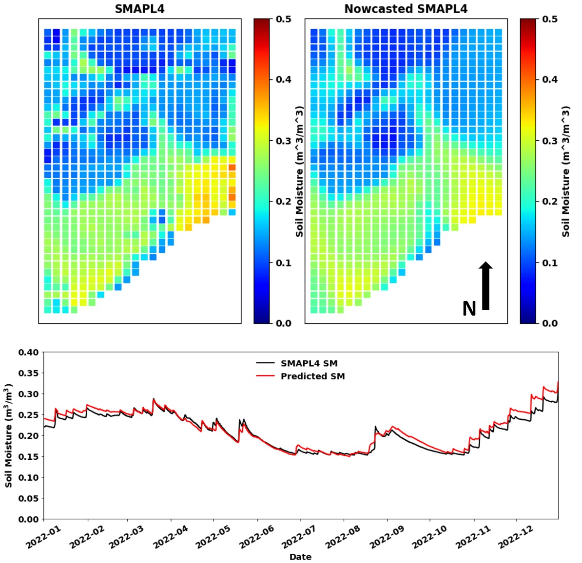
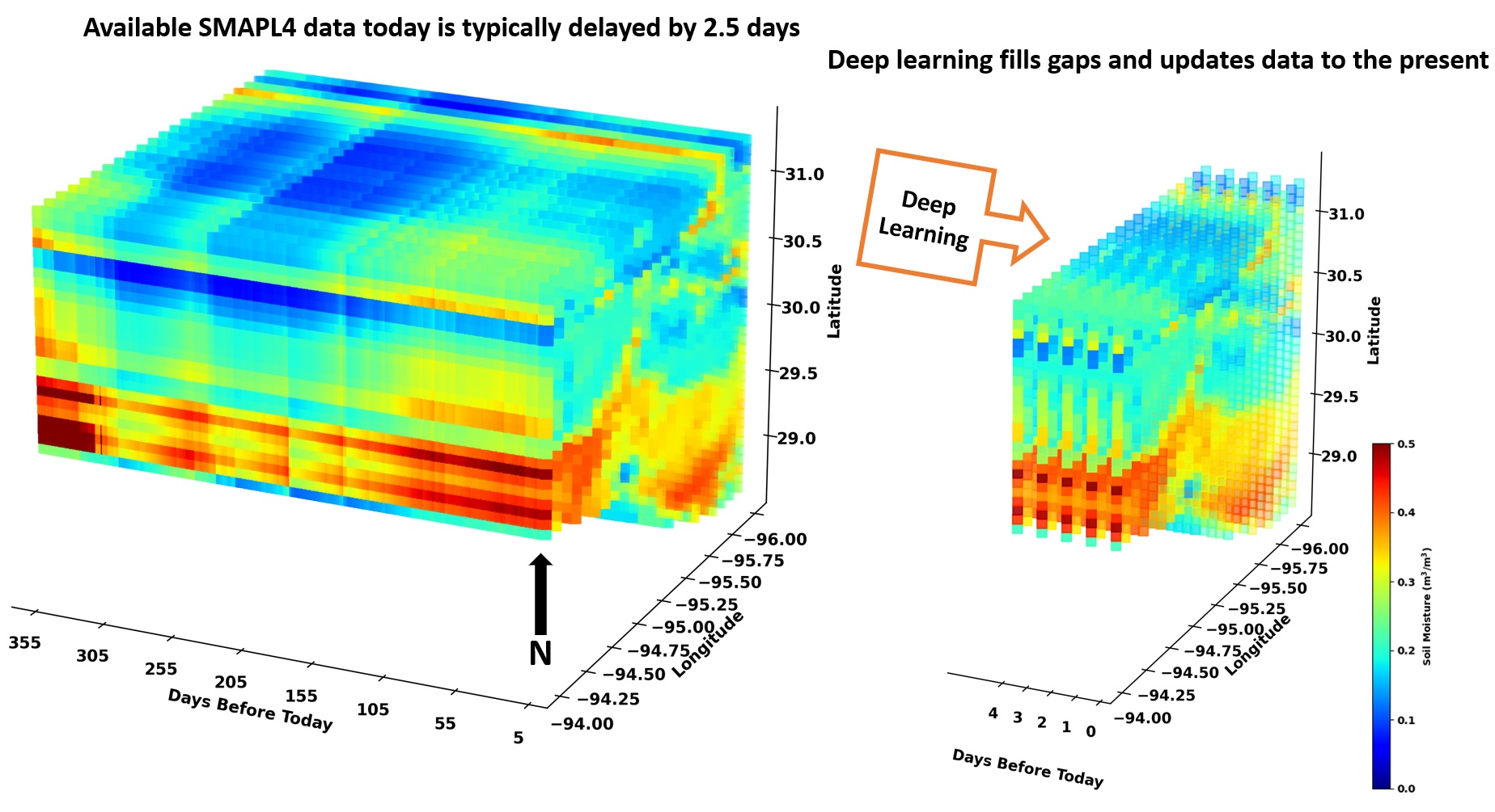
For over a decade, Bureau of Economic Geology researchers have measured and interpreted soil moisture data from its Texas Soil Observation Network (TxSON) sensors and NASA’s satellite driven Soil Moisture Active Passive (SMAP) product. Soil moisture is a key component of the hydrologic cycle, moderating weather and climate patterns and flooding potential, as well as impacting agricultural production. Although the researchers’ interpretations have provided invaluable information to stakeholders, there has always been a delay of several days before the data was available to review. There was no way to capture and distribute real-time data. Until now…
Bureau researchers led by Hassan Dashtian, with contributions from Michael Young, Bissett Young, Ashraf Rateb, and others, developed a model that integrates advanced machine learning techniques and different data sources, including field-based soil moisture observations collected from remote monitoring stations. The approach blends the data into accurate, real-time estimates of soil moisture, eliminating the usual delay in providing vital information to emergency managers and government decision-makers. This timely soil-moisture data will be invaluable to those assessing and responding to fire, flood, and drought risks.
Accurately estimating real-time soil moisture levels is a complex, yet crucial task, especially in areas prone to natural soil moisture-related hazards. This important new research has been published as “A framework to nowcast soil moisture with NASA SMAP level 4 data using in-situ measurements and deep learning” in the Journal of Hydrology.
More information is available here.