Sustainable Water Resources
SWR Research Example: India
Water Sustainability in Natural and Agricultural Ecosystems in the Thar Desert, Rajasthan, India
Water and nutrient availability for crop production are often critical issues in (semi)arid regions; however, information on these issues is limited. The purpose of this study was to assess the use of unsaturated zone chloride tracer data and nutrient (NO3 and PO4) concentrations for quantifying subsurface recharge and nutrient availability in different land use settings in and adjacent to the Thar Desert. Boreholes were drilled to depths of 3.0-14.6 m and soil cores collected in dune/interdune settings in the arid Thar Desert (west study area, near Jaisalmer) and in rainfed (nonirrigated) and irrigated cropland settings in the semiarid margin of the desert (east study area, near Jaipur). Soil samples were analyzed for water content and Cl, SO4, NO3, and PO4 concentrations. Recharge rates were estimated using the chloride mass balance (CMB) approach. In the west study area with sparsely vegetated dune/interdune settings, recharge rates range from 3 to 6 mm/yr, 2-3% of precipitation (165 mm/yr). These estimates represent lower bounds on actual recharge rates because of potential drying during sample collection in these sandy soils. In the eastern, cultivated semiarid region, estimated recharge rates at two rainfed sites are 61 and 94 mm/yr, 10-16% of precipitation (600 mm/yr). Reliable recharge rates could not be estimated for irrigated sites because of uncertainties in irrigation inputs and cycling between irrigated and rainfed agriculture. Minimum recharge estimates based on precipitation input only are 18, 28, and 104 mm/yr at sites irrigated with high quality groundwater and 0.3, 5.6, and 33 mm/yr at sites irrigated with more saline groundwater. The higher recharge rates (104 and 33 mm/yr) result from sections of the profiles with very low Cl, indicating periods of rainfed agriculture with recharge rate of 120 and 50 mm/yr, respectively. Similar recharge rates were calculated at all sites using SO4, which is attributed to the meteoric origin of SO4 and conservative chemical behavior in these sandy soils. Chloride inventories are high under irrigated cropland, particularly in the area of saline groundwater. Nutrients are low in the west study area and higher under irrigated cropland in the east study area. Nutrient inventories are highest in the root zone and generally lower at depth. Higher nutrient inventories in areas irrigated with high quality water are attributed to higher fertilizer application rates. However, increasing nutrient application may further enhance crop production in irrigated areas. Recharge rates of 60-90 mm/yr under rainfed agriculture indicate that irrigation of 20-30% of the cultivated land with 300 mm/yr would be sustainable. This study provides reconnaissance information on recharge rates and nutrient availability in this (semi)arid region that is important for estimating sustainable development of water resources and crop production in this region.
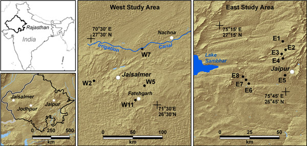
Figure 1. Shaded relief map showing west (near Jaisalmer) and east (near Jaipur) study areas in Rajasthan, India. The towns/cities are shown with white dots and the borehole locations with black dots.
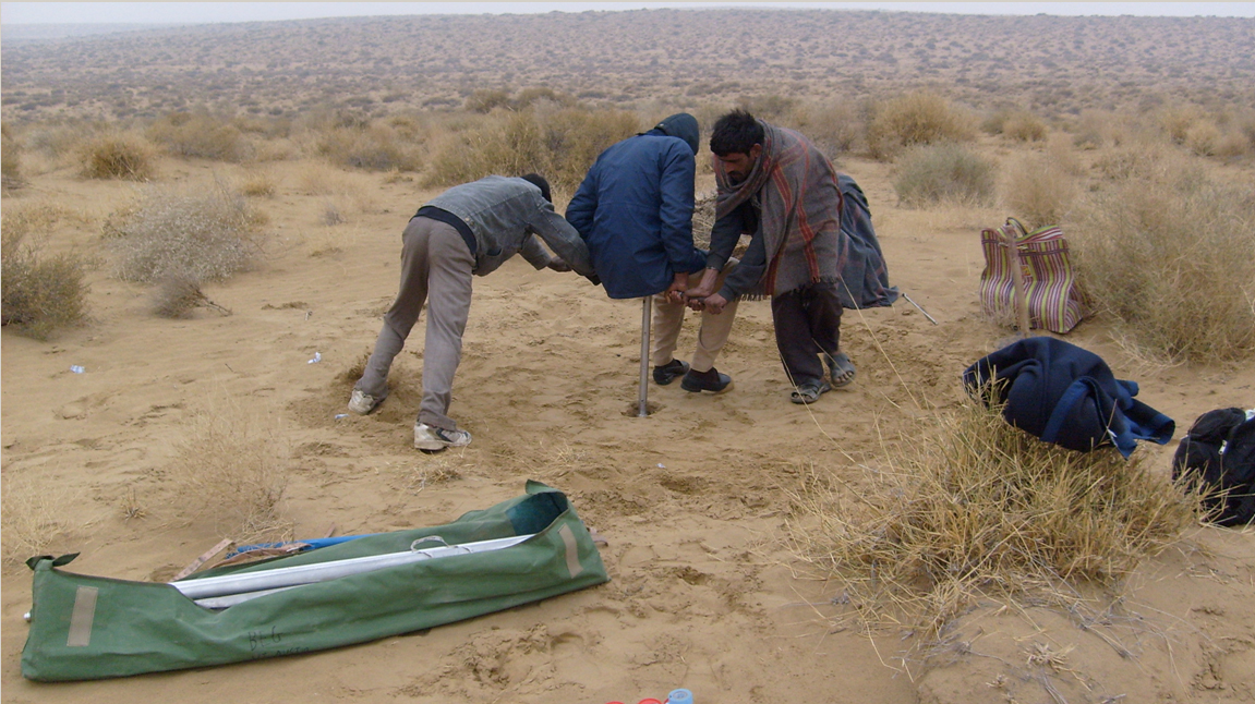
Figure 2. Drilling a soil profile in an ancient dune in the Thar Desert, Rajasthan. (click to enlarge)
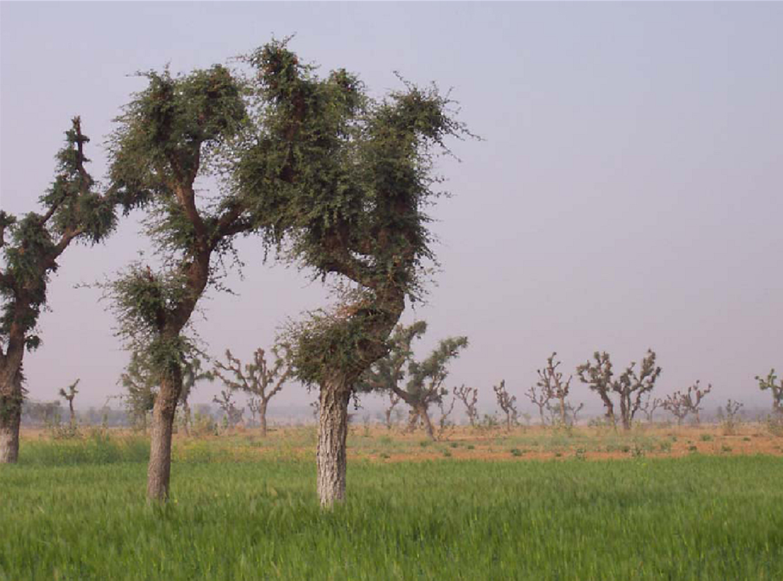
Figure 3. Irrigated cropland near Vir village, in Dudu county, in Jaipur District. Typical crops include winter wheat, summer oats/millet, and mustard. The site has been irrigated for 13 years. Irrigation water is groundwater. (click to enlarge)
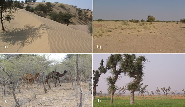
Figure 4. Photographs of borehole sites, a) W5, modern dune, b) W11, interdune, c) W7, plantation and d) E8, high salinity groundwater irrigation.