
Making Underground Maps
You’ve seen those colorful geologic maps, right? The ones that tell you where various rock formations are located on the Earth’s surface? Well, maybe you didn’t know it, but many geologists actually make maps of rock layers that are buried underneath the surface! There are good reasons to know about "buried rocks," including the fact that we get most of our industrial minerals, metals, oil and natural gas, and even water from them. Subsurface geological knowledge also provides insights into how the Earth formed, land stability and hazards such as earthquakes, and the history of our planet—including how life evolved.
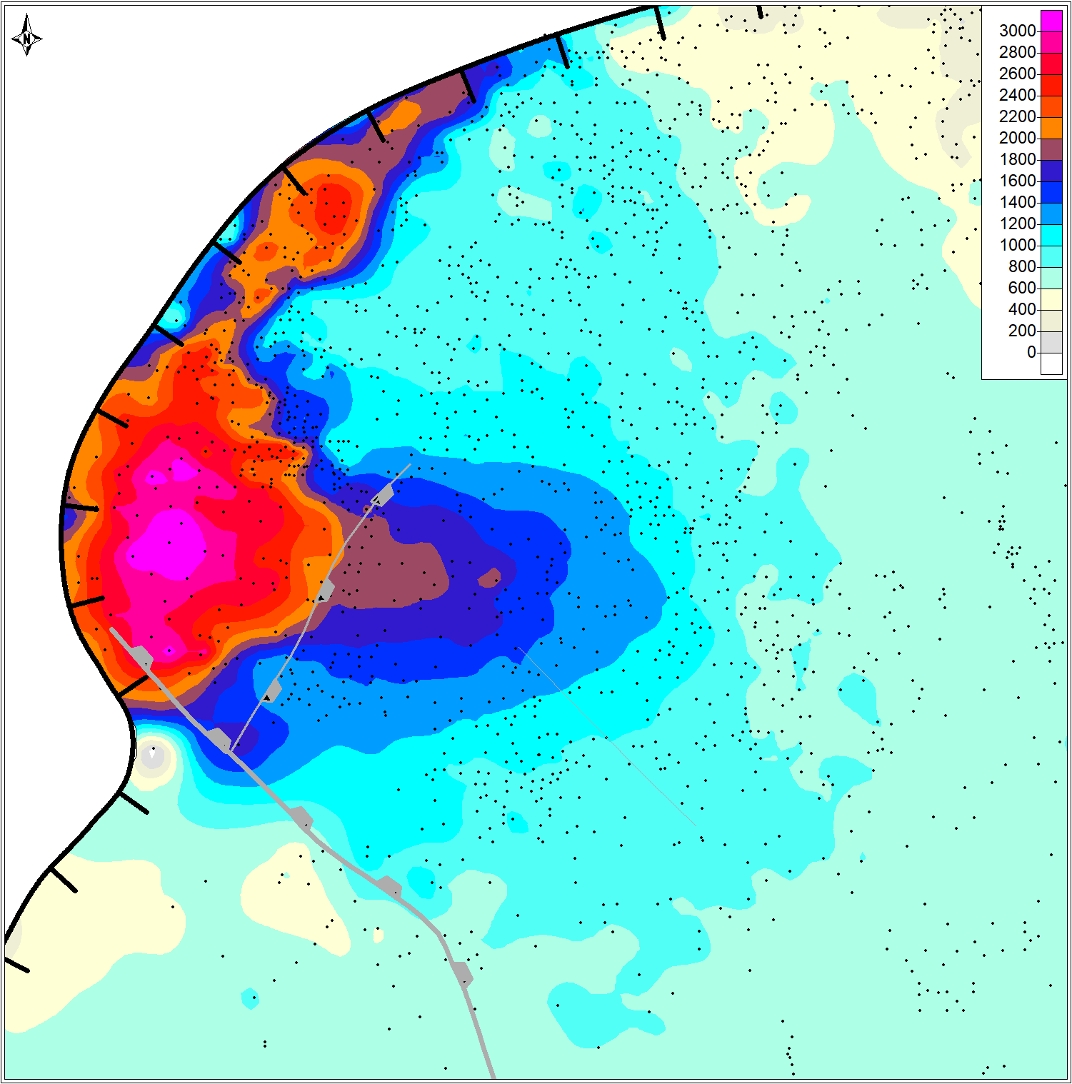
Making "underground" geologic maps is fun because it requires an interesting combination of scientific, engineering skills and a good imagination. The example map shown here uses information from hundreds of oil wells (black dots) in the Permian Basin that were drilled to depths of about 2 miles (map scale is in feet). The map essentially represents a fossil submarine fan that existed about 290 million years ago!
To make this map, I identified the thickness of a layer of mostly limestone that was transported from a shallow, clear-water shelf (northwest, to upper left of black hachured line) into a several-thousand-foot deep seaway. The fan is made up of limestone grains and debris that were moved by currents and gravity from the shelf into the deep sea. The thickest part of the fan is where most of the limestone debris landed, right next to the shelf edge, and it thins gradually to the east (right). The thickest parts of the fan are located on the down-thrown sides (hachures) of faults, where currents following gravity into these deeper areas carried large volumes of limestone sediment.

