
GIS at the Bureau
Information about oil and gas operations in the state of Texas is an important component to both energy and environmental research. The Bureau uses GIS (Geographic Information System) to store, view, and analyze geologic and related data. To build a model of subsurface operations, we collect and compile oil and gas data from multiple sources. The Texas Railroad Commission is the regulatory agency responsible for permitting wells and tracking oil and gas operations. FracFocus, the national hydraulic fracturing chemical registry, collects information from operators and makes those records available to the public. Additionally, various other data vendors collect and standardize oil and gas operations data from state agencies and operators across the nation.
At the Bureau, we compile all these data. First, the wellbore is constructed in 3D subsurface space within a GIS environment. All data related to a given well can now be analyzed within a geospatial framework. This value-added data is then incorporated into more comprehensive research initiatives. Operational data is constantly being generated in the oil and gas fields of Texas, and the ways we utilize these data continue to develop.
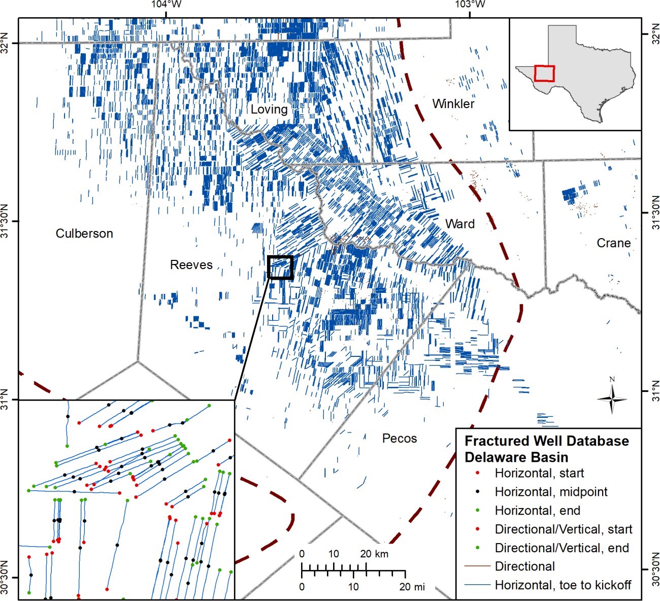
Map showing fractured wells in the Delaware Basin. This work is part of a statewide GIS project and a related manuscript is in progress.

