Texas’ Surprising Tuff Production
The State of Texas is fortunate to host some of the most famous and prolific oil- and gas-producing formations in the world: sandstones, limestones, and shales found from the Panhandle to the Rio Grande. Now, the little-known story of oil production from the state’s shallow volcanic rocks is being reopened by the ever-curious researchers of the Bureau of Economic Geology.
Central Texas geologists recorded formations of volcanic rock on or near the surface of the area southeast of the Balcones Escarpment as early as the late 1800’s. However, it was not until 1914, when a shallow water well inadvertently intersected a mound of mafic tuff (porous volcanic rock) and the well began filling with oil, that the general public took note. The Bureau studied the phenomenon, and Udden and Bybee published the first paper on this oil-producing volcanic rock in 1916. It was not long before wildcatters began drilling for the shallow oil (found as shallow as 612 ft in Williamson County’s Thrall Field) trapped in the remnants of an ancient belt of volcanic activity.
Studies over the years have shown that this swath of volcanism stretches from Milam County in the northeast along the Ouachita Belt southwesterly all the way to the vicinity of Uvalde, Texas. The layers of volcanic rock dip away and become deeper to the southeast. These small volcanoes (including Pilot Knob in the Austin area) all erupted under the ocean, with some actually rising high enough to form islands surrounded by reefs. The majority of the recorded oil production came from the shallow tuff itself, but there was also associated production from the ancient island reefs and the fractured Austin Chalk just below. A 1986 Baylor University study estimated that these volcanic formations produced a cumulative total of 54 million barrels of oil.
Today, Bureau scientists, funded by the State of Texas Advanced Resource Recovery (STARR) program, have taken new interest in Texas’ tuff production. Researchers Rob Reed, Bill Ambrose and Bob Loucks are seeking to answer some important questions about these unique formations, including the tuff’s controls of porosity, the changes in the size distribution in that porosity, and the role of natural fractures in the permeability of these volcanic rocks. Fortunately, the researchers have two excellent well cores from the Bureau’s Core Research Center to study, including several hundred feet of core through an entire section of volcanic rock. A new chapter is now being written in the unusual story of Texas’ oil-producing tuff.
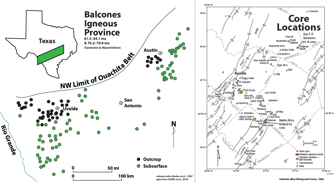
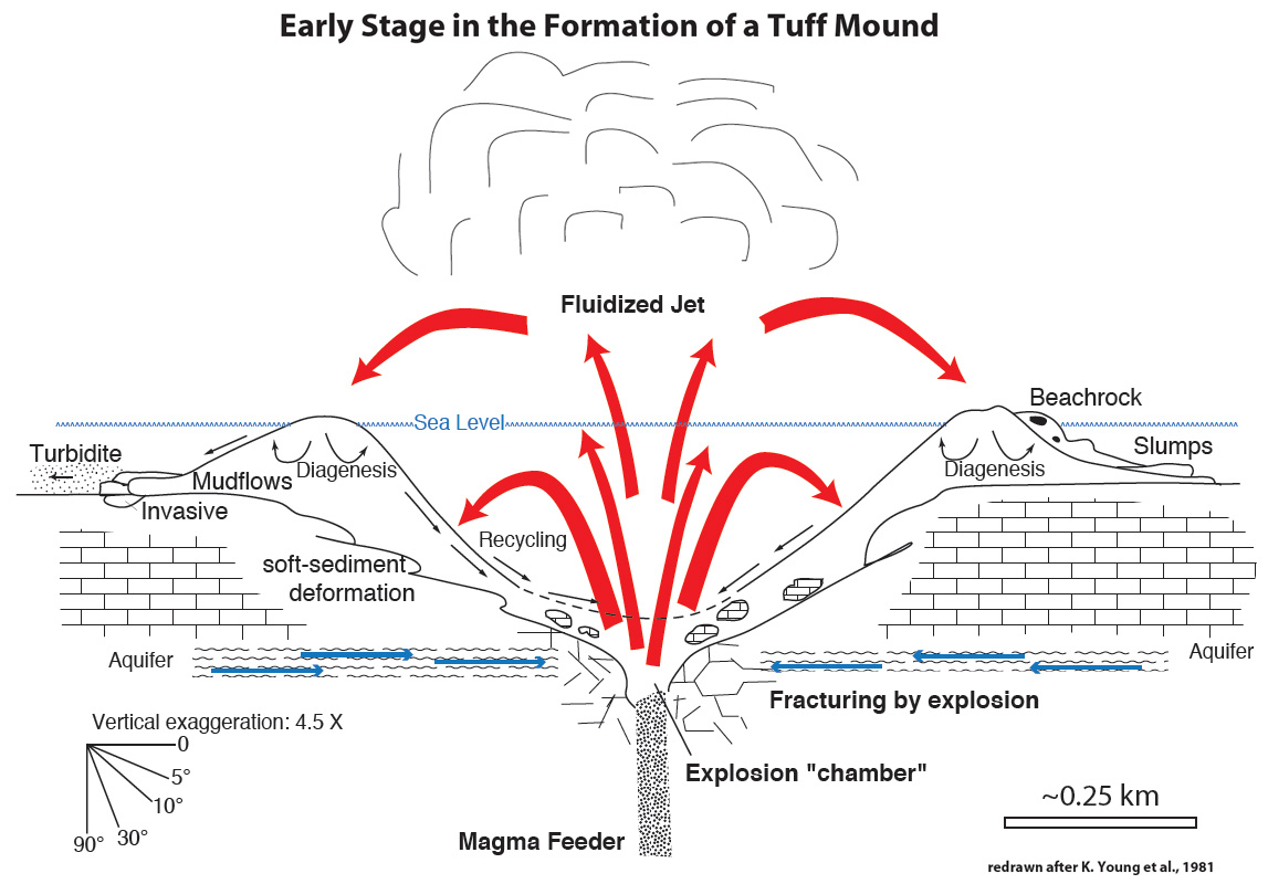
Above: regional maps indicating the regional study area and core locations. Below: diagram showing the formative processes in the early stages of a tuff mound.