
Front page: Bureau Information Geologist Linda Ruiz McCall has led a Bureau team effort to make the Texas GeoSign Project a reality.
The Bureau has partnered with the Texas Department of Transportation (TxDOT) to post geologic information signs at TxDot Safety Rest Areas (SRA’s). This work is part of the Texas GeoSign Project, a new initiative whose goal is to engage the public and promote the understanding of geologic information. Currently, signs are posted in Eastland and La Salle County SRA facilities.
The long-term plan for the Texas GeoSign Project is to develop and post two signs a year with TxDOT and other partners across the state. In addition, a web-based platform will feature the images of the signs and allow the public to explore geoscience information and learn about the geology of Texas.
Linda Ruiz McCall, Information Geologist with the Bureau, leads the Texas GeoSign Project with team members Dr. Charles Woodruff, Caroline Breton, Cathy Brown, and Jamie Coggin. Contributions to the La Salle sign were also made by Dr. Ursula Hammes and Dr. Robert M. Reed. Jackson School of Geosciences graduate student Heather Christensen also contributed to the project.
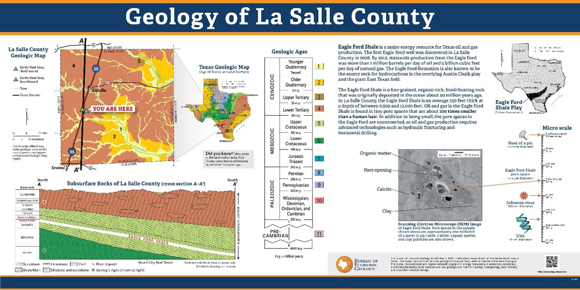
An example of a GeoSign from La Salle County, showing the regional geology and examples of typical rock types.

