
Meckel, GCCC Awarded $2.5M DOE Grant for CCS 3-D Seismic Study
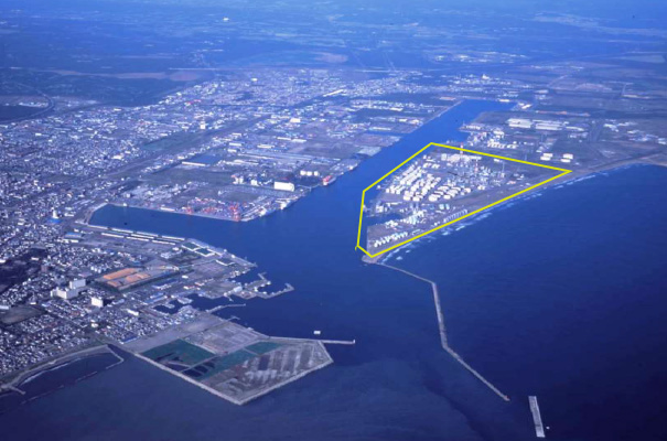
Tomakomai carbon-storage site offshore of the Japanese island of Hokkaido. Facing the Pacific Ocean, the CCS facilities are indicated by the yellow line.
Research Scientist Tip Meckel and the Bureau’s Gulf Coast Carbon Center (GCCC) research team have been awarded $2.5M for their new project, “Validation of MVA Tools for Offshore Carbon Capture and Sequestration: Novel Ultra-High-Resolution 3D Marine Seismic Technology Integrated with Coring and Geochemistry.” The Bureau project was one of eight selected under the U.S. Department of Energy’s Subsurface Technology and Engineering Research, Development, and Demonstration (SubTER) Crosscut initiative, which focuses on furthering geothermal energy and carbon storage technologies; the project will be funded by the Office of Energy Efficiency and Renewable Energy’s Geothermal Technologies Office and the Office of Fossil Energy’s Carbon Storage program.
The research seeks to validate GCCC’s unique ultrahigh-resolution 3D marine seismic technology for carbon-storage monitoring, verification, and accounting (MVA) at the fully developed Tomakomai carbon-storage site offshore of the Japanese island of Hokkaido. Deployment of P-cable technology (so called because it is towed perpendicular to the direction of a ship’s track) at this location will seek to demonstrate significantly improved spatial resolution over a commercially meaningful offshore area with improved accuracy and economic viability, thus decreasing the cost and uncertainty in measurements.
“This is an excellent method for GCCC and the U.S. program to advance our expertise in storage in the near-offshore setting via international collaboration with the unique project in Japan,” said GCCC’s Primary Investigator Susan Hovorka. To learn more about GCCC’s research in Ultra-High-Resolution 3D Marine Seismic imaging, click here.
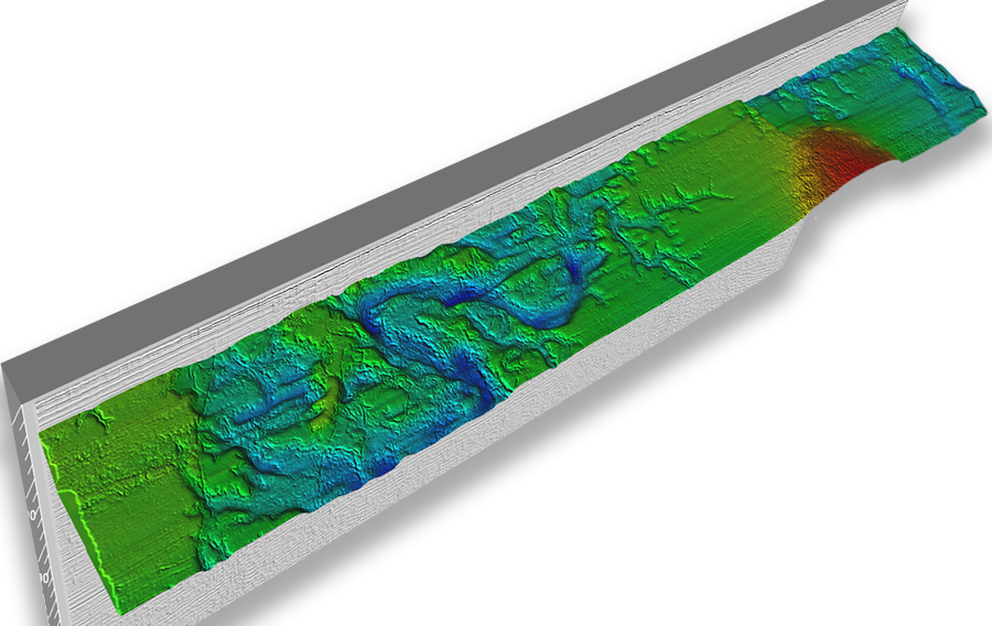
A volumetric interpretation based on P-cable ultra-high-resolution 3D marine seismic data from the Gulf of Mexico, from research described in Use of novel high-resolution 3D marine seismic technology to evaluate Quaternary fluvial valley development and geologic controls on shallow gas distribution, inner shelf, Gulf of Mexico by Timothy A. Meckel and Francis J. Mulcahy, 2016.

