Collecting and disseminating data resources that support research on natural and potentially induced earthquakes is a critical component of CISR. Initial focus is to collect earthquake waveform data from permanent and portable seismic stations operated within the TexNet Seismic Monitoring Program. Data will be made available through the IRIS Data Management Center (DMC).
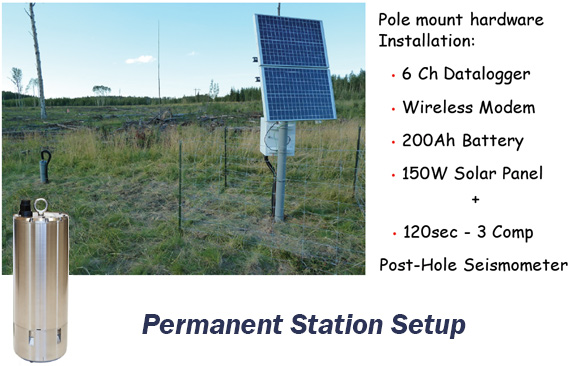
Installation and operation of TexNet permanent seismic stations
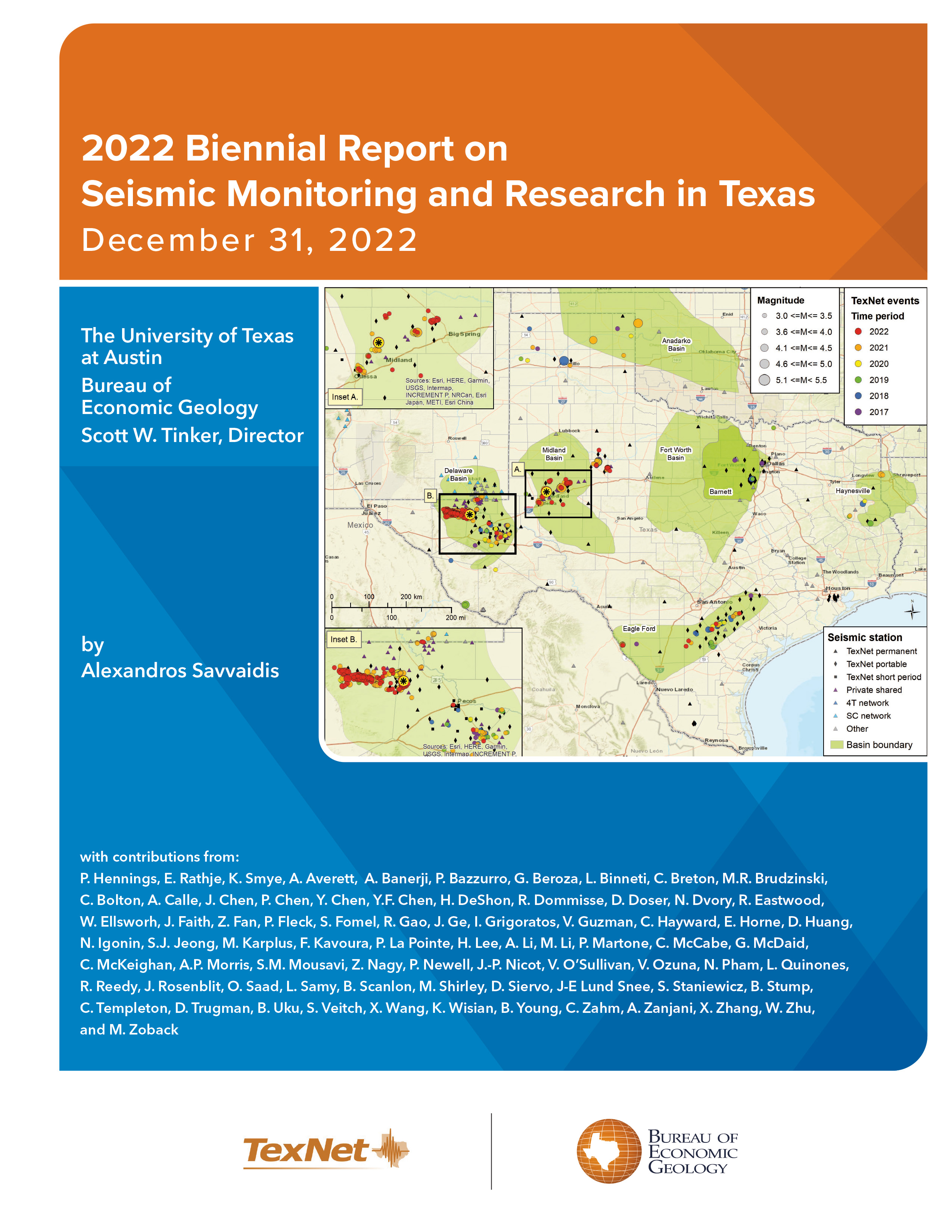
TexNet will acquire and install at least 22 permanent seismic stations in Texas, augmenting the 17 existing stations currently operated in the State of Texas by different entities. TexNet has two primary goals: (1) to monitor, locate, and catalog seismic activity with magnitudes of M 2.0 and larger, and (2) to improve our ability to rapidly investigate ongoing earthquake sequences in Texas. Of particular importance are those earthquakes larger than M 3.0 in or near urban areas, or in locations where ongoing human activities may be influencing earthquake activity.
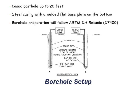
The mission of TexNet is to provide easy and open access to data and information regarding earthquake activity in Texas. The TexNet Project Manager and technical staff will support and maintain the TexNet seismic network infrastructure and oversee network operations, data analysis, and reporting. Site characterization, including the measurement or estimation of the average shear wave velocity over the top 30 m (i.e., Vs30), will be coordinated through TexNet-CISR projects.
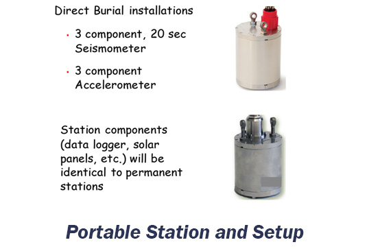
Rapid response to significant seismic events using TexNet portable seismic stations
CISR, with guidance from the Governor-appointed Technical Advisory Committee (TexTAC) and the internal CISR Science Advisory Council (SAC), will determine when to deploy the TexNet portable seismic stations to areas of recent and ongoing seismic activity as detected by the permanent stations. The decision on when and where to deploy portable seismic stations will be based on several factors, including but not limited to proximity to urban areas and critical infrastructure, severity of the earthquake recorded with existing seismometers, possible natural causes of the initial events, and other factors as determined by CISR with input from the TexTAC and SAC. Seismic data from both the permanent and portable instruments will be interpreted through activities in the Seismology research thrust. For selected events, rapid response investigations will include data collection, analysis, and modeling of relevant subsurface factors including in-situ stress state, subsurface structure, nearby production and disposal activity, reservoir hydrodynamics, and geomechanical sensitivity.
A primary activity of routine TexNet operations will be to accurately locate earthquakes at regional scales, with spatial (location) uncertainties of a few km or less when using permanent stations and uncertainties of 100’s of m when rapid-response stations are deployed. CISR seismology research efforts will focus on developing and implementing cutting-edge methods to determine earthquake locations more accurately than possible with routine methods. While phase arrivals can sometimes be automatically picked accurately, ambiguous phase arrivals require careful re-analysis. Precise locations are achieved with these data and a locally-tailored seismic velocity model. Sometimes relocating aftershocks, or clusters of earthquakes, reveals new information about regional geology that has significance for seismic hazard analysis. For example, planar aftershock clouds may delineate previously unknown buried faults. Detailed spatial maps and temporal plots of seismic activity provide a baseline for all other aspects of CISR research. These data will help constrain improved crustal seismic velocity models that will be distributed to the broader community through peer-reviewed publications and the CISR website.