
GREAT PLACE #9
San Solomon Spring and Toyahvale
Counties: Reeves and Jeff Davis
Landscape Domain: Basin and Range (Davis Mtns) (at edge of Pecos Valley)
Ecoregion: Chihuahuan Desert/Low Mountains and Bajadas; Montane Woodlands
-
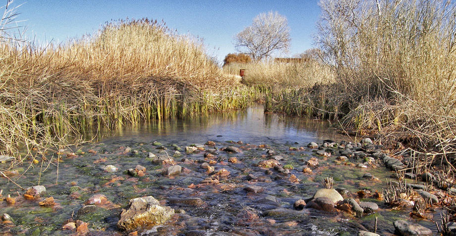
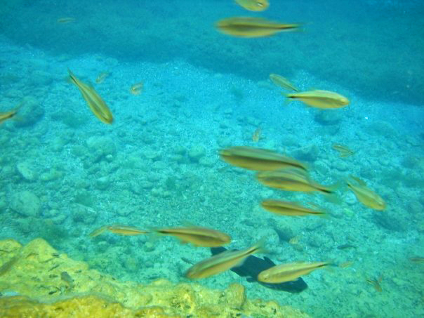
The renatured wetlands of the San Solomon Cienega
Photo by Larry D. Moore (CC BY-SA 3.0) -
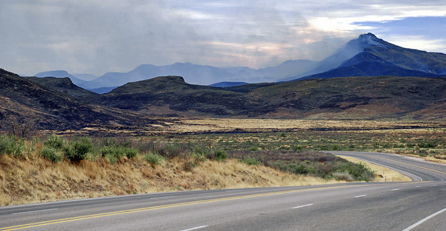
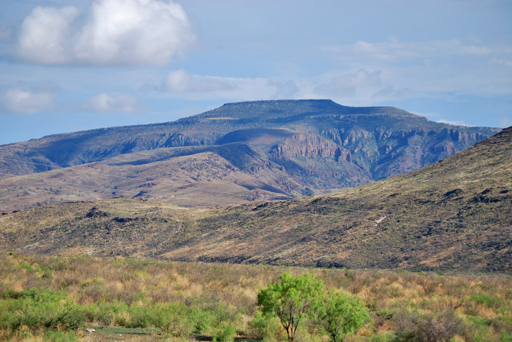
A wildfire burns high in the Davis Mountains, as seen from TX-17 driving south out of Balmorhea
Photo by Cliff Hammond. Some Rights Reserved (CC BY 2.0).
Why it's a great place
- Major spring in the desert
- Good views of Davis Mountains volcanics
- The Rounsaville syncline and possible salt dissolution
- Scenic drive up through the Davis Mountains front to the Boy Scout Ranch
Did you know?
- San Solomon Spring is a series of artesian and gravity springs formed by subsurface geologic faults
- Balmorhea State Park was built by the Civilian Conservation Corps in the 1930s and opened to the public in 1968
- The Balmorhea State Park Cienega Project created a natural wetlands environment at the park, which are now home to two endangered species of small desert fish: the Pecos Gambusia and the Comanche Springs Pupfish
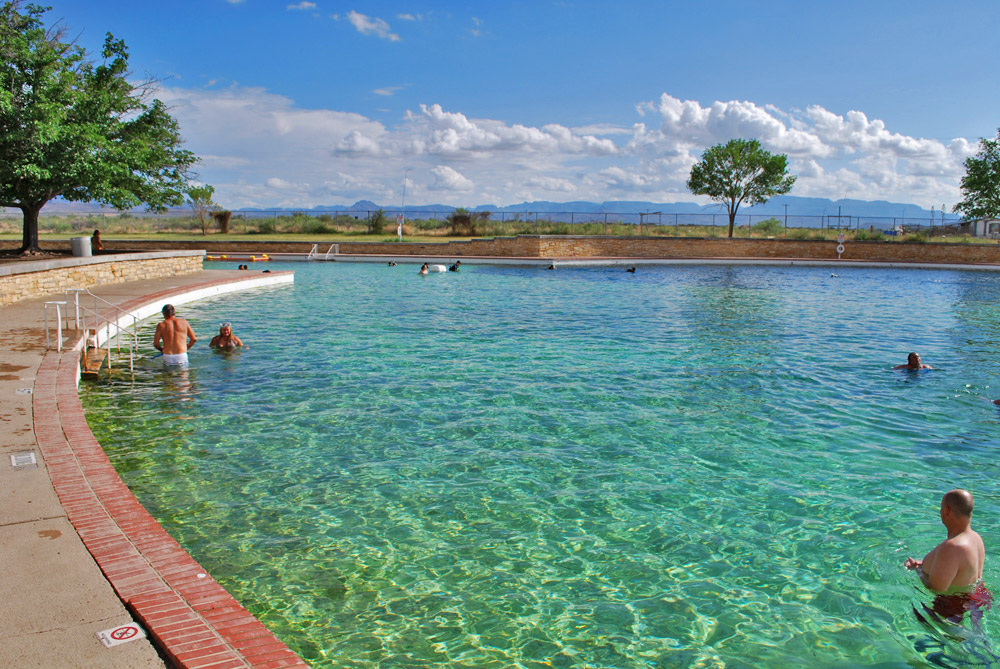
- The San Solomon Spring pool is the world's largest spring-fed swimming pool, covering an area of 1.75 acres
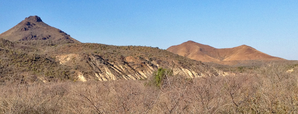
The Toyahvale area lies at the foot of the volcanic Davis Mountains, on the western side of the Pecos Plains, and overlies the buried Permian reef trend.
San Solomon Spring is a major spring in West Texas, forming an oasis for human travelers and settlers. The spring was developed for irrigation in the 1870s and for recreation in the 1930s. It flows at a rate of 1 million gallons per hour. The water is thought to come up faults from the buried Permian Capitan reef, ultimately sourced in the Apache Mountains and Salt Basin area to the northwest.
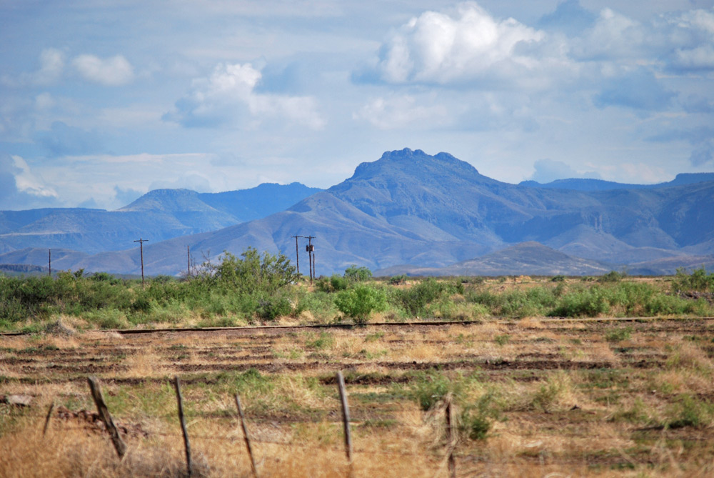
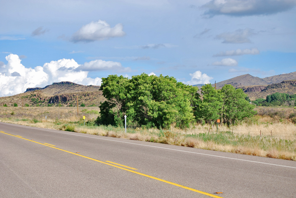
The view of the Davis Mountains front is spectacular. Paleogene volcanics overlie soft Upper Cretaceous clay and impure limestone. A major syncline with a relief of over 1000 feet is well exposed along the road south from the springs.
Access
From I-10, exit Balmorhea (TX-17 Southbound), drive south 6.9 miles to Balmorhea State Park.
30°56'40"N 103°47'17"W 3322'
Access level: 1
(Short walk to viewpoint or exposure, less than 0.2 miles; handicapped accessible; may have small steps or curbs)
San Solomon Spring is the largest of a set of four in the immediate area. Sometimes known by an earlier name, Mescalero Spring, it was the site of Apache settlements. The present name was given by Hispanic farmers who settled the area in the 1860s.
The spring was developed for large-scale irrigation in the 1870s, when an outlet canal was dug to feed Balmorhea Reservoir. Today the system irrigates about 6000 acres of cropland along Toyah Creek.
The present pool, along with the buildings and the motor court, was built when the State Park was established in the 1930s. In the 1990s, small natural wetlands were recreated to give us a sense of what the whole area must have looked like in its natural state.
Spring flow averages 1 million gallons per hour. The present pool contains 3.5 million gallons. The water is a nearly constant 72 to 76°F in temperature.
Why is this spring here? What is the water source? Bedrock around the spring is not visible, but it is probably Cretaceous limestone and shale. The spring lies in a northwest-trending zone of folding and fracturing, the Rounsaville Syncline (see below). One can imagine that the fracturing helps water reach the surface. The source of the water has been studied by LaFave and Sharp, who think that most of the water has risen up from the older Permian-age rocks of the Capitan Reef. This reef (the same as that exposed in the Guadalupe Mountains, see Great Places #5 and #6) is exposed in the Apache Mountains trending southeast, and probably exists beneath our feet in the Balmorhea area. The reef is known as an important aquifer (water-bearing rock), especially in areas east of Carlsbad, New Mexico, and into the Wink area of West Texas (see Great Place #7). The water at Balmorhea is very similar in chemistry to water from springs in the Apache Mountains.
LaFave and Sharp also think that the water may have entered the Capitan from the Salt Basin graben. This valley, just east of Van Horn (see Great Place #4), is filled with thick deposits of gravel and sand that host large freshwater supplies.
Access level: 0
(Car stops; viewpoints or roadcuts; fully accessible; may have curbs)
Just west of the park, Texas 17 turns south to go towards Fort Davis. From that area there is a great view of the front of the Davis Mountains. To the southwest is Star Mountain, the stair-stepped and flat-topped peak that you could see from the parking lot at the spring. To its north is a large spiny peak, called Big Aguja Mountain (Aguja means spine), and then a broader, forested mountain (Timber Mountain). The mountains continue north to Gomez Peak—the northernmost of the Davis Mountains and the peak that is most visible from the junction of I-10 and I-20.
All of these mountains are underlain by volcanic rocks of Paleogene age, about 35 to 20 million years old. The shapes of the volcanoes have mostly been lost, but the resistant rocks of rhyolite, trachyte, and basalt hold up the high mountains. The mountains rest on weak clay, clayey limestone, and soft limestone of Late Cretaceous age (70–90 million years old). This rock is so unstable that large masses of volcanic rock have slid down into the valley. The landslide deposits nearly cover the Cretaceous rocks, which are seen only in valley and arroyo cuts.
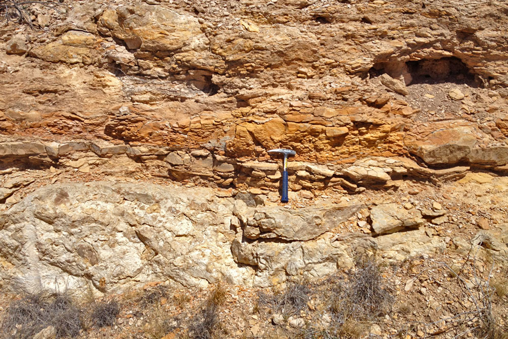
Look again to the south, where Texas 17 goes. The same layered rocks that are found high on Star Mountain occur, dipping up to 40 degrees towards us, just to the left (east). Farther east, they dip 40 degrees away from us. This relationship is best seen by driving up Texas 17 about 6 to 8 miles. This structure is the Rounsaville syncline. It has a relief (lowest spot to highest spot) of well over 1000 feet, making it a big feature. (Rounsaville was a small settlement, now abandoned, situated near the geologic feature.)
There is some controversy about the Rounsaville Syncline. It was thought to be related to faulting seen to the north and to be the most northeasterly representative of the Neogene faults that formed the Rio Grande, Hueco, and Salt Basin grabens. Other work, though, indicates that it formed by the dissolution and removal of large thicknesses of Permian salt over and along the front of the Capitan limestone. Either way, the syncline formed after the volcanics were erupted, as they do not thicken into the structural low spot.
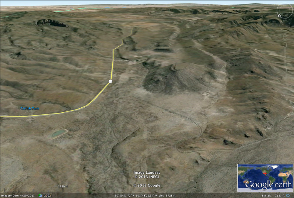
6.7 miles south on Texas 17, turn right.
30°48'52"N 103°56'13"W 4366'
Access level: 0
(Car stops; viewpoints or roadcuts; fully accessible; may have curbs)
This road provides an 11-mile-long scenic drive up close to the Davis Mountains front. The road begins in the center of the Rounsaville Syncline and continues west toward Big Aguja Peak. The white soils exposed by arroyos low down on the mountains are the Cretaceous sediments (mud and muddy lime). The road turns right and a bigger stream cut into the Cretaceous white limestone is visible to the right, across the valley. Many of the hills are capped by landslide debris of volcanic rocks. Towards the ranch the valley tightens up and is quite scenic, with lots of dark red-brown volcanic debris. The road ends at the Buffalo Trail Scout Ranch entrance.
Texas Parks & Wildlife Department website
J.I. LaFave and J.M. Sharp, Jr., 1987, Origins of ground water discharging at the springs of Balmorhea: West Texas Geological Society Bulletin, v. 26, no. 9, reprinted in C.W. Kreitlerand J.M. Sharp, Jr., Hydrogeology of Trans-Pecos Texas: BEG Guidebook 25, 1990, p. 91–100.
Road to Fort Davis (AL-0): The drive up into the Davis Mountains along Texas 17 is very scenic, and a wide variety of volcanic rocks can be observed up close and across the valley. See MacLeod's book "Davis Mountains Vistas" for a good illustrated roadlog.
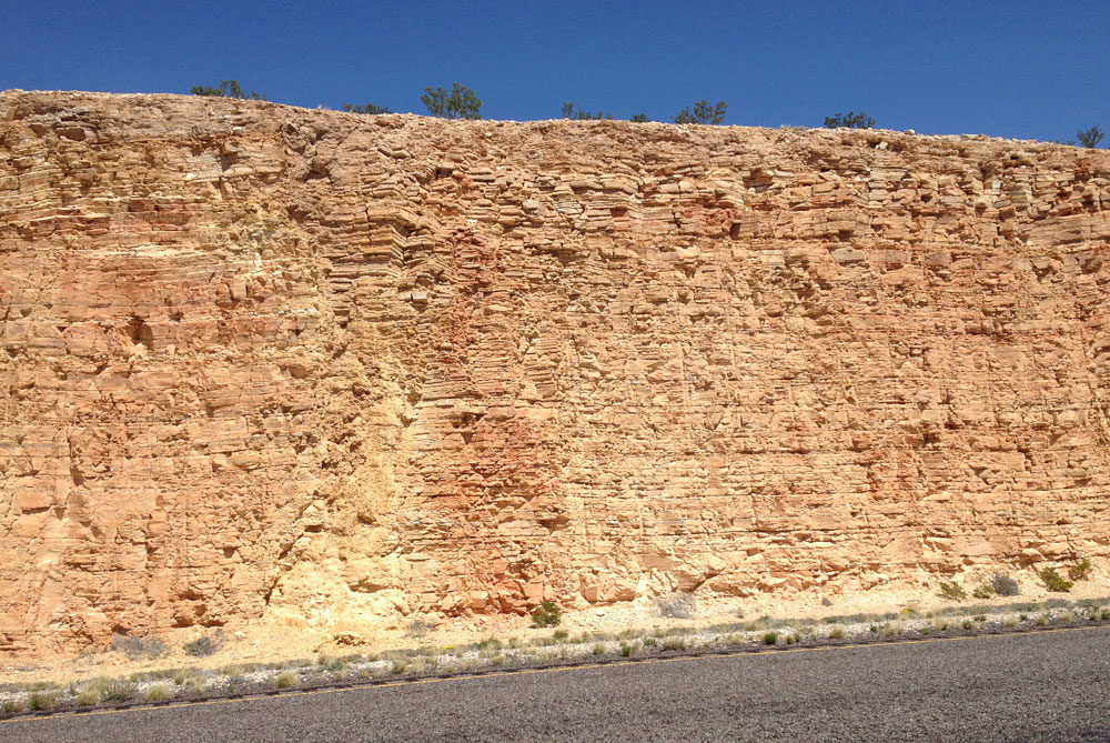
I-10 roadcuts and views of Gomez Peak (AL-0): From the intersection with Texas 17 at the springs, the old road (now RR 2903) continues northwest several miles along the Davis Mountains front to an intersection with I-10. Then I-10 continues west towards Gomez Peak and the joining of I-20 from Dallas. The roadcuts here expose distinctive red-brown flaggy (thin-bedded) limestone of the Eagle Ford or Boquillas formation, and underlying tan to gray limestone of the Buda—all mid-Cretaceous (90–100 million years old).