
GREAT PLACE #64
Sabine Pass and Sea Rim SP
County: Jefferson
Landscape Domain: Coastal Prairie (Shore zone)
Ecoregion: Texas-Louisiana Coastal Marshes, Western Gulf Coastal Plain
-
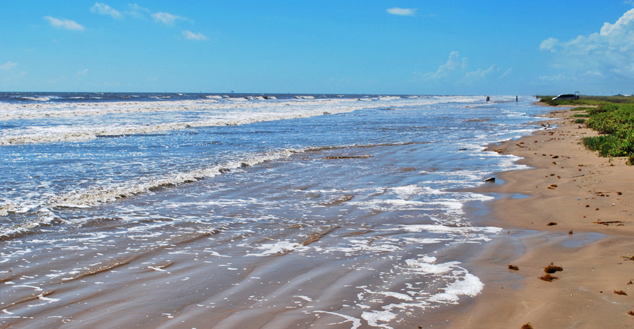
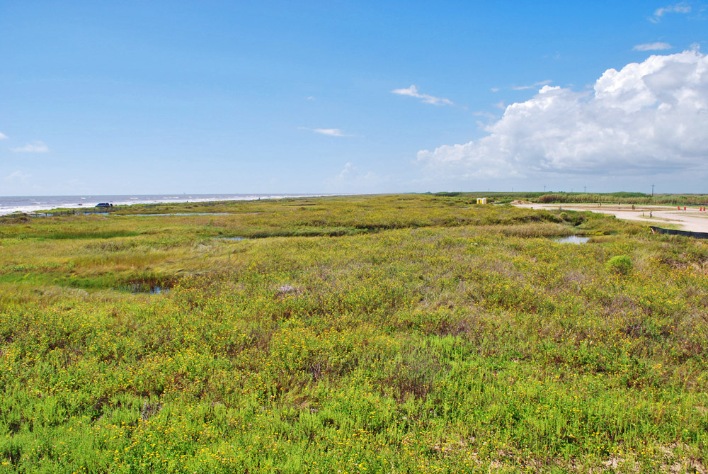
A low, broad beach with low waves and ripples at Sea Rim
-
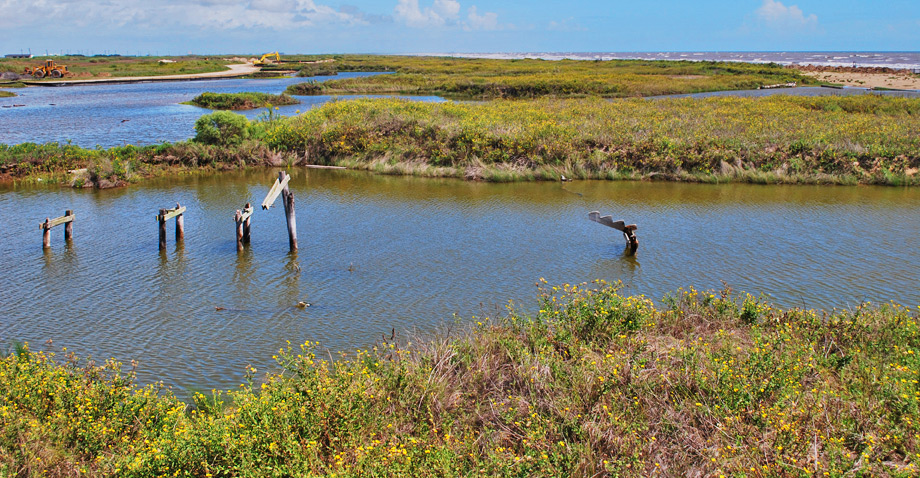
Dune blowouts along an old path. Hurricane wind and surge quickly scour out any place where the vegetation cover is broken along the dune line
Why it's a great place
- Lies on the west end of the Louisiana chenier plain at a major tidal entrance
- Example of a transgressive barrier beach with different profiles
- Many observable dune "blowouts"
Did you know?
- Sea Rim State Park occupies 4,141.1 acres of marshland and 5.2 miles of shoreline
- As part of the Greater Texas Coastal Birding Trail, the marshland plays host to countless species of migratory birds on their journey through the Central Flyway
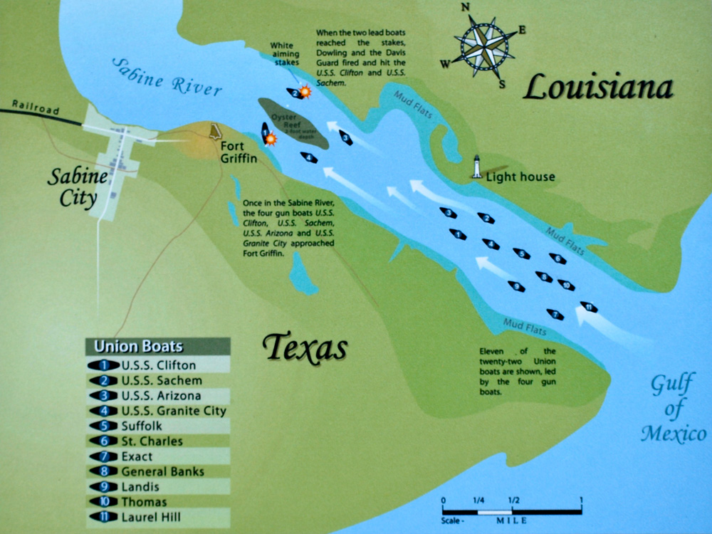
- The 1863 battle at Sabine Pass lasted less than one hour
- McFaddin National Wildlife Refuge is home to the largest remaining freshwater marsh on the Texas Coast
- The marsh habitat at McFaddin National Wildlife Refuge is currently eroding at a rate of 14 to 15 feet per year—an issue made drastically worse by the region's frequent hurricanes
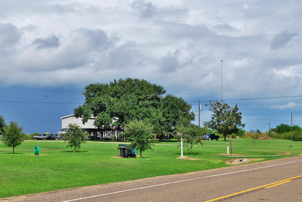
Sabine Lake is a Texas bay with brackish to saline water. About 20,000 years ago, the Sabine and Neches Rivers were deeply entrenched in a valley system that ran under the Louisiana side of the lake and south and west to the shelf margin. As sea levels rose, the valley was filled by river and delta deposits and then by bay muds. The bay area was widened by storm activity into an oval area. The southern entrance was nearly sealed by the west end of the Louisiana chenier plain since 2500 years before present. (A chenier plain is a mixture of sandy beach ridges with oak trees growing on them, and muddy grass flats. The sand comes from wave winnowing; the mud from the great mud plume spewed from the Mississippi River to the east.) River input and tidal exchange from the lake to the Gulf keeps the pass open as a narrow channel and distorts the beach ridges in its area.
To the west of Sabine Pass, the beach ridges consolidate into a single recent beach, which is rapidly migrating landward in the McFaddin Beach area. This rapid migration has led to the closure of Texas 87 west of Sea Rim State Park.
Access
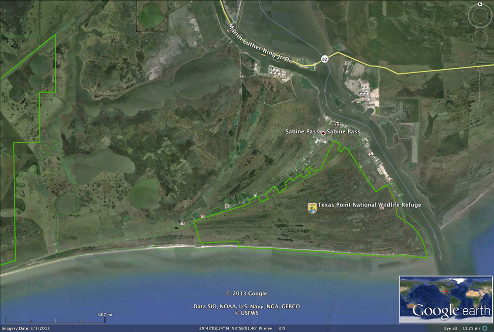
Take Texas 87 from Port Arthur (11 miles from junction with Texas 82). In Sabine Pass community, turn right on Texas 87 to Sea Rim (10 miles), or ahead on FR 3322 to the battlefield (2 miles) and Texas Point (5.7 miles to end of road).
Ownership: Texas Parks and Wildlife (Sea Rim SP), Texas Historical Commission (Sabine Pass Battleground)
29°40'25"N 94°02'46"W
Access level: 1
(Short walk to viewpoint or exposure, less than 0.2 miles; handicapped accessible; may have small steps or curbs)
Sea Rim State Park is a great place to see a flat, narrow beach profile at the west end of the chenier plain. Walk over the Dune Boardwalk to get an aerial view of the beach and dune line. The dunes here are low and in two rows; a front line by the beach that is very low, and the rear line closer to the parking area that is higher. This may be a remnant piece of a beach ridge, perhaps the oak-covered one we drove in along from Sabine Pass community. The dunes have several large "blowouts" that have scoured through and are water-filled. Examination of historical photography shows that all of these blowouts occur along old paths to the beach that were excavated during Hurricane Rita in 2005. The blowouts fed washover sand into the marsh to the north. The beach itself is low and has conspicuous large ripples in the swash zone.
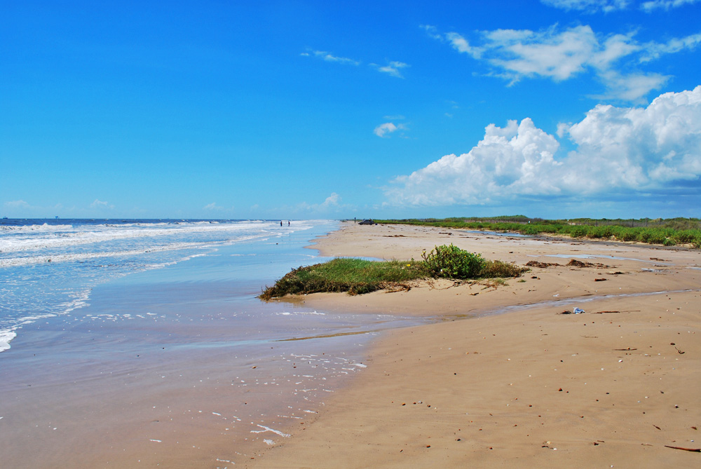
If we drive two miles west to the beach access at the boundary of McFaddin Beach National Wildlife Refuge, the appearance is quite a bit different. The dune line is higher and occurs right behind the vegetation line. The beach is higher and wider with occasional runnels, down which swash waters return to the Gulf. This beach is at the west end of the chenier plain. To the west, where there is only one narrow sand ridge at the beach, the road was closed due to beach retreat. The beach in that area, called a perched beach because the sandy beach perches on top of the marsh, is considered highly vulnerable because the marsh root-mat in front of the swash zone is exposed to erosion.
29°44'02"N 93°52'27"W
Access level: 1
(Short walk to viewpoint or exposure, less than 0.2 miles; handicapped accessible; may have small steps or curbs)
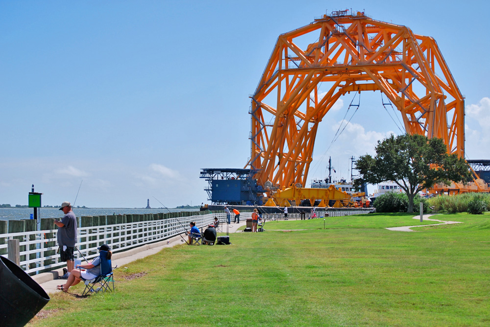
To view the Sabine Pass and understand its human history, make a stop at the Sabine Pass Battlefield. This was the site of a Confederate fort, which defeated an attempted landing by Union troops in 1863. Standing on the embankment, we can see the busy activity at the Pass, with large cranes and jack-up rigs downstream to the right and the Cheniere LNG plant across the Pass. Downstream and on the left is an abandoned lighthouse, built in 1857 to help navigate the narrow waterway.
The fort was sited at a point where the pass had two narrow channels on either side of an oyster reef. The well-trained gunners under Captain Richard "Dick" Dowling, an Irish-Texan and saloon-owner in Houston, immobilized the first two gunboats, one in each channel, blocking the other gunboats and troop transports from moving upriver and landing. The victory at the Battle of Sabine Pass was celebrated across the Confederacy.
The narrow pass connects the Gulf and Sabine Lake. The combination of river flow into the lake and tidal exchange keep this pass open and fairly deep. The water flow causes sediment to accumulate around the pass, widening the chenier plain.
Texas Parks & Wildlife Department website
www.texasbeyondhistory.net/mcfaddin
www.proctormuseum.us/Texas/McFaddin-each/mcfaddinbeach
www.visitsabinepassbattleground.com
K.T. Milliken, J.B. Anderson, and A.B. Rodriguez, 2008, Tracking the Holocene evolution of Sabine Lake through the interplay of eustasy, antecedent topography, and sediment supply variations, Texas and Louisiana, USA; in Response of upper Gulf Coast estuaries to Holocene climate change and sea-level rise, in J.B. Anderson and A.B. Rodriguez, eds., GSA Special Paper 443, p. 65–68.
Texas Point: the southeasternmost point in Texas accessible by road; from end of FR 3322 follow right South First St., which become Jetty Road; road is intermittently paved and potholed; end of road is at 29°41'22" 92°50'34", about 3/4 mile from the southeasternmost point of Texas. From the end of the road one can see the breakers on Louisiana Point across the Pass; also the 1850 Sabine Pass Light on the Louisiana side upstream. The area gives a good vista of salt marsh wetlands and ocean frontage.