
GREAT PLACE #41
Pedernales Falls State Park
County: Blanco
Landscape Domain: Balcones Canyonlands
Ecoregion: Edwards Plateau/Balcones Canyonlands
-
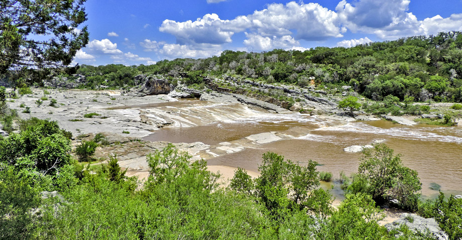
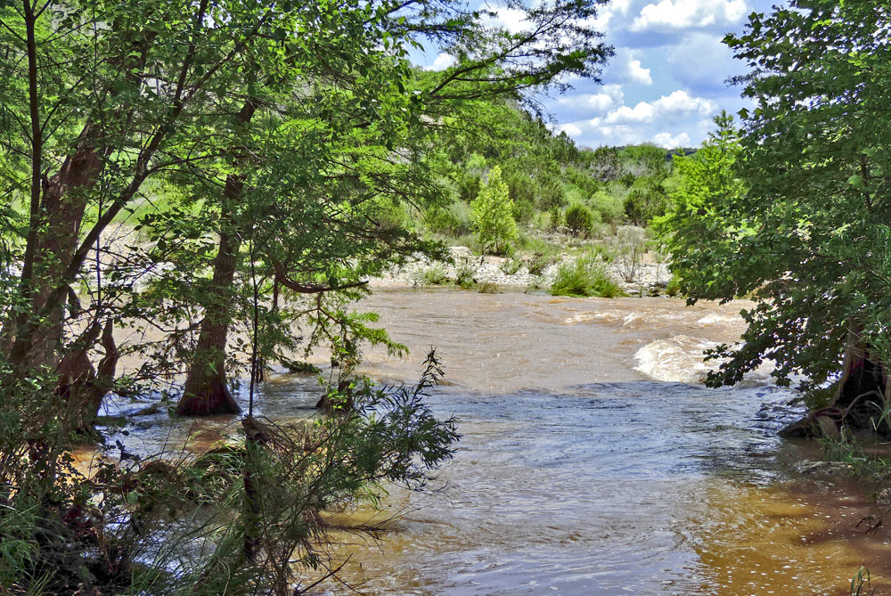
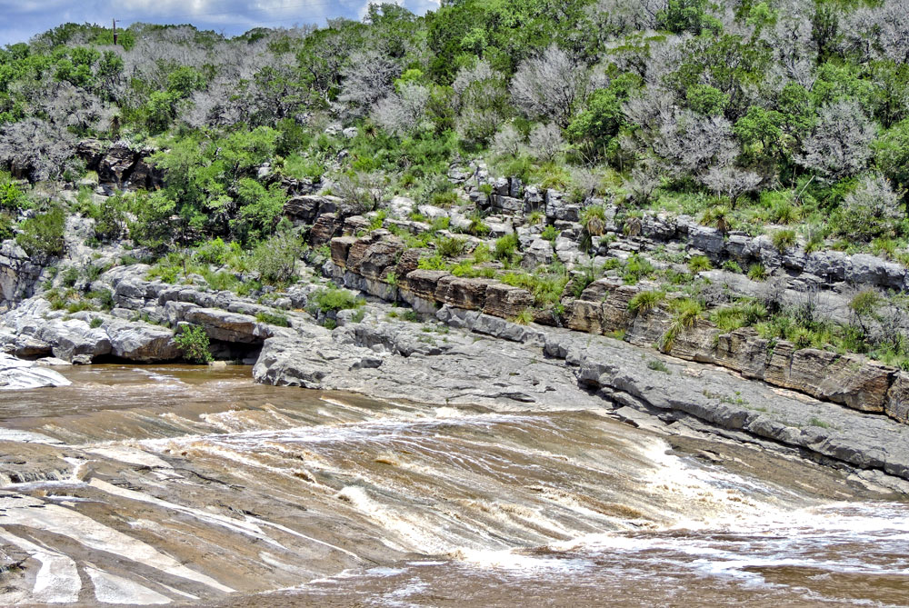
The main falls after a heavy rain. Note the east-dipping (right-dipping) beds of Marble Falls Limestone that form the falls also are exposed on the north wall.
-
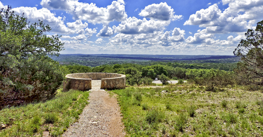
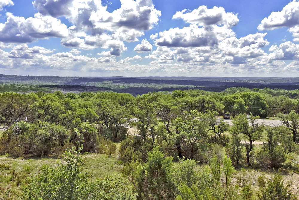
Clouds seem to hang low at the top of the hill at the Headquarters Overlook
-
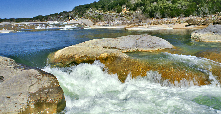
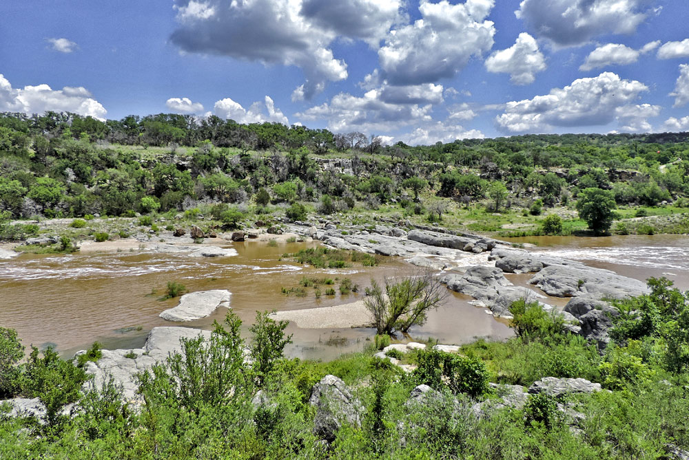
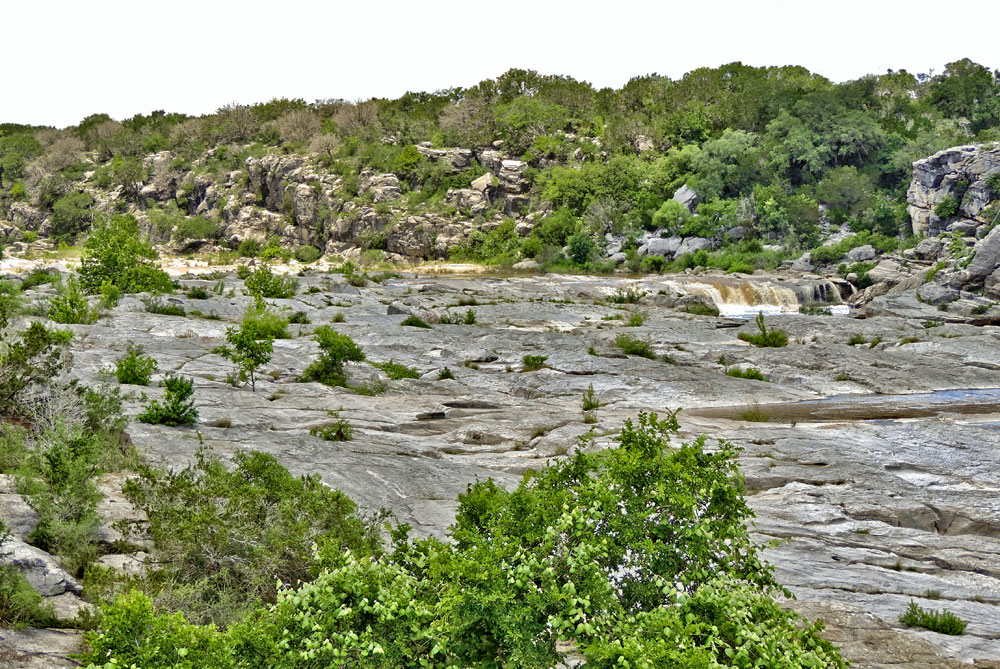
The tilting of the Paleozoic rock that makes up the river bed forms a series of pools and cascades down the river
Photo courtesy of David Stephens -
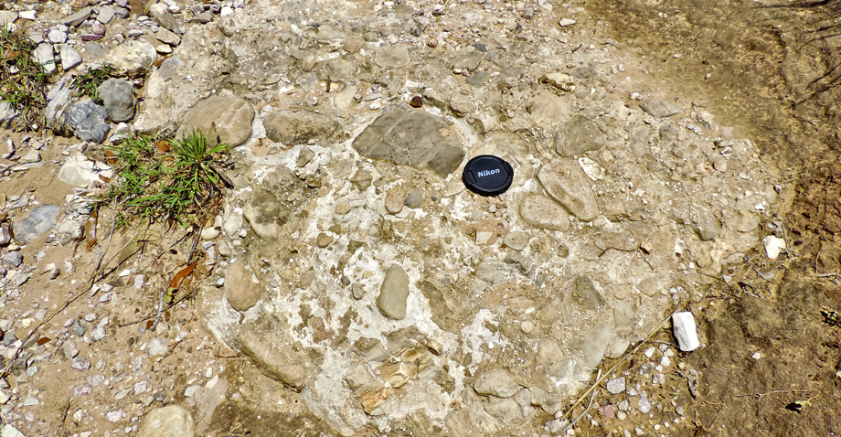
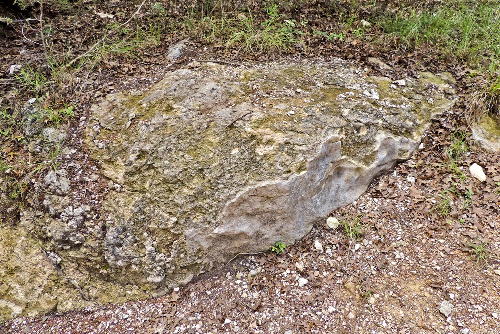
A well-cemented block of conglomerate with some sandy mud matrix is embedded in the trail to Trammell's Crossing, lens cap for scale
-
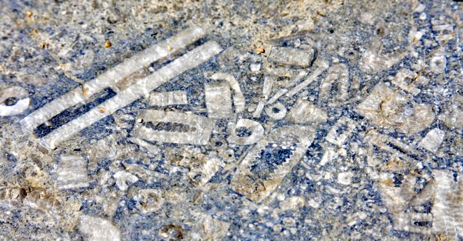
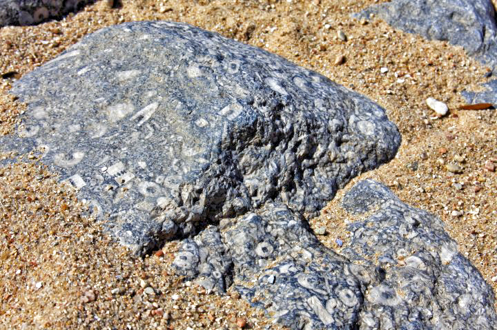
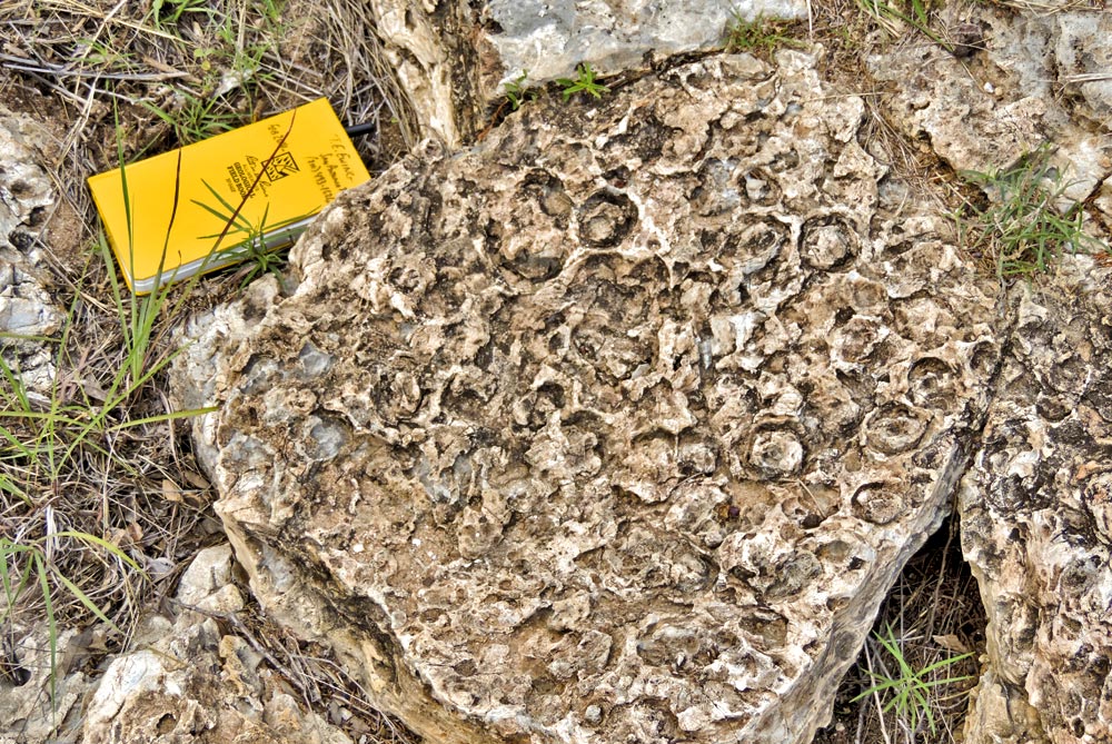
Most of the crinoid fossils found here are segments of the columnal stalks of the ancient marine crinoid 'sea lilies'
Photo courtesy of Jennifer Loeffler -
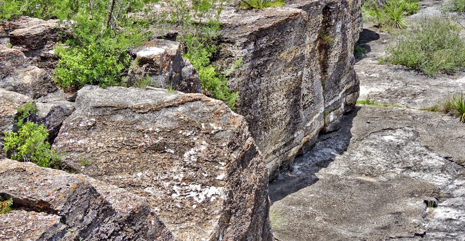
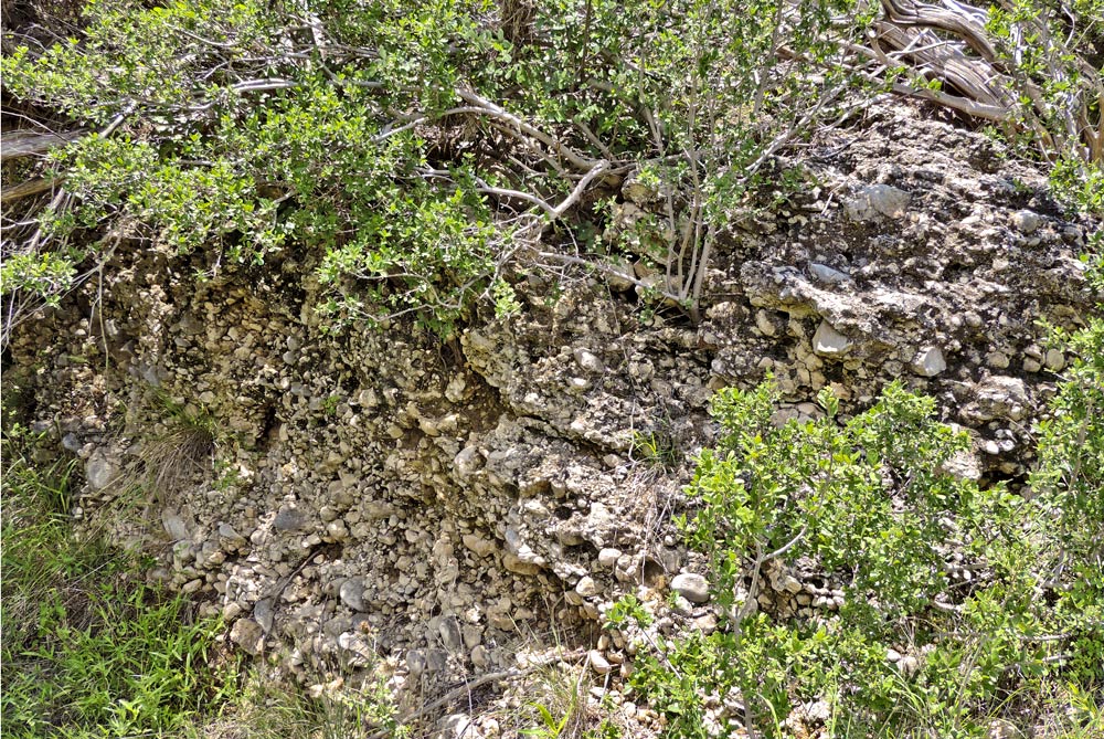
Cliffs of the thick, cherty marker bed in the Marble Falls limestone. Light brown chert (silica) replaces burrows and forms much of this rock.
Why it's a great place
- Classic Hill Country scenery and landscapes
- Excellent illustration of the power of river erosion
- Visible angular unconformity: flat-lying Cretaceous (115 Ma) over tilted Pennsylvanian (320 Ma) rocks
- Cretaceous conglomerate, shale, limestone, sandstone – an observable succession of environments from river fan to shallow sea 115 million years ago
Did you know?
- The Pedernales River flows through the park and was named by Spanish settlers for its characteristic flinty sands and gravels
- The park occupies a total area of 8.143 square miles
- Rocks in the park have a history going back more than 300 mIllion years
Pedernales Falls State Park, convenient to both Austin and San Antonio, is a popular place for recreation by foot or horseback. It is also a geologically interesting place. It lies at the northern edge of the limestone hills of the Balcones Canyonlands and at the southern edge of Llano Country. In the uplands north and south of the Pedernales River, we find the ledgy fossil-bearing marine limestone of the Glen Rose Formation. Within the river valley, older units are exposed: the Cow Creek limestone, which forms sharp fissured bluffs, and a conglomerate called the Sycamore deposited by ancient streams. All of these Cretaceous units (105–115 million years old) overlie some much older rocks that have been tilted and eroded before the Sycamore was deposited. The Marble Falls limestone, some 320 million years old, makes up the main cascade in the park.
Access
Take FM 2766 east from Johnson City 9 miles to park entrance on left; or FM 3232 north from US 290 for 6 miles, then turn right and take the first left into park entrance. Continue 2.5 miles to park headquarters; stop at overlook to right (short walk) after paying entrance fee.
30°18'28"N 98°15'24"W
Access level: 1
(Short walk to viewpoint or exposure, less than 0.2 miles; handicapped accessible; may have small steps or curbs)
From the Headquarters Overlook, we get a great view of the Texas Hill Country, a landscape shaped by erosion. Intense thunderstorms and other rainfall have worn deep canyons and ravines into the resistant limestone. Major rivers like the Pedernales have eroded deep into the geology to form canyons, exposing rocks that are deeply buried under the nearby ridges. In this climate, limestones resist erosion, but shale and sandstone are less resistant. Because of the alternation of past environments, the Cretaceous section (105–115 million years old) has layers of conglomerate (called Sycamore), shale, limestone (Cow Creek), and sand, followed by resistant limestone (called Glen Rose). The overlook is located near the base of the Glen Rose hills. The weak shale and sand layers form flats; the intervening Cow Creek limestone forms bold bluffs overlooking the river. We can view these rocks close up on the trail to Trammell's Crossing, in the Twin Falls area, and farther downstream to the east.
30°18'29"N 98°14'44"W
Access level: 3
(Longer walks to exposures or sites, less than 1 mile; not handicapped accessible due to rocks, brush, or other obstacles)
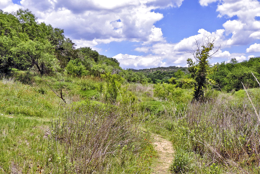
On the trail to Trammell's Crossing we get a close-up view of many of the Cretaceous rocks. The flat area as we enter the trailhead is on the Hensel geologic formation, which contains sand and mud that is easy to erode. Walking down the trail, we find resistant boulders and ledges of Cow Creek limestone; then a covered zone with underlying mudstone; then, at the base of the hill, a conglomerate (cemented gravel) with rounded pebbles to cobbles of older rocks (Marble Falls and others).
The Cow Creek limestones contain broken oyster shells and abundant quartz sand. These sandy limestones with some ripple marks formed in a beach environment. Farther along, the limestones contain filled burrows of worms, clams, and shrimp.
About 20 yards beyond the amphitheater, the soil becomes muddier and the trees change from live oaks to mesquite and Spanish (red) oak—indicating a change to muddy bedrock, here the Hammett Shale.
Where a side trail heads left, it ultimately reaches a ledge of Sycamore conglomerate. This unit typically has abundant cobbles (and boulders) of older limestone, including Marble Falls and yet older Ellenburger limestones. The cobbles are cemented by a limy material that may be Cretaceous caliche (soil-deposited carbonate, typical of desert and semidesert environments).
At the base of the hill, the road enters the floodplain of the Pedernales River, which it crosses on a concrete-lined ford. Around the ford we can see the debris left by major floods that have swept down the river valley. Floods have reached 45 feet above the riverbed; we can see flood-wrecked cypress trees along the stream and large boulders encased by tree roots.
Cow Creek and Sycamore rocks are also exposed along the river to the south. Twin Falls is a small stream falling over a ledge of Sycamore conglomerate. Cow Creek forms an extensive bench above the river, where primitive camping is allowed; the bench can be reached via the Wolf Mountain Trail near the park headquarters.
30°20'14"N 98°15'06"W
Access level: 2/3
(Longer walks to exposure or sites, less than 1 mile; handicapped accessible with great difficulty due to rocks, brush, or other obstacles)
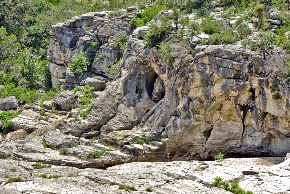
At the north end of the park, the river cuts through the Cretaceous beds and exposes a much older limestone, the Marble Falls cherty limestone of the Pennsylvanian age (320 million years old). These older beds dip about 10 degrees to the southeast. They were initially deposited flat-lying, but they were tilted some time after they were laid down and lithified, long before the flat-lying Cretaceous sediments were deposited. The lowest Cretaceous layer is the Sycamore conglomerate, exposed at the top of the rock stairs. The boundary between the two layers is an angular unconformity, marking a time gap of some 200 million years.
The Marble Falls limestone is very fine-grained, with crusts and beds of chert (silica) that are more resistant to stream erosion than the limestone. The limestone contains crinoid fossils, stems of "sea lilies" (a flower-shaped animal) that captured their food from the Pennsylvanian sea.
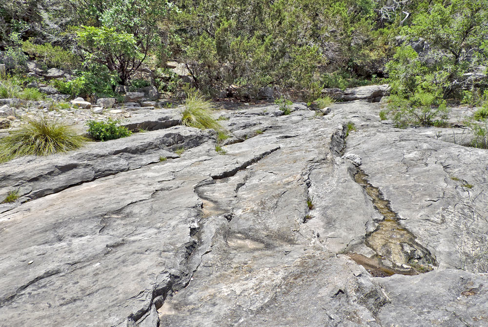
The Marble Falls limestone has been eroded by river flows into a variety of beautiful and interesting forms, including flutes, potholes, and eroded fissures. Potholes form where eddies drive rocks in a swirl that erodes the limestone (and traps the rocks). Small shallow pits and widened fissures are caused by chemical erosion or dissolving of the limestone.
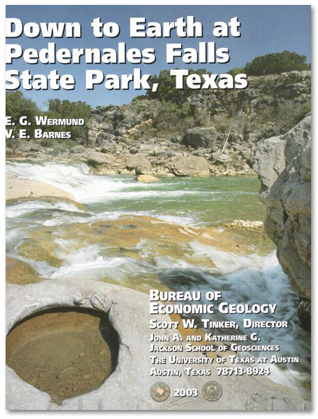
Down to Earth at Pedernales Falls State Park, Texas
by E.G. Wermund and V.E. Barnes: Bureau of Economic Geology, 48p. (2003)
This nontechnical guidebook describes seven trails that visitors can walk within Pedernales State Park. Included are numerous color photos, brief discussions of the park's geology, human history, and Pedernales River, and a geologic map of the park.
30°20'31.8"N 98°07'38.6"W
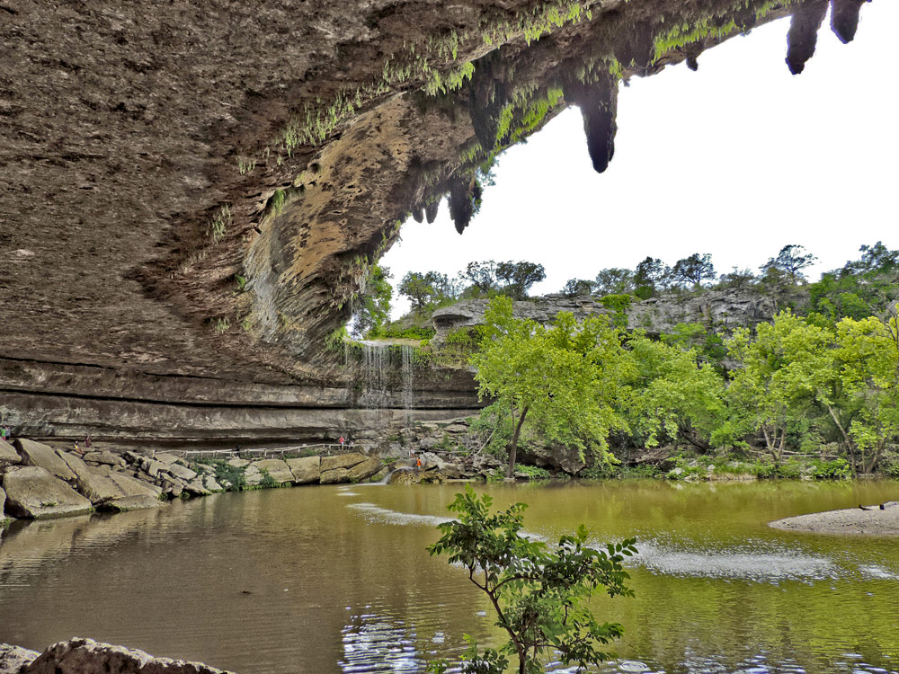
The Hamilton Pool Preserve: Located 7.5 miles east of Pedernales Falls, Hamilton Pool is a Cretaceous section similar to Pedernales Falls. A scenic waterfall and swimming hole are formed on the Cow Creek limestone and underlying Hammett Shale at the head of a box canyon that feeds into the Pedernales River.