
GREAT PLACE #21
Monahans Sandhills State Park
County: Ward
Landscape Domain: Pecos Valley (border with Southern High Plains)
Ecoregion: High Plains/Arid Llano Estacado, Shinnery Sands (border with Chihuahuan Desert Basin)
-
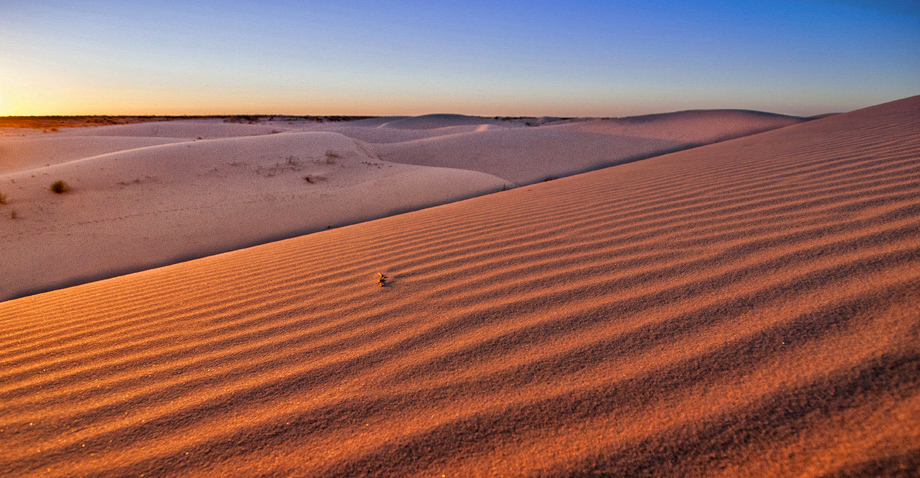
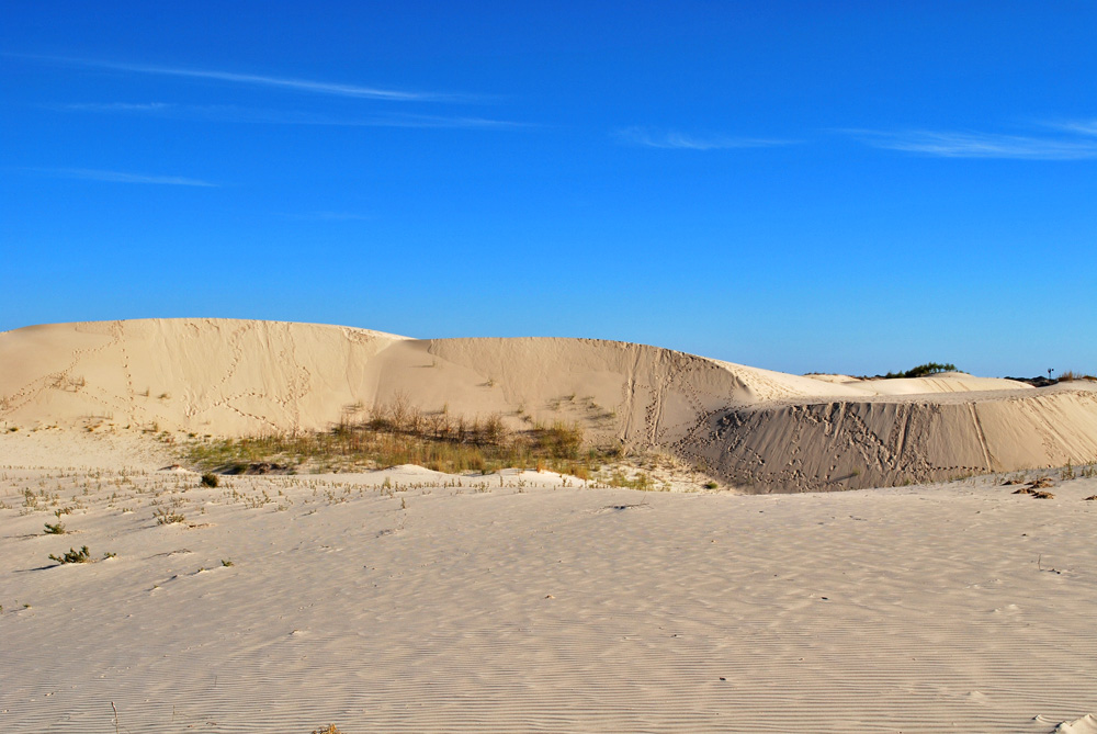
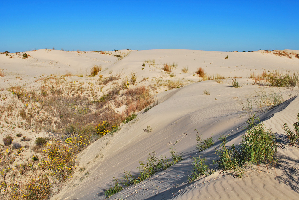
The dunes are comprised of mostly quartz grains whose luster can cause them to shimmer in the light
-

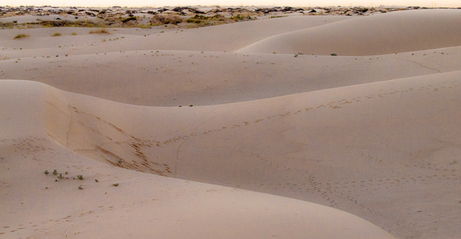
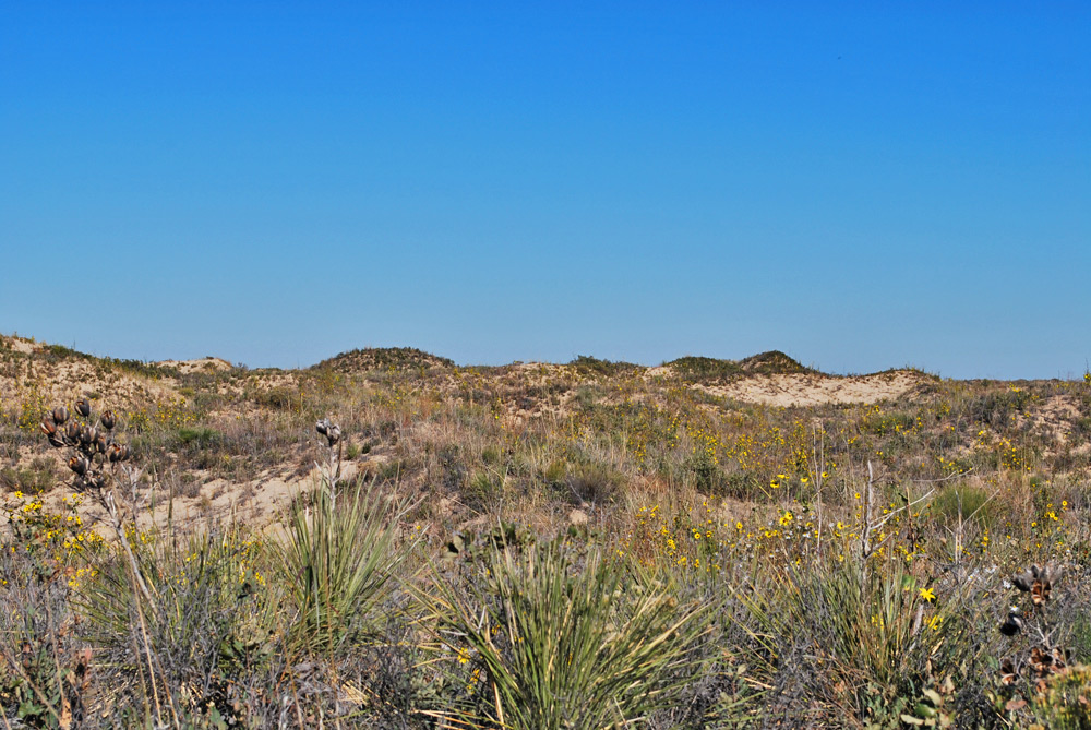
White flowers dot the landscape at Monahans Sandhills State Park
Photo by Sean Murphy -
The dune field stretches on past the horizon- all the way up through the High Plains in New Mexico
Photo by Sean Murphy -
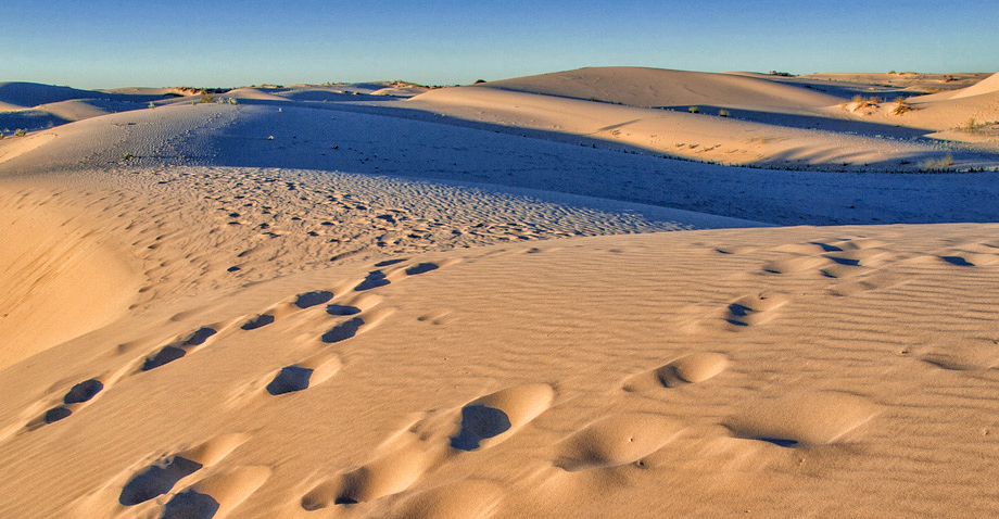
Active dunes in the foreground and shinnery stabilized dunes in the distance
Photo by Sean Murphy -
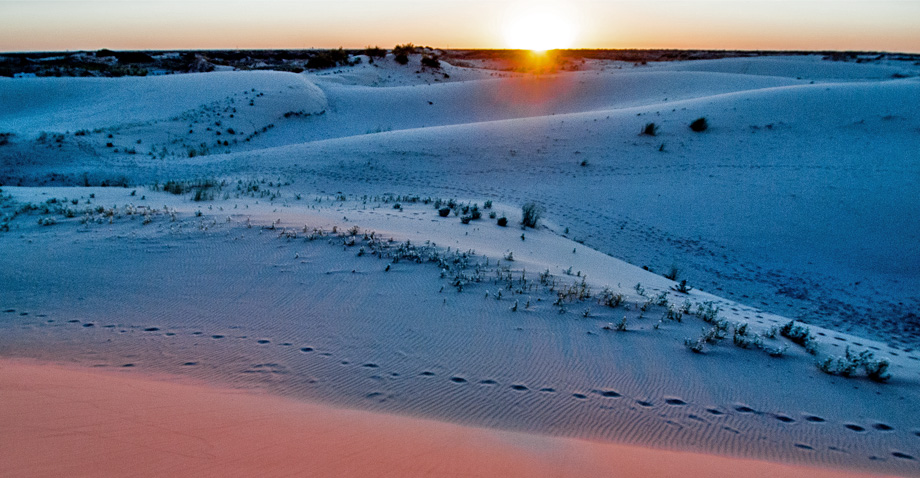
Monahans Sandhills at sunset
Photo by Sean Murphy
Why it's a great place
- Excellent example of active sand dunes and stabilized dunes
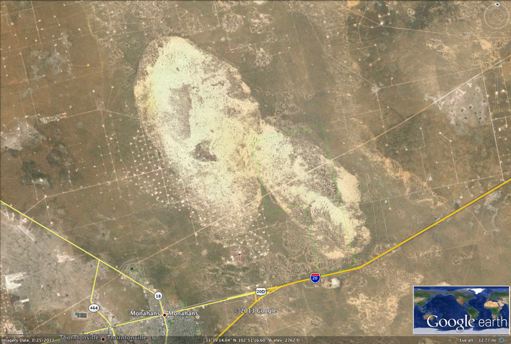
- Small part of a huge dune field that extends along the southwestern edge of the High Plains
Did you know?
- Monahans Sandhills State Park occupies 3,840 acres of sand dunes and was opened to the public in 1957
- Native Americans lived in the area from 12,000 years ago, utilizing the dunes as a fresh water source
- The largest dunes in the park have been recorded at up to 70 feet high
Sand-dune (aeolian) environments are a unique geologic setting. Large amounts of loose sand are shaped by the wind into a variety of forms, ranging from high, complex hills to long, linear features. Plant life is always trying to colonize the dunes and stabilize them. During times of humid climate the plants make progress, but they die back in arid cycles. Rainfall sinks into the loose sand and sometimes feeds small pools between dunes.
Sand dunes are widespread along the western and southwestern edge of the High Plains. They occur in a belt from southeastern New Mexico (Hobbs area) south and southeast through Monahans and nearly to Crane. East of this belt, the Caprock Escarpment rises some 300 feet above the Pecos Valley plains. This rise in elevation trapped sand that was being carried by strong winds from the west and northwest, probably during cold and arid ice age periods. A highly arid period occurred about 16,000 years ago, and another at 25,000 years.
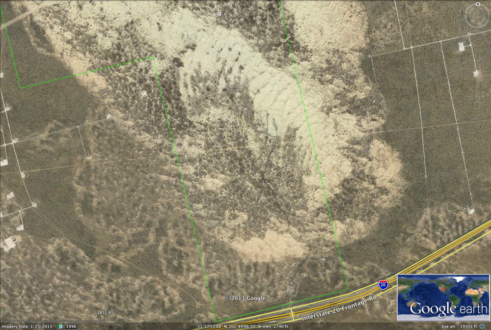
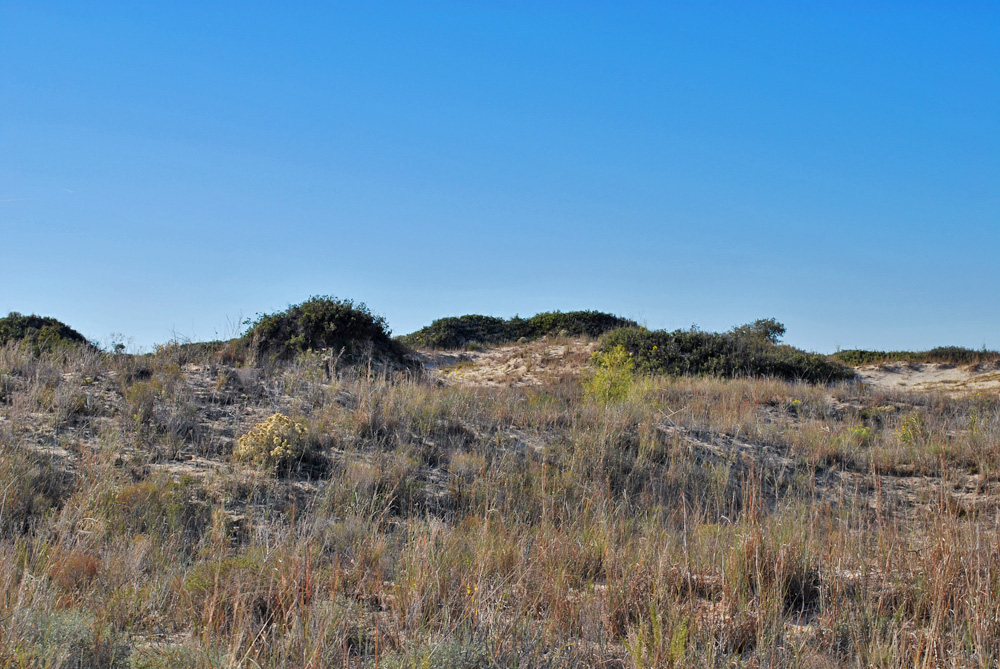
Today most of the sand dunes are stabilized by vegetation and have become sand hills. In the more active areas, the dunes are stabilized by grasses; these dunes are semi-active. Shinnery (shin oak, or Harvard oak) colonizes the dunes and stabilizes them with long, shallow root systems and dense foliage low to the ground. Some mesquite is also found in this zone. In older areas, more plant species occur, making a complete ground cover. Areas of active dunes, recently stabilized dunes, and older stabilized dunes are easily distinguished in aerial images.
North of I-20 is a large area of active and recently stabilized dunes. Active dunes are up to 85 feet high. Much of this area is included in the 3,840-acre State Park. The southern half of the park is developed with a park road, picnic and camping areas; the northern half is wild and seldom visited.
Access
From I-20, exit 86 to Park Road 41; Visitor Center is immediately north, across the railroad tracks. Park road continues 1.8 miles past picnic area and campgrounds to Pumpjack picnic area.
Ownership: State Park (leased)
Dunes are dynamic features. They shift continually in response to wind direction and wind speed. Winds must be over 14 mph to move sand grains. The grains are lifted and carried a short distance downwind, and then they fall and dislodge other grains that continue the movement—a process known as saltation. Even on days with strong winds, the sand is not lifted more than a few feet off the ground. Other grains are pushed along the ground (surface creep). Sand grains move along a surface until an obstacle (a rock or clump of vegetation) causes wind speed to drop; sand accumulates around the obstacle.
As a sand dune grows, it develops a gentle windward slope and steep downwind slope, called the slipface. Sand builds up at the crest until the slipface slope steepens to 34 degrees; then the sand cascades down.
The Monahans area supports many types of dune features. The most prevalent is a type of transverse dune, ridges of sand oriented perpendicular to the wind direction. The dunes present here are examples of a particular form known as Aklé dunes, which have undulating crests and slipfaces in both directions. Aklé dunes form because the winds at Monahans blow from several directions: from the southeast in the summer and early fall, from the northwest behind strong fall and winter storms, and from the west or southwest in the spring. Because of the opposing wind directions, the pile of sand tends to stay put. But the slip faces can reverse, and local shifts in dune features still occur. The major active dunes trend northeasterly in response to the summer and winter winds, but spring winds form an overprinted trend oriented northwesterly.
31°37'09"N 102°48'42"W
Access level: 0
(Car stops; viewpoints or roadcuts; fully accessible; may have curbs)
Access level for walk in dunes: 3
(Longer walks to exposures or sites, less than 1 mile; not handicapped accessible due to rocks, brush, or other obstacles)
After the visitor center, the road passes an area of old, stabilized, and lowered, or degraded dunes with abundant mesquite (around the equestrian pullout). Ahead on the left is a patch of active dunes, which the road will skirt.
Just past the maintenance road on the right (0.2 mi), the road enters an area of stabilized dunes with shinnery and a little mesquite. It is hard to pick out original dune forms in these stabilized areas. To the left is the patch of active dunes, around a picnic table.
The side road through the Shin Oak Picnic area to the right (1.0 mi) makes a nice profile through stabilized and semi-active dunes. At the turn into the road, the dunes have a lush growth of shinnery. About halfway in, the dunes become mostly grass-stabilized or semi-active. At the end of the spur road the dunes are nearly unvegetated.
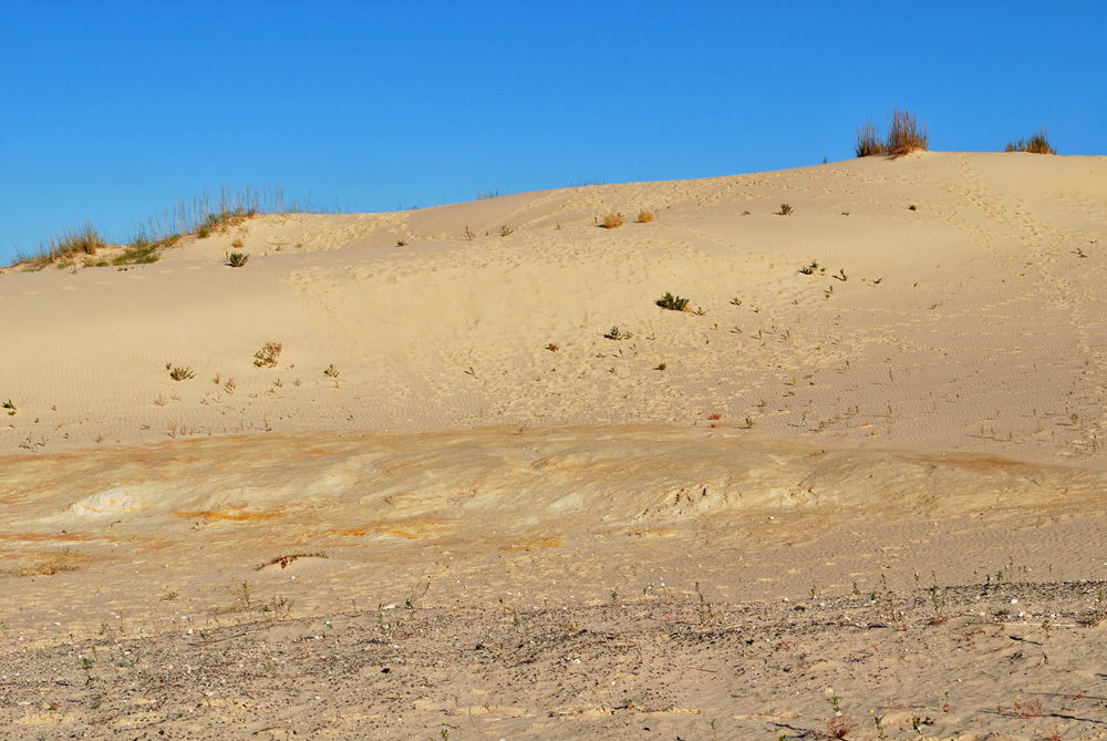
At the Sandhills picnic area and the campground, (1.3 mi) the road reaches the active dune field. At the south side of the picnic area entrance is an exposure of an older sand unit with a reddish soil zone separating it from the active sand. There is a long history of sand accumulation and soils in the area. North of the campground, the road follows a long transverse (NE-trending) ridge of sand that is lightly stabilized by grass and a little shinnery.
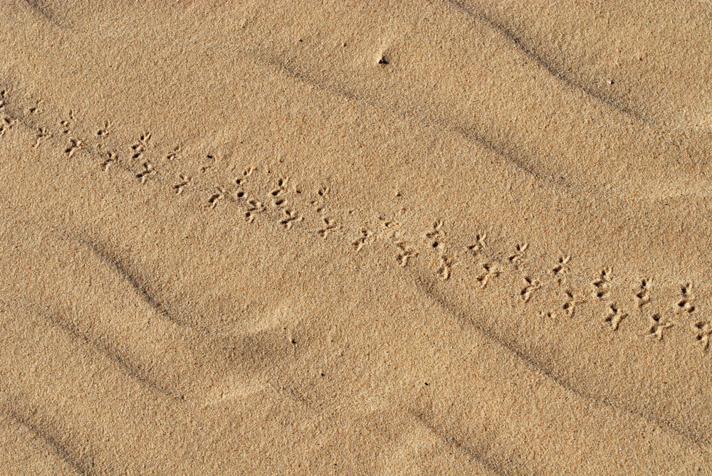
The end of the road is at the Pumpjack picnic area (1.8 mi). From here it is a short (1000-ft) walk to the northeast to cross the active dune field. If you climb the nearest dune, you can see the long transverse dunes with undulating crests and varying slipfaces. You can look out over miles of dunes, active and stabilized. Monahans lies in the distance to the southwest, and the pumpjack at the parking lot can keep you from getting lost. Abundant animal tracks testify to the diverse life of this arid region. Aerial photos on Google Earth show perhaps 100 feet of northwestward migration of dunes in this area. (In 1996 there was an interdune low just northeast of the parking area, but it is now mostly filled in.) Today, interdunes with groundwater seeps and abundant wildlife occur north and northwest of the picnic area.
M.D. Machenberg, 1984, Geology of Monahans Sandhills State Park, Texas: Bureau of Economic Geology Guidebook 21, 39 p.
Resource links:
Texas Parks & Wildlife Department website
Odessa Meteor Crater (Great Place #22).
Other places to see sand dunes: The gypsum dunes in the Salt Basin (Great Place #5); The dunes along the seacoast at Padre Island (Great Place #66).