
GREAT PLACE #42
Enchanted Rock
Counties: Llano and Gillespie
Landscape Domain: Llano Country
Ecoregion: Edwards Plateau/Llano Uplift
-
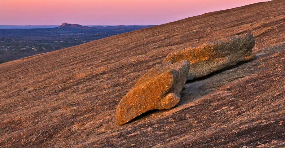
The weathered granite of Enchanted Rock and nearby granite knobs glow even more intensely pink in the sunset
Photo courtesy of David Stephens -
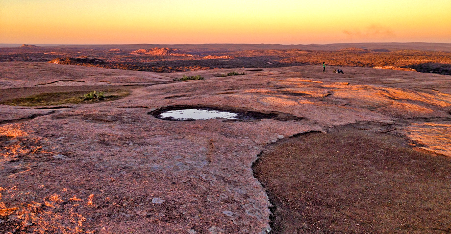
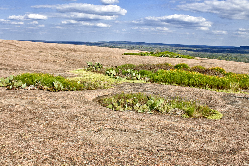
A shallow, water filled tinaja atop Enchanted Rock at sunset
Photo courtesy of Tracey Terall -
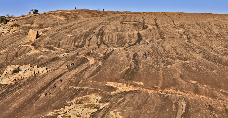
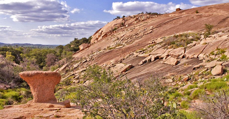
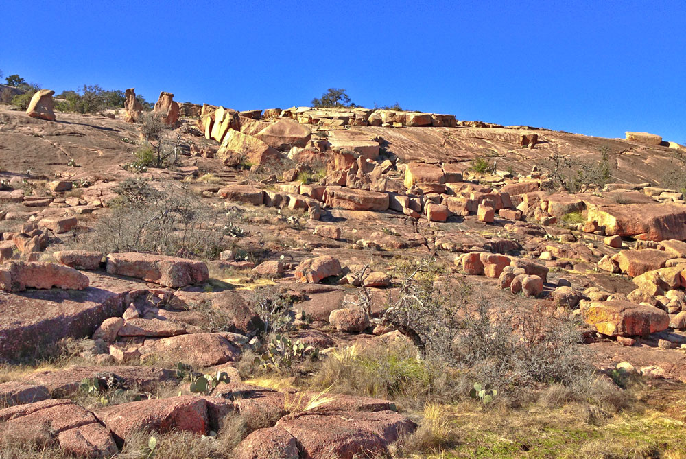
Hikers scale the exposed granite pluton; large blocks and weathered slabs come to rest in various depressions on the slope.
Photo courtesy of David Stephens -
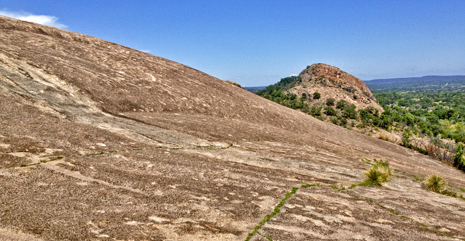
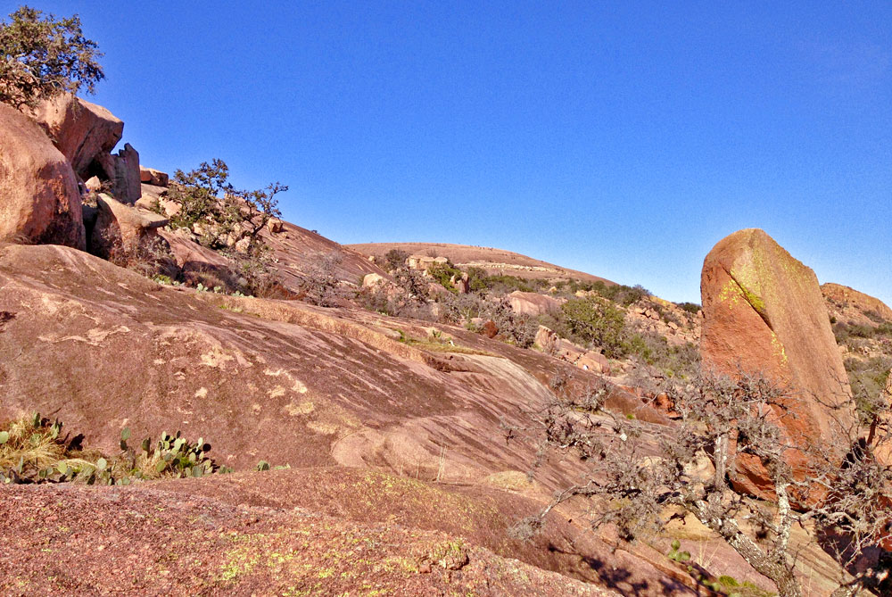
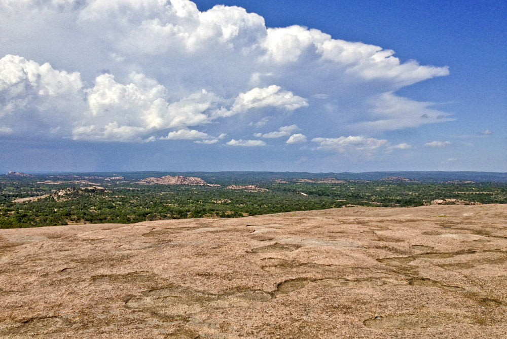
A slope formed by wash erosion, Turkey Peak in the distance
-
Various erosional features and thick granite exfoliation slabs slowly slide down the slope
Photo courtesy of Tracey Terall -
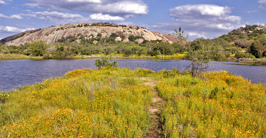
Wildflowers grow in abundance on the banks of Moss Lake on the northwest side of Enchanted Rock
Photo courtesy of Tracey Terall -
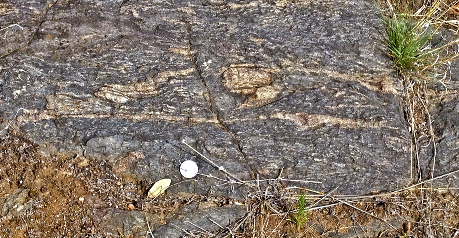
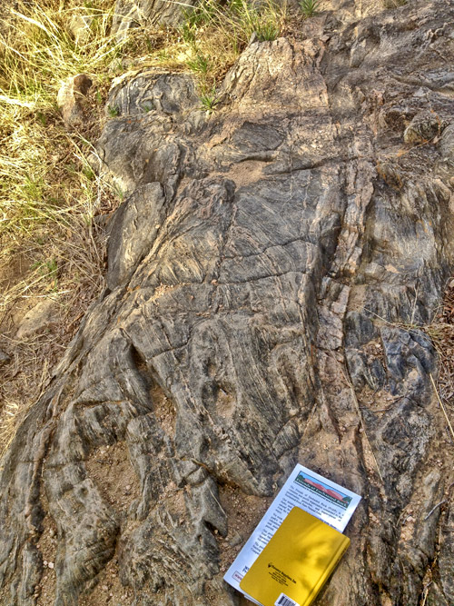
Light pink quartz-feldspar veins in an exposed, folded section of gneiss
Why it's a great place
- Large exfoliation dome in Precambrian (1.09 Ma) granite
- Exposures of granite pluton with schist at margins
- Views of Edwards Plateau rim to south, fault-bounded range of Cambrian to east, granitic hills to north and west
Did you know?
- Enchanted Rock opened as a state natural area in October 1978
- More than 400 archeological sites have been discovered in the park, of which about one-quarter are State Archeological Landmarks
- As temperatures fluctuate, particularly in the evening, the rock can be heard groaning and creaking—a once-mysterious trait that lends itself to legends of the "enchanted" nature of the park. We now know that these sounds are caused by the thick sheets of granite contracting and expanding across one another.
- Translucent Fairy Shrimp are known to live in the dome's vernal pools. The depressions are frequently dry, but the eggs can survive without water, hatching after rain refills the pools.
- The vernal pools also support rock quillwort—an endangered species of grass only found in Central Texas
Enchanted Rock is the heart of Texas. The sheer granite dome, with its views in all directions and vernal pools hosting a variety of plant and animal life, is a source of natural and spiritual grandeur to thousands of visitors each year.
The rock is an exfoliation dome, caused by weathering of the granite of its batholith (big intrusion). The batholith is 12 miles across and 20 miles long in map view, elongated to the northwest; Enchanted Rock is just a small part of the batholith, located on its southeastern margin. We don't know how deep into the subsurface the rock extends. It was emplaced 1,082 million years ago, based on the decay of uranium to lead in zircon crystals. Calculations based on the minerals in adjacent schist indicate that the granite was intruded some 3–6 km (2–4 miles) beneath the Earth's surface.
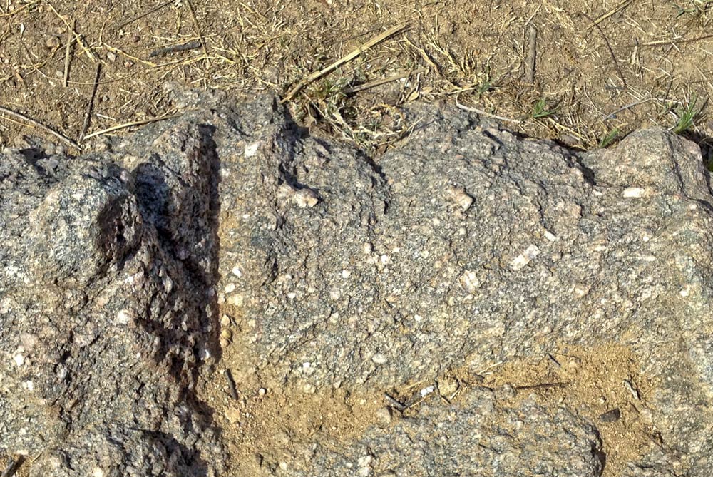
Granite weathers by the action of water, particularly soil water. Water promotes weathering of biotite and other minerals in the rock, leading eventually to a grus, or pea gravel of feldspar and quartz. Water penetrates along fractures and is trapped by bits of soil. But unfractured granite, since it is unroofed by erosion, spalls off in continuous sheets several feet to hundreds of feet thick. Water gets into the fractures and helps the sheets slowly come apart first into blocks, then into granite pedestals, and finally into sand.
Enchanted Rock is part of a series of granite hills that includes Little Mountain, Turkey Peak, Freshman Mountain, Buzzard's Roost, and Flagpole Mountain, all located in the State Natural Area. Enchanted Rock and Little Mountain show the large broken sheets and smooth slopes of the exfoliation dome. Turkey Peak and Buzzard's Roost have single large east-dipping sheets of granite that make sharp, pointed peaks. Freshman Mountain has a thick coating of weathered granite and gravel on its west side, perhaps a residue of more humid conditions in the past.
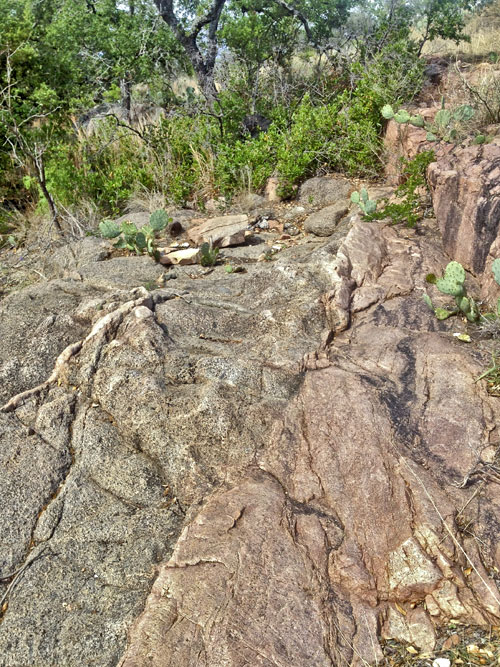
The boundary zone of the batholith is exposed along Sandy Creek in the northeastern part of the Natural Area. Here we can see a variety of rock types and try to imagine the dynamic process of intruding a mile of granite into already existing rock.
Access
Enchanted Rock SNA is located 16.6 miles north of Fredericksburg on RM 965. Trailhead is just past entrance station, as are the parking circle and picnic area.
Ownership: Enchanted Rock State Natural Area, Cross Mountain Park
30°30'23"N 98°49'08"W 1829 ft
Access level: 2/3
(longer walks to exposure or sites, less than 1 mile; some areas handicapped-accessible with great difficulty due to rocks, brush, or other obstacles)
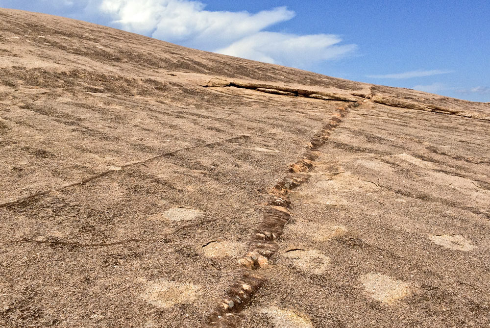
The Summit Trail to Enchanted Rock is 0.7 miles long and climbs over 400 feet, mostly on smooth granite slopes. The first 0.2 miles are flat, crossing Sandy Creek and a granite-bottomed tributary, reaching the junction with the Loop Trail to the north. The trail then climbs a series of rocky stairways. Some fresh-cut granite blocks have been used for the stairs; we can compare them with the weathered granite that is natural to the area. The biotite and other mafic minerals are being leached, and the feldspars (pink–white tabular minerals) are becoming redder. At 0.37 miles, we reach the last shade tree and a steeper granite slope. There are good views here of the valley and of the Cretaceous mesa to the east and south. The Echo Canyon Trail takes off left, going down a fracture zone to the bouldering and climbing areas on the west side of Enchanted Rock.
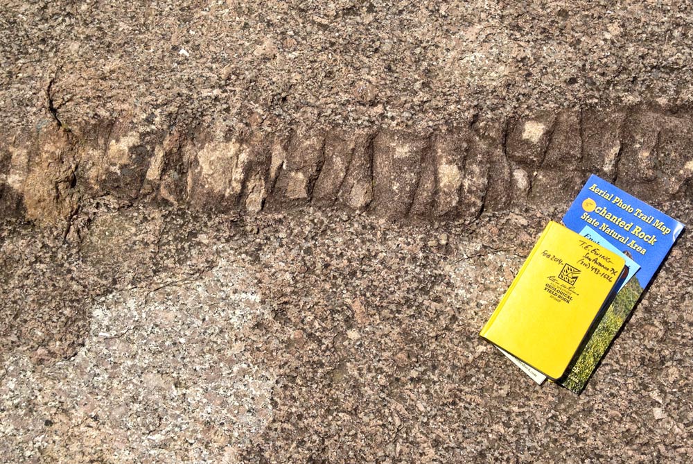
Staying with the Summit Trail, we climb and bear gently right, aiming at the right end of the granite ledge that faces downhill. From this viewpoint, we can see Turkey Peak to the east and Little Mountain to the southwest. At 0.5 and 0.56 miles, aplite dikes cross the ascending path. Aplites are quartz-feldspar rocks similar to granite but having a fine-grained "sugary" texture. They tend to form late in the intrusion of granite masses. The second set of aplites also contain a small amount of pegmatite—coarse-grained quartz-feldspar and sometimes rarer minerals, formed by water-rich late-stage segregation from the crystallizing granite.
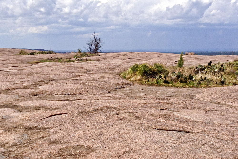
At about 0.65 miles, the slope becomes gentle and we find ourselves on a broad rolling tableland of solid granite. Numerous depressions (tinajas) trap water during rains; the larger tinajas have islands of vegetation (vernal pools) that include grass, shrubs, and the occasional prickly pear cactus. The water trapped in these tinajas and by the soil in the vernal pools promotes erosion of the granite and enlarges the depressions.
Near the crest of Enchanted Rock (0.75 miles), at 1829 feet above sea level, a dying live oak tree is rooted in one of these vernal pools. Although we are high above the surrounding valleys, we are still lower than the rim of the Cretaceous mesa (part of the Edwards Plateau) to the south. Cretaceous rocks once covered this granite mass; what we see now is the product of the last 20 million years or so of erosion. We notice the irregular granite hills to the north, the line of large granite domes and peaks including Enchanted Rock, and a granite quarry a few miles northwest.
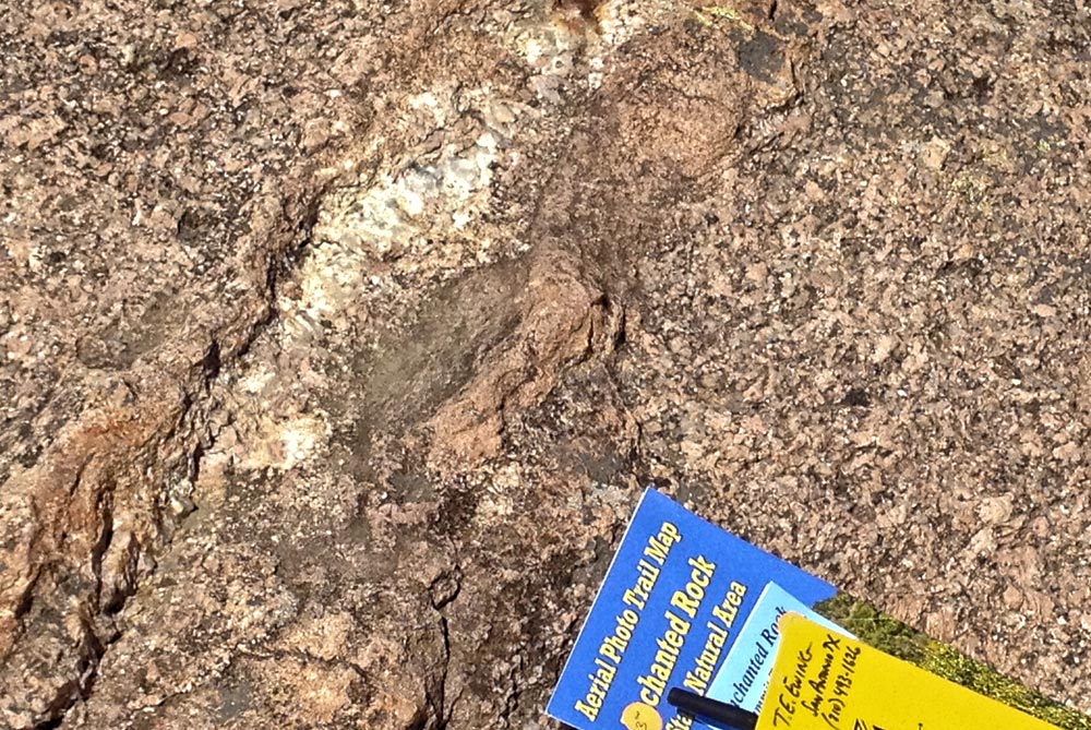
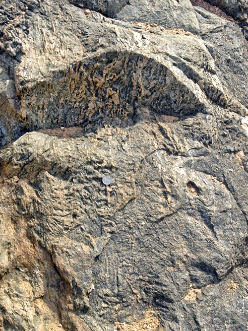
The complex margin of the granite intrusion and its surrounding metamorphic rocks (into which the granite intruded) are exposed along the Loop Trail north of the Summit Trail. The biggest exposures are 0.85 miles north of the Loop/Summit junction. Some of the granite is similar to the main mass, but somewhat darker-looking. Other igneous rock is quite dark, with large feldspar crystals. These may be older granite within the country rock. The wall rock is dark mafic gneiss and schist, with folded quartz-feldspar veins. Pinkish aplitic granites and small pegmatites are also present. These are mapped as part of the Packsaddle Schist. The minerals in the schist include sillimanite, a sign of high temperature and pressure. Similar exposures occur 0.8 miles northeast of the trailhead on the Loop Trail spur, but they are not as dramatic or varied.

30°18'29"N 98°14'44"W
Access level: 0
(car stops; viewpoints or roadcuts; fully accessible; may have curbs)
The relationship of the Proterozoic (1100 Ma) granite to the Cretaceous flat-topped mesas is best shown at Bear Mountain, 3.5 miles north of Fredericksburg on RM 965 (12.5 miles south of Enchanted Rock). A granite hill rises to the right of the road, with a dimension-stone quarry at its south end and many rough granite rocks and mesquite trees. On either side of Bear Mountain are flat-topped mesas capped by Edwards limestone and dolomite. The "mountain" is actually a buried hill (probably around 200 feet high) from the pre-Cretaceous landscape, which was surrounded and finally covered by the Cretaceous sea and its carbonate sediments. Today's streams are eroding the carbonates and exposing (exhuming) the old hill.
The same Edwards and underlying Antlers/Hensel rocks are exposed at the hill crest 13.8 miles north of Fredericksburg (3 miles south of Enchanted Rock). There, the base of the Cretaceous area is the extensive flat area below the crest, giving us an idea of the size of the Cretaceous Bear Mountain.
Texas Parks & Wildlife Department website
R.M. Hutchinson, 1988, Enchanted Rock dome, Llano and Gillespie counties, Texas; No. 83 in Centennial Field Guide: South-Central Section (O.T. Hayward, editor): Geological Society of America, p. 369–372.
R.M. Reed, 2011, Geology and geomorphology of the Enchanted Rock State Natural Area, central Texas: Austin Geological Society Field Trip Guidebook 32, 45 p.
Willow City Loop
30°26'51.4"N 98°39'27.6"W
Located 7.5 miles east of Pedernales Falls, Hamilton Pool is a Cretaceous section similar to Pedernales Falls. A scenic waterfall and swimming hole are formed on the Cow Creek limestone and underlying Hammett Shale at the head of a box canyon that feeds into the Pedernales River.
Cross Mountain (Kreuzberg)
31°17'21"N 98°52'03"W
This hill 1.2 miles north of Fredericksburg off of RM 965, now a city park, has borne a cross since the 18th century. Easter fires here are an old tradition from Germany. The hill is an outlier of the mesa capped with Edwards Formation limestone and dolomite. A short trail leads to scenic views. At the parking lot, a pink Hensel/Antlers soil is overlain by carbonate. Sandy Antlers/Hensel soils underlie the valley to the south and east, hosting vineyards and peach orchards.