
GREAT PLACE #6
Guadalupe Mountains; El Capitan and area
County: Culberson
Landscape Domain: Basin and Range (Guadalupe Mountains)
Ecoregion: Arizona-New Mexico Mountains and Chihuahuan Desert
-
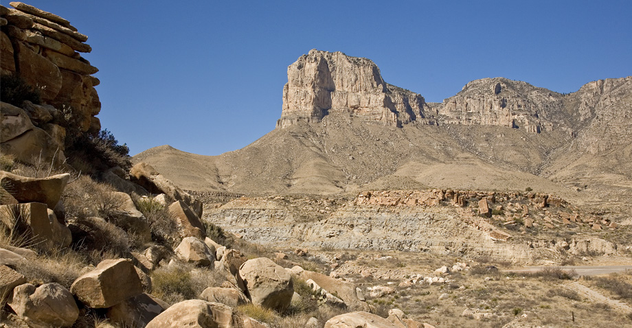
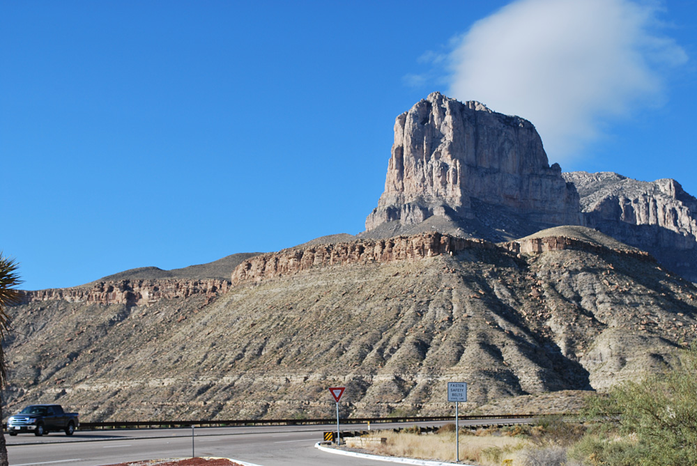
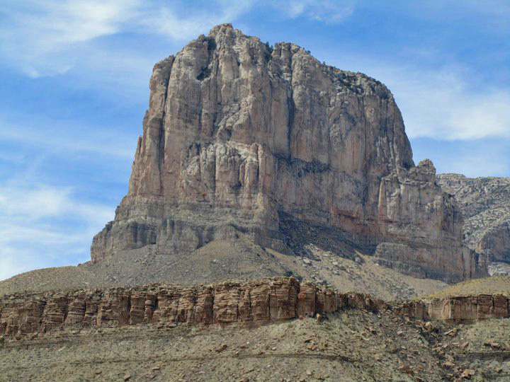
El Capitan from the east; basin-floor sandstone in foreground, looking up towards the reef
-
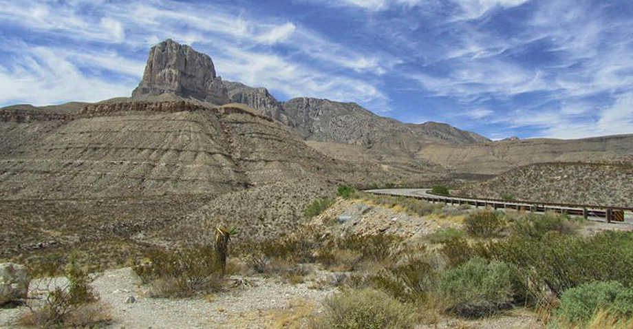
El Capitan; another scenic view
Photo courtesy of Nabiel Eldam -
Looking northwest into the Salt Basin
Photo courtesy of NPS
Why it's a great place
- Highest point in Texas
- Magnificent cliffs of Capitan reef and forereef
- Excellent roadcuts and views of Delaware Basin sandstone
- View of the Salt Basin
Did you know?
- Guadalupe Peak is the highest natural point in Texas at an elevation of 8,751 feet
- El Capitan is the eighth-highest peak in Texas at 8,604 feet in elevation
- El Capitan was used as a signal peak by travelers through the area for hundreds of years because of its visibility from multiple directions
- The stainless steel pyramid atop Guadalupe Peak was erected to commemorate the 100th anniversary of the Butterfield Overland Mail stagecoach route and the Pony Express Riders of the Butterfield Stage
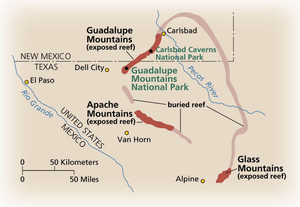
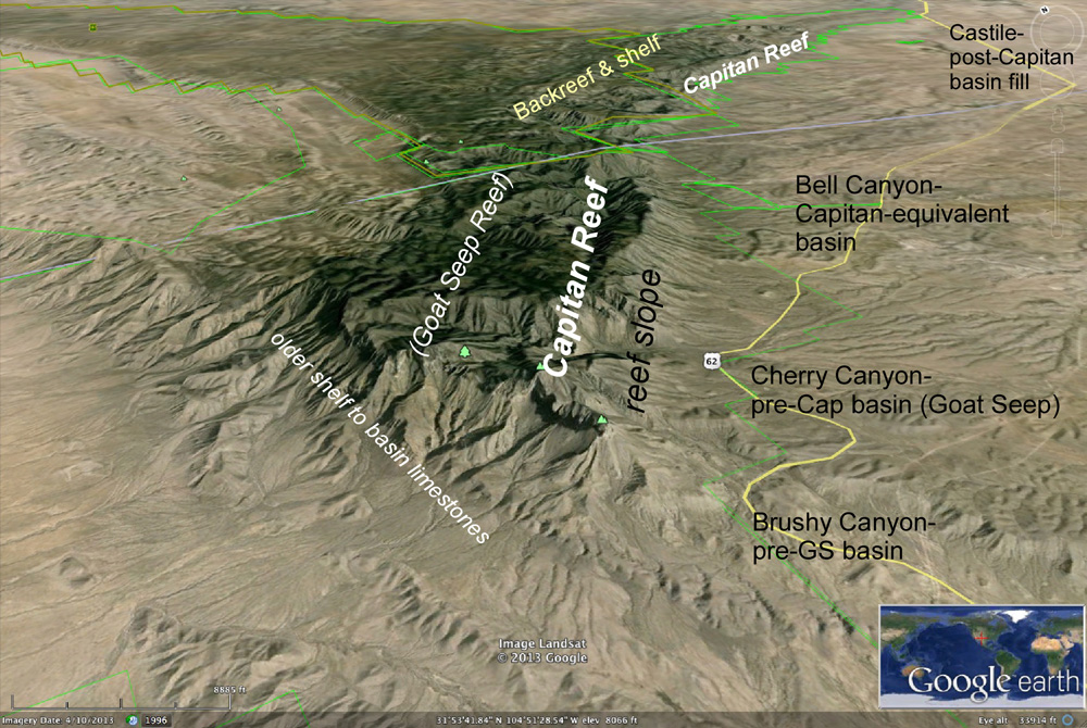
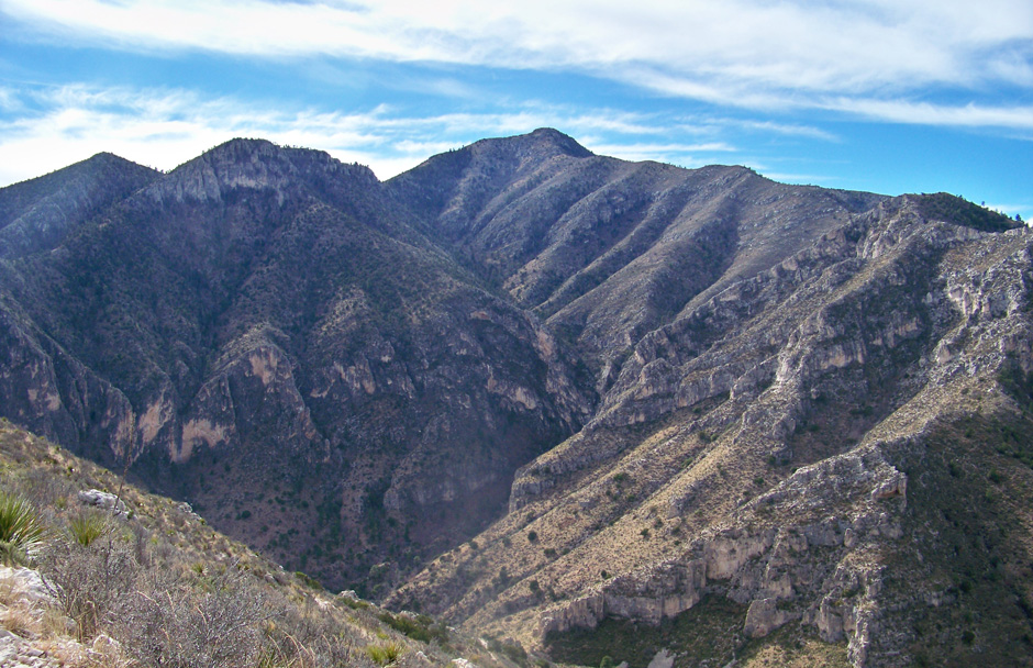
The southern Guadalupe Mountains expose perhaps the finest cross-section of an ancient marine reef complex on Earth. The Capitan Reef of middle Permian (Guadalupian) age forms tall, massive cliffs on the canyon walls, together with the back-reef shallow-water limestones high on the mountaintops and the deep-water marine limestones and sandstones in the foothills. The reef rings the Delaware Basin for some 400 miles, but the exposures here are the most complete.
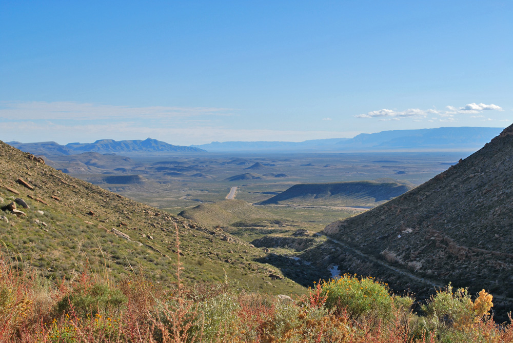
In the southern part of the park, we can examine the sandstones deposited in the deep Delaware Basin, while looking up to the forereef and reef deposits of the Capitan majestically exposed on El Capitan. We can also get a scenic view of the Salt Basin, with Sierra Diablo in the distance.
Access
Roadside rest area on westbound lanes of US 62/180 is 4.5 miles from the National Park Visitor Center at Pine Spring, and 57 miles from Carlsbad. Great Place includes all roadcuts on the highway, the area around the visitor center, and the route up to Guadalupe Peak.
Ownership: National Park Service, Guadalupe Mountains National Park
31°51'14"N 104°50'41"W 4890'
Access level: 0
(Car stops; viewpoints or roadcuts; fully accessible; may have curbs)
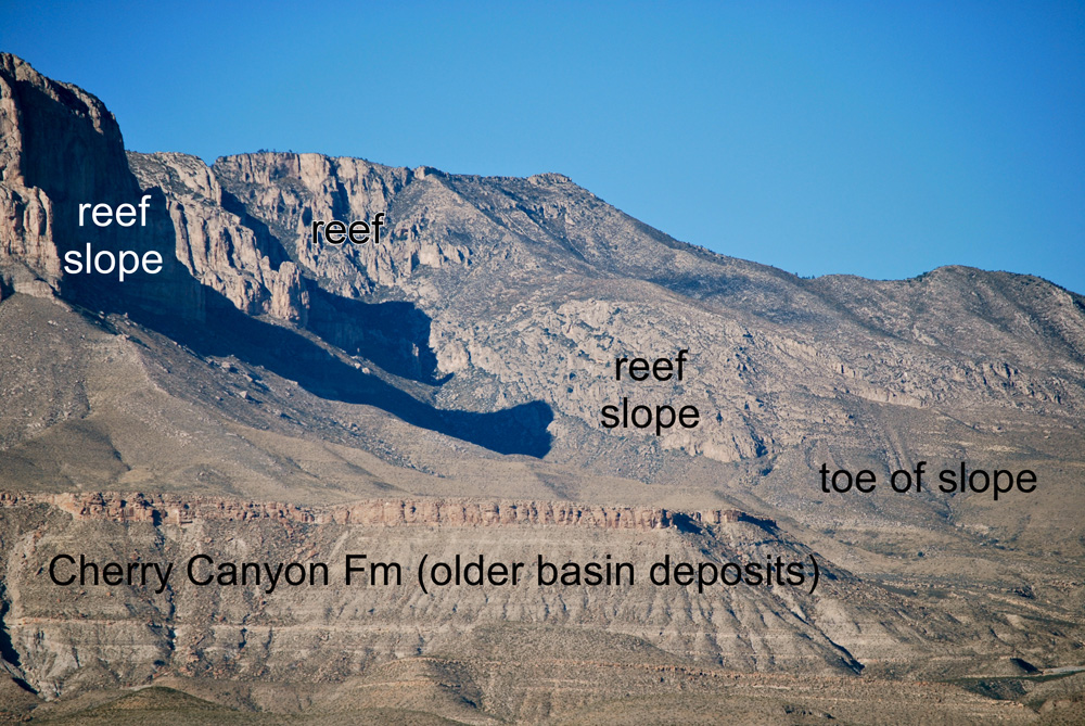
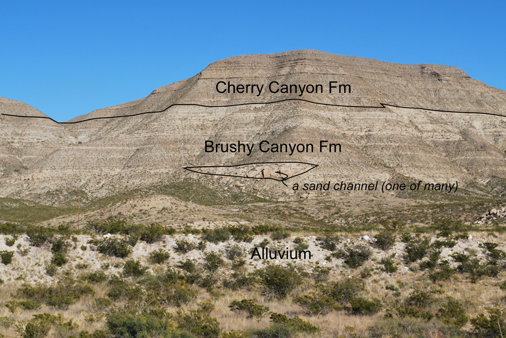
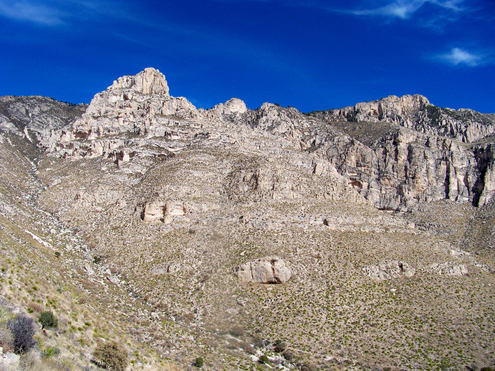
The roadside rest south of El Capitan provides the classic view of the south end of the Guadalupe Mountains. The great limestone block of El Capitan (8085-ft at the summit) looms 3000 feet above the roadside rest. The mountain has been a landmark for centuries. It's not immediately apparent here, but the entire block is in the forereef slope facies, and has bedding dipping up to 20 degrees to the southeast (mainly towards us). To the right of the big block is a high ridge. If you look carefully you can see the thick limestone of the slope wedging out into much thinner toe-of-slope and basin carbonates.
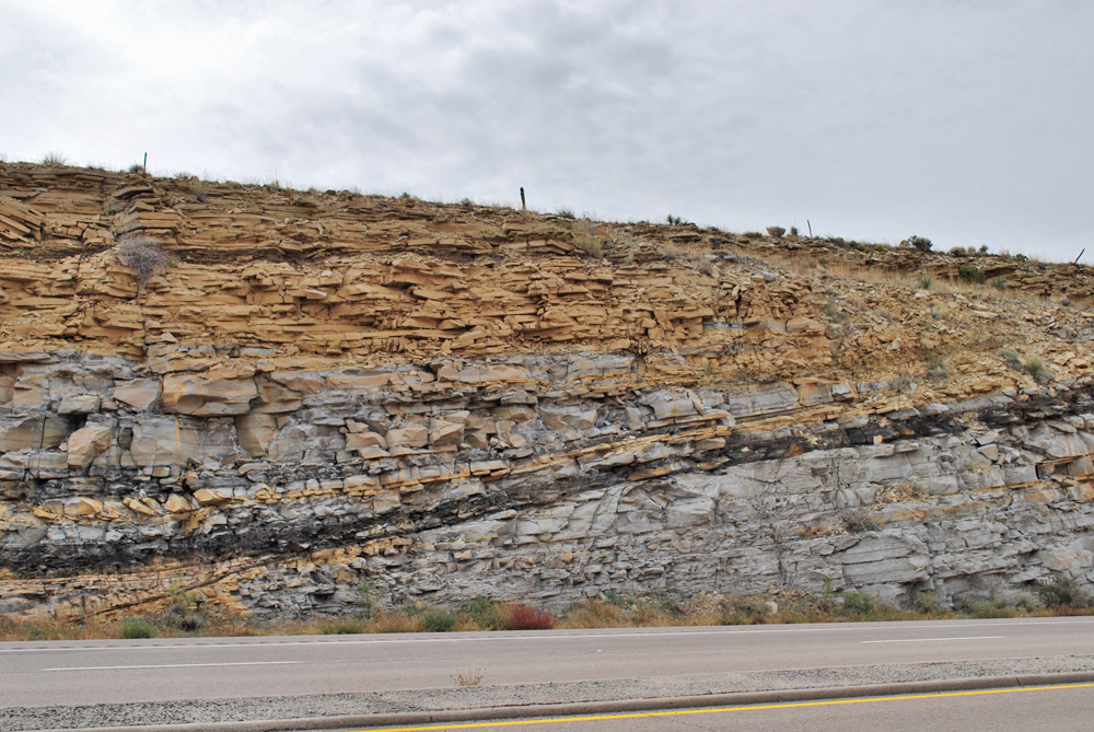
Below the big limestone are evenly-bedded, mostly slope-forming rocks. These are siltstone and sandstone of the Cherry Canyon Formation, which formed in deep water southeast of the earlier Goat Seep reef. The conspicuous bench-forming sandstone is the top of the much sandier Brushy Canyon Formation, which continues to the rest area and down the hill.
The view east from the rest area is less dramatic but is informative. The hills there show a smooth upper half—the Cherry Canyon—and a more cliffy lower half—the Brushy Canyon. Look at the light-colored cliffy sandstones: they go for a ways and then die out. These sandstones were deposited in submarine channels that trend southeast into the basin. The excellent exposures here in natural outcrop and in roadcuts make this area a leading laboratory for geologists to understand how sandstones are deposited in deep water. (The same kinds of sandstones produce oil just a few miles east in the Delaware Basin.)
An interesting question: How did all this sand get through the big limestone reefs into the basin? Presumably it came through narrow bypass channels between reef buildups, but these channels are not visible today. So we don't know with certainty. The sandy Brushy Canyon seems to have been deposited when sea levels were low and the carbonate reef or bank was exposed and eroded. The west side of the mountains shows evidence of channels that may have fed sand into the deep waters of the Delaware Basin.
To the south and southwest is a great view of the Salt Basin. The basin is a graben bounded by faults on the west and east (see Great Place #5A). On this side of the basin are many smaller faults down to the west—some are seen in roadcuts just uphill from here. The graben formed in the last 10–20 million years, about the same time that the Delaware Mountains and Guadalupe Mountains were uplifted and tilted to the east, creating all these excellent rock exposures.
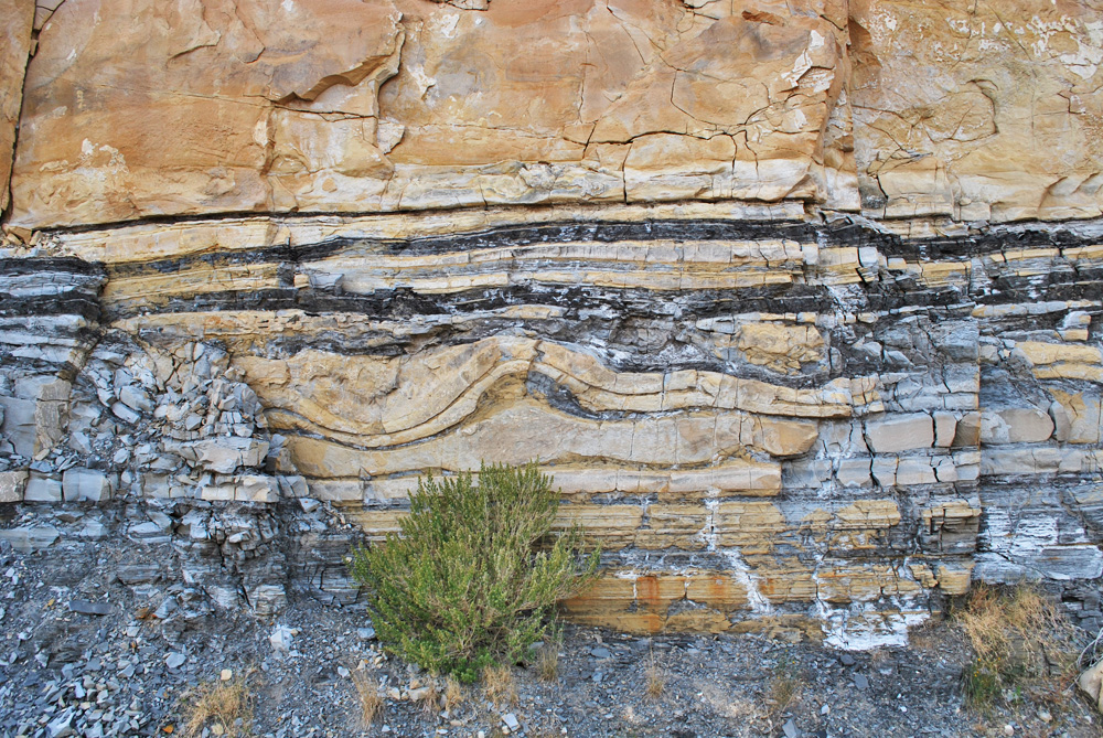
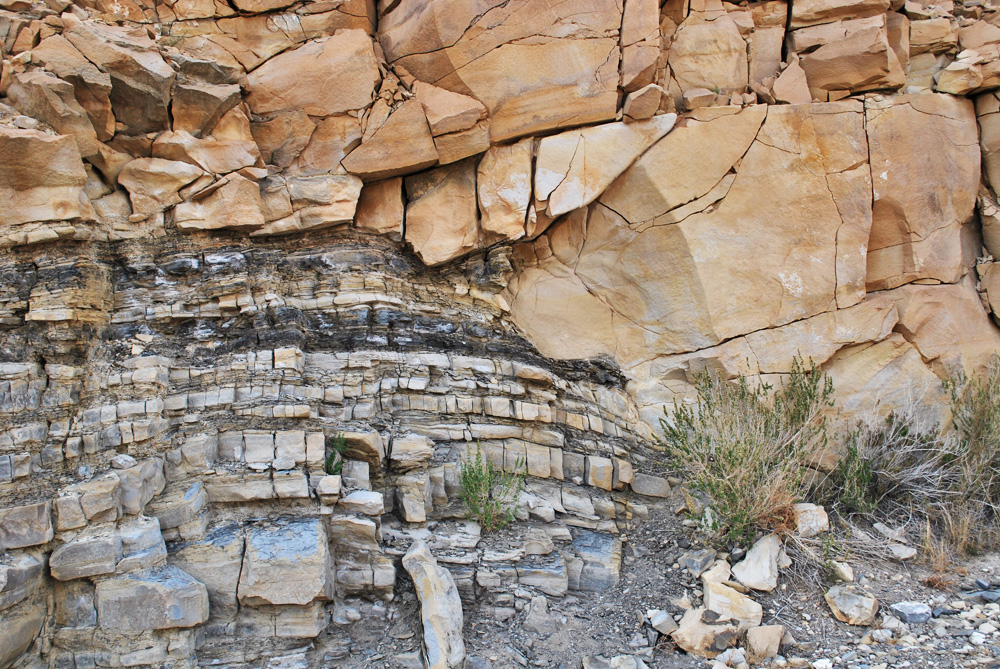
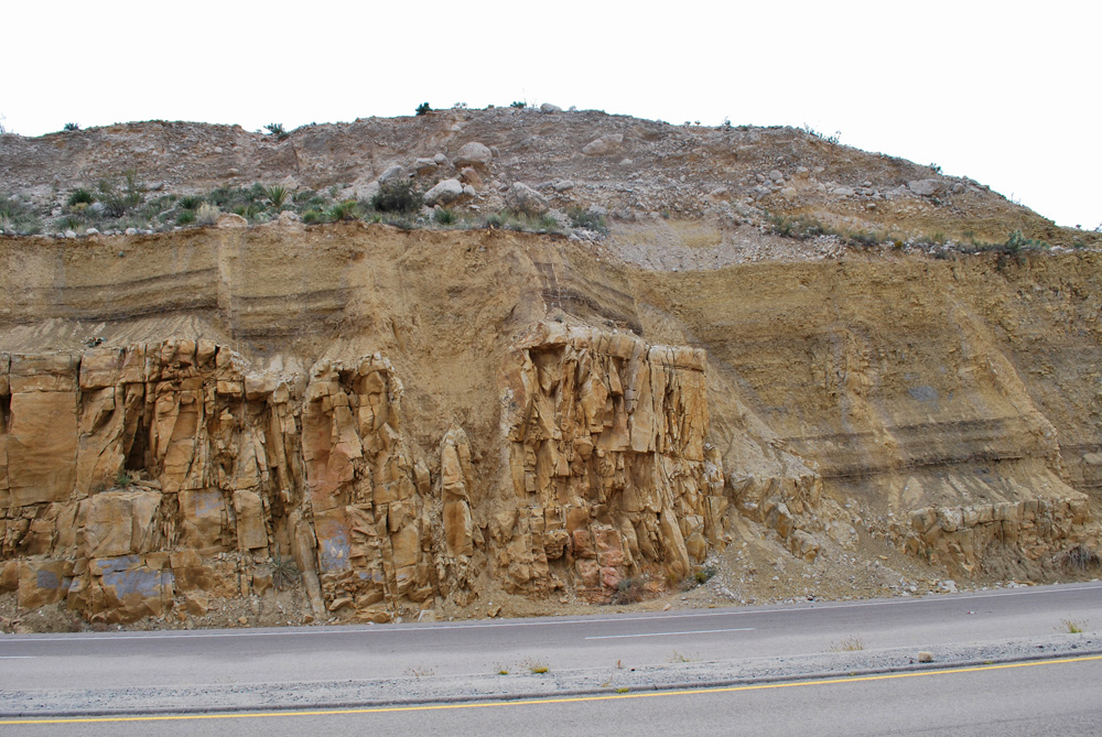
Brushy Canyon sandstones are well exposed in roadcuts uphill and downhill from the roadside rest. The roadcut 1/2-mile downhill beautifully exposes the base of a channel sandstone; the base cuts down into the older interbedded sand and dark, organic-rich shale. One group of beds below the channel shows folds (called convolute bedding) and disruption in bedding that almost certainly formed shortly after deposition, perhaps when the overlying channel was actively eroding and carrying sand into the basin.
Back uphill a mile from the roadside rest is a roadcut with shale (mud) over sandstone, with several west-down faults dropping the shale/sand contact down below road level. Another half-mile uphill is a long roadcut with great exposures of the Cherry Canyon and Brushy Canyon sandstones. One channel base, lined with dark mud, cuts deeply into underlying sandstone; this channel includes fragments of reef and backreef carbonate. Hundreds of these channels existed, one cutting into another, through the deep basin near the shelf edge, though probably only a few were active at any one time.
31°53'37"N 104°49'42"W 5734'
Access level: 0
(Car stops; viewpoints or roadcuts; fully accessible; may have curbs)
Access level for trail: 4+
(Long hikes to exposures or sites, over 1 mi; not handicapped accessible due to rocks, brush, etc. Special skills may be required.)
The Visitor Center and Pine Spring Campground lie in Pine Spring Canyon, a major cross-drainage at the southern end of the Guadalupe Mountains. The reef and forereef rocks are well exposed in Hunter Peak and the edge of the Bowl to the north and in Guadalupe Peak and El Capitan to the south. The Bell Canyon basinal sediments that are the equivalent of the Capitan Reef are exposed around and north of the campground. At the base of the mountains are a number of springs, where water that entered the rock at the mountain crest finally discharges. These springs (Pine Spring and Smith Spring are accessible by trail) form lush oases in the desert, and were vital sources of water for Native campsites, for the trail camps and Butterfield stage station at the Pinery, and for today's ranches and visitor facilities.
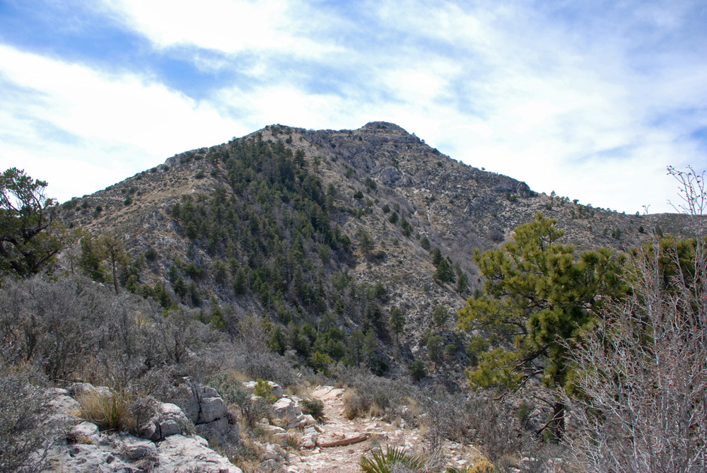
The 4.2-mile trail to Guadalupe Peak (the highest point in Texas) is well worth the exertion (8.4 miles return; 3000 ft of ascent and descent; allow 6–8 hours). The well-graded trail begins with many switchbacks climbing up into the slope limestone deposits, then follows a forested ridge with more switchbacks to a camping area. The area around the camping area is composed mainly of reef limestone. The climb up to the summit cone finds well-bedded limestone of the Tansill Formation that was deposited in shallow water behind the reef. So the section is the same as that seen on the Permian Reef Trail in McKittrick Canyon (Great Place #6) but not quite as well exposed.
From the summit cone is a great view south over the top of El Capitan down to the roadside rest, the Delaware Mountains, and the Salt Basin. The steep east dip of the slope limestones of El Capitan is clearly visible from here. At the top we can see far into West Texas and New Mexico; we may see the 12,000-foot Sierra Blanca in New Mexico, some 80 miles away (particularly if the peak is capped with snow). To the south we can see to the Apache and Davis Mountains, Sierra Diablo, and Sierra Blanca. The salt lakes of the basin glint below our feet—they lie at the base of sheer 2000-foot cliffs and a row of foothills and lower scarps. To the northeast the reef trend gradually lowers until it dives beneath the plains west of Carlsbad; we can see and feel the tilt to the northeast. This is truly a great place for all who are able to visit and meditate on the earth history of Texas!
S.T. Reid, R.O. Bass and P. Welch, eds., 1988, Guadalupe Mountains revisited: West Texas Geological Society, Publication 88-84, 202 p. Note roadlogs p. 7-21 (US 62/180) and p. 77-81 (McKittrick Canyon).
Williams Ranch and west flank of Guadalupes: A four-wheel-drive road passes around and to the Williams Ranch (elevation 4948 ft) at the western foot of the Guadalupe Mountains (the locked gate is 3.6 miles south of the roadside rest; get the key from the Visitor Center). This area provides views and access to the majestic western escarpment of the Guadalupes, where the prograding of the reef and forereef over the basin is beautifully exposed on 2000-foot-high cliffs. Closer to the ranch are cliffs of the Victorio Peak limestone of San Andres age, representing a carbonate shoal (without the sponge-algal reef boundstones of the Capitan).
McKittrick Canyon and Permian Reef Trail: See Great Place #7.
Salt Basin and Gypsum Dunes: See Great Place #5.