
GREAT PLACE #51
Comal Springs
County: Comal
Landscape Domain: Blackland Prairie and Inner Coastal Plain
Ecoregion: Boundary of Edwards Plateau Woodland, Blackland Prairie, and Northern Nueces Alluvial Plain (Tamaulipas-Texas Semi-Arid Plain)
-
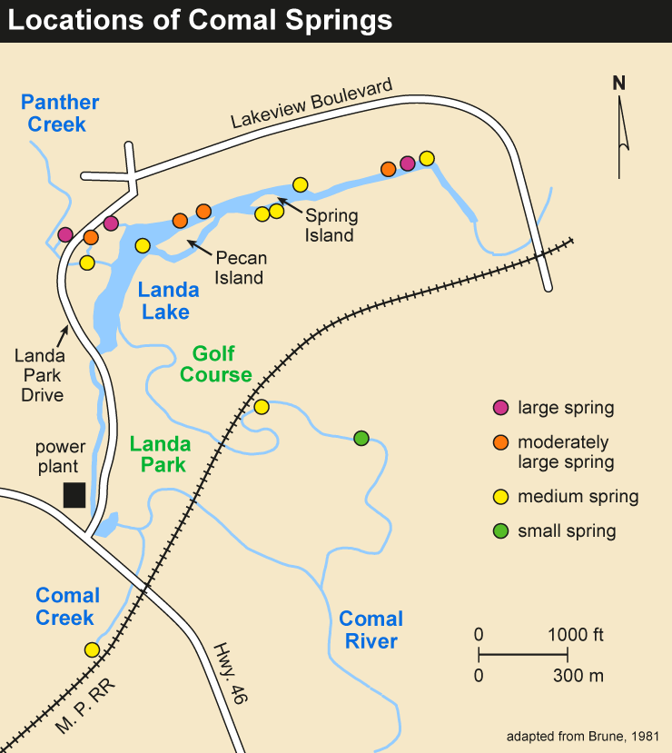
Additional springs just north of Spring #1
-
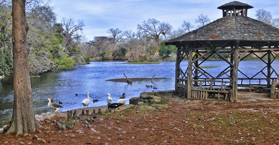
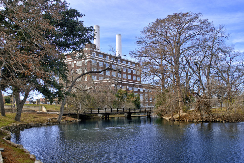
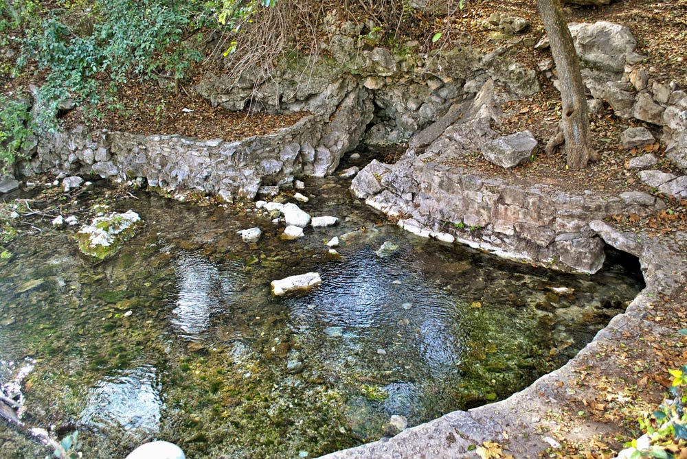
Landa Lake catches the springs outflow near the base of the hill
-
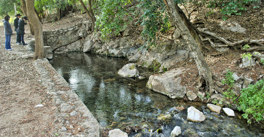
Springs line the base of the hill along a fault; harder rocks on the left (western) side
-
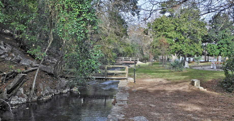
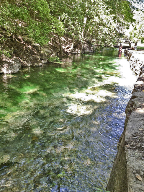
Looking out to Landa Lake from a bridge over the spring discharge channel
Why it's a great place
- Largest springs in Texas, outlet for Edwards (Balcones) Aquifer
- Balcones Fault Zones
Did you know?
- The springs and surrounding area were once home to the indigenous Tonkawa people before being discovered by Spanish explorers
- The town of New Braunfels began to take shape with the arrival of German settlers in 1845, and by the 1860's the springs were powering local grist- and sawmills
- Comal Springs consists of seven major springs and dozens of smaller springs occurring over a distance of approximately 4,300 feet at the base of a limestone bluff in Landa Park
- Comal Springs and the Comal River are home to the federally endangered fountain darter—a small, reddish-brown fish
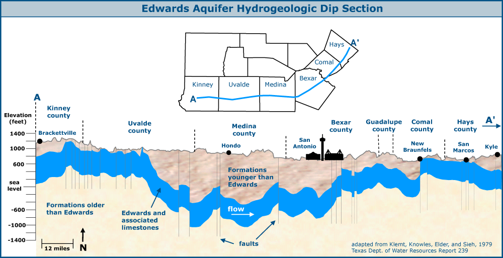
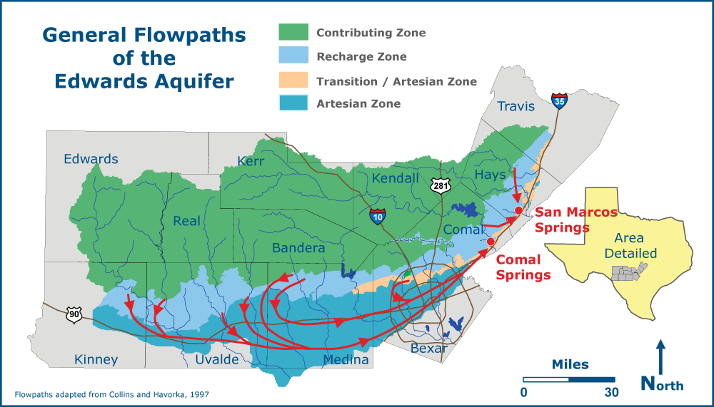
The Edwards (Balcones Fault Zone) Aquifer is the largest and most prolific groundwater source in Texas. It provides water for agriculture in the Uvalde, Hondo, and Castroville area; city water for metropolitan San Antonio; and spring flow to the Guadalupe and San Marcos Rivers. A separate segment of the aquifer provides spring flow to Barton Springs in Austin.
The main natural outlets for the water in the Edwards Group carbonate rocks are Comal and San Marcos Springs. Fresh water flows generally south from the Edwards outcrop area into the confined zone (where younger, impervious rocks overlie the porous Edwards rocks). The water then moves eastward from the Uvalde and Hondo area beneath San Antonio and turns northeast toward New Braunfels and San Marcos. The flow is focused within a narrow zone on the southeast side of two large faults of the Balcones Fault Zone. The water rises along the fault planes to the two major springs. Comal Springs, in the valley of the Guadalupe River, is the larger spring, and its flow is nearly entirely from the deep confined aquifer. Some of the confined water continues northeast in the upthrown Edwards Aquifer to the San Marcos Spring (in the Blanco River Valley), where it mixes with more locally recharged waters.
Access
Springs are located in Landa Park, a large city park. From Austin, take IH 35 south and head west on TX 46/Loop 337. Turn left onto California Street and continue until you reach the park.
Ownership: City park at and around springs
29°42'47"N 98°08'15"W (Comal Springs; Spring #1)
Access level: 1
(short walk to viewpoint or exposure, less than 0.2 miles; handicapped accessible; may have small steps or curbs)
Comal Springs are the largest spring complex in Texas. The seven major and many smaller spring outlets occur for a distance of 4300 feet along the Comal Springs Fault, the main southeast-down Balcones normal fault in the area. Many of the springs lie beneath Landa Lake or along its edge. Upthrown to the fault, Edwards carbonate rocks are exposed in Panther Canyon along the nature trail. The same rock layers are over 800 feet below the surface of Landa Lake.
The largest and most conspicuous spring is Spring #1, which lies just south of Landa Park Road (California Street) at the mouth of Panther Canyon. The spring discharge here averages 180 cubic feet per second, a bit over half of the total spring discharge. Other springs can be found across the road along the line of hills (which is the fault line) toward Landa Lake. A historic marker indicates the location of the short-lived Spanish mission "Nuestra Señora de Guadalupe" from 1756 to 1758.
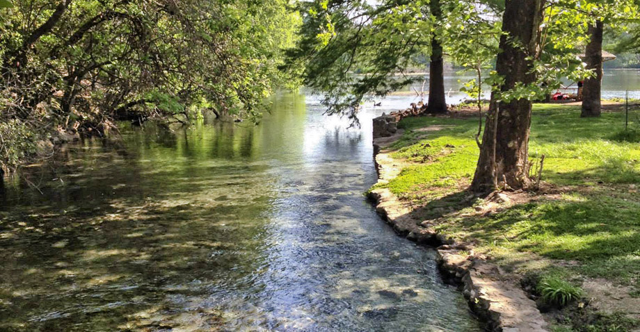
The springs give rise to the Comal River, which runs only five miles before joining the Guadalupe River—it's known as the shortest significant river in the United States. The steady flow of water was developed for water power beginning before 1860. Mills were built downstream of the springs, where the natural spring lake was enlarged by a low dam. A large millrace runs along Landa Park Road to the hydroelectric plant. The old mill buildings now host the annual Wurstfest celebration.
T.E. Ewing, 2008, Landscapes, Water and Man: Geology and History in the San Antonio Area of Texas. South Texas Geological Society, 110 p.
San Marcos Springs
29°53'39"N 97°55'47"W
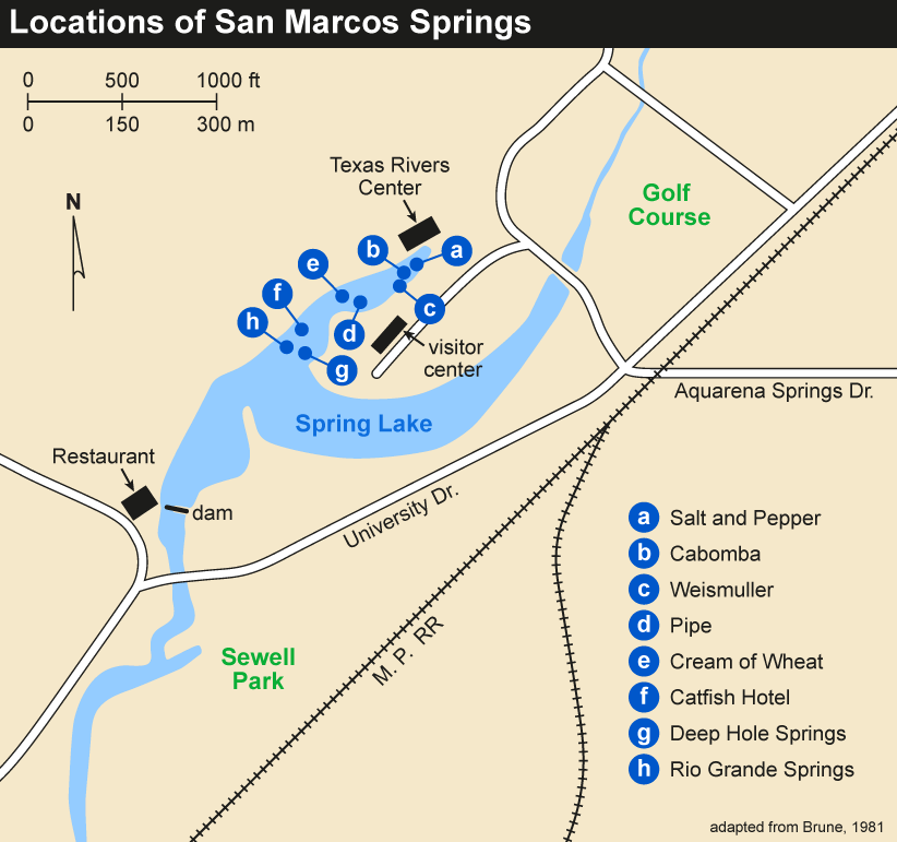
The second large spring outlet for the aquifer lies in the city of San Marcos, on the campus of Texas State University. The springs discharge into Spring Lake and give rise to the San Marcos River. The springs were developed as an amusement park and hotel complex (Aquarena Springs) that were a Texas institution for many decades.
Wasserfall der Guadalupe
29°41'50"N 98°06'26"W
This riverside exposure of Austin limestone (about 12 feet of section) was the first geologic exposure studied in Texas, described by Ferdinand Roemer in 1846. A low dam has been built across the middle of the old outcrop, which fed textile mills to the north. The limestone lies beneath about 40 ft of gravel, sand, and silt deposited by streams in geologically recent time. The fractured limestone pavement is best viewed from the old Mill Street Bridge, now a foot and bicycle bridge. This Austin limestone lies some 300 feet below Landa Lake, showing that the springs occur in a graben (faulted low).
Natural Bridge Caverns
29°41'32.1"N 98°20'33.9"W
This privately owned cavern is the most extensive in the San Antonio area and one of the largest in the state. The Caverns, which lie in the Balcones Fault Zone, were carved into Glen Rose and Edwards limestone by water traveling through joints and faults deep underground, eroding them into huge passages over time. Many levels of caverns were formed by a descending water table, which eventually drained out of the caves all together causing multiple levels to collapse in on themselves. For more information visit www.naturalbridgecaverns.com.
Canyon Lake Dam: see Great Place #43