
GREAT PLACE #38
Colorado Bend Area
County: San Saba
Landscape Domain: Lampasas Cut Plain (border with Llano Country)
Ecoregion: Edwards Plateau / Woodland (border with Limestone Cut Plain)
-
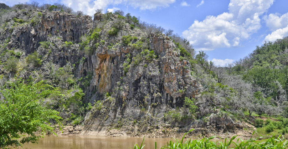
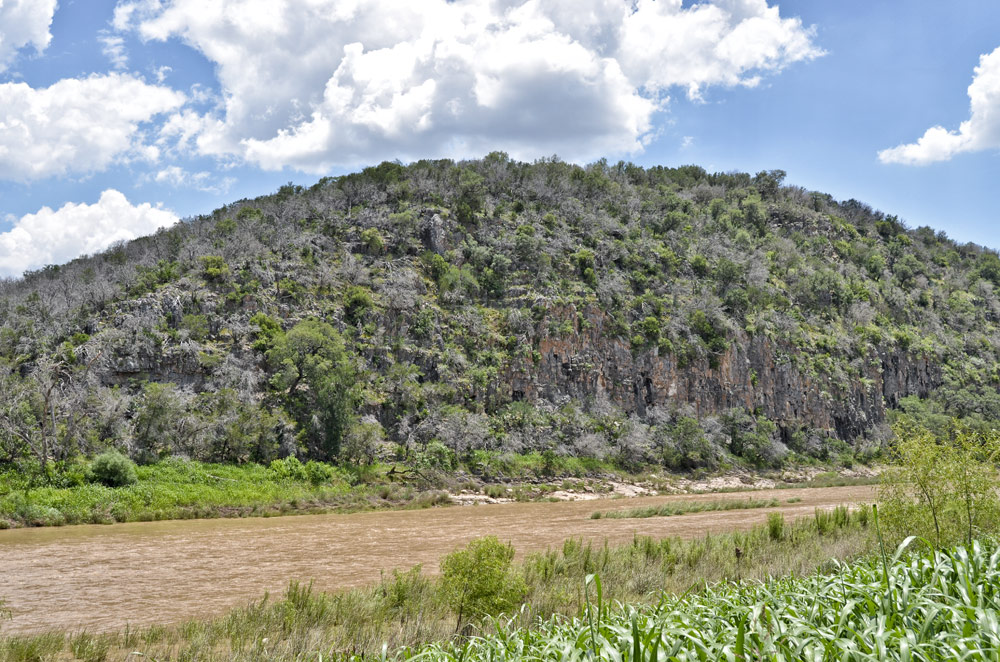
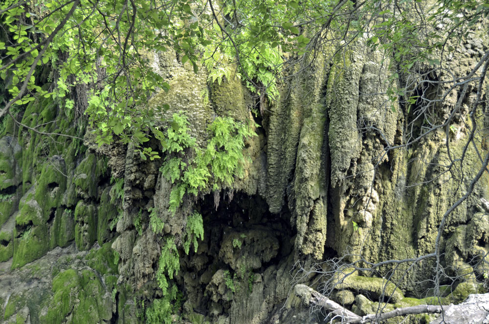
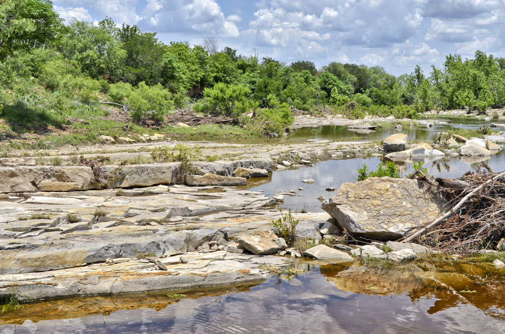
A paleotufa mass (formed from an old spring outflow) forms cliffs along the Colorado River
-
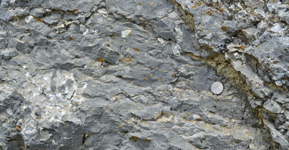
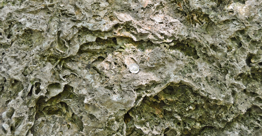
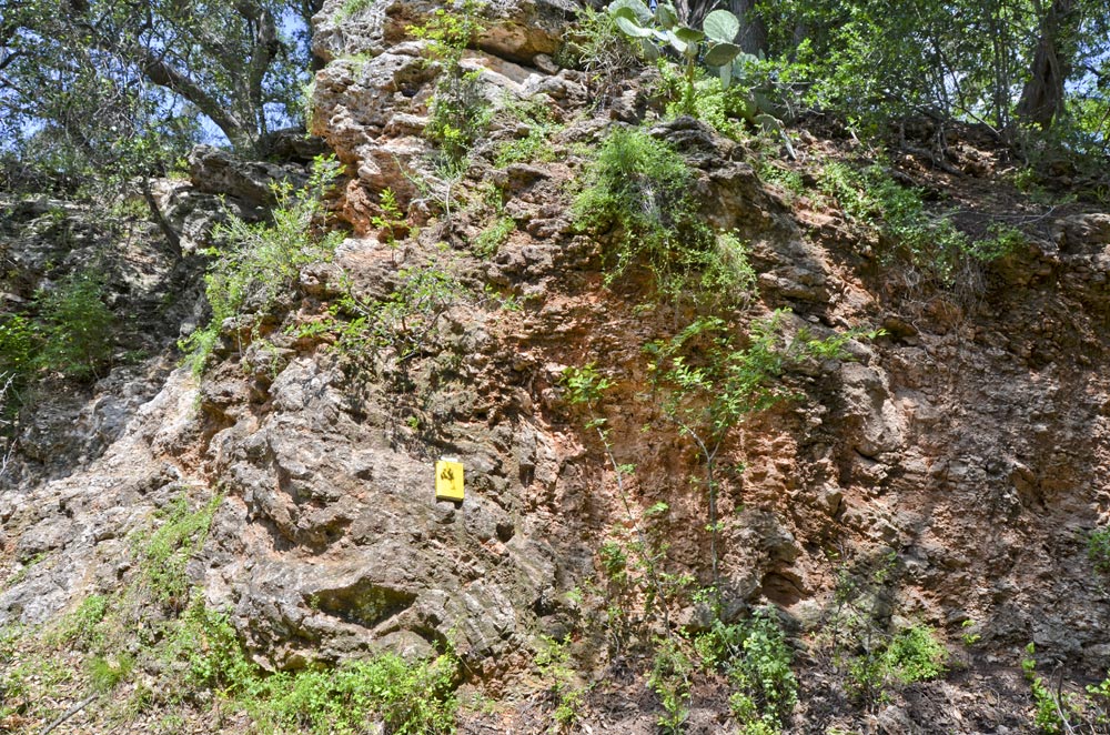
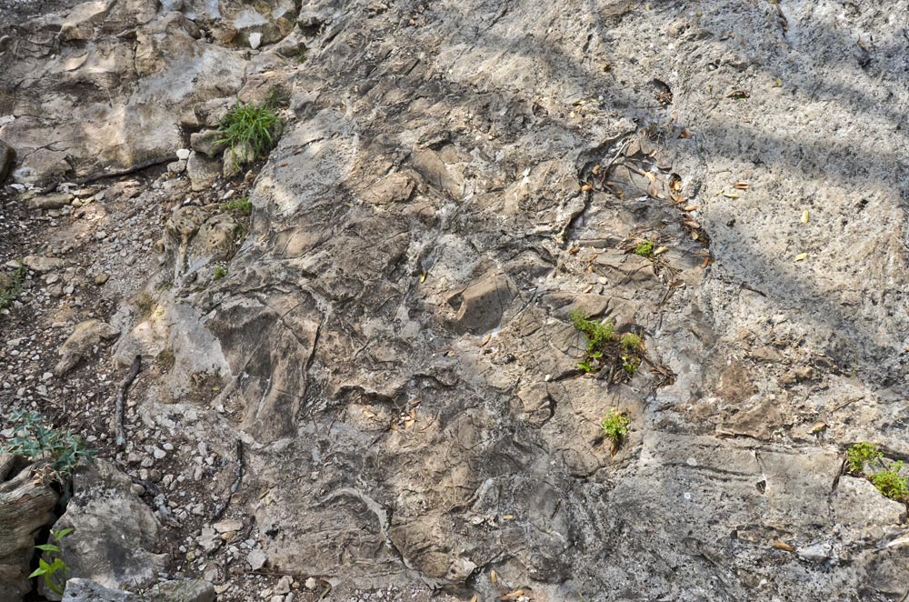
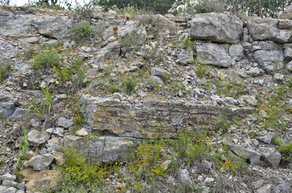
Chappel limestone close-up; note the visible small chert nodules and fossils
-
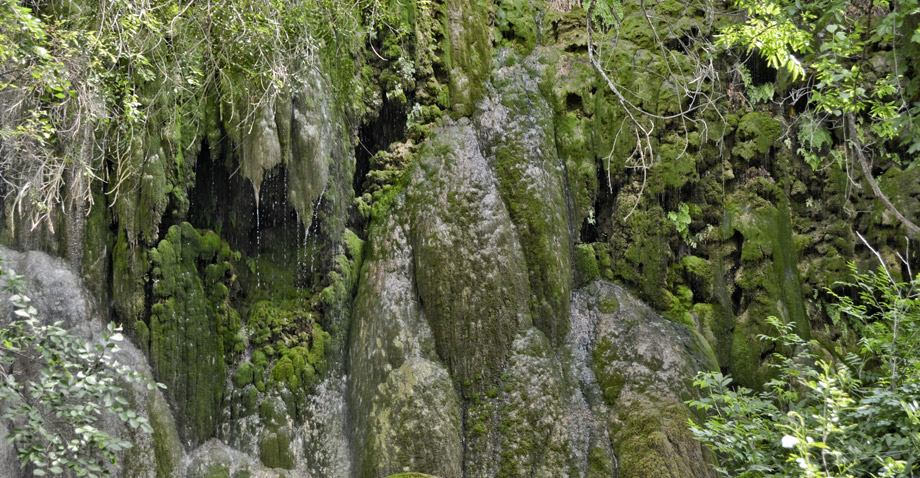
Stalactites and stalagmites are also forming in the tufa at Gorman Falls
-
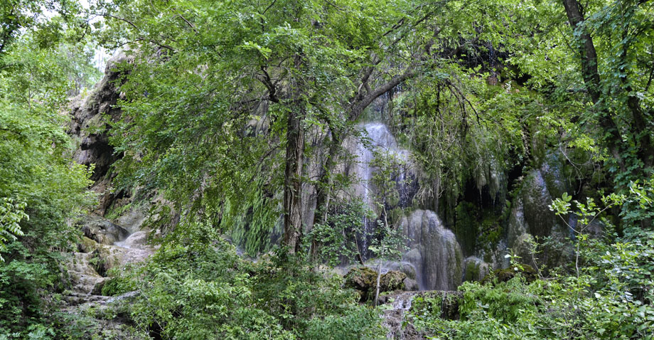
Overview of the main Gorman Falls tufa cone
-
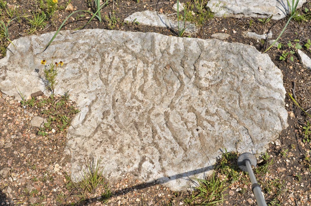
Close-up of paleotufa topset beds with plant impressions
Why it's a great place
- Scenic canyon in Ellenburger limestone and dolomite
- Spectacular springs and tufa waterfalls
- Shale valleys and limestone ridges
- Barnett Shale and Chappel Limestone outcrop in area
Did you know?
- Colorado Bend State Park is a 5,328.3-acre park that was purchased in 1984 and opened to the public in 1987
- The park boasts many outdoor activities including primitive camping, hiking, mountain biking, caving, fishing, swimming, paddling, birding, and guided tours; there are 32 miles of trails and 155 different species of birds within the park
- Guadalupe bass—Texas' state fish—thrive in the pools formed by small travertine dams at Gorman Falls
The Llano area is a "window" eroded into Cretaceous limestone by the Colorado River and its drainages, exposing Paleozoic and pre-Paleozoic rocks. The northern part of the area, near San Saba and Bend, contains great exposures of Ordovician, Mississippian, and Lower Pennsylvanian rocks.
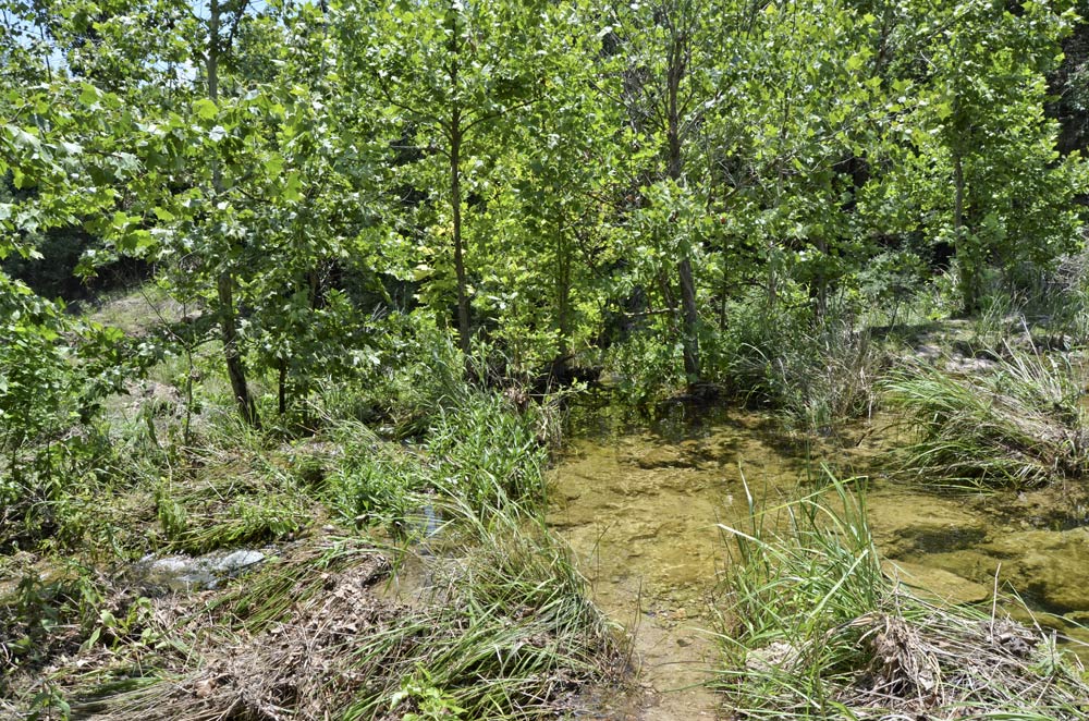
The Ordovician limestone and dolomite of the Ellenburger Group form gently rolling rocky uplands used for pasture. Near the Colorado River and its drainages, they are eroded into rugged canyons. Big cave and fracture systems feed groundwater into the eroding canyon, forming big tufa cones and waterfalls, some still active.
Above the Ellenburger is a thin sandwich of Mississippian. At the base of this Mississippian section are a few feet of crinoidal limestone (Chappel) formed in a shallow marine shelf. Above the Chappel is the Barnett Formation, which consists primarily of black shale, olive-gray mudstone, limy mudstone, and thin limestone. This unit, about 50 ft thick in outcrop, thickens to several hundred feet in the Fort Worth and Decatur areas, where it hosts the giant Barnett Shale gas field (Newark East).
Above the Mississippian is a thick Lower Pennsylvanian limestone unit called the Marble Falls Formation, which forms another set of rocky uplands. The overlying unit is made up of a dark marine shale (Smithwick Shale). When the limestone formed a carbonate bank near the Llano and Concho arch, the shale was deposited in deeper waters off the eastern flank of the carbonate bank.
All of these rocks are displaced by a series of normal faults of Pennsylvanian age, part of the Llano fault system that extends from Del Rio to Fort Worth. Here the rocks form a series of northwest-tilted blocks, and the faults are mostly southeast-down. The Smithwick underlies green valleys, since it is least resistant to erosion. The Barnett is a small scarp between the two thick carbonate units. It is often marked by borrow pits, stock ponds, and ranch roads, all caused by the clayey soils developed there.
Access
Colorado Bend State Park headquarters is 9.6 miles from Bend (on road from Lampasas to Llano). Gorman Falls trailhead is 5.6 miles from headquarters (4 miles from Bend). Chappel Hill road cut: drive west from Bend on RR 580 and RR 501, 5 miles to CR 424 (at cemetery); turn right and drive 4.9 miles on gravel to join RR 1031; continue 7 miles to road cut on left (2.7 miles from San Saba).
31°01'23"N 98°26'32"W (Colorado Bend State Park HQ)
Access level: 2/3
(longer walks to exposure or sites, less than 1 miles; some areas handicapped-accessible with great difficulty due to rocks, brush, or other obstacles)
Colorado Bend State Park preserves a part of the scenic canyon of the Colorado River as it cuts through the Ordovician Ellenburger Group. The oldest part of the Ellenburger, the Tanyard Formation, is exposed near park headquarters. Younger units are exposed to the northwest as the strata dip gently in that direction, with Gorman Formation near Gorman Falls and some Honeycut Formation at the northwest end of the park. These units are hard for the untrained eye to tell apart! Outcrops just north of the park headquarters show typical tan-gray limestone with some bedding and occasional laminations.
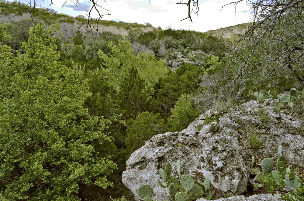
Walking south from the Spicewood day-use area on Spicewood Springs Trail is scenic. The first half mile is on river sands. Views left across the river show some isolated large cliffs without apparent bedding. Just over a half mile (0.6 miles), Spicewood Canyon Trail takes off; beyond, the trail turns right through a low gap in rubbly tufa to meet and cross Spicewood Creek. The cliff and hill on the right are all composed of tufa deposits of an earlier, less eroded stage of the creek and its source springs. (Tufa is deposited from cold springs that precipitate calcite around abundant vegetation.) A current tufa cone or mound is being deposited just below the trail crossing, where it forms a dam in the creek. Spicewood Canyon Trail leads up the hill to the top of this mass of tufa, which has a scenic view of the canyon; typical Ellenburger lies just beyond. The big cliffs along the river are similar paleo-tufa deposits, formed near springs and side streams draining the Ellenburger hills.
A scenic hike leads from a trailhead 1.4 miles to Gorman Falls. The first mile is gently level but very rocky. Much of it follows a few beds of thin-bedded Gorman carbonate with spectacular trace fossils (worm burrows). At 1.2 miles, there is a trail junction (spring to right, falls to left); the falls trail then goes along and steeply down some massive paleo-tufa to a viewpoint at the base of Gorman Falls. The Falls are a massive tufa deposit with stalactites and stalagmites, ferns and moss, and lots of waterfalls—an incredibly scenic place after crossing the scrub ranchland. The tufa forms as the outflow of a major spring with karstic (cave) drainage of a good bit of the Ellenburger.
31°01'55"N 98°34'39"W (Chappel Hill road cut)
Access level: 0
(car stops; viewpoints or road cuts; fully accessible; may have curbs)
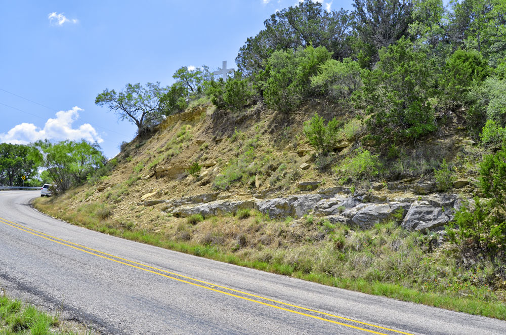
As you drive northwest from the park, the road crosses first the Barnett Shale (a pond and borrow pit to the right) and then the Marble Falls Limestone (good outcrop in Cherokee Creek) before reaching a Smithwick Shale valley at the town of Bend. As you drive west on RR 580 and 501, the road follows the valley floored by the Smithwick, with a couple of dark shale road cuts. The road once you turn right on CR 424 at Chappel Cemetery crosses one of the Llano faults onto Ellenburger, then follows a Barnett Shale slope for a mile before crossing Marble Falls to another Smithwick valley (where the road becomes RR 1031), then crossing another fault onto Ellenburger. Once you go 10.7 miles farther, the road begins to descend and a wide valley (Smithwick again) is visible ahead; this is the Chappel Hill road cut.
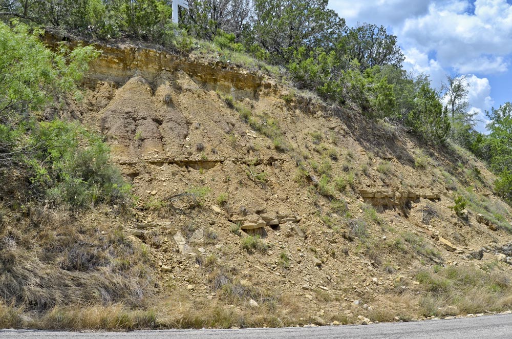
The road cut exposes some of the upper Ellenburger at the base of the hill. After a covered interval, a gray crinoidal limestone rich in fossil fragments about 5 ft thick (Chappel Limestone) is found at the base of the high cut. Above is about 20 ft or so of lower Barnett Shale, an olive-gray mudstone with a few thin limestone and siltstone layers. Upper Barnett (not exposed in the cut) is a more continuous black shale. These thin rocks thicken northeast into the Fort Worth Basin, becoming source rocks for oil and gas and hosting the Barnett Shale play (Newark East Field).
Texas Parks & Wildlife Department website
R. S. Kier, 1988, Paleozoic strata of the Llano region, central Texas: No. 80–81 in O. T. Hayward, ed., Centennial Field Guide 4—South-Central Section: Geological Society of America, p. 351–360. (Locality 5, Chappel Hill)
Marble Falls west of Chappel
31°01'55"N 98°34'39"W
A good exposure of the Marble Falls Limestone (Morrowan, earliest Pennsylvanian) occurs along FM 501 at Cherokee Creek, some 2 miles beyond Chappel Cemetery (at the junction of FM 501 and Rough Creek Rd). The unit is limestone, including abundant fossils, siliceous sponge spicules, and abundant chert in many layers. The unit represents shallow-water open-marine deposition around the Llano area and Bend Arch. The upper part of the Marble Falls probably includes younger limestones of the same age as some Smithwick Shale and "Strawn" (possibly Atokan) sandstones to the northeast.