|
|||
|
|
Maps
 |
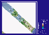
Location of the study area on the Texas Gulf Coast |
 |
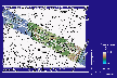
Map of the Mustang Island area showing transect locations |
 |
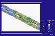
Aerial photomosaic of Mustang Island showing transect locations |
Mustang Island State Park (MISP) Transect
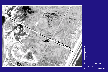 |
Aerial photomosaic, MISP transect area |
 |
Aerial photomosaic and 1992 NWI units, MISP transect area |
 |
Digital elevation model, MISP transect area |
 |
Digital elevation model and 1992 NWI units, MISP transect area |
Port Aransas (PA) Transect
 |
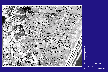
Aerial photomosaic, PA transect area |
 |
Aerial photomosaic and 1992 NWI units, PA transect area |
 |
Digital elevation model, PA transect area |
 |
Digital elevation model and 1992 NWI units, PA transect area |