In its 84th and 85th legislative sessions, the Texas Legislature tasked the Bureau with helping to locate and determine the origins of earthquakes in our state and, where possibly caused by human activity, with helping to prevent earthquakes from occurring in the future. The Texas Seismological Network and Seismology Research (TexNet) was established to accomplish these goals.
The mission of TexNet is to serve as an independent scientific body that monitors earthquake activity, analyzes associated data, and distributes findings and data to government, industry, and the public for their benefit and the benefit of the State of Texas.
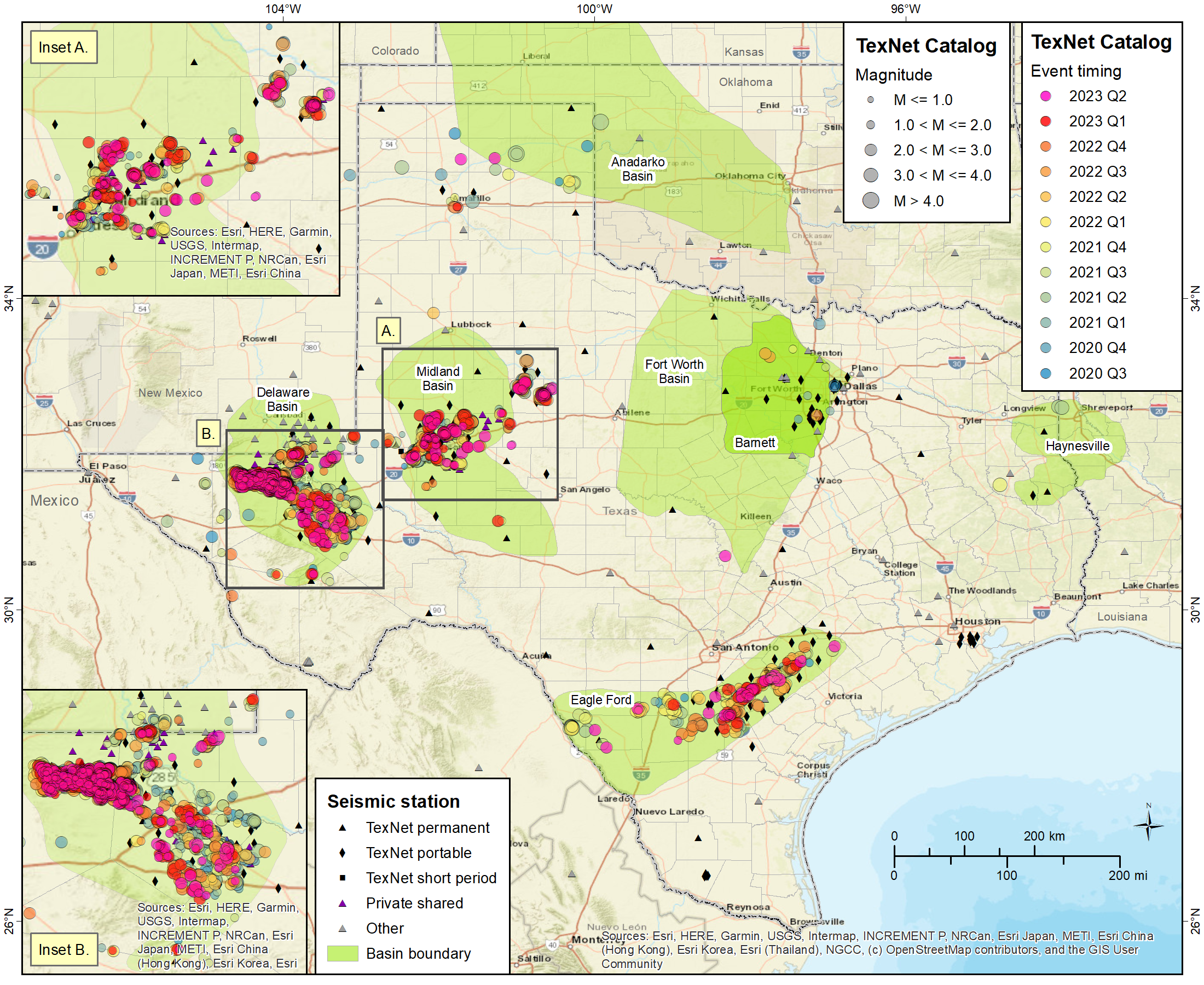
As part of the program, the Bureau's TexNet research team has developed the TexNet Earthquake Catalog, a dynamic mapping web page that provides information on the location of monitoring stations and recorded earthquakes across the state. The map and data include events recorded since January 1, 2017, when data collection began. Keeping Texas citizens informed about earthquake activity helps mitigate and reduce effects of future earthquakes through improved knowledge and preparation.
Please click on the map below to see monitoring-station locations and earthquake events. Please adjust the magnitude range and time period of interest using the left panel on that page.