
Bureau Data Now Available in Geofacets
Elsevier, the information analytics company specializing in science and health, announced that content from the Bureau of Economic Geology is now available in Geofacets, Elsevier’s online database for research of surface and subsurface geology. The Bureau’s content in Geofacets will help both conventional and unconventional oil and gas companies discover economically viable hydrocarbons in Texas, particularly in the Permian and Gulf Coast Basins and other tight oil and shale gas plays in the state.
The Bureau’s data has been enriched, enhanced, and digitized in Geofacets, making its maps, figures, and table data easily accessible. More than 6,500 maps (4,000 geo-referenced), 1,700 figures, and 200 tables were added to Geofacets from Bureau content. The data—sourced from geological circulars, Reports of Investigations, and atlases of major oil and gas reservoirs—adds to Geofacets’ comprehensive portfolio, which consists of more than 1.5 million maps, figures, and tables from nearly 100 publications. The additional content focuses on natural resource exploration, including borehole/core location, play (fairway), well location (oil/gas), structural geology and tectonics, sedimentology, and stratigraphy data.
Visit: https://www.elsevier.com/solutions/geofacets.
Guidebook
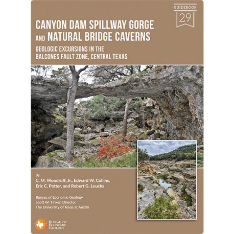
Canyon Dam Spillway Gorge and Natural Bridge Caverns: Geologic Excursions in the Balcones Fault Zone, Central Texas
Woodruff, C. M., Jr, Collins, E. W., Potter, E. C., and Loucks, R. G., 2017, The University of Texas at Austin, Bureau of Economic Geology, Guidebook No. 29, 56 p., 29 figs., 1 appendix, 2 appendix figures, 1 color plate.
The latest Bureau guidebook—by Chock Woodruff, Eddie Collins, Eric Potter, and Robert Loucks—focuses on two spectacular geologic sites, Canyon Dam Spillway Gorge and Natural Bridge Caverns, which both occupy the Balcones Fault Zone in Comal County between Austin and San Antonio. These sites provide contrasting views of the limestone terrains west of the Balcones Escarpment, which cuts through Central Texas and marks the eastern edge of the Hill Country. The sites occupy roughly the same sequences of Cretaceous bedrock strata, but the different hydrologic processes that acted on the strata produced dramatically different landforms over disparate intervals of time, imparting important geologic lessons about how landscapes evolve.
This guidebook begins with a road log for the entire excursion that starts and ends in Austin. Specific locations along the route are keyed to mileages presented in the road log to aid navigation and provide on-ground reference points for running commentaries about points of geologic, geographic, cultural, or historical interest. Separate articles present guided tours for each of the two stops. An appendix summarizes geochemical processes of water on limestone terrains.
GB0029 can be purchased online at The Bureau Store or in the Publication Sales bookstore at the Bureau.
Reports of Investigations
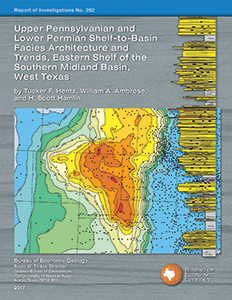
Upper Pennsylvanian and Lower Permian Shelf-to-Basin Facies Architecture and Trends, Eastern Shelf of the Southern Midland Basin, West Texas
Hentz, T. F., Ambrose, W. A., and Hamlin, H. S., 2017, The University of Texas at Austin, Bureau of Economic Geology, Report of Investigations No. 282, 68 p., 40 figs., 2 tables, 2 appendices, 1 plate, and 1 CD in back pocket.
RI0282 by Tucker Hentz, William Ambrose, and Scott Hamlin will be of special interest to those seeking detailed knowledge of the eastern Permian Basin. This study is the first comprehensive examination of the depositional framework of the entire southern portion of the Eastern Shelf of the Midland Basin, an area comprising approximately 15,500 sq mi in this major West Texas petroleum province.
The report provides detailed descriptions and interpretations of whole cores representing key depositional intervals; seven regional, shelf-to-basin, fold-out transects of all formation tops within the study area; and a downloadable spreadsheet of the more than 25 Canyon–Cisco formation tops of the 266 transect wells and 2,247 total study wells. This study provides a starting point for those interested either in the detailed stratigraphic context of local oil or gas fields or the facies framework for more regional study. RI0282 is available in both softcover and downloadable digital versions online at The Bureau Store or in the Publication Sales bookstore at the Bureau.
Geological CO2 Sequestration Atlas of Miocene Strata, Offshore Texas State Waters
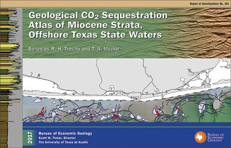
Treviño, R. H., and Meckel, T. A., eds., 2017, The University of Texas at Austin, Bureau of Economic Geology, Report of Investigations No. 283, 74 p., 7 chapters, 1 appendix.
RI0283, edited by Ramon Treviño and Tip Meckel, summarizes research undertaken as part of a multiyear study (2009–2014) of Texas State Waters and the adjacent Federal Offshore Continental Shelf. The goal of the study was to assess and analyze existing data from historical hydrocarbon-industry activities in a regional transect of the Texas coast in order to verify the ability of Miocene-age rocks of the region to safely and permanently store large amounts of anthropogenic (industrial) CO2.
Prior hydrocarbon exploration history has set the stage for successful and low-risk carbon capture and storage (CCS) deployment at offshore locations in general, and the near-offshore waters of Texas in particular, for reasons including suitable geology, abundant and high-quality geologic data sets, proximity to CO2 sources, and reduced risk to shallow sources of drinking water.
The atlas provides a resource for exploring the geological CO2 sequestration potential of the near-offshore waters of Texas via large-scale regional and qualitative, as well as detailed quantitative, information that can help operators quickly assess CO2 sequestration potential at specific sites. This is the first comprehensive attempt to accomplish this goal in the near offshore Gulf Coast and United States.
RI0283, in both softcover and downloadable digital versions, can be purchased online at The Bureau Store or in the Publication Sales bookstore at the Bureau.
Maps
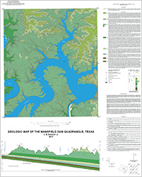
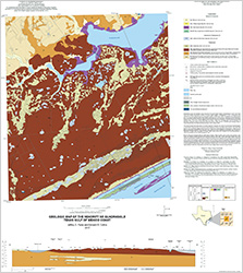
Geologic Map of the Mansfield Dam Quadrangle, Texas
Woodruff, C. M., Jr., 2017, The University of Texas at Austin, Bureau of Economic Geology, Open-File Map, OFM0229, scale 1:24,000.
The dominant surface features on this map include impounded meanders of the Colorado River and its tributaries that compose the lower reaches of Lake Travis. The river has cut into Lower Cretaceous strata that dip gently to the southeast and include localized exposures of Cow Creek Limestone and Hensel Sand along lakeshore at the map’s western edge. The highest elevations on the map have formed on the Edwards Limestone that composes outliers of the once-continuous Edwards Plateau. The most areally extensive geologic formation across this area is the Glen Rose Limestone, consisting of upper and lower members as well as an informal map unit at the formation’s top that is composed chiefly of weathered silty dolomitic strata. This map includes classic landscapes of the Central Texas Hill Country, with multiple high-gradient ephemeral water courses draining disjunct plateau uplands and sculpting stepped terrain from diverse underlying strata. Relief of more than 460 ft occurs above lake level along the abrupt meander bed east of Mansfield Dam; the lake depth in this area adds another 200-plus ft to the pre-impoundment topographic relief. Local Quaternary alluvial deposits occur downstream from the dam, but elsewhere most of these deposits lie inundated beneath the lake. Purchase this map online at the Bureau Store.
Geologic Map of the Pontotoc Quadrangle, Texas
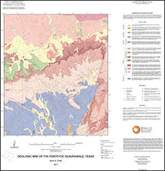
Elliott, B. A., 2017, The University of Texas at Austin, Bureau of Economic Geology, Open-File Map, OFM0230, scale 1:24,000.
This map, one of several 1:24,000-scale maps of the region north of the Llano Uplift, focuses on sand resources in the Cambrian and Ordovician stratigraphy of Central Texas. Maps for this region provide a basic geologic framework to aid in managing water and earth resources; planning land use; identifying aquifer recharge areas; and identifying earth resources such as dimension stone, aggregate, construction sand and specialty sand, and gravel. This study area lies north of Llano Uplift Precambrian Valley Spring gneiss, within the Cambrian-age Hickory Formation eolian to near-shore setting; is transitional to marine transgressional through the Wilberns and Tanyard Formations; and is overlain by Cretaceous limestone and sandstone. The Hickory Formation is an important sand resource in Central Texas, and the Hickory aquifer recharge zone is important for water resource management in the region. Purchase this map online at the Bureau Store.
Geologic Map of the Shingle Hills–Dripping Springs–Driftwood–Rough Hollow–Henly–Hammetts Crossing Area, Central Texas
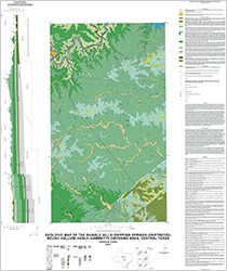
Collins, E. W., 2017, The University of Texas at Austin, Bureau of Economic Geology, Open-File Map, OFM0231, scale 1:50,000.
This map area lies mostly within the dissected eastern margin of the Edwards Plateau west of Austin, which is experiencing relatively rapid suburban and local urban development. Geology of the map area consists of as much as 900 ft of Lower Cretaceous shelf- and shore-zone deposits. Map units include Sycamore Sand, Hammett Shale, Cow Creek Limestone, Hensel Sand, upper and lower Glen Rose Limestone, Walnut Formation, and Edwards Limestone. Purchase this map online at the Bureau Store
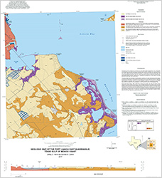
Geologic Map of the Seadrift NE Quadrangle, Texas Gulf of Mexico Coast
Paine, J. G., and Collins, E. W., 2017, The University of Texas at Austin, Bureau of Economic Geology, Open-File Map, OFM0232, 2 sheets (sheet 1: scale 1:24,000; sheet 2: digital-elevation model, geophysical logs, time-domain electromagnetic induction soundings, and frequency-domain electromagnetic induction measurements).
This map illustrates the geology at the southern margin of Powderhorn Lake and the western part of Powderhorn Ranch, a planned state park and wildlife management area near Port O’Connor. The area’s geology consists of sediments deposited within Pleistocene barrier and fluvial–deltaic systems and a Holocene bay–estuary system. Map units include Pleistocene barrier and deltaic deposits and Holocene bay margin and valley margin deposits. Purchase this map online at the Bureau Store.
Geologic Map of the Port Lavaca East Quadrangle, Texas Gulf of Mexico Coast
Paine, J. G., and Collins, E. W., 2017, The University of Texas at Austin, Bureau of Economic Geology, Open-File Map, OFM0233, 2 sheets (sheet 1: scale 1:24,000; sheet 2: digital-elevation model, time-domain electromagnetic induction sounding, and frequency-domain electromagnetic induction measurements).
This map illustrates the geology at the northern margin of Powderhorn Lake and the western margin of Matagorda and Lavaca Bays. The area’s geology consists of sediments deposited within a Pleistocene fluvial–deltaic system and a Holocene bay–estuary system. Map units include Pleistocene muddy and sandy facies of a fluvial–deltaic setting and Holocene bay-margin deposits. Purchase this map online at the Bureau Store.

